
McKinleyville, California, to Keno, Oregon
2020 has not really been a good year for travelers. Global pandemics, kind of put a damper on moving about.
My friend Greg has not let the specter of COVID-19 stop him. He’s done three F*ck COVID rides over the past few months, taking him around the western US. I felt it was time for a F*ck COVID ride of my own.
Greg wanted to tag along on my trip and said I would do the planning for once. The pressure was on, as I felt I had to make sure the trip lived up to the expectations of the seasoned motorcycle traveler. I decided on a loop around eastern Oregon, but did not really have a plan.
It was a chilly, foggy morning in Humboldt County when we met at Greg’s driveway. We bucked tradition by not meeting at Starbucks – another victim of COVID-19, as we would not be able to sit at a table inside to get properly caffeinated before rolling out. Instead, we sipped coffee over the tailgate of Greg’s pickup and looked over the map so I could plot out the day’s travels.
We headed into the foggy morning northbound on Highway 101. The crisp and clean air was a welcome relief from the smoky skies that had hung over the area recently due to two nearby fires, one of which was the largest in the history of California.


Greg stopped in Crescent City to top off so we could try to sync our fuel stops – his Triumph Tiger drinks gas a little faster than my V-Strom. While at the gas station Greg looked over by bike and spied my front tire, the original one that came with my bike, and said, “We need to talk.” I knew time was running out on the tire, but I figured I could probably make it through the trip before needing to replace it. Greg told me I should get the tire replaced on the trip to be safe. Seeing it was Sunday, and motorcycle shops are typically closed Sundays and Mondays, I would need to plan our route to be near a city with a shop on Tuesday morning. I looked up a few shops while we were stopped, some surprisingly saying they were open on Monday, and knew we could figure something out.
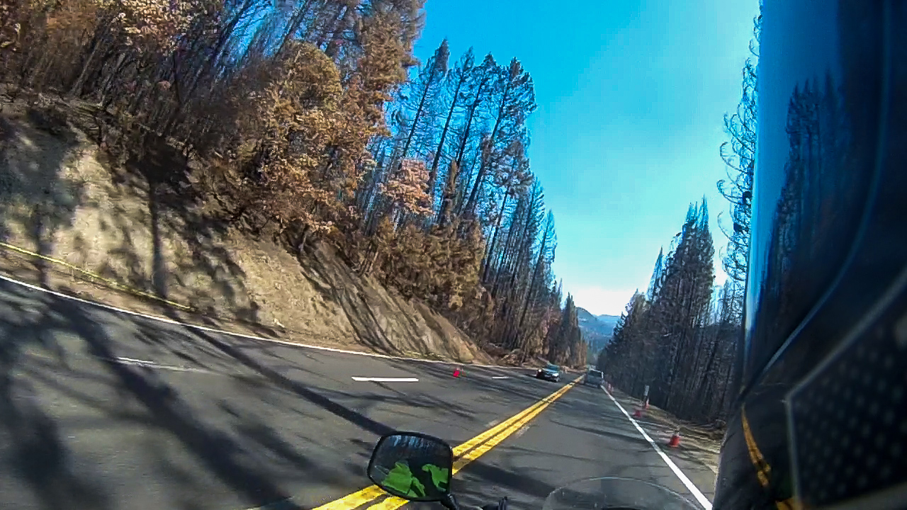
We turned east onto Highway 199 toward Oregon. Highway 199 starts by winding through the redwood forests of Jedediah Smith State Park, and soon exits into the fir and pine forests of the Siskiyou Mountains. As we got closer to Oregon, we could see the path of destruction from the Slater Fire that ran through the area. Initially, I could smell an odor similar to VapoRub – possibly from the burnt sap and tree resins – but as we got deeper into the burnt area, the smell of burnt wood and grass got thicker. We rolled through the Collier Tunnel and emerged into an area that was completely cleared out – no foliage on the trees, no undergrowth on the forest floor, just a forest of burnt matchsticks.
We stopped at Taylor’s Country Store, a destination for area riders, for a socially distanced lunch on the outdoor patio. Greg ordered a burger that took about three days to arrive, while I had a hot link sausage. I had nearly finished before Greg received his food. While waiting, I found a shop that was open on Monday in Klamath Falls, the direction we were heading. Keeping our schedule ever fluid, I decided we would continue in the direction of Klamath Falls and see if the shop had a tire the next morning and if not, we would head north toward Bend.
At Grants Pass, we made a turn onto Oregon Highway 238 to point toward Ashland. Highway 238 winds its way through the Applegate River Valley, past miles of farms and vineyards. As we rode through the valley, we often got the pungent whiff of growing marijuana – in the case of the farms in the Applegate Valley, industrial hemp, which is the same species of the cannabis sativa plant as marijuana, but does not contain high enough concentrations of THC to get someone high. The smell was accompanied by fields of the green stuff planted in rows like cornfields along the edge of the highway.
After passing through the town of Jacksonville, we turned south on Oregon Highway 99 and rode through the towns of Phoenix and Talent before entering Ashland.
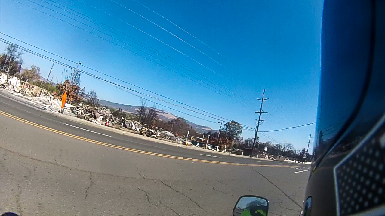
Fire had run through Phoenix and Talent in September, destroying much of the cities along Highway 99. Businesses were totally burned out, leaving only small remnants of what used to be there. RV parks were filled with burned out shells of the trailers and mobile homes that used to be there. One used car dealer’s lot was full of burned cars, with one mysteriously untouched by the flames. Only the vault and sign remained where the Umpqua Bank once stood. The Phoenix Motel was reduced to just its sign. Like the mythical bird, the city will rise from the ashes.
We stopped for fuel in Ashland and headed east on Route 66 – Oregon Highway 66, that is. The road climbed up into the Siskiyou Mountains on a sinuous two-lane road with vertigo-inducing cliffs and tight curves that were perfectly cambered.

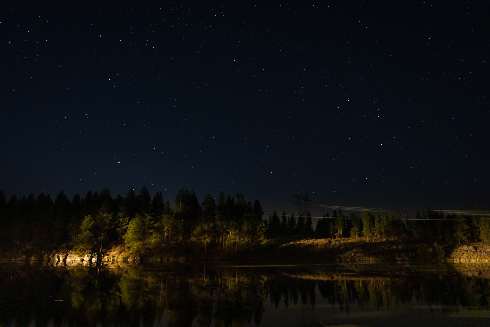
We arrived in Keno in the late afternoon and made the first of our many projected miles of dirt to get to the Topsy Campground on the shore of the John C. Boyle Reservoir. We set up our camp as fish jumped out of the water, breaking its stillness. Canada geese honked in the air and dove into the water, making a stop on their southerly migration.


Later in the night, we stood out on the shore of the lake and watched the International Space Station, chased by a Cygnus supply ship pass overhead.

Day’s Mileage: 248.1, Total Mileage: 248.1