The night was cold. Any opening in the sleeping bag let in a draft of cold air. Temperatures dropped into the low 30s overnight and we woke up to a layer of frost on our bikes. Fortunately, the sun was up and it was quickly warming.
After the damp night at Salt Point and the rain the previous night, our tents had not had a chance to dry out. We laid them out in the sun to dry out while we warmed up.
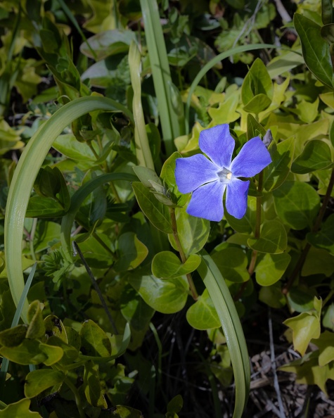
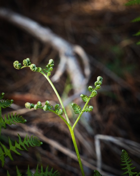
As we waited for stuff to dry, we took a hike on a nearby trail. The trail climbed up a hill and there were great views of Clear Lake. Spring had sprung and flowers were starting to bloom all around. Many rocks on the trail were green with moss.
After about an hour of walking, we returned to camp to find our stuff dry. We packed up and headed out. We made a quick stop in Lakeport for brunch and got back on the road to power home.
Winds started to pick up on Highway 20 as we passed through the Cold Creek valley around the Blue Lakes. Narrow valleys act like a wind tunnel, speeding up winds as the gap narrows. We turned onto Highway 101 north of Ukiah and the winds turned biting cold.
One thing I like to do when riding is listen to music. My iPod is as much a riding companion as my helmet. Somewhere near Willits the music stopped. We stopped near Willits so Greg could put on a liner and I tried to get the iPod going again to no avail. I guess my headphones were now earplugs for the remainder of the trip.
To add to the losses this trip, near Leggett I felt something hit my right knee. I looked down and saw a piece of plastic wedged between my knee and the tank. I recognized it as a spacer from my handguard clamp. Noticeably missing was half of the handguard clamp. I guess the screws had vibrated loose. Fortunately, the remaining part of the clamp was securely wedged between the brake fittings and the handlebar.
Winds continued to pick up as we continued north. They swirled around in the Eel River valley from Garberville north. At some point, I lost sight of Greg, so it felt like riding solo. Just south of Eureka, Greg appeared out of nowhere behind me.
Winds were strong on the shores of Humboldt Bay as we entered the final stretch. I could see Greg ahead of me leaning noticeably to his left to keep the bike on a straight path.
We arrived home a little before 5 p.m. and put another adventure into the books.
Here’s the thing with camping by the ocean at spring time: everything is damp when you wake up. You would have thought it had rained overnight with how wet the tents and bikes were.
Greg and I took our time getting up and ready; extra time to hopefully have the sun peek through the trees enough to dry our stuff. We made our coffees, wiped down the outside of our tents, and slowly packed up.
We pored over the map to plan out the day’s route. We would head south for a bit and take a windy local road, the Butler map called it a “Paved Mountain Trail,” inland to Guerneville. We would then make our way northeast to Clear Lake. The weather was good and we had all day to explore.
We headed south on Highway 1 and made a left turn at Fort Ross. Fort Ross was the southernmost Russian settlement in North America. The road was narrow, windy, and rough as it wound its way through the forest and climbed into the hills and crossed the San Andreas Fault.
After a few miles, we reached a ridge overlooking the Pacific. We followed the ridge for a few more miles than turned east, dropping down into a narrow valley carved by the south fork of the Gualala River. The road continued to be narrow and twisty with pavement crumbling in many places. It reminded me a lot of the western portion of Nacimiento-Fergusson Road in Monterey County.
Fort Ross Road passed through the town of Cazadero and dropped us onto Highway 116, which follows the Russian River. We stopped for gas in Guerneville and asked for a breakfast recommendation from the clerk. We backtracked and stopped at the Northwood Golf Club outside Guerneville for a hearty breakfast.
We left Guerneville and headed for the hills. We turned onto Sweetwater Springs Road and climbed up another narrow, windy road. We passed the old Sonoma Mine on the way. The mine looked like a cartoon mine, complete with a faded wood “Keep Out” sign. I half expected Yosemite Sam to pop out and start throwing dynamite at us.
The tree-lined road climbed up onto a ridge. Soon the ridge dropped down into wine country. Green hills covered in vineyards stretched out as far as the eye could see. I found a nice hillside covered in bright green grass. A herd of dairy cows had spread out across the hill to graze on the grass. The hill reminded me a lot of the Windows XP wallpaper, “Bliss,” which oddly enough was a photo taken about 30 miles away.
We crossed over Highway 101 and headed east to Calistoga. Traffic in Calistoga was heavy with tourists walking around town and searching for places to park. Being at the north end of wine country, Calistoga has avoided the encroachment of freeways and big business, letting people see “old Wine Country.” The town is also known for its sparkling water and hot spring spas.
Greg and I turned north onto Highway 29, which climbed Calistoga Grade toward Robert Louis Stevenson State Park. The highway’s route was slow-going, with many tight hairpin turns.
Highway 29 dropped us into Middletown, which was severely damaged by fire in 2015. The town was on the rebound, but the scars of the old fire were still evident in the areas around town. From Middletown, we turned onto Highway 175 toward Kelseyville.
We arrived at Clear Lake State Park to find the campground was full. With it being late in the afternoon on the first day of spring, we called several other campgrounds and found they were either booked up or not yet open to tent camping. We had a conundrum on our hands. We asked the gate host, Bailey, if there was anything she could do for us to get us a spot in the campground – give us a no-show site, abandoned site, or even if the camp host would let us set up on his site – it wasn’t looking good. I saw the light bulb illuminate above Bailey’s head. She said the campground has “emergency” sites that are kept empty in case fire fighters or emergency personnel need them. Greg told her she was in luck, and told her what we do for a living. A Sheriff ID was good enough for her. We had ourselves a site! I handed over my pass and she didn’t even charge us for a second vehicle.
Looking at the skies, it appeared rain might have been coming. We repeatedly checked weather apps, which told us rain was imminent. We set up our tents quickly and put gear inside. As if on cue, the skies opened at the time the weather apps predicted. A light rain started to fall and temperatures dropped. A rainbow appeared over the lake. It was a beautiful site. The temperature kept dropping and soon the rain started falling harder. I sat inside my tent with a blanket on to keep warm, waiting for the rain to pass. About an hour later, the skies cleared and the rain stopped.
We tried to start a fire to warm up, but it was stubborn. A lot of the wood and kindling was just damp enough that it didn’t want to stay lit. We split our logs into smaller and smaller pieces to get to the driest wood on the inside of the logs. Eventually, the wood dried out enough to stay lit and we warmed up around the fire.
I’ve been a bad motorcycle owner. My bike has been sitting in the garage since my last trip in October. However, winter is nearly over, and spring is coming and taking colder temps and rain away with it. I sent a message to Greg and suggested a road trip. Greg is always up for some two-wheeled travel.
We looked at our maps, threw out some suggestions, and decided we’d head south and see where the roads would take us. Along the way, we would take some new roads to add to our highlighted maps.
The week before our departure date, things weren’t looking too promising. Nothing but cold temps and rain. Up to the Wednesday before we were to leave, it was still questionable whether the weather would cooperate. I was following several weather web sites and radar images like I was preparing an evening newscast. It looked like it would be a crapshoot whether it would be dry or not.
On the day of departure, we woke up to pleasant mostly sunny skies. Small, puffy clouds were scattered in the air, but there was no rain. Perhaps the weather gods were looking out for us. I dropped the kids off at school, kissed my wife goodbye, and rode over to Greg’s to plot out the day’s route over a cup of coffee. We left ourselves a few options and headed south on Highway 101 around 9:30.
No more than 15 minutes into the trip, I saw Greg raise his arm and wave at the western skies. It appeared there was an ominous wall of clouds hanging off the coast. Could this be an omen of our future? Did the weather gods trick us? I hoped the clouds would stay put and leave us alone.
Just south of Eureka, Greg suddenly put on his right turn signal and exited the highway. I wondered what was going on. Did he suddenly have an idea of a destination that he just had to share? I pulled up alongside him.
“Suit up!” he said as he opened his pannier to get his rain gear.
I dug out my rain suit and put it on over my riding gear. Sporadic drops of rain started to fall, making tapping noises on my helmet. Looks like we’re going to get wet.
I took a peek at the weather radar app on my phone. Bands of rain were descending on the Eureka area, but things looked promising to the south. Maybe this won’t be so bad.
We got back on the road and continued on. We’ve ridden through rain before, so this won’t be a problem.
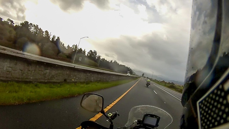
As we passed the College of the Redwoods area, the rain drops turned into the tapping of hail on my helmet. Well, this will be fun. I cranked the grip heaters to max and squinted through the layer of mist on my visor.
They say, “If you don’t like the weather in Humboldt County, wait five minutes.” Actually, I think they say that about a lot of places. It rang true in this case. Five minutes later, the rain stopped and the sun started to peek out of the clouds. OK, then. As we rode on, we got the occasional light shower, but nothing crazy. By the time we got out of Humboldt County, the rain had stopped.
We made a stop in Laytonville for gas and snacks. I warmed myself up with a cup of hot chocolate and looked at the weather radar. The radar and a look at the skies seemed to show the last of the weather passing by and heading away from our path. A line of clouds was passing over the coast range to the west and nothing but blue skies appeared to be on the other side. We decided to head over to the coast and go south on Highway 1.
Greg and I rode west on Branscomb Road, the main route between Laytonville and the coast. For most of the way, Branscomb Road was in much better shape than Highway 1 between Leggett and Westport. Where Highway 1 has many steep, tight turns, Branscomb Road’s curves were much more gradual and the grades were more gradual.
We passed through the town of Branscomb, a relic of a bygone era when logging was king in this area. The abandoned Harwood Lumber Company mill sat empty, having gone bankrupt in 2008. The gates to the property were blocked by several K-rails. Along the road, adjacent to the mill sat the Branscomb Store. The red walls on the outside were fading and cracking from lack of care. The store was long since closed, but still had a single fuel pump out front with a sign that said unleaded gas was 60 cents per gallon.
West of Branscomb, we started to climb into the coast range as the road followed Packard Ridge. We passed through groves of old redwood trees as the road followed the contours of the ridge before dropping down onto Highway 1 north of Westport.
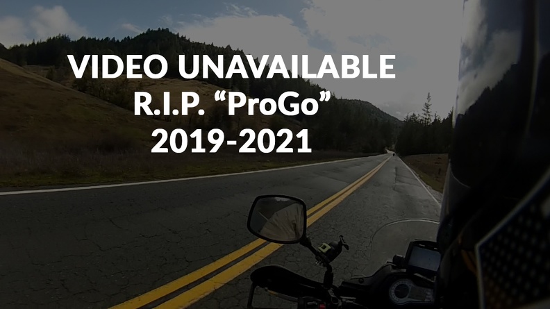
I would have had a video of the ride on Branscomb Road, but there was a little bit of a mishap with my video camera. More on that later.
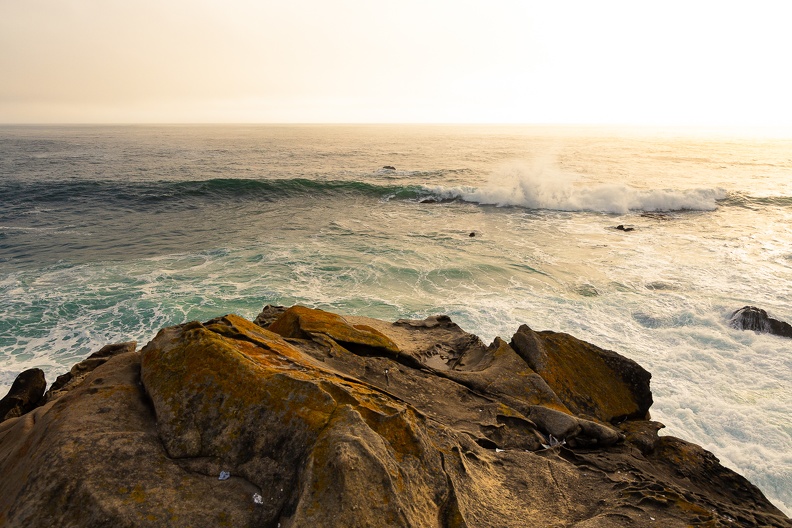
We stopped at a turnout to stretch our legs and look at the waves crashing on the shore. Looking out over the ocean and to the south, it appeared there would be no more rain in our future. The sun was out and we were warming up.
We stopped in Fort Bragg to pick up supplies for the night’s camp. Since the weather had passed, we also packed away our now dry rain suits. We looked at the map to see how much farther we would go before finding a place to camp. We decided to head to Salt Point State Park, another 75 miles down the road.
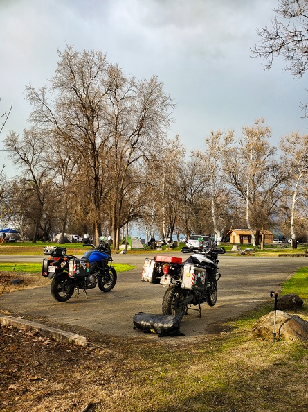
At about 4 p.m. we arrived at Salt Point State Park near Jenner. Greg and I always tend to stay at state parks or federal campgrounds. I have a state park pass that allows me to camp for free, and we both have federal passes that give us heavy discounts at those federal campgrounds that charge. However, here’s a strange thing about the state park pass. Camping is free, but there’s a charge for a second vehicle. So you can show up to the campground in an SUV with seven people inside and camp for free. But if two people show up on two motorcycles, which take up less combined space than an SUV, you pay for an extra vehicle. California State Parks, if you’re reading this, it does not make a lot of sense when one thinks about the reasoning behind the extra vehicle charge.
Apparently we were just in time, as there were only two more walk-up camp sites available. The gate host gave us our choices and we went to check out which site would suit us better. We picked our site and started to set up camp.
As I walked around my bike to get my camping gear out, I noticed something strange. Where my video camera had been was only the metal clamp that held it to the bike’s crash bar. The plastic mount had been sheared off and the camera was nowhere to be found. I remembered it still being there when we stopped after getting off Branscomb Road, but had no idea where it might have fallen off. We had covered about 100 miles of road, and there was no way there was time to go back and look. It wasn’t a huge loss as it was a $40 GoPro knockoff (or “ProGo”), but still sucks to lose it.
After getting home, I went through the video footage from my helmet-mounted Contour camera to see if I could narrow down when the ProGo fell off. Through my sleuthing, I discovered the camera was still there when we stopped in Fort Bragg. Additionally viewing showed the camera was still there just north of the town of Elk. This didn’t help much, as it had been several days, and it only narrowed the area down to a 50-mile stretch of Highway 1. R.I.P. ProGo.
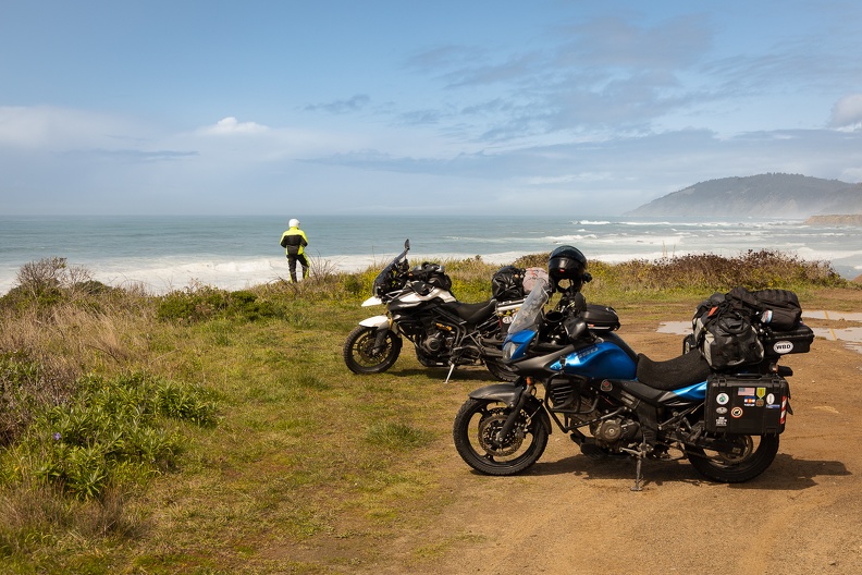
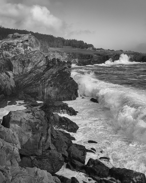
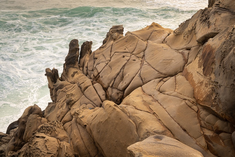
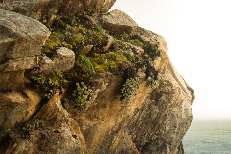
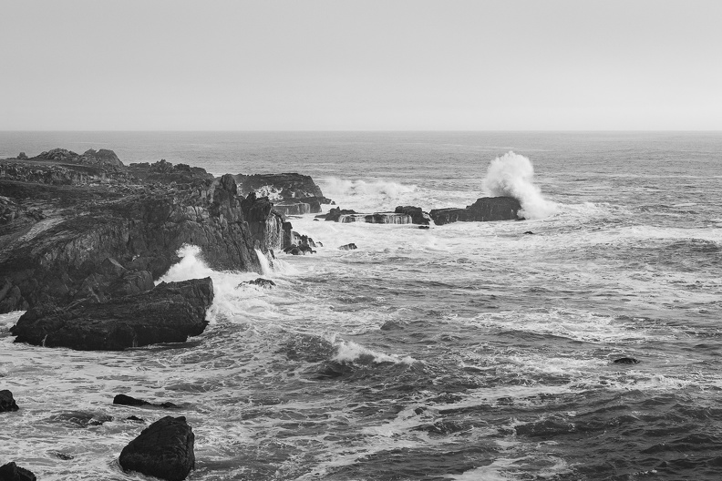
After setting up camp, Greg and I walked down to the cliffs above the ocean to watch the waves. Though the weather had passed, I could tell it was still affecting the surf, producing many large waves. There were many interesting rocks along the coast. The cliffs here are made of sedimentary sandstone, and their sedimentary nature was evident in many places. Several feet of soil was visible above the sandstone rocks where small creeks had found their way to the ocean. Many rocks had small round cavities in them called tafoni. There are many possible explanations for how tafoni are created, but the most likely cause is weathering caused by salt crystals. Water drives salt crystals into crevices in the sandstone. The salt reacts with the sandstone, causing some parts to harden and some to soften. The soft parts then erode away leaving the common honeycomb pattern of the tafoni.
Back at camp, we got a fire going, after Boy Scout Greg worked his magic in getting it started and getting some of the damp wood to dry out. We sat by the fire chatting, solving all the world’s problems, and smoking cigars.
I fell asleep to the sound of the waves crashing against the cliffs in the distance.