It got pretty cold overnight, down into the mid-30s. I was mostly warm, but I did not realize that my new “extra-large” sleeping bag would not fit over my shoulders. I dug out my camping quilt for a bit extra insulation. Even once I got warm, I don’t think I slept very well, tossing and turning. It might be time to look for another sleep option.
The sun was already over the hills east of camp when I got up. Though it was only still in the high-40s, the sunlight added just enough warmth to be comfortable as I made my morning coffee. I broke down camp and got on the road a little after 9 a.m.
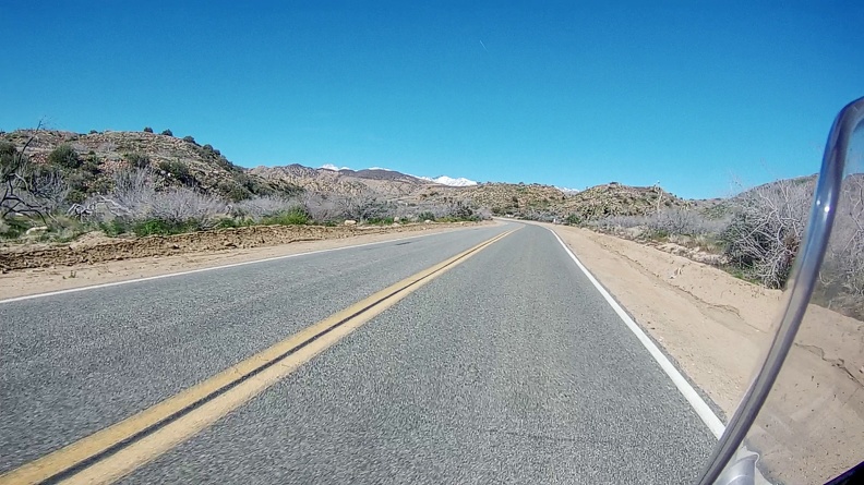
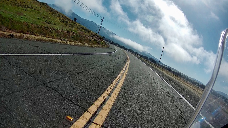
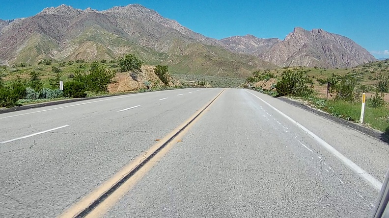
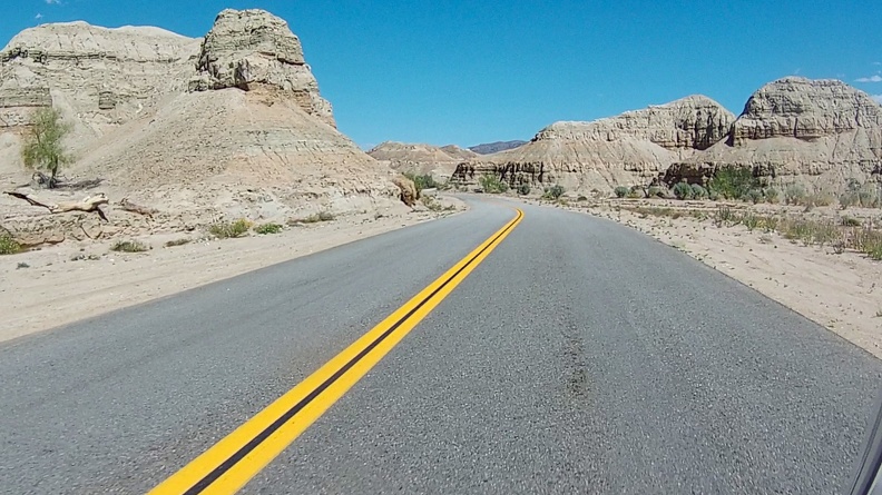
I took off north into Yucca Valley for the short ride back home. Since just heading home on Highway 62 would be so short, I decided to take a detour to explore just a bit. I turned onto Pioneertown Road and headed into the foothills north of Yucca Valley.
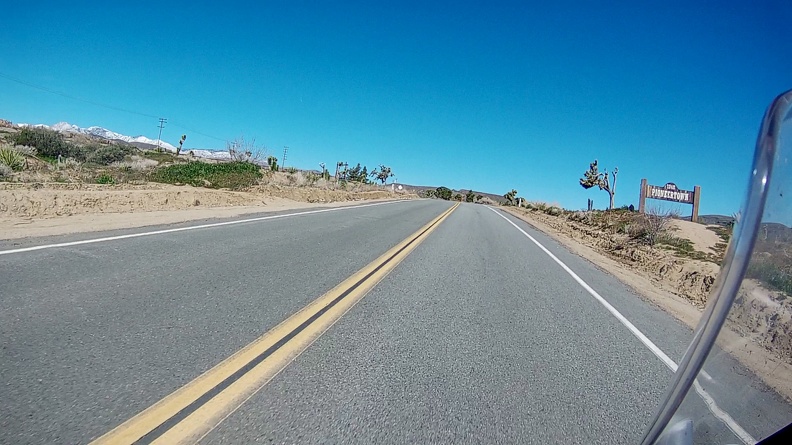
The road climbed into the Sawtooths, where large granite boulders and desert scrub lined the canyon. The snowcapped 11,503-foot summit of Mount San Gorgonio occasionally made an appearance in the distance. The road emerged in a large desert valley just south of Pioneertown. The town was built in the 1940s as an old-west themed living studio. Hollywood studios could use the town as a movie set and it appeared in hundreds of movies such as The Cisco Kid and Judge Roy Bean. The Singing Cowboy Gene Autry even filmed his weekly TV show in Pioneertown. Today, the town hosts old-west gunfight reenactments, hosts a museum, and sometimes still gets used for productions that need an old-west town. Since it was Sunday, everything was closed, so I did not stop.
I continued through the valley and turned onto Pipes Road. Along the road were multiple large ranches. Off in the distance, the road disappeared between two flat-top mesas. It was like riding through a John Ford movie.
After a short while, I found myself back on Highway 247 and heading back down toward Yucca Valley, where I rejoined Highway 62.
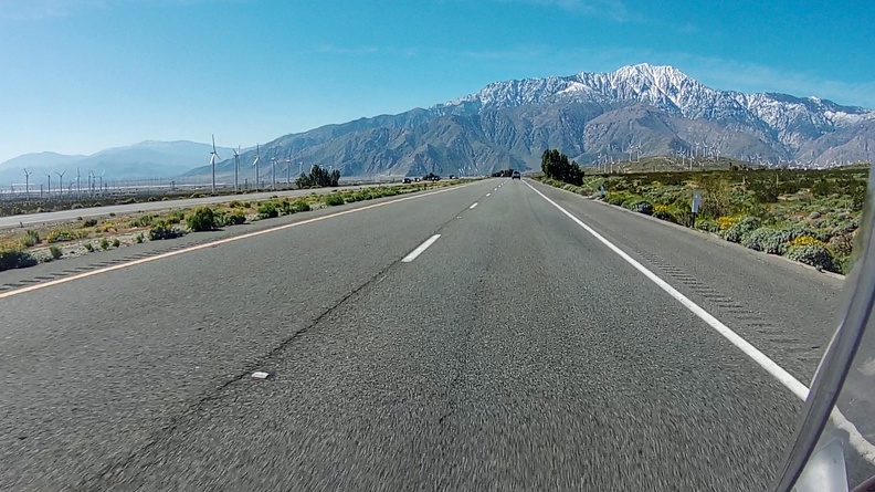
Highway 62 rejoined Interstate 10 at the east end of San Gorgonio Pass. The many dozens of, actually more than 1,200, large wind turbines that line I-10 stood in the shadow of Mount San Jacinto to the south. The area is perfect for a windfarm. Air moving inland from the Pacific Ocean, gets squeezed as it enters the pass, which separates the San Bernardino and San Jacinto Mountains. As the air enters the narrow pass, it speeds up.
The topography of the pass makes things a bit difficult for truckers and motorcyclists. Air along the sides of the pass gets deflected back toward the center when it hits the mountains. At the same time, air that was coming straight down the center of the pass stays its course. The result was I had to ride into a headwind, which wanted to slow me down, and a crosswind, that wanted to push me into the next lane. I kept my head down, gave a bit of throttle and let the bike do what it wanted to do as much as I could.
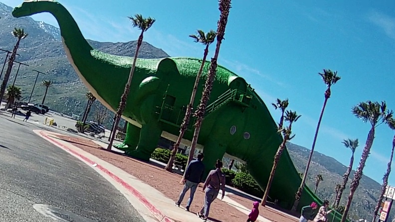
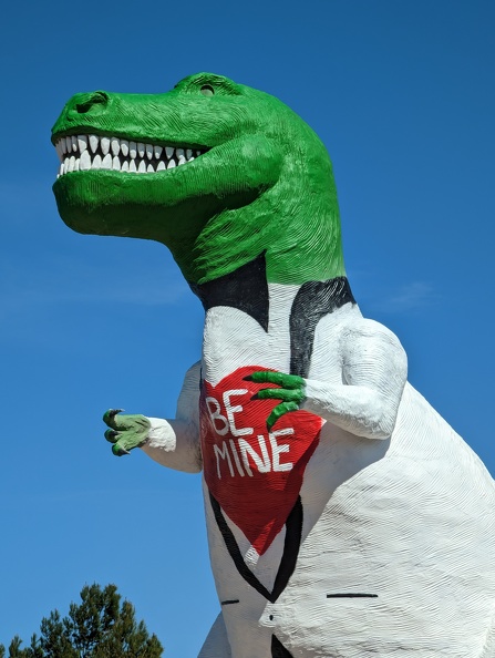
I pulled over for a quick stop at the Cabazon dinosaurs. The two dinosaurs, a 150-foot-long brontosaurus, and a 65-foot-tall tyrannosaurus, are famous landmarks that have stood next to I-10 for nearly 60 years. Mr. Rex was still decorated for Valentine’s Day with a painted shirt that read “Be Mine.”
After avoiding an oblivious BMW driver who did not know how to navigate a roundabout, I got back onto the highway for the short trip back home.
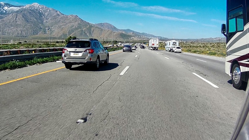
As is typical for Sundays on I-10, traffic started to pick up near Beaumont. There were many more courteous drivers on the freeway, who kindly moved over so I could split the lanes and keep moving.
I got home just in time for lunch and to knock out a term paper that was due later that night.
It was a short trip, but a good one. Until next time.
I had myself a night free and decided to make a full day of riding and a night of camping out of it. I packed minimally the night before. I would not need much in the way of a change of clothes – just a pair of socks, underwear, and sweatpants for lounging around camp. I had room in my boxes for a few extra supplies.
I got on the road around 8:30 in the morning. Overnight it had been a bit cold, and the temperature when I left was in the high-40s. I hoped it would warm up a bit as I got going. The morning sun was a welcome sight after what felt like several straight months of rain here in Southern California.
There was some weekend traffic, it was a Saturday in March after all, so Spring Break was in full swing around the country. Add Spring Break to the first sunny day in a while, and that meant people were getting out.
I headed east on Interstate 10 and turned onto State Highway 79 and headed toward Hemet. As I came out of Lambs Canyon into the San Jacinto Valley, I could see the morning light casting a slight orange glow on the sprawling farmlands, and a bit of wispy haze hung over parts of the valley.
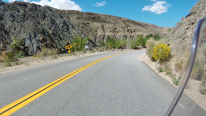
I made a quick stop for gas – you never can be too careful, right? – and got back on the road, turning onto Sage Road on the south side of Hemet. Sage Road winds its way through several small canyons cutting through the Magee Hills and is a shortcut between the Hemet portion of Highway 79 and its portion that goes through the Aguanga Valley after looping through Temecula. Like a good person, who shares the road, I moved over when necessary to let the giant, speeding trucks pass. Somewhere around the Lancaster Valley on the south side of the hills, I saw a quick-paced Africa Twin approaching from behind. Being one to ride my own ride, I let him pass with a friendly wave.
I caught up to the Africa Twin at the stop sign where Sage Road rejoins Highway 79. Passing traffic on the highway left little in the way of gaps for us to merge in to. After about a minute or two, we got a gap and headed east on 79. As I was riding behind this stranger on the A-Twin, I could not help but to think about the time riding with The Stig. It had been about a year since we had ridden together, and I wished he was along for this ride.
Highway 79 made a southerly turn toward the town of Warner Springs. Ahead of me was a dump truck that was handling the turns at high speed like a sports car.
The highway crested Sunshine Summit near Holcomb Village and dropped into the San Jose Valley and Warner Springs. Fog was lingering over the valley, yet to be burned away by the rising sun. The fog added a sudden chill to the air, and my grip heaters did little, even on full power, to keep my fingers warm.
I bid adieu to the Africa Twin as I made a turn onto Montezuma Valley Road and he continued south. Perhaps he was heading for a piece of apple pie and a coffee in Julian, or maybe he was making a run for the border. Who knows?
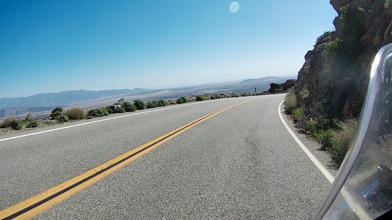
Montezuma Valley Road climbed from about 2,500-foot elevation at Warner Springs to about 4,200 feet just east of the little town of Ranchita in the San Ysidro Mountains. I had passed the fog, and it was starting to warm up prior to the drop into the Anza-Borrego Desert.
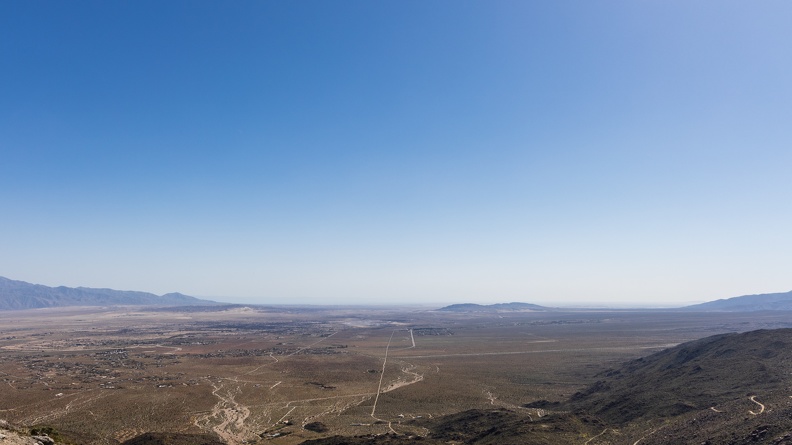
Montezuma Valley Road made the quick drop into the Anza-Borrego Desert via a windy road that drops more than 3,500 feet in 12 road miles, or 6.5 miles as the crow flies. About halfway down the drop was a vista point that gave a view of the vast desert with the Salton Sea far off on the horizon.
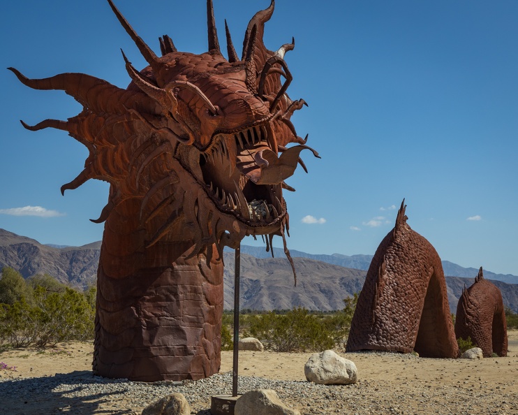
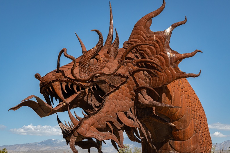
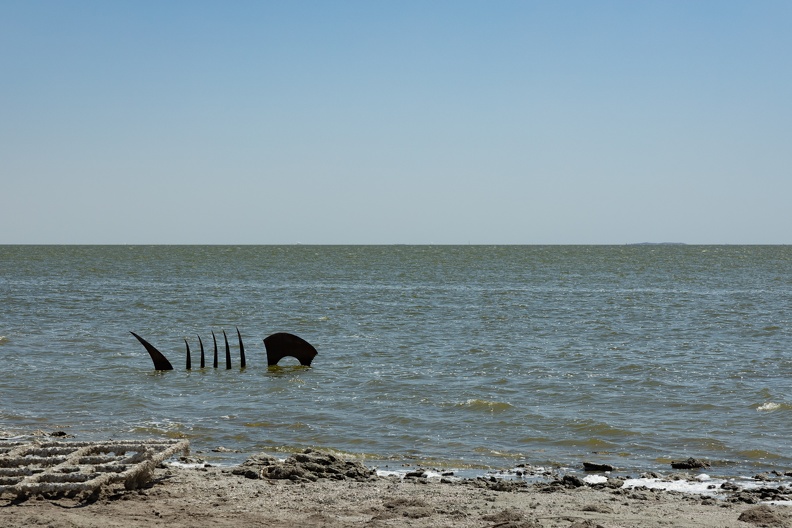
The road leveled off as I rolled into Borrego Springs. The town was bustling with what I imagine is typical weekend traffic of RVs, trucks towing four-wheelers and side-by-sides, and motorcyclists. Metal sculptures dot the desert floor, the work of an artist named Ricardo Breceda. The more than 100 sculptures – velociraptors, giant rats, scorpions, and even a 350-foot-long sea serpent – are made by the self-taught Breceda out of metal. The sculptures are one of the iconic features of the Anza-Borrego desert, and the sea serpent is world famous as a symbol of the area.
I stopped to view a few of the sculptures, including the sea serpent. The serpent stands more than 20 feet tall and its body appears to disappear and re-emerge from the desert sands for its length, which extends across Borrego Springs Road.
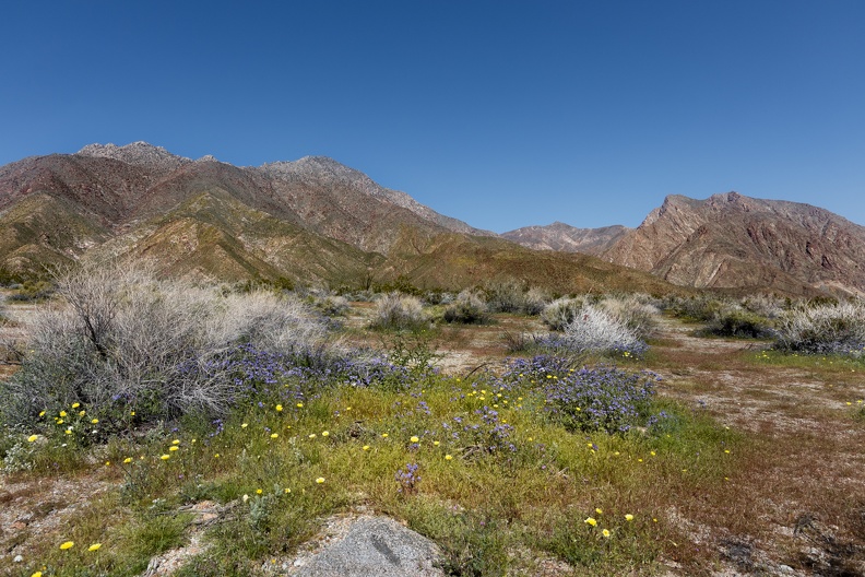
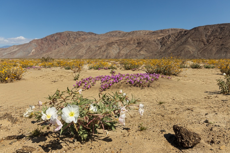
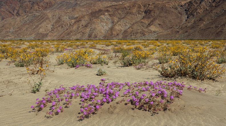
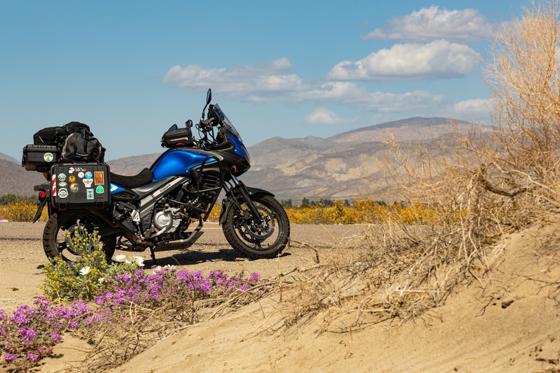
The sides of the mountains and the desert floor were covered in yellow, purple, and orange wildflowers courtesy of the recent rains. Instagrammers wandered through the fields striking various poses, all while avoiding views of the rest of the crowd, to gather likes. I found the colors of the flowers a striking contrast to the red and brown mountain backdrop.
I turned onto the Borrego-Salton Sea Way and continued east toward into the desert. The desert sands on both sides of the road were filled with dozens of off-roaders enjoying the desert. Nearly every weekend year-round all the area campgrounds are fully booked with fun seekers. One of the special things about the Anza-Borrego Desert, and the eponymous state park that covers the desert, is that camping is allowed almost anywhere and not just limited to campgrounds. Perhaps some time in the future.
As Borrego-Salton Sea Way crossed into Imperial County the quality of the pavement became terrible. There were so many bumps and broken sections that I could not tell if it was still asphalt or had turned to dirt. Imperial County needs to do something about that.
I turned onto south Highway 86, which runs along the west shore of the Salton Sea. The vast area of the sea offered little – well, absolutely nothing – to block the winds crossing the highway. I turned at the south side of the sea near the town of Westmoreland. The area was filled with large farms that grow much of the produce available in Southern California. The farms filled the air with the scents of orange blossoms, celery, and even green onions.
I headed north on Highway 111 along the east shore of the Salton Sea. I was waved through a Border Patrol checkpoint north of Niland, well north of the Mexican Border, a quirk in the laws giving the Border Patrol jurisdiction up to 100 miles from the border. Obviously, on my motorcycle, I was not harboring any illegal immigrants, so I was waved through by the agent with a smile.
The Salton Sea is a California oddity. It covers part of the floor of the Salton Sink, a large valley created by geologic stretching between the nearby San Andreas Fault and the East Pacific Rise that runs from the South Pacific off the coast of Chile into the Gulf of California. Three million years ago, the Sink was the northern end of the Gulf of California, and in that time, it has been covered by various lakes that have come and gone. The current Salton Sea covers an area of 343 square miles and was created by Colorado River flooding in 1905.
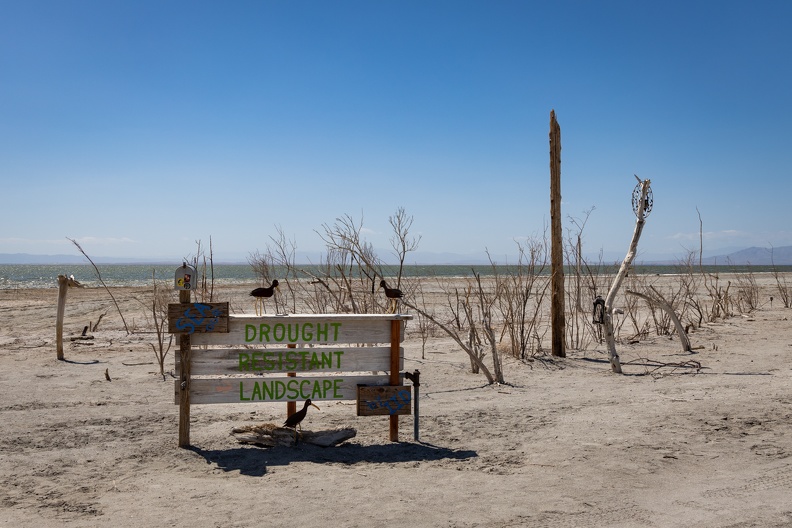
This accidental lake was once a flourishing resort area, with several communities along its shores. However, the Salton Sea no longer receives as much water as it once did due to the irrigation needs of the Imperial Valley taking much of the water that once flowed into the Sea.
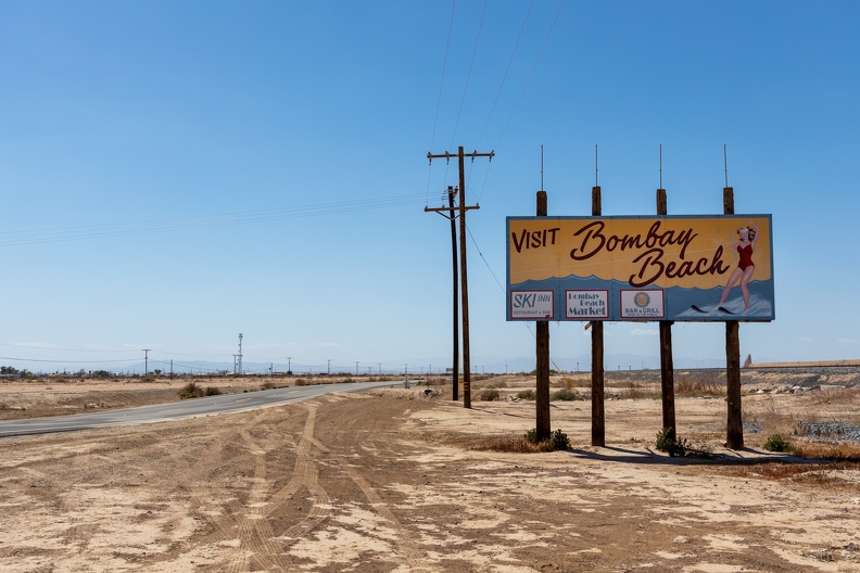
I stopped at Bombay Beach, one of the former resort towns on the Sea’s shores. At 232 feet below sea level, the shore of the Salton Sea is one of the lowest places in California. Only Death Valley is farther below sea level in California. In just a few hours, I dropped nearly 4,500 feet in elevation along the ride.
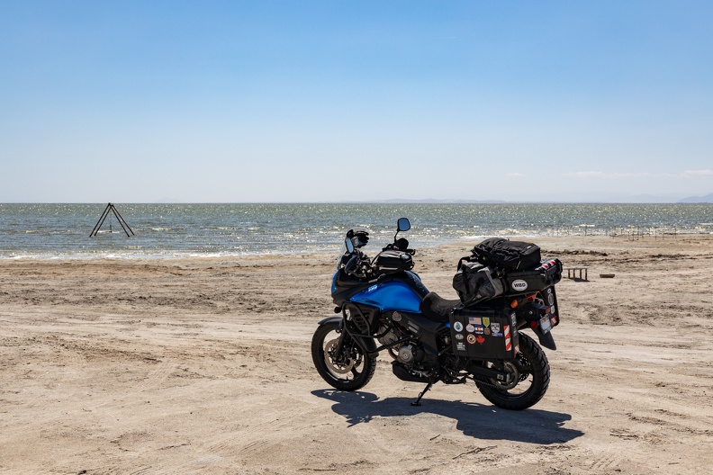
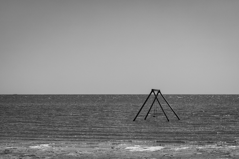
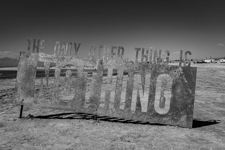
Bombay Beach is an odd town. Though its glory days are behind it, the town lives on through its history and the odd artworks around the town. I rode onto the beach as far as I could. A creepy old swing set stood just offshore, its solitary swing swaying in the breeze. A metal silhouette of a sea monster poked out of the water not far from the swing. Water so salty that it is mostly inhospitable to life gave the air an odor of dead fish and rotten eggs. The sand along the water’s edge looked to be made up of ground-up fish bones and soggy bird feathers. Were it not for the area’s history, this would likely be the last place someone would want to visit.
I continued north and stopped for gas in Mecca. My gas light had started to blink, so it was time. Lessons learned, am I right?
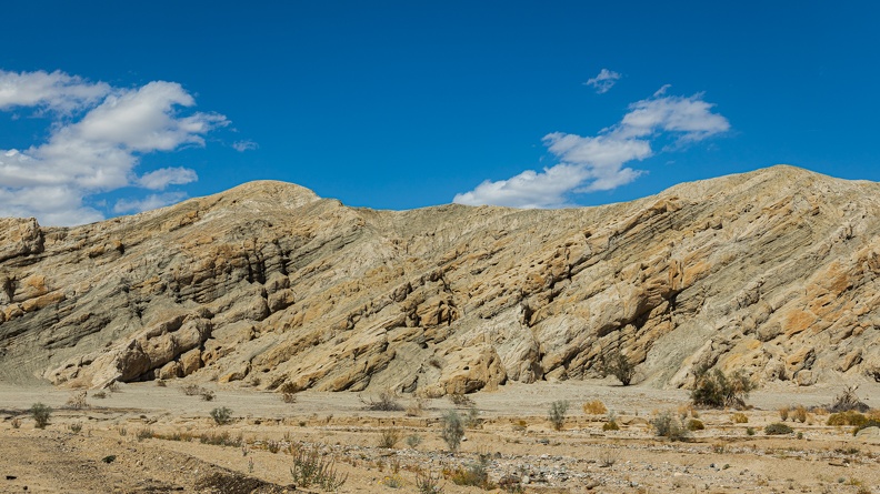
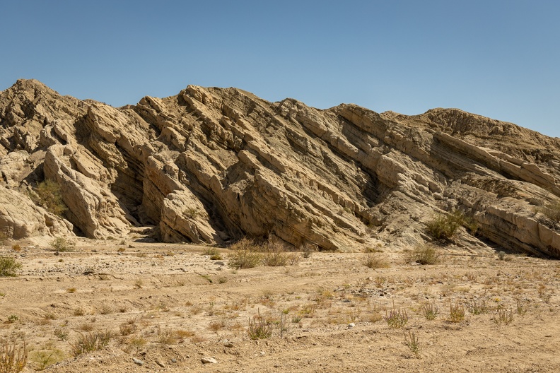
From Mecca, I headed east into the Mecca Hills. The hills were created by movement of the nearby San Andreas fault causing the crust under the hills to buckle and fold as both sides of the fault struggled to slip past each other. Box Canyon crosses the hills and the road through the canyon is a shortcut between Mecca and Interstate 10.
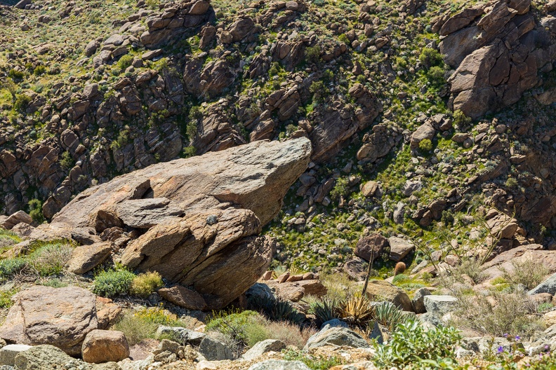
As I rode through the canyon, I got a really good glimpse at the amazing geology of the area. Layers of rock, hundreds of millions of years old, rose up from the floor of the canyon at steep angles. In other areas, the layers of rocks had a wavy appearance like ripples on a pond. Wildflowers, ironwoods, and smoke trees dotted the floors of the canyon. There were many spots where campers had set up right next to the canyon walls, which towered over their tents and trailers. It seemed like it would be a peaceful area to spend a night.
Box Canyon emerges in the Shaver Valley, which separates the Mecca Hills from the Cottonwood Mountains that form the south boundary of Joshua Tree National Park. I rode north into the park a little before 3 p.m. I stopped at the Cottonwood Visitor Center to stretch my legs and have a snack. The parking lot was full, as is typical for the weekends here, so I boldly stopped in a “No Parking” zone for my quick stretch and snack.
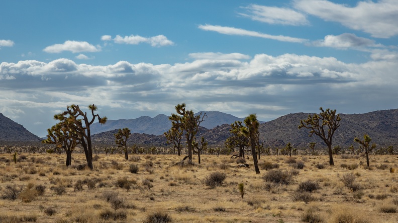
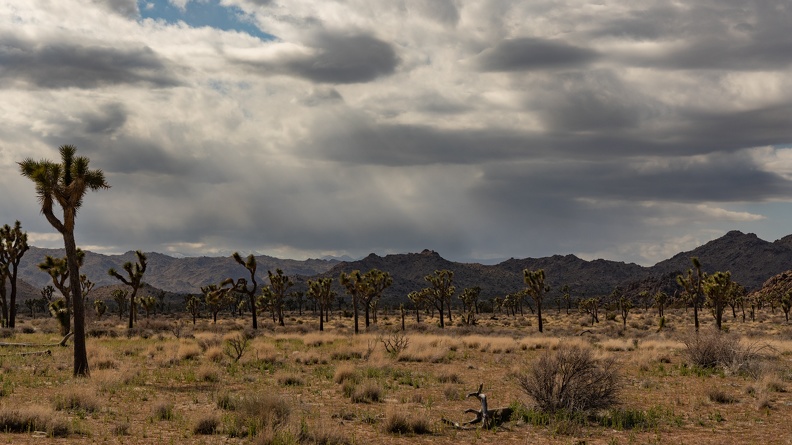
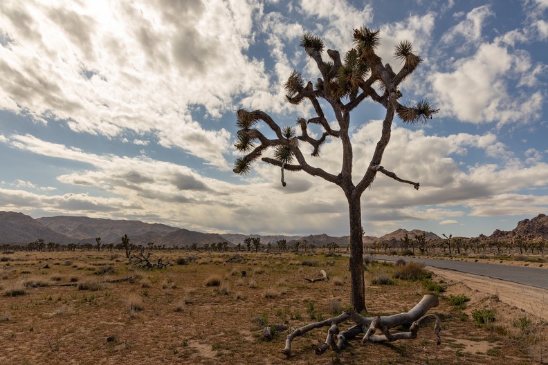
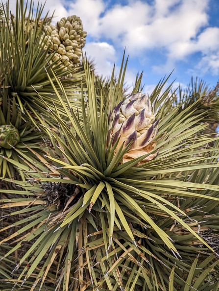
As I rode through the park, it started to cool down. It had been around 80 degrees in Mecca, but in the park, it was in the 50s. I stopped in a few spots to take some pictures of the desert landscape. Many of the parking areas of the park’s big attractions were full of crowds. I turned onto Park Boulevard, which leads to the park’s west entrance in Yucca Valley. Off in the distance, over the far-off San Bernardino Mountains, dramatic dark clouds were hanging over the range’s eastern peaks. I continued west through a landscape of giant boulders and thousands of Joshua Trees. The landscape is like nothing else in Southern California. I can see why the park is such a popular place.
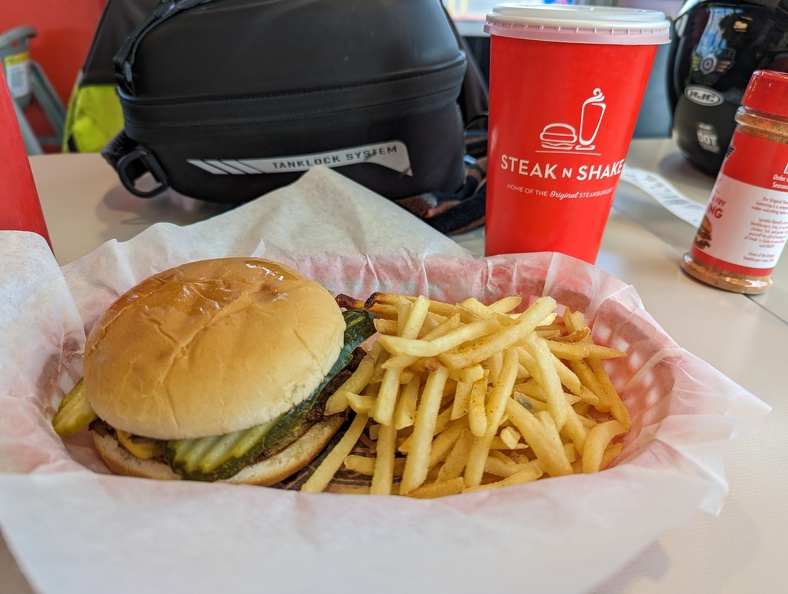
After exiting the park, I made a short stop in Yucca Valley for a late lunch at Steak ‘n’ Shake and picked up some snacks and drinks for camp.
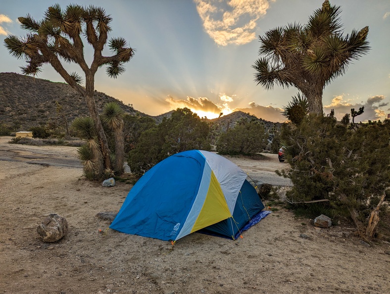
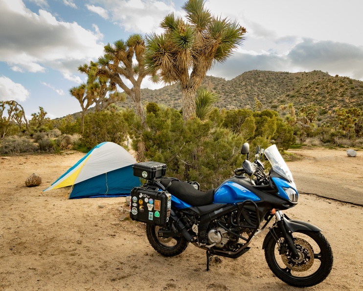
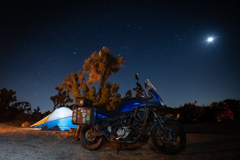
I set up camp at Black Rock Canyon Campground, finishing the day’s highs and lows at right about 4,000 feet elevation. The campground is in JTNP but is separated from the main park. The roads in the park were torn up from the winter’s rains, and some of the sites had been washed out. I found my campsite, which I had been fortunate enough to find available for reservation two days earlier and set up my tent. Most of the site was sloped, so it took a while to find a relatively level place to pitch the tent. In the site’s parking spot, the rain had softened the sand, and my bike’s stand sunk in an inch or two.
Any clouds in the sky had cleared up by the time the sun went down. The air got chilly after dark, and I made myself a campfire. I cheated a bit due to space limitations and brought a couple Duraflame logs for my fire. To the south, the hills of the Little San Bernardino Mountains rose up from camp. To the north, I had a view of the lights of Yucca Valley and the darkness of the desert beyond.
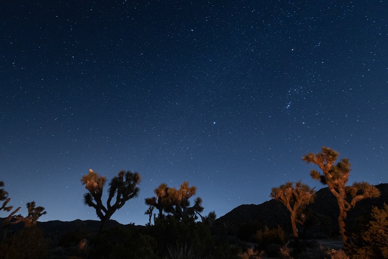
I made myself dinner and enjoyed a beer and cigar by the campfire. As it got darker, packs of coyotes howled in the distance. Other than that, the only sound was that of the occasional airliner passing over on their approaches to Los Angeles. Venus and the waxing crescent moon dominated the western sky. Millions of stars dotted the rest of the heavens, and my fire cast a flickering orange glow over the Joshua Trees surrounding my camp. It was a peaceful end to a great day of riding.
Total Mileage: 313 miles Trees Met Not Named Joshua: 0