The night was chilly. Thankfully, my sleeping bag was warm. I got up around 8:00 and made myself a cup of coffee. I sat there on the picnic table sipping the hot drink and listening to Hat Creek off in the distance.
We packed up our camps for the home stretch. The air warmed up quickly as we packed.
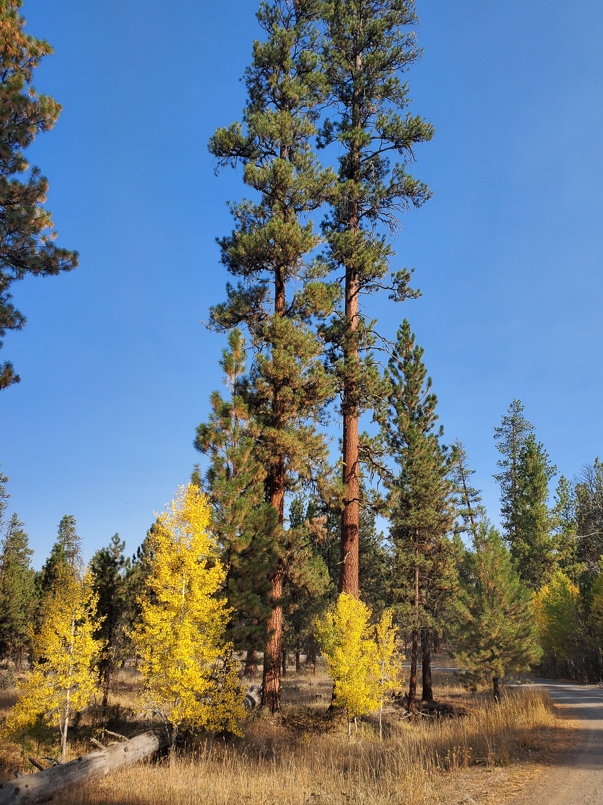
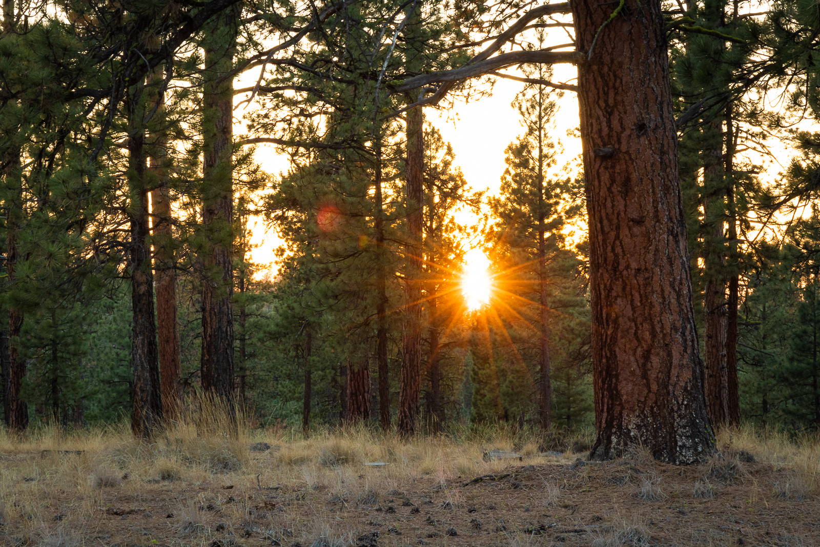
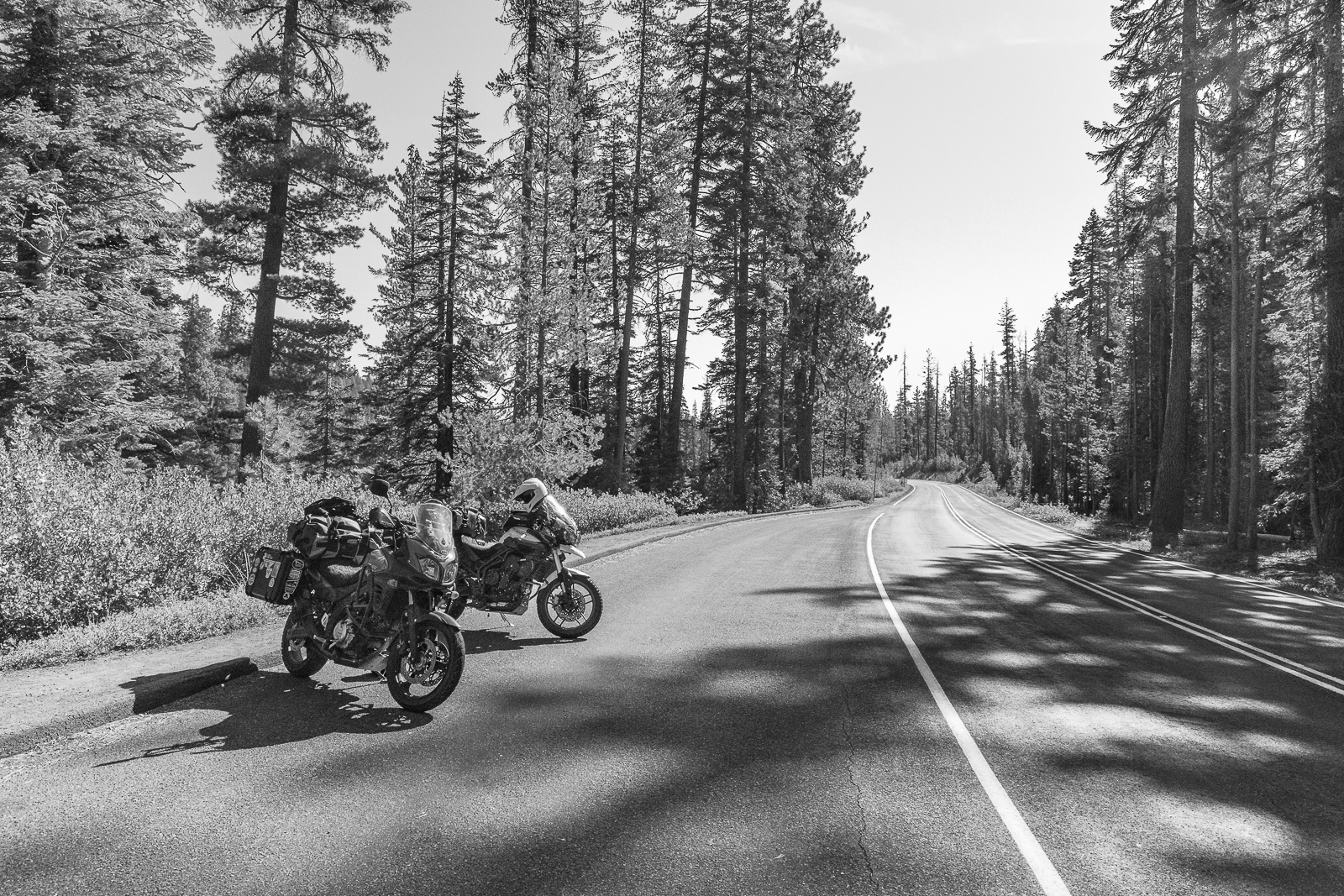
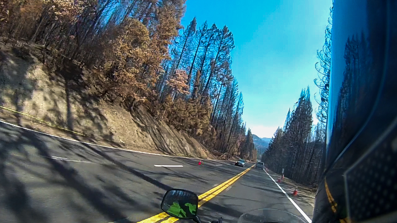
We rode west on Highway 89, which turned into Highway 44 within a few miles. The highway wound its way thought a fragrant pine forest. The scent of the trees was thick in the air.
As we descended in to the Central Valley east of Redding, fleeting glimpses of Mount Shasta were visible off to the right. It was a breezy day in the Redding area.
We stopped at Five Guys for lunch, then gassed up for the run down Highway 299 and the coast.
Traffic on Highway 299 was light, so the riding was spirited. As we entered the Trinity River Canyon, Greg motioned for me to follow him and gave me an impromptu riding lesson to help improve my riding skills. I did my best to keep up and follow his lines.
We got back to town a little after 2:00. We waved goodbye to each other and headed for our respective homes. I must have gotten back early, because nobody was home. I had time to take a shower and get a shave before the family got home.
Virgin Valley Hot Springs, Nevada, to Old Station, California
Woke up to a dramatic sunrise in the east, orange with dark clouds of an approaching weather system. Off in the western distance were skies that looked dark and threatening. I looked up to see what way the clouds were blowing, hoping that any bad weather would be heading away from us. The clouds appeared to be heading northwest, away from our planned route. Hopefully, we would miss any bad weather. We were on the road by 8:30, heading west toward Oregon.
The highway was mostly empty at this time of morning. That gave me a chance to take a “ghost rider” picture with my bike on its center stand parked in the middle of the highway.
We pulled off at the Oregon-Nevada border for a moment. As I lifted up my face shield, I could smell the odor of oncoming rain. Off in the distance were dark clouds with the mist of falling rain below them. We donned our rain gear.
People have asked, “What happens if it starts raining when you ride?” The answer is: You get wet. Our only option is to continue through it. The rain was light at first, but I could feel the temperature dropping as we continued on.
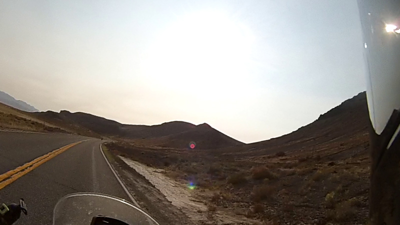
The highway made a right turn and dropped down the side of a steep ridge into the narrow Guano Valley. The highway dropped about 1000 feet from the top of the ridge to the valley floor in a little under three miles. The views from the top of the ridge, and on the way down were amazing. We passed a pickup pulling a trailer, and the view of the oncoming truck looked like it was right out of a commercial.
We crossed into the Fremont National Forest and followed several canyons through the mountains. The temperature continued to drop, settling around 42 degrees. Coupled with the rain, it was fairly miserable. To top it off, my visor kept fogging up. I tried lifting it a bit, but got a face full of frozen water droplets pounding my face. My grip heaters were no match for the wet and cold. Unable to see, and with my hands freezing, I powered on. As Neil Peart said: There’s no such thing as bad weather, only the wrong clothes … Or the wrong attitude.
Greg waited for me at the intersection of Highway 140 and Highway 395. I gave him a thumb’s up and we turned south and continued through the rain.
The rain let up as we crossed into California, and I could see the weather clearing off in the distance.
We stopped for fuel and breakfast in Alturas. Chicken fried steak and hot coffee at the Wagon Wheel were just what I needed to warm up. While eating, I saw a couple of kids, who were probably around 8 years old, running around and looking in awe at the motorcycles. We gave them a wave as we rolled out.
Winds coming off a plateau to the north picked up as we turned onto Highway 299 and rode through the Warm Springs Valley. The winds continued as rode through several canyons that wound through the Modoc National Forest.
We stopped at Burney Falls State Park to get a campsite, only to find out the campground was closed. We checked the map and decided to head for Old Station, outside Lassen National Park, to seek out camp for the night. There were several campgrounds in the area, so finding a spot should be easy.
Oh look, a campground … Closed … Ride on.
Oh look, a campground … Closed … Ride on.
Oh look, a campground … Closed … Ride on.
Guess we might be making a run for home tonight.
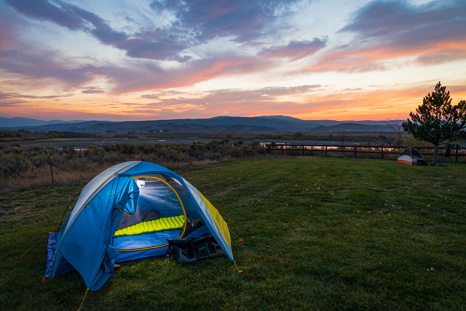
Just as we entered Old Station, we found the sign for Cave Campground. It was open! We found a spot a stone’s throw from the rushing Hat Creek. Cloudy skies still appeared to be threatening rain, so we were quick about putting up our tents. Luckily, the skies cleared a while later.
The entire Old Station area is built on ancient lava flows from Lassen Peak and other volcanic vents of the Hat Creek volcanic area. Across Highway 89 from the campground is the Subway Cave, a lava tube. Lava tubes are formed when flowing lava moves under the hard surface of a lava flow. When the tubes empty, they leave caves behind.
Subway Cave formed about 20,000 years ago when lava covered the Hat Creek Valley. Though there are many lava tubes in the Hat Creek area, Subway Cave is the largest and most accessible. Halfway through the cave is an offshoot cave where one can go, turn their light off, and experience complete darkness. On hot days, the cave is a great place to get out of the heat, as the air inside consistently stays around 50 degrees.
Clouds returned early in the evening, so we weren’t able to see the ISS on our final night on the road.
I fell asleep to the sounds of Hat Creek babbling in the distance.
Frenchglen, Oregon, to Virgin Valley Hot Springs, Nevada
The night was cold, but the morning was surprisingly warm. A south wind brought the temperatures up into the 50s by the time we stumbled out of our tents.
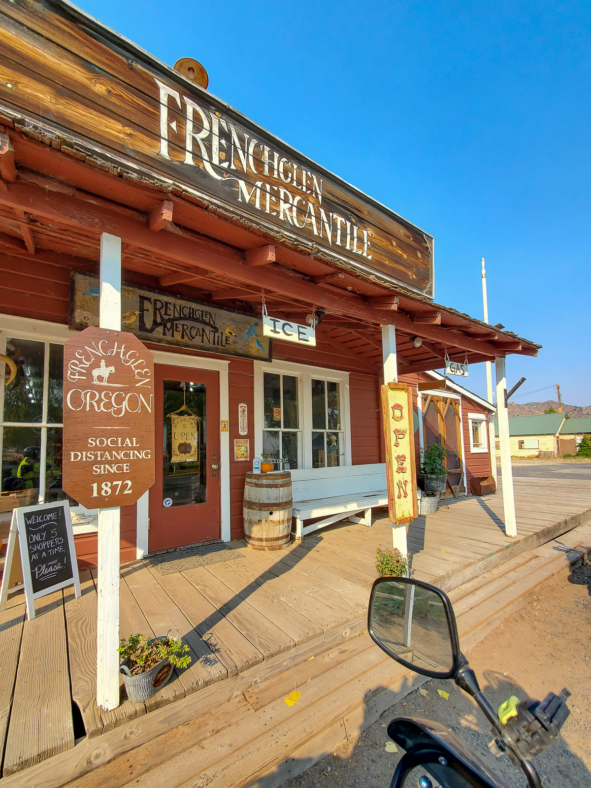
We thanked Rick and his wife for their hospitality and headed out for the day. We stopped in Fenchglen for breakfast at the Frenchglen Hotel on Rick’s recommendation.
The hotel was built in 1916 by the Swift Meatpacking Company who owned a nearby ranch. People doing business at the ranch would stay there. Later, the hotel was used to house the teachers who worked at the Frenchglen School. The hotel was then bought by the Fish and Wildlife Service when it bought the land for the Malheur Wildlife Refuge. In the 1970s, the State of Oregon bought the hotel and owns it to this day.
Breakfast at the hotel was anything we wanted, as long as it was their French toast special. The French toast was thick and sweet, and the bacon was … well … bacon, so it was good.
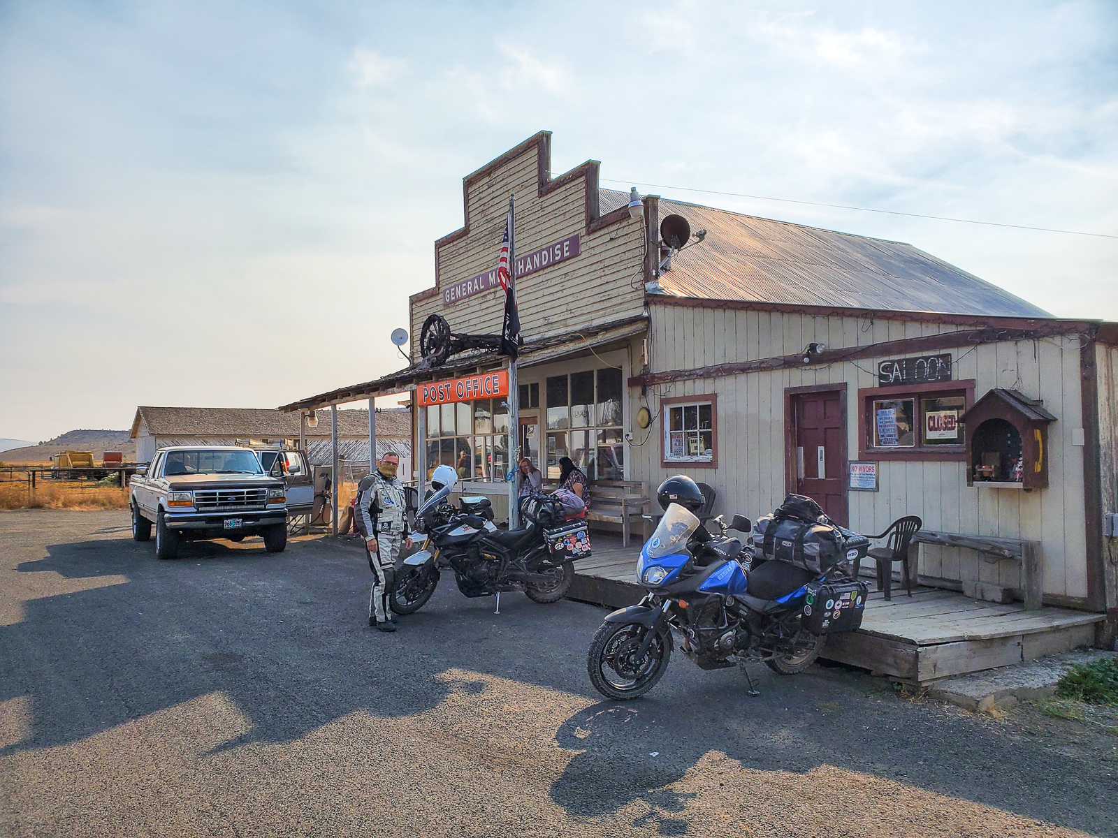
Across the street from the hotel was a relic of times past … a phone booth. The phone was long since removed, but there was another historical artifact inside, an 8-Track tape. Down the street was an old general store with the only fuel for miles. We plotted our route for the day. We would head to McDermitt, Nevada, 152 miles away, and the next closest gas. Greg topped off his tank to make sure he would make it to McDermitt. I had filled up in Burns and according to my estimation from my fuel gauge, should be able to go about 200 more miles before I needed to fill up.
We headed north on Highway 205 and turned off toward the Diamond Craters. The area was a perfect example of the lands of the Basin and Range – large flat grasslands alternated with steep mountain ranges. The Basin and Range stretches from eastern California to central Utah. In the area around Diamond Craters, we traveled through large stretches of ancient lava flows that covered the plains.
We made a pit stop at Burns Junction at a gas station that had closed back in the days when leaded gas was still available. We were 55 miles from McDermitt and I still had two bars remaining on my fuel gauge – an estimated 100 miles. We headed south from Burns Junction on Highway 95 into one of the basins between parallel mountain ranges. We crossed into the Mountain Time Zone and back into the Pacific Time Zone and I watched the clock on my GPS go forward one hour, then back one hour.
About 20 minutes after leaving Burns Junction, the second bar on my fuel gauge disappeared – 50 miles of fuel left. I thought, “Well, I’m less than 50 miles from McDermitt, so it’s still looking good.” I wasn’t having any regrets of not topping off in Frenchglen. Twenty minutes later, the final bar on my fuel gauge started to flash. I was only 20 minutes from McDermitt. This was going to be close.
Thoughts started going through my mind. I imagined the tank running dry just as I pull into the gas station. I imagined running out miles from town and being stuck on the side of the road. I patted the gas tank and talked to the bike. Come on, baby. You can do it. As the miles went on, I became accepting of the fact that I could run out. If I ran out, I ran out. Not much I could do about it. I reduced my speed to try and save what gas fumes I had left.
Five miles from McDermitt, I started to climb a hill. The engine started to sputter as I went up. Come on, you can do it! The engine died near the crest of the hill. I pulled onto the shoulder and tried to keep the bike going. As I crested the hill, the engine came back to life. I could see McDermitt off in the distance. You can do it. The bike kept running as I went down the other side of the hill. Maybe I would make it after all.
The GPS read 3.2 miles to McDermitt. The road was flat, if not slightly downhill. Things were looking good. I’d like to tell you I made it to McDermitt. I really would. The engine sputtered again and died. I pulled the clutch and hit the start button … nothing. I coasted to a stop with McDermitt clearly visible in the distance.
At least Greg was ahead of me and had a fuel can. I fired off a text, sure that he would see it when he stopped and checked his phone. Out of gas, 3 miles north of town. I’m never going to live this down. I had the chance to top off, but my arrogance over the range of my bike bit me in the ass. Ten minutes went by, cars, RVs, and semi-trucks whizzed by without slowing down. Greg responded. Oh my. Ok. Filling RotoPax.
Almost made it.
I stood there on the side of the road, watching the traffic blow by without so much as slowing down. The narrow shoulder kept the bike and me close to the action.
Soon, off in the distance, I saw a motorcycle approaching. Like a white knight coming to the rescue, it was The Stig with gas to bring my bike back to life. He threw up a finger – you know which one – as he passed and turned around. He shook his head as he got off the bike. I hung my head in shame.
With some gas back in my tank, I was off for McDermitt to top it off. We stopped and grabbed food for the night, then plotted where we would stay.
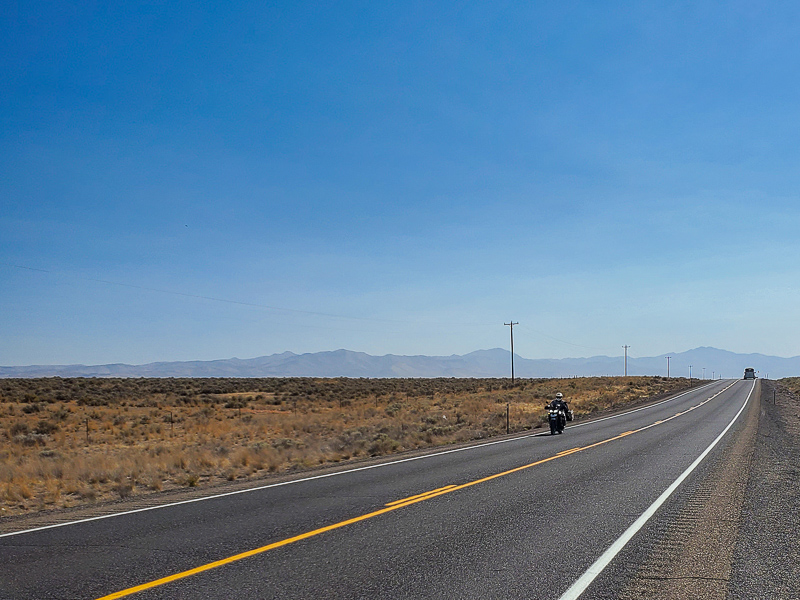
We headed south on Highway 95 into the desert. To the left of us were the Santa Rosa Montains with their exposed granite peaks. To the right, the vast sagebrush plain of the Quinn River Valley. More magnificent desolation.
Suddenly, a flock of birds flew across my view. One bird was flying just a few feet above the pavement. He looked in my direction, I looked at him. I’m pretty sure the bird’s eyes got huge and he freaked out. The bird turned itself around, trying to stop in midair. He looked like a car trying to skid to a stop. You could almost hear the tire-screeching noise. It wasn’t enough. The poor bird flew into my left shin and exploded into a puff of feathers. A small bird is no match for a man’s leg coming at it at 75 miles per hour. I was left with a crime scene of bird blood and guts on my leg and its associated feathers and splatter on the frame of the motorcycle.
We turned onto Highway 140 and headed west. The road was one of those stereotypical desert roads: Miles of ruler straight pavement stretching from horizon to horizon, disappearing into a far-off mountain range. I could have taken a nap and not hit anything.
We stopped in Denio Junction to top off our tanks (one can’t be too careful), and continued into the valley between the Pueblo Mountains and Pine Forest Range. The road rounded the tip of the Pueblo Mountains and entered the Bog Hot Valley. Evidence of volcanism was present all around. Basaltic hills on each side, ancient lava bombs rested on the sides of the road – rocks bigger than a house that had been flung there by volcanic eruptions. One wouldn’t want to find themselves under one of those.
We turned onto a dirt road with a sign that read “Opal Mines.” After a few miles of dirt road, we came to the Virgin Valley Hot Springs campground. This campground was different from the other camps we had been to. It was all dirt; not a speck of grass in sight. A few old brick buildings whose uses are unknown to me dotted the campground. Some had fences around them, one was right next to a pond. We circled the camp to find the right spot and parked the bikes.
We set up camp and then walked around to explore. A few feet from our campsite was the remains of an old chimney. There was nothing to tell me what it was for. Was it the remains of an old kiln? Did there used to be a house there? It was a mystery.
We got into our swim trunks and headed for the pond. The pond was surprisingly warm; I’d guess at least 90 degrees. It wasn’t like a hot tub, but the warmth felt good. It wasn’t a proper bath, but was nonetheless refreshing.
After the swim, we headed back to our camp to make dinner. While heating our meals, a couple of other campers came up. The mystique of the motorcycle traveler drew them to us. We talked about our trip and the remaining plans. The two campers bid us farewell, thinking we were the coolest guys ever because we were traveling on motorcycles and playing Frank Sinatra music at our campsite. Take the compliments as they come.
The ISS-viewing streak came to an end tonight. The station rose too low in the sky to see.
Day’s Mileage: 296.1 (302.1 for Greg), Total Mileage: 1342
Woke up to the sun still behind the mountains east of the lake. The air quickly warmed up once the sun rose above them. Off in the distance a herd of cows was mooing loudly and geese honked on the waters of the lake. We took our time packing up and letting the sun dry our tents before heading out on Oregon Highway 245.
Highway 245 followed the Burnt River east from Unity Dam before climbing up into the Blue Mountains. The road was tight and twisty as it made its climb over one of the range’s ridges. We passed the scars of fires past near the ridge’s crest.
We dropped down into the valley carved by the Powder River and rode west on Highway 7. The road followed the river’s curves through scenes that looked like they came from a Bob Ross painting. We passed the nearly empty Phillips Lake where I could see former lake bed had turned into large meadows where cows were grazing. The area’s mining history was evident from the miles of tailings along the sides of the river between the lake and the turnoff to Sumpter.
We met back up with Highway 26 at the town of Bates. We stopped for a light breakfast at the Austin House Cafe. Greg told me about a previous visit to the cafe. He had been riding on Highway 26 and saw a handpainted sign on the side of the road that said “Fresh Blackberry Cobbler.” Greg had left a mile-long skidmark as he slammed on his brakes to stop.
The sign was not out today; the clerk said it hadn’t been put out in years. We ordered coffee and some of the cobbler. Greg made friends with a cat roaming the patio area while we enjoyed the delicious cobbler. Greg always seems to make friends with cats on road trips. Inside the cafe was an old bar, made in the 1800s. The bar’s arm rest was worn from years of elbows being placed against it. The pillars on the back side of the bar were carved images of nude women that would surely cause a quite a stir if made today.
While getting ready to get back on the road, we were approached by a couple in an RV who asked about our travels. Out of the blue, the man asked if we had taken Highway 27 toward Prineville a few days prior. Of course, we had. He said he recognized us, specifically me, as they had passed by while I was on the side of the road taking pictures. Small world!
Greg and I gassed up in Prairie City and then headed south on Grant County road 62 into the Strawberry Range. The road twisted its way into a small canyon with pines all around. We didn’t see any fires, but heavy smoke filled the air. We turned onto Forest Route 16 to head west. We were the only ones on the road for miles. The pavement was not the greatest, but the curves were long sweepers, which lent themselves to some spirited riding through the forest.
Forest Route 16 met up with Highway 395 at Seneca, where we stopped for stretch. We headed south on Highway 395 into the Divine Canyon. More volcanic rocks lined the road on all sides.
Before reaching Burns, we emerged from the canyon onto a large plain. Crosswinds picked up as we came out of the canyon. Normally crosswinds bother me, but not today. I dealt with it without any problems.
We stopped in Burns for a top-off and late lunch before the final push to Frenchglen. We stopped at the Steens Mountain Brewing Company. The restaurant was built out of an old auto repair garage and still had the original concrete floors and roll-up doors in front. We were the restaurant’s first customers for the day. I ordered a pulled rib sandwich that was quite good. The meat was tender and the seasonings and sauce had a great kick to them.
From Burns we rode south on Oregon Highway 205 toward Frenchglen. The road was ruler straight as it went through the Malheur Wildlife Refuge. Suddenly we came to a ridge directly in our path. The road made a left turn and went up the side of the ridge.
The ridge, known as Wrights Point, was a remnant of eastern Oregon’s volcanic past. At one time, Wrights Point was a stream bed. During the Pliocene Epoch, between 5 million and 2.5 million years ago, the bed was covered by a lava flow. Over time the area surrounding the former stream eroded away, though the basalt that covered the stream was harder than the land around it. The erosion left the 200-foot-tall ridge we see today, which is essentially an inverse imprint of the stream bed.
We continued south as Highway 205 ran through lands that are part of the Malheur National Wildlife Refuge. The wide, flat plain and marshy areas around Malheur Lake are home to many more than 300 species of birds, a dozen species of fish, and nearly 60 species of mammals. The refuge is a stopover for migrating birds on the Pacific Flyway, and Canada geese were a common sight in the air at this time. As we passed through, we caught a glimpse of pronghorn antelope grazing in the refuge’s grassland.
As we got closer to Frenchglen, the highway was sandwiched between the sheer cliffs of Jackass Mountain and the marshy Blitzen Valley. The red orange rocks of the mountain and its flat top reminded me of scenery from a John Ford western. There’s something special about roads following the contours of the land instead of cutting right through it.
We arrived in Frenchglen in the late afternoon and took the 2-mile dirt road to Page Spring Campground. The campground sits in a little canyon on the bank of the Donner und Blitzen River. As soon as we rolled into the campground we got waved down by a man standing by his RV. The man, Rick, told us the campground was full, but offered to share his campsite with us since he was only using the parking pad of the 90-foot by 90-foot site. We wet up socially distanced on the far side of the grass across from the RV.
The camp host did not seem to be happy with our presence, or with Rick sharing his site. Apparently, Rick had offered up his grass on the previous night as well. The host complained about COVID and this and that. Rick told the host we were close friends of his and pointed out that we were on opposite sides of the site. Rick might have also told the host we were former co-workers of his wife, who had retired from a law enforcement career. The host wandered off grumbling, and we stayed put.
The sun set behind the canyon walls and the temperature quickly dropped and a breeze picked up. It felt like it was going to be a cold night.
We got our fifth straight visit from the ISS tonight. The has been our constant companion throughout the trip.
The morning was comparitavely warm, with a temperature up near 50. The rising sun was providing welcome warmth that made it easier to get up and around. We made our coffees, packed up our gear, and got out on the road.
We headed north on Forest Route 17 and then turned onto Forest Route 16 to make our way back to Highway 380. I got into my groove quickly and we made quick work of the 20-plus miles back to the highway.
I arrived at the intersection where FR 16 and Highway 380 meet and came to a stop to ensure the coast was clear. I felt for my front brake lever, but found it wasn’t there. I stopped to see what was going on and found one of the bolts holding the lever to the handlebar had rattled out somewhere on the bumpy dirt road. The remaining bolt had loosened up and almost made its way out. I repositioned the lever, tightened the remaining bolt and got back on the road with a plan to find a hardware store at our next stop.
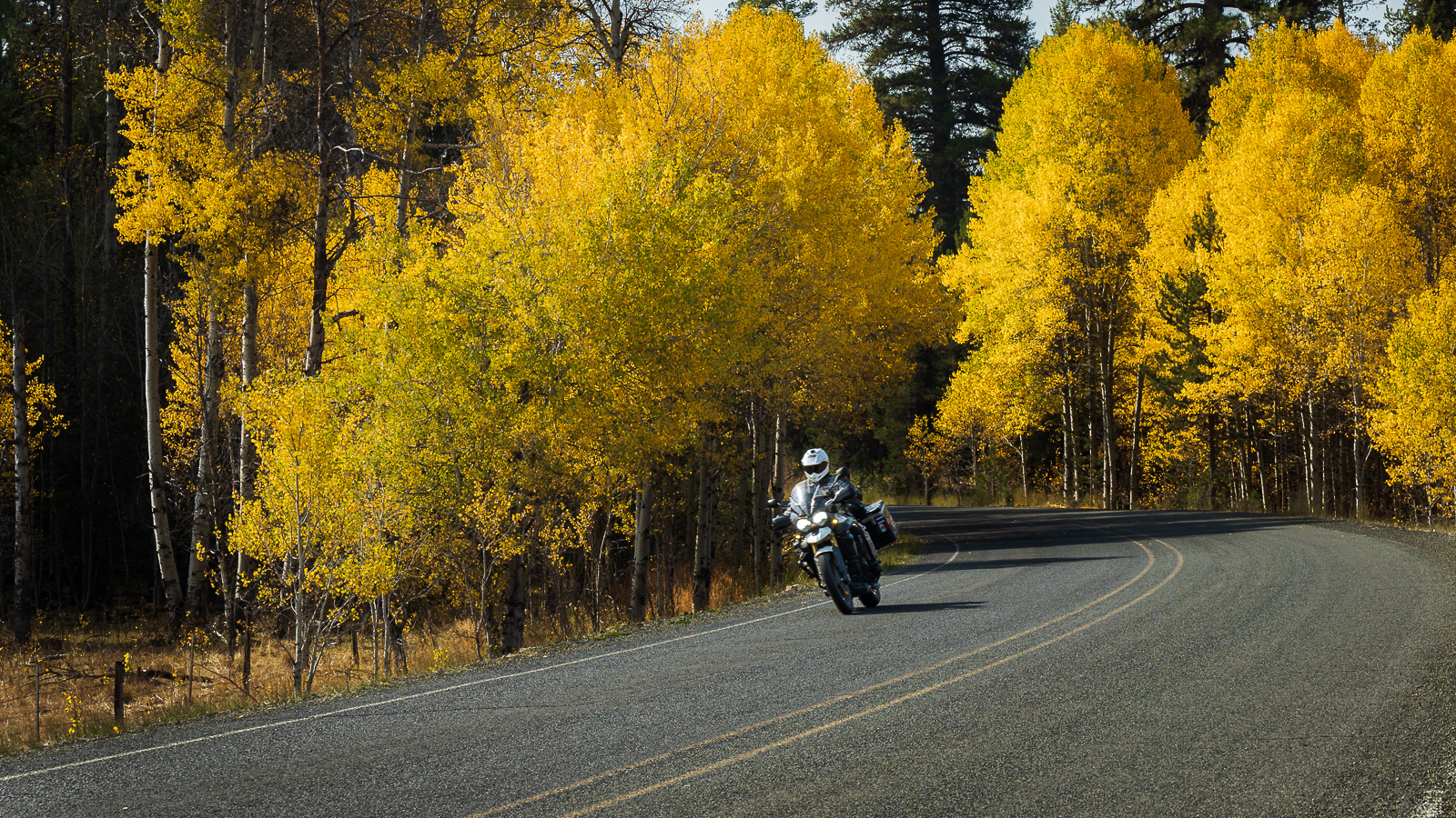
Highway 380, as we headed east, was amazing country. Miles of canyons and valleys lined with green pines and ash trees with leaves that had turned yellow for the fall. Occasionally, we would ride through a layer of the yellow leaves, sending a cloud of leaves fluttering into the air.
We turned onto Grant County Road 63 and wound through the Malheur National Forest and Ochoco Mountains. The road was fun and twisty, with very little traffic. We found ourselves riding through tunnels of trees as we made our way toward Canyon City and John Day.
We stopped in John Day and picked up a new bolt (and a tube of Loctite). With my front brake level securely back in place, we sought out a meal. Taking up the recommendation of the clerk at the hardware store, we checked out the Grubsteak Mining Company.
The restaurant looked like an old-time Wild West saloon on the inside. The seats were made from logs, and the walls looked like rough-cut wood boards. Greg and I both ordered the meatloaf sandwich, which was on special. Comfort food always sounds good when you’re eating one cooked meal a day. The meatloaf was just like homemade, and the bacon and cheese added just the right amount of flavor.
We rode east on Highway 26, climbing into the Blue Mountains. The air cooled as we climbed up above 5000 feet at Blue Mountain Summit before dropping down into the Burnt River Valley.
We stopped at Unity Lake State Park and set up camp. Using my Oregon State Parks pass, we got another night of free camping. The campsites were huge – Greg set up his tent about 100 feet from mine – and the grass tent areas were soft and green. Another great amenity of the state park were the hot showers. Taking a hot shower after a few days of wiping myself down with a washcloth felt great.
Skies took on a bright orange-pink hue at sunset and the clouds added just the right amount of drama as the sun went down behind the Blue Mountains. Rays of sunlight streamed upwards through the clouds making the sky take on the look of a painting.
Just before calling it a night, we got another visit from the ISS. I kept looking up at the stars – Saturn and Jupiter were aligned in the sky. I put my telephoto lens on my camera and pointed it skyward, easily seeing the Galilean moons of Jupiter.
Newberry National Volcanic Monument to Antelope Reservoir
Woke up to another cold morning with temps in the mid to low 30s. We were on the road by 8:30 and headed for the shop in Bend to get a new tire. I dropped the bike off with the folks at M-Tech Motorcycles and walked down the street for coffee. In about an hour my wallet was $200 lighter, and my bike had a new Dunlop Trailmax Mission replacing the original Bridgestone Trailwing.
We made a quick stop at REI for some camp food. The Bend REI was built inside the brick shell of an old lumber mill. The walls inside are bare brick, and the mill’s three smokestacks still reside on the roof. I looked for some base layer pants to help keep me warm at night, but could not find any. I got a dehydrated meal and some protein bars instead.
Greg and I then headed east on Highway 20 into the Oregon high desert. Highway 20 climbed through the rugged Oregon Badlands – a vast plain of old basalt lava sparsely covered with juniper trees and grasses. It was a preview of the “magnificent desolation” we would see in southeast Oregon.
Just west of the town of Brothers we turned onto Oregon Highway 27, the Crooked River Highway, to head toward Prineville. From Highway 20, Highway 27 starts off as a straight washboard dirt road that will rattle the fillings out of your mouth. The gravel was a little loose and it took a couple miles for me to find my dirt groove. I thought back to the training the Motorcycle Relief Project gave me in Colorado. I soon remembered to trust the bike and got my dirt groove and a comfortable pace.
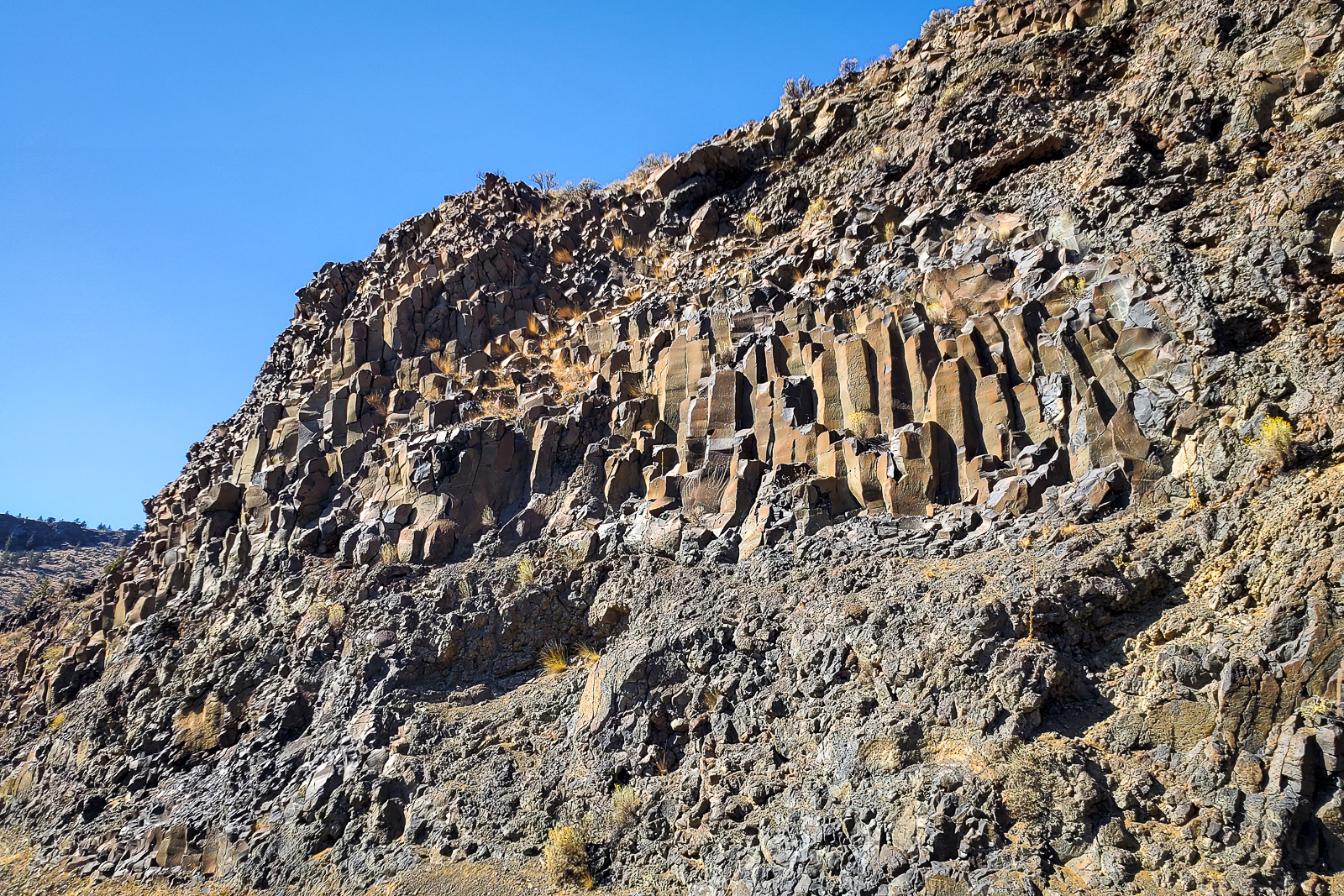
After about 17 miles, the dirt turned to pavement as it entered the Crooked River Canyon. The road followed the curves of the Crooked River and gave us amazing views of the river and canyon walls. The volcanic nature of the eastern Oregon landscape was evident in the canyon. The river had carved through millions of years of basalt deposits and hexagonal basalt columns were visible on both sides. They appeared as if they were holding up the land at the top of the canyon.
We grabbed gas and supplies for the night in Prineville and headed east on Oregon Highway 380. As we rode east, we passed the town of Post, which bills itself as the “Center of Oregon.” Sure enough, if you look on a map, you’ll find Post almost dead center in the state.
Just east of Post, we turned onto unpaved Forest Route 17 and climbed into the Maury Mountains to seek our campground. As we rode the 18 miles to our stop, I found myself keeping up with Greg as we rolled through the forest. We climbed to what felt like the top of the mountains and stopped at the Antelope Flat Reservoir Campground. The campground seemed large, but we were one of only three sites that were occupied.
The campground sits in a pine forest above the reservoir. We hiked down to the reservoir to take a swim, but found the water to be dirty and shallow. A couple fisherman came by to chase down their dogs that had ran over to see us. They said the reservoir has been low for a long time, as have many across the state due to hemp farms.
After coming up empty at the reservoir, we returned to camp and washed our clothes at the campground’s well. One thing about motorcycle travel is you don’t have a lot of room for a week’s worth of clothes. Doing laundry, even at a campground in the middle of nowhere, is a necessity – nothing beats a clean pair of socks.
I made the dehydrated meal I had bought earlier at REI and was pleasantly surprised. The AlpineAire chicken jambalaya didn’t taste like it had come from a foil pouch. It actually tasted like jambalaya.
After the sun went down the temperature dropped quickly. The air was dry and we were at 4600 feet elevation. I started a campfire to fight off the cold.
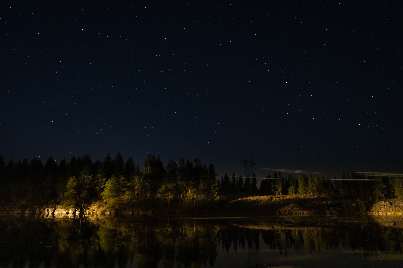
We got another visit from the ISS during the night. That’s three days in a row. The ISS has turned out to be our regular companion during the trip. While watching the station tonight, it crossed overhead almost horizon to horizon before disappearing from sight. We waved at the astronauts aboard the station, but can’t be sure they waved back.
Keno, Oregon, to Newberry National Volcanic Monument
We woke up to temperatures in the low 30s and the sun casting an orange glow over the lake. A thin layer of mist hung above the water.
We made our coffee and breakfast and sat watching the still water. Fish were starting to jump as the sun warmed the water. A bald eagle made a low pass over the lake before disappearing into the trees.
I made a call to a motorcycle shop in Klamath Falls, which was surprisingly open. They did not have any tires in the right size for me. I called a shop in Bend and found out they had the right sized tire in stock. We planned to head for Bend, an easy day. I figured if we made it there early enough, I could get the tire today; if not, first thing Tuesday morning.
We turned north on Highway 97 at Klamath Falls and rode along the shores of Upper Klamath Lake. The water of the lake was still.
We turned onto Oregon Highway 62 to head toward Crater Lake. Near the towns of Klamath Agency and Fort Klamath, we passed through more devastated areas from recent fires. Fire is a strange beast. Often we saw areas where most of the trees were burned out, but a few in the middle would survive and remain green. In other parts, the whole area would be burned, but structures that had been surrounded by the flames survived.
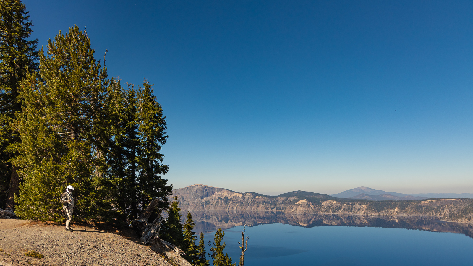
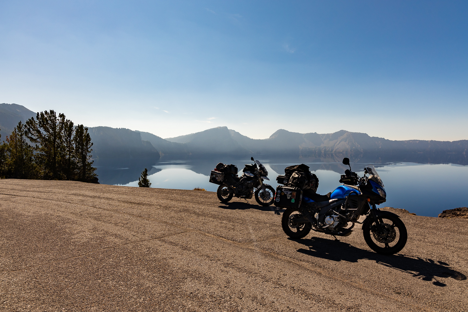
We entered Crater Lake National Park and climbed up East Rim Drive. I had ridden on the west portion of Rim Drive before and the views area always breathtaking. This was my first time on the east portion, which is usually closed by this time of year. We stopped at the overlook for the Phantom Ship, a pointy island in the lake that looks like a ship in dark or foggy conditions. The brown and orange rocks contrasted against the deep blue waters of the lake. We continued around the rim of the lake, stopping occasionally to take in the views of the whole lake. A light haze hung in the air inside the crater.
We dropped down from the crater onto Highway 97 again. We went north on 97 and stopped in La Pine for lunch and to figure out where we would stay. We ate lunch at a truck stop where Greg raved about the chicken fried steak. I had a turkey, bacon, and ranch melt. Greg, for all his raving about the chicken fried steak, had a burger.
We pored over the map for local campgrounds. We decided to head for Newberry National Volcanic Monument to stay at one of the lakeside campgrounds. Our stop would put us a stone’s throw away from Bend on Tuesday morning.
Newberry protects the area around the Newberry Volcano. The caldera contains two lakes separated by a cinder cone.
We set up camp at East Lake Campground and then headed to the lake for a swim. Fishermen were far out on the lake. The water was very cold, but it was refreshing and invigorating to soak after a day in the saddle. Because the lake is on a volcano, we occasionally got the whiff of sulfur coming from the water. Small warm and hot springs dot the edge of the lake.
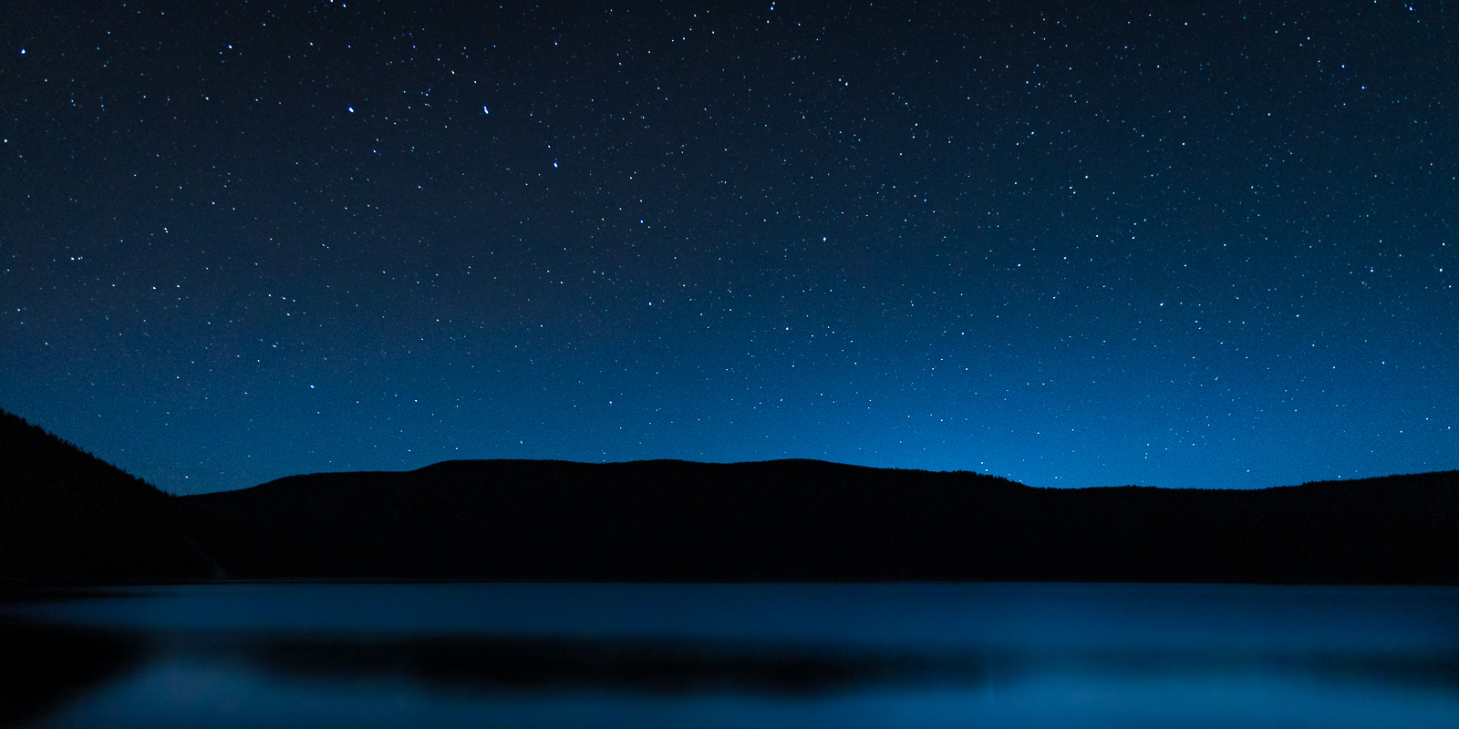
We enjoyed a couple of cigars after the sun went down. You come up with solutions to all the world’s problems when you’re sitting by a lake watching the stars and enjoying a stogie. We saw the ISS again and some shooting stars.
2020 has not really been a good year for travelers. Global pandemics, kind of put a damper on moving about.
My friend Greg has not let the specter of COVID-19 stop him. He’s done three F*ck COVID rides over the past few months, taking him around the western US. I felt it was time for a F*ck COVID ride of my own.
Greg wanted to tag along on my trip and said I would do the planning for once. The pressure was on, as I felt I had to make sure the trip lived up to the expectations of the seasoned motorcycle traveler. I decided on a loop around eastern Oregon, but did not really have a plan.
It was a chilly, foggy morning in Humboldt County when we met at Greg’s driveway. We bucked tradition by not meeting at Starbucks – another victim of COVID-19, as we would not be able to sit at a table inside to get properly caffeinated before rolling out. Instead, we sipped coffee over the tailgate of Greg’s pickup and looked over the map so I could plot out the day’s travels.
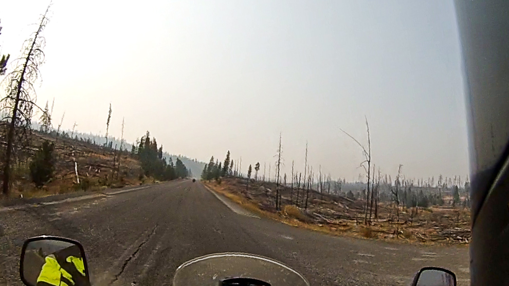
We headed into the foggy morning northbound on Highway 101. The crisp and clean air was a welcome relief from the smoky skies that had hung over the area recently due to two nearby fires, one of which was the largest in the history of California.
Greg stopped in Crescent City to top off so we could try to sync our fuel stops – his Triumph Tiger drinks gas a little faster than my V-Strom. While at the gas station Greg looked over by bike and spied my front tire, the original one that came with my bike, and said, “We need to talk.” I knew time was running out on the tire, but I figured I could probably make it through the trip before needing to replace it. Greg told me I should get the tire replaced on the trip to be safe. Seeing it was Sunday, and motorcycle shops are typically closed Sundays and Mondays, I would need to plan our route to be near a city with a shop on Tuesday morning. I looked up a few shops while we were stopped, some surprisingly saying they were open on Monday, and knew we could figure something out.
We turned east onto Highway 199 toward Oregon. Highway 199 starts by winding through the redwood forests of Jedediah Smith State Park, and soon exits into the fir and pine forests of the Siskiyou Mountains. As we got closer to Oregon, we could see the path of destruction from the Slater Fire that ran through the area. Initially, I could smell an odor similar to VapoRub – possibly from the burnt sap and tree resins – but as we got deeper into the burnt area, the smell of burnt wood and grass got thicker. We rolled through the Collier Tunnel and emerged into an area that was completely cleared out – no foliage on the trees, no undergrowth on the forest floor, just a forest of burnt matchsticks.
We stopped at Taylor’s Country Store, a destination for area riders, for a socially distanced lunch on the outdoor patio. Greg ordered a burger that took about three days to arrive, while I had a hot link sausage. I had nearly finished before Greg received his food. While waiting, I found a shop that was open on Monday in Klamath Falls, the direction we were heading. Keeping our schedule ever fluid, I decided we would continue in the direction of Klamath Falls and see if the shop had a tire the next morning and if not, we would head north toward Bend.
At Grants Pass, we made a turn onto Oregon Highway 238 to point toward Ashland. Highway 238 winds its way through the Applegate River Valley, past miles of farms and vineyards. As we rode through the valley, we often got the pungent whiff of growing marijuana – in the case of the farms in the Applegate Valley, industrial hemp, which is the same species of the cannabis sativa plant as marijuana, but does not contain high enough concentrations of THC to get someone high. The smell was accompanied by fields of the green stuff planted in rows like cornfields along the edge of the highway.
After passing through the town of Jacksonville, we turned south on Oregon Highway 99 and rode through the towns of Phoenix and Talent before entering Ashland.
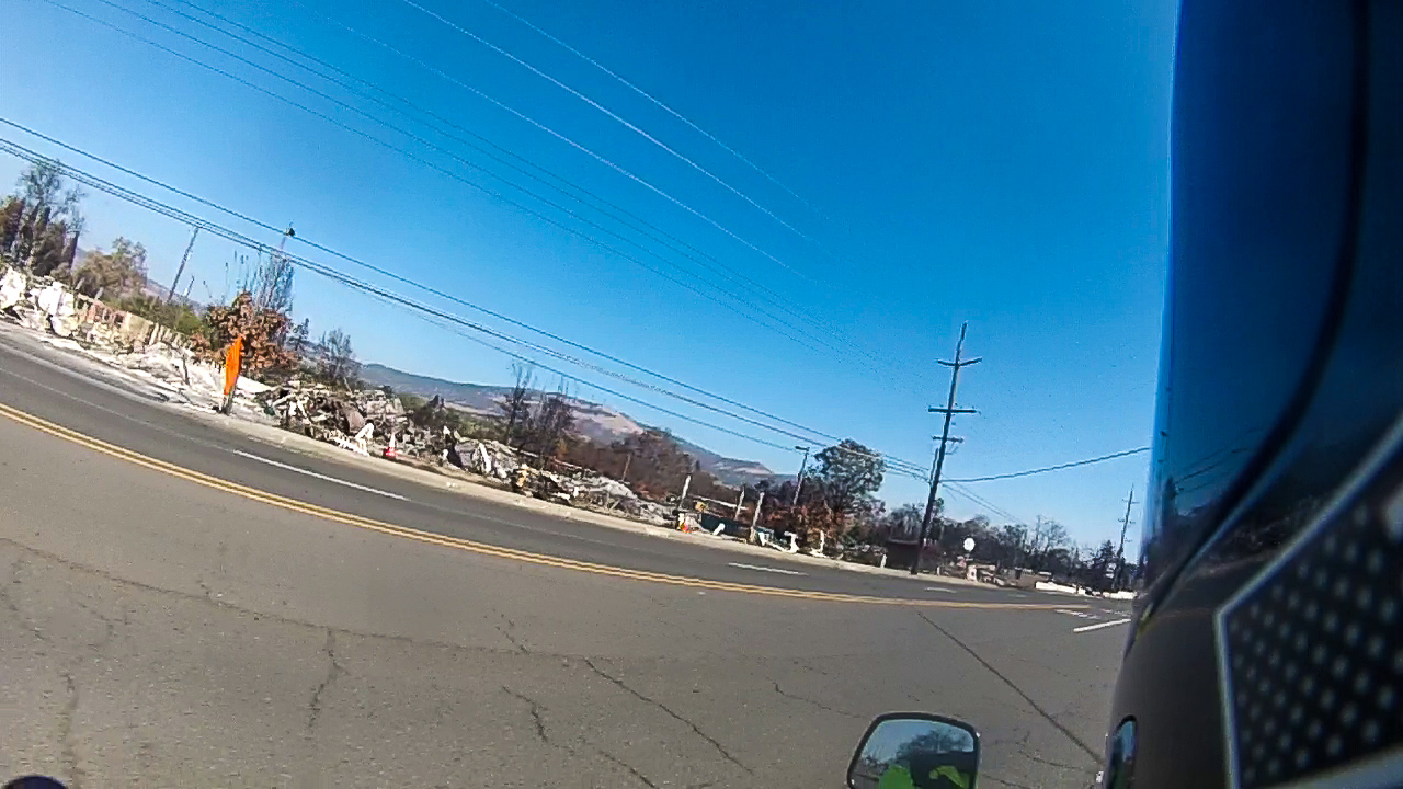
Fire had run through Phoenix and Talent in September, destroying much of the cities along Highway 99. Businesses were totally burned out, leaving only small remnants of what used to be there. RV parks were filled with burned out shells of the trailers and mobile homes that used to be there. One used car dealer’s lot was full of burned cars, with one mysteriously untouched by the flames. Only the vault and sign remained where the Umpqua Bank once stood. The Phoenix Motel was reduced to just its sign. Like the mythical bird, the city will rise from the ashes.
We stopped for fuel in Ashland and headed east on Route 66 – Oregon Highway 66, that is. The road climbed up into the Siskiyou Mountains on a sinuous two-lane road with vertigo-inducing cliffs and tight curves that were perfectly cambered.
We arrived in Keno in the late afternoon and made the first of our many projected miles of dirt to get to the Topsy Campground on the shore of the John C. Boyle Reservoir. We set up our camp as fish jumped out of the water, breaking its stillness. Canada geese honked in the air and dove into the water, making a stop on their southerly migration.
Later in the night, we stood out on the shore of the lake and watched the International Space Station, chased by a Cygnus supply ship pass overhead.