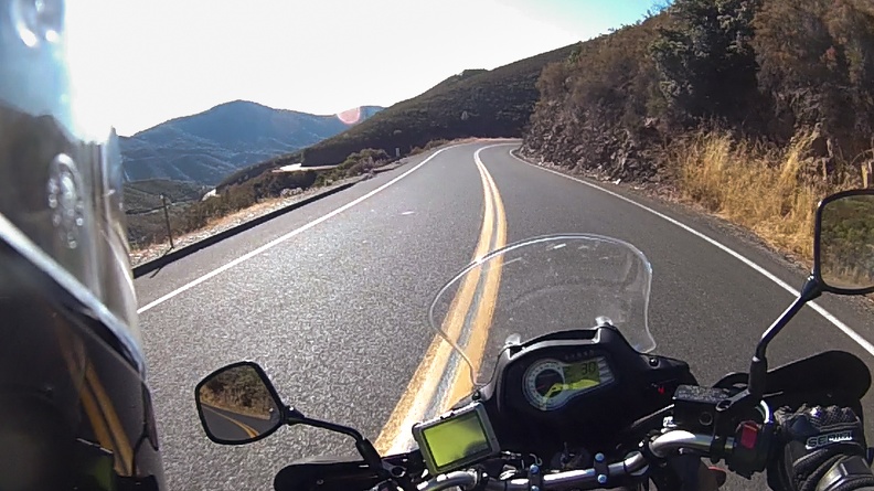
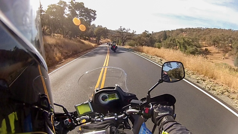
There’s an ongoing thread over at Stromtrooper.com called the Motorcycle Picture of the Week. The rules are rather simple: post a picture of a motorcycle you own that fits the week’s theme. Each week has a new theme, and at the end of the week the participants vote on their favorite. The winner gets to pick the new theme.
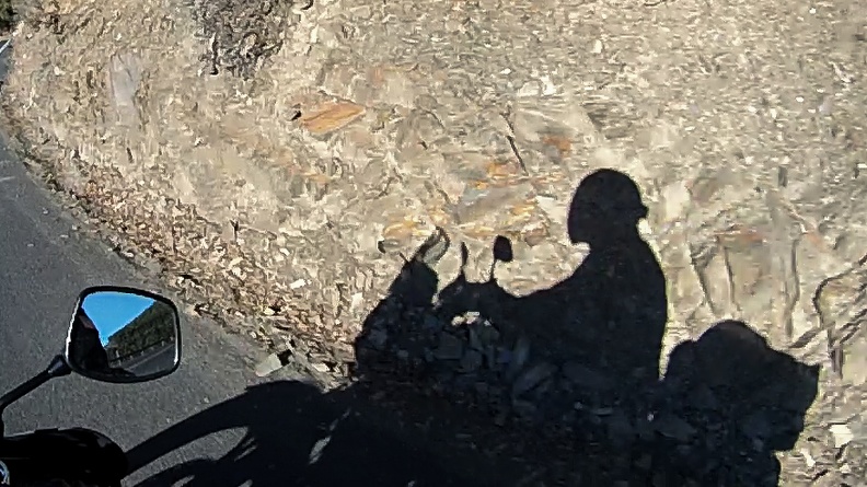
This week’s theme was “Music.”
This is a mural titled “Arkley Performing Arts” by Randy Spicer. It’s on G St. between Fourth and Fifth Streets, facing the Arkley Center for the Performing Arts.
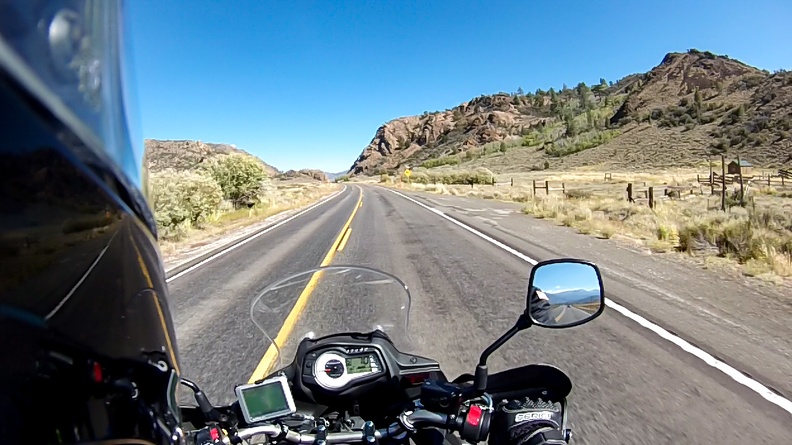
I was greeted by a beautiful orange sunrise over the Delta. Unfortunately, I didn’t dig out the camera. I packed up my camp and hit the road by 8:30.
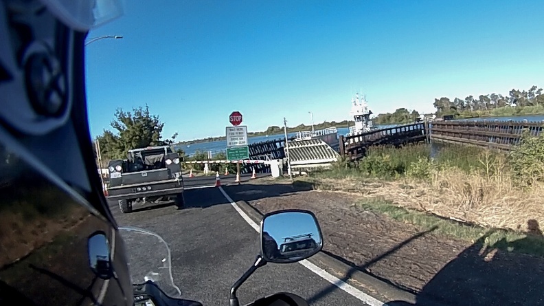
I stopped for fuel in Rio Vista and headed north on Highway 84. A couple miles north of Rio Vista, on 84 is the Ryer Island Ferry. The Ryer Island Ferry is one of two Delta ferries owned and operated by Caltrans. The ferries run 24 hours a day, 7 days a week, crossing the Sacramento River. I had read about these oddities and figured that I was so close, that I had to do it just because.
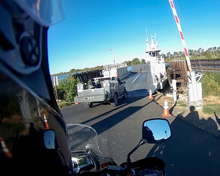
I pulled up to the ferry gate and the operator lowered the ramp. I rolled my bike onto the ferry called the “Real McCoy II.” It was a small ferry, with room for about six cars. I was the only passenger on this trip of less than 1000 feet. I wondered if it would be more cost effective for the state to just build a bridge, rather than run a ferry constantly. There must be some reason why the ferries still exist here.
Real McCoy II
The ferry ride itself was nothing special. Just sitting on the bike for two minutes as the ferry ferried me across the river. Once on the other side, the ramp lowered and the gate went up and I rode off, passing a couple cars waiting for the westbound run. I went down the road a ways and turned around to take the ferry back. The operator might have thought it was strange, but I’m sure this isn’t the first time someone has just gone back and forth.
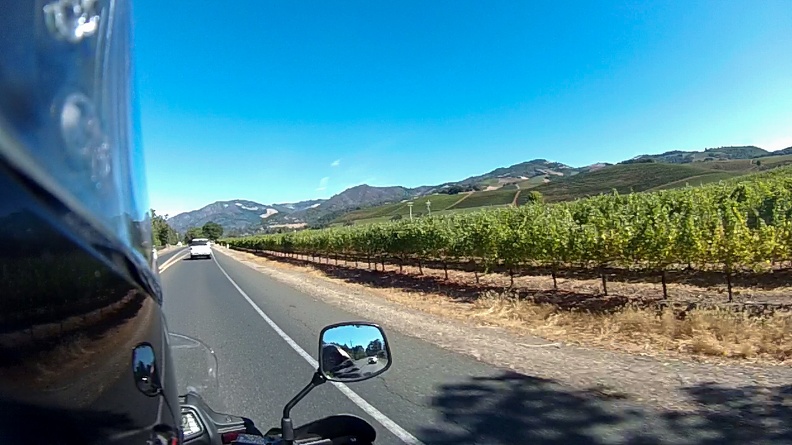
After my detour, I returned to Highway 12 to continue on toward the Napa Valley. I had planned to take Highway 12 and then get onto Highway 128 and ride through the Calistoga area, but my written directions didn’t mesh with the GPS and I must have missed the turn. I stayed on Highway 12, heading toward Santa Rosa.
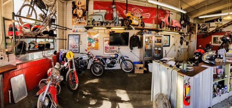
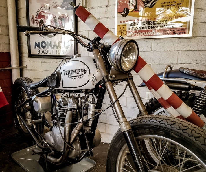
I hit the town of Sonoma and started to feel hungry, as I hadn’t eaten breakfast. For such a touristy, hipster town, it seemed unusually devoid of coffee places. Then again, this is wine country. I was on my way out of town and found what I was looking for. Almost as if it was fate, I saw a sign for a cafe with several motorcycles parked out front. I pulled into the parking lot and parked my motorcycle behind an old BMW R80 G/S … the original adventure bike. In true hipster form, that bike was adventure before adventure was cool. The cafe, Cafe Scooteria, was a neat little drive-up coffee joint where the coffee is made on a small trailer. But there’s also a seating area for those who aren’t on the go. The seating area is an old service station and is chock full of motorcycle memorabilia and old motorcycles. I sat next to an old Triumph and enjoyed a white mocha and a spicy sausage breakfast burrito.
Cafe ScooteriaOld Triumph
Fully caffeinated and with a full belly, I continued on.
I passed through rolling hills with gentle curves, bordered on both sides by vineyards as far as the eye could see. I surely didn’t miss out on any scenery. I passed a few roads that headed east into the mountains. After reviewing the roads back home, a few of them would have taken me over the mountains on roads that were a motorcyclist’s dream, and put me back on my original planned track. I was running on a schedule though, and didn’t stop to check when I had the chance.
Wine Country
I arrived in Santa Rosa and turned onto Highway 101, a road I was very familiar with in a car. Highway 101 seemed to be an easy way to finish the ride. There was little traffic, and the highway’s gentle sweeping curves were much nicer on the bike. When I got to Leggett, I exited 101 to hop on Highway 271. 271 is the old highway that was built before 101 was expanded to a four-lane freeway through Leggett. At the end of the off ramp I crossed past with a guy who was likely one of the local “farmers.” He was easily recognizable by his flat-bill hat and lifted Toyota. For an unknown reason, he must have been trying to assert his dominance because he revved up his engine and took off down the curves as fast as he could. Whatever floats your boat, man. I’m not one to get into dick-swinging contests with douchebags. I was not impressed by him.
“Running Home”
Highway 271 was tight and twisty, following the contours of the canyon. The road kept you on your toes with several patches of loose gravel that had fallen from the mountainsides above the pavement. After a few miles, I got back on 101 for the run home along the Eel River Canyon.
I finished up riding through familiar territory in the Eel River Valley. There’s something comforting about finishing up in familiar territory.
In all, today was my longest single-day ride since I began riding.
Day 6: 314.8 mi. Total Distance: 1345.82
Highways Taken: CA-12, CA-84, US-101, CA-271
The natural beauty of California never ceases to amaze me. The sheer size of geological features in the Cascades and Sierras is both awe inspiring and humbling. Californians are truly blessed with some of the best riding areas in the world.
The thing about adventures is that once you finish one, you want to plan the next. Before this trip, I had never gone anywhere near as far on a motorcycle. Still being a new rider, unfamiliar roads still worry me a little … and maybe it’s an irrational fear, or maybe it’s human nature to fear the unknown. I had no doubt that I could do it though. And it always helps to have good friends with you. Ted Simon said it best: “It is remarkably easy to do things, and much more frightening to contemplate them.”
Horizons Unlimited met all my expectations. I met a bunch of cool new people, heard wonderful stories of travel to near and far-off lands, and got some inspiration. But reality awaited, and I needed to go home.
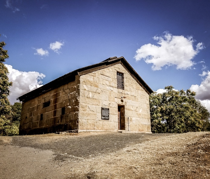
Mariposa was a neat little town with lots of history. It has the oldest county courthouse in California. In fact, the county still uses the original one-room courthouse with all the original furniture from the 1800s.
As I do when I travel, I stopped at the local constabulary, in this case the Mariposa County Sheriff’s Office, and traded for a shoulder patch for my collection.
Mariposa County CourthouseMariposa County’s Original Jail
My original plan was to go all out and do one long day on Sunday morning after HU finished. I had to be home to take Alicia to the airport because she was leaving for a work trip. On Friday afternoon I came to the realization that doing a 450-mile trip all in one day with a fairly hard deadline was probably not the best idea. I didn’t want any potential delays to get in the way. Plus, I’d be by myself for the whole trip.
Good decisions …
I decided I would leave Saturday afternoon and break the trip up into two legs. I worked out a plan of where I would stay on Saturday night, leaving me nearly all of Sunday to finish a much shorter trip home.
I went to a couple presentations on Saturday morning. I listened to Christopher Baker talk about his travels in Cuba. I bought his book and got him to sign it. I then listened to Lynda Lahman talk about managing fear. The takeaway: Don’t dwell on the bad stuff, or it will happen.
I packed my camp up during breaks between presentations and I headed out around noon. Dave, Greg, and I had planned to ride into Yosemite Valley while we were in Mariposa, but it never happened. I couldn’t be so close and not do it, so I planned my route home to take me on a loop through the valley and back out on Highway 120. Even if I just did a lap of the valley, it’s still a wonderful thing. Thank you to my wife Alicia for the idea!
I said goodbye to the new friends I had made and headed out of town. Greg had gone to do laundry, and was not at the campground. I kept an eye out for his bike as I passed through town, but since I didn’t know where the laundromat was, I didn’t know where to look. I didn’t find him. A text message would have to do.
I rode out on Highway 140 toward the valley. Traffic was unusually light for a weekend, but I had no problem with that.
I rode into the valley and felt that same sense of awe I had the very first time I went to Yosemite. There’s something special about seeing things on a motorcycle.
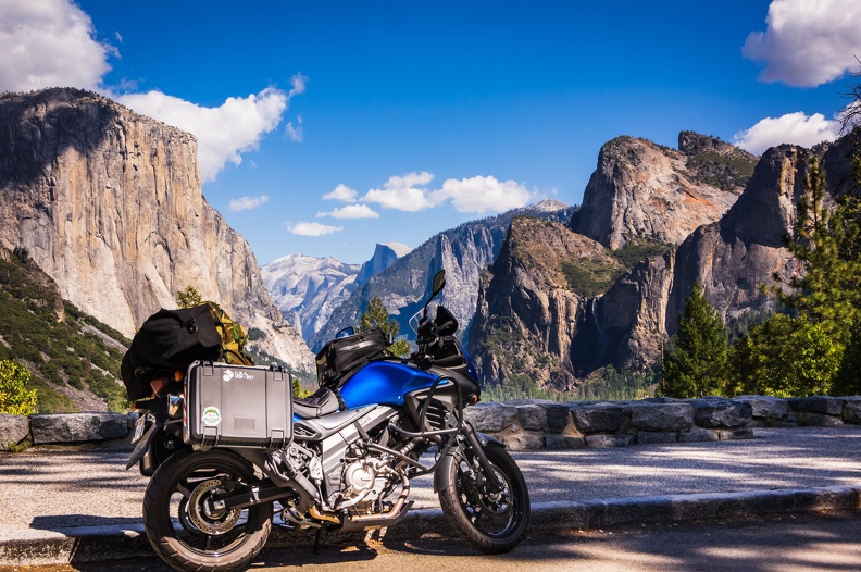
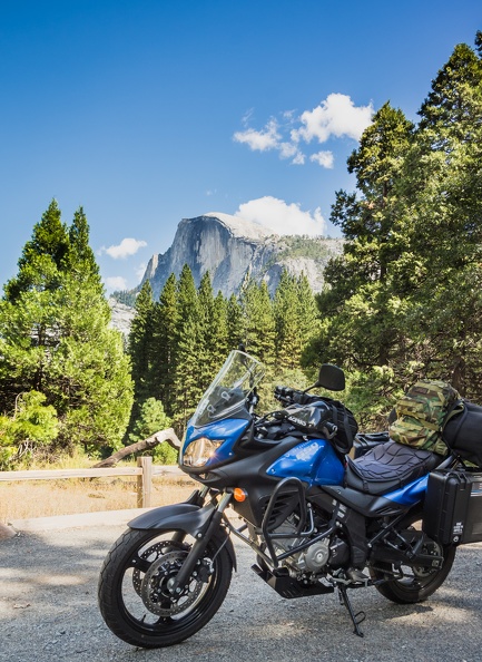
I headed up for the obligatory photo at Tunnel View on the southwest side of the valley. This tunnel view vista is different from the one on Big Oak Flat Rd.; you can actually see all the landmarks of the valley: El Capitan, Half Dome, and Sentinel Dome. Unfortunately, the viewpoint is also very crowded. I squeezed the bike in to find a place to park. Luckily, a group of Harleys were just about to leave the parking lot. I parked my bike right next to the curb, because when you’re on a motorcycle, you can park just about anywhere. I snapped a few photos of the view with and without the bike and went back downhill.
I emerged from the trees at the bottom of the road to Tunnel View and was greeted with a vast expanse of the grandeur of the valley. Everything seems larger when you’re not confined to a steel box. The valley looks like a painting. I snapped a few pictures of the bike with Half Dome and headed toward the Village Store and visitor center.
Traffic in the valley sucks. People are stopping all the time, and there’s just a lot of cars all going in one direction because the road is a one-way loop. My “quick” lap of the valley turned into two hours, putting me a little behind what I had planned. Oh well ….
Climbing out of the valley, I suddenly felt a chill in the air. The valley floor is at 4000 ft, but the road out climbs up to about 6200 feet at Oak Flat before descending back down. I stopped to put on a sweatshirt under my jacket, then continued west.
I passed through hilly terrain much like on Highway 108 a few days earlier. I rode through small communities whose only current purpose appeared to be providing lodging for travellers to Yosemite.
Soon I reached Priest Grade. There’s two roads at Priest Grade – the current highway and Old Priest Grade Rd. On the east side, you start at about 2500 feet, and you drop to about 900 feet on the west side. On the old road, is steep and narrow, covering the drop in a little under 2 miles. It’s not uncommon to see vehicles with smoking brakes. The current highway stretches the drop to about 5 miles, making it easier on the brakes – or so you would think. The “new” Priest Grade road has more than 100 curves and hairpins – sort of a mini Tail of the Dragon – so it may not be that much of a brake saver. I took the new road. It did not disappoint.
Priest Grade
At the bottom of the grade is a town called Moccasin and Don Pedro Lake. Don Pedro Lake is one of the many reservoirs in the area that provides drinking water to much of southern and central California. There’s a bridge that crosses the lake, and it was undergoing repairs. I noticed the edges of the bridge were no longer there. A K-rail will be the limit of your road today.
Highway 120 starts to become boring after this. By the time you’ve reached the town of Oakdale, you’ve hit the Central Valley. Curves disappear, as do hills. You’re left with flat, straight roads the rest of the way. The upside is your average speed goes up.
My destination was in the California Delta, a park called Brannan Island State Recreation Area. By the time I hit Oakdale, my GPS was estimating I’d arrive at about 6:45 pm. Sunset was at about 7 pm. That’s cutting it close to not have to make camp in the dark.
I took some side roads through farmland, smelling cows, and other assorted animals, and at one point green onions. There’s a lot of different smells in the Central Valley, but I can’t recall ever smelling green onions. I was pretty much the only vehicle on these side roads. Plus one for the shortcuts!
I came out on Highway 99 just south of Stockton. I slabbed it on 99 for a few miles and turned onto Highway 4, in the heart of Stockton. By this time, the sun was low in the sky, and it was an adventure in visibility with the sun shining directly in my eyes. I turned onto Interstate 5 to slab it for the next 10 or 15 miles.
I-5 needs some major work. The concrete is crumbling, leaving large seams and big missing chunks in all the lanes. I dodged semi-trucks and pulled off at Flag City in Lodi to make my final run toward camp. Oh lord, I’m stuck in Lodi again. A quick stop to grab some dinner, and I was heading west into the Delta.
The road west in the Delta was another exercise in trying to see. The sun was even lower, and directly over the center of the road. The builders of Stonehenge couldn’t have lined it up more perfectly. Maybe I should pull over and sacrifice a virgin or something.
I made it to Brannan Island just as the sun crossed the horizon. I wouldn’t have much time to locate a campsite and get set up. I circled the park once looking for the right spot before settling on one right next to the entrance gate. I figured I’d be getting up early and getting on the road. Might as well make for a quick exit.
I got everything set up and sat down on the picnic table for a dinner under the light of an LED headlamp. Canned chili and pistachios with Diet Pepsi – the dinner of champions. I topped it off relaxing with a cigar in the dark.
I found it a little strange camping solo after spending most of the week with Dave and Greg. However, there was something to be said about sitting there alone with just the sounds of the Delta to listen to, and a sky full of stars to stare at.
Just before turning in, I realized I should have looked around a little more before deciding on a campsite. It was a 200-yard walk to the closest bathroom. During the walk, I found several empty campsites in much closer proximity. Convenient isn’t always better. Hopefully I wouldn’t have to get up in the middle of the night to answer the call of nature.
Day 5: 210.8 mi. Total Distance: 1031.02 miles
Highways Taken: CA-140, Big Oak Flat Rd., CA-120, County Highway J9, County Highway J7, CA-99, CA-4, I-5, CA-12, CA-160
We woke up to a cold and windy morning in Mammoth Lakes. Once again, I was up with the sun.
While making my coffee, Greg came out of his tent and told me we needed to discuss today’s ride. The previous night, we had made plans to ride down to Panamint Springs to see “Star Wars Canyon.” Star Wars Canyon is a narrow canyon near Death Valley where military jets from Edwards AFB, China Lake, and Nellis AFB make low-altitude passes following the canyon’s curves. There is a vista point off the highway at the edge of the canyon, and the planes pass by at eye level. It was to be a short day, as Panamint Springs was only 153 miles – a 3-hour ride – away.
Greg told me he had looked at the weather forecast for Tioga Pass, since we would be crossing tomorrow. The forecast was calling for snow overnight, and Greg was concerned snow would close the highway, and we’d be stuck taking a much longer route to Mariposa on Thursday. I checked the weather forecast myself, and saw there was a 50 percent chance of snow in the pass.
We had two choices: continue to Panamint Springs and chance it – risking a ride just shy of 400 miles, taking Highway 395 south to Kramer Junction and then taking Highway 58 west to Highway 99 in Bakersfield; or forget Panamint Springs and cross Tioga Pass today. We decided the longer trip on Thursday was not worth it, and chose to cross Tioga Pass. We made a plan to cross the pass and camp in the Yosemite Valley for the night.
We packed up and headed into Mammoth Lakes to fuel up. We stopped at a Shell station, which was out of the ordinary because Dave and Greg typically, and religiously, stop at Chevron stations. After fueling up, I saw Greg had parked his bike by the store entrance and was taking a picture of it. He soon showed me why. Earlier this year, Greg had taken a motorcycle trip to Baja, Mexico, and had returned home through Mammoth Lakes. Greg got caught in a freak spring snowstorm and stopped at the Shell station. Greg showed me a picture of his motorcycle parked in the exact same place with the ground covered in snow.
We headed out and turned north on Highway 395.
After leaving Mammoth Lakes, it became fairly windy on the highway. As we approached Lee Vining, it was getting difficult to ride the motorcycle straight due to the crosswinds. I had looked at the weather report earlier and saw 25-30 mph sustained winds were forecast, with gusts up to 50 mph. I didn’t have an anemometer, but I’d guess the forecast was pretty spot on. I did what I could to keep the bike going straight — loose grip, light pressure on the bars on the left side toward the wind, and leaning my body toward the wind. It worked to a point, but my bike still wanted to veer to the right. Nevertheless, I carried on.
We made a right turn onto Highway 120 just south of Lee Vining. A short way up the road, Dave and Greg stopped on the side to take a picture. The vantage point gave me a great sense of the size of the Sierra Nevadas. Sitting at the base of 10,000+ft peaks will surely make even Andre the Giant feel small. It was also a little intimidating – we had to go up there! I’m sure the early settlers to the area thought the same thing. At least I had a road to get me there!
Bottom of Tioga Pass
We started up the pass, and I soon lost sight of Dave and Greg, as usual. There were lots of other motorcyclists out on the road — Highway 120 is a popular route for them. I was perfectly fine, riding at my own pace and letting the faster folks pass me by so I could take it all in. I was taken aback by the amazing views of the mountains, and the sheer drops off the edge of the road. The road was fairly steep, but I don’t recall seeing anything as steep as the 26 percent grade in Sonora Pass. The winds continued through the pass, rocking my bike during turns, but I found my happy place and did my best to counteract them.
I passed by a resort that had been crushed by the record snowfall of the previous winter. Nobody ever thinks of snow as heavy until there’s a lot of it. Nature never ceases to amaze me with how something small like snow can cause so much damage. I passed by Ellery and Tioga Lakes, where cars full of tourists had stopped to take pictures, their jackets and other clothing flapping in the blustery winds. Mountain passes are typically windy places. The narrow opening between peaks acts like a funnel, channeling air through, compressing it and speeding it up, until it can spread out again on the other side.
I reached the top of the pass, where it must have been about 40 degrees. That’s to be expected at 9945 ft – the highpoint of California’s state highway system. I felt bad for the poor parks employees at the fee station who had to stand there in the cold.
The top of the pass is an entrance point for Yosemite National Park. Most people think of Yosemite as just the valley, but there are many other beautiful parts to the park. I had never been to any of them other than the valley.
I was amazed at the awesome scenery of this portion of the park. Many times I said, “Oh my God,” and “Wow,” in my helmet. Lush meadows and granite domes abound. Yosemite is much more than the valley, and Tuolumne Meadows along Tioga Rd. is a beautiful place.
We stopped at the Tuolumne Meadows Visitor Center to stretch. Tuolumne Meadows is a vast meadow, wedged between Lambert Dome on the east and Pothole Dome on the west. Hikers and tourists criss-crossed the road. RVs had to be dodged. We decided we would head into Mariposa for lunch, then return to the valley to camp at historic Camp Four.
We continued west past Pywiack Dome and Tenaya Lake … onward past picturesque Olmstead Point, where the road is literally cut into the side of a granite dome. From here, I was able to catch a glimpse of the valley’s iconic Half Dome – a view I have never seen before.
We carried on down the windy road, where the pavement – made with aggregate consisting of granite quarried inside the park – sparkles in the sun like diamonds. I turned on my video camera in hopes to capture the glimmering bits in the pavement. Someday this phenomena will be gone, as there were several places where the road had been covered by ordinary black asphalt.
We passed Big Oak Flat and turned toward the valley. On the right were hillsides I remembered being covered with trees just a few years ago. The trees were no more, erased from the landscape by fire, leaving a vast view of an empty valley.
Sneak Peek of the Yosemite Valley
As I approached the tunnels leading toward the valley, I caught a glimpse of El Capitan and Half Dome from the road. There’s something special about seeing them from the back of a motorcycle, a feeling you don’t get when confined inside a car with a roof on it. Motorcycles provide a panoramic view of the world around you, making you feel you are a part of the scenery instead of simply viewing it.
We rolled into Mariposa and stopped for lunch at Happy Burger, which boasts “The Largest Menu in the Sierras.” Surely enough, the menu was about 8 pages long with numerous items on each page. We placed our orders and made use of the WiFi. While watching the order window, we all gazed upon the glory that was someone else’s steak sandwich – the thing looked amazing — and wondered why we had not ordered such a delicacy. A decision was made to come back again during our stay.
After Greg put out a message out on Facebook about crossing Tioga Pass today, and where we planned to camp, we decided we would just check into the campground at the Mariposa Fairgrounds a day early to secure good spots. Once again, making good decisions has come into play.
We went to the fairgrounds and set up camp on the grass lawn. I was looking forward to sleeping on soft ground instead of the hard campsites we’d been at before. While I did have an air mattress, anyone who’s owned one can tell you that they all deflate through the night. Comfort prevails.
We set up our camp and introduced ourselves to the other early birds. We were all pretty tired, so the night ended early. Wouldn’t you know it, just after we went to bed it started raining and carried on for a few hours.
Tioga Pass was closed in the morning … snow.
Good decisions.
Day 4: 138.9 miles. Total Distance: 820.22
Highways Taken: US-395, CA-120, Big Oak Flat Rd., CA-140, CA-49
I slept pretty well, but Dave and Greg said they didn’t due to noise. Greg said “never again” to this KOA. I pointed out that a campground we stayed at in Oregon a few months prior was right next to I-5 and wasn’t as loud as this one. We went into Placerville and fueled up with a plan to ride to Sonora and get breakfast.
Dave tried to put air in his tires, but in true Murphy’s Law fashion, the inflator at the gas station didn’t work. Dave decided to wait until the end of the day and use Greg’s inflator (which was buried at the bottom of one of his panniers).
We left Placerville on Highway 49 and soon met up with a couple BMW riders. Dave and Greg took off, following and keeping pace with the BMWs. I kept them in sight, but soon they pulled away.
Highway 49
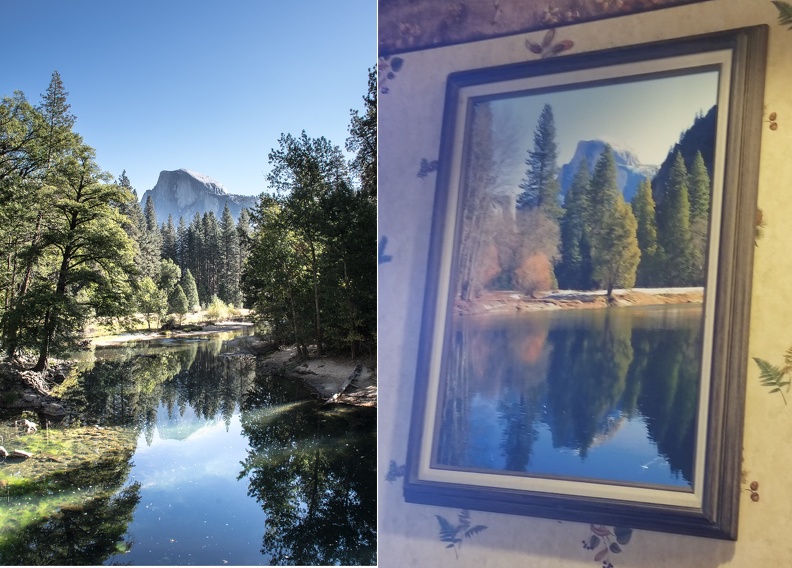
We stopped in Sonora and had breakfast at a place called Jeb’s Hill Country Cooking. The food was really good. I ordered a corned beef hash breakfast, but a few minutes after ordering I was told they had run out of corned beef hash. I opted for a Portuguese scramble — eggs, peppers, potatoes, and linguica — instead. We chatted with the waitress, whose boyfriend rode a GSX-R. I looked around the restaurant and found a picture of Half Dome that was very similar to one I had taken on a previous trip.
That looks familiar!
Next stop … Sonora Pass.
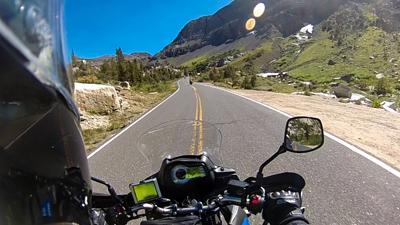
Sonora Pass is the second-highest highway pass in California at 9624 feet. The terrain gradually climbs in elevation leaving Sonora, and you’re presented with some great twisties as you climb. Once again, Dave and Greg took off ahead. I was having fun just doing my thing.
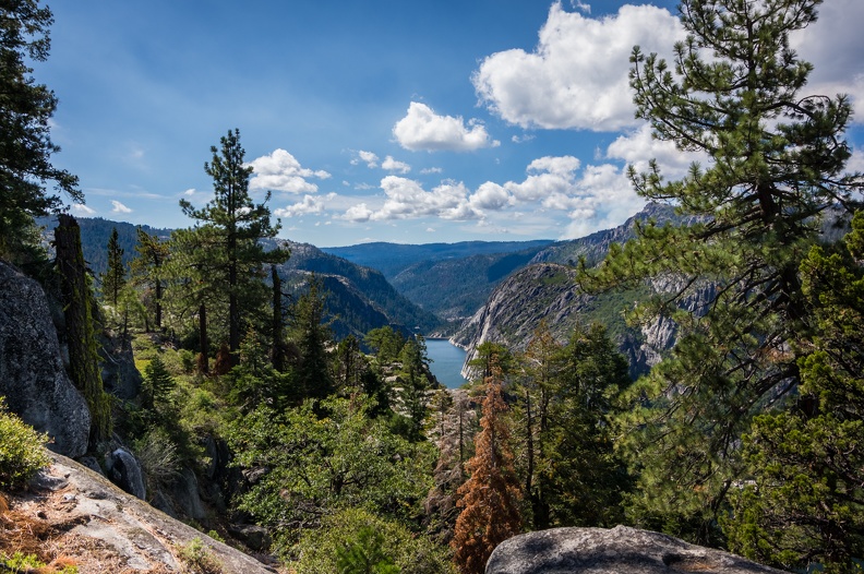
I soon came across the Donnell Vista Point and decided to stop in, since Dave and Greg were ahead of me and I wasn’t about to catch up. What’s a few minutes to take in a cool view and maybe get some pictures? Well, surprise surprise! I pulled into the vista point and Dave and Greg were there! How about that?! I walked around and took some pictures of Donnell Lake. Greg flipped off the camera when I turned it towards him.
Donnell Lake
We continued east and soon reached Dardenelle. It was odd that this area was relatively flat, especially knowing that a climb was ahead of us. I could see the mountains in the distance, and knew we still had to get over them. The scenery was amazing nonetheless — this large valley surrounded by tall mountains.
Soon we reached a sign indicating a 26 percent grade. Twenty-six percent! That’s 26 feet of rise for every 100 feet of horizontal travel. It works out to an angle of 14.57 degrees. If you draw it out on paper, it doesn’t look all that steep. Most roads that go uphill or downhill will have a grade of 6 or 8 percent. To make a comparison, a 6 percent grade is an angle of 3.43 degrees. These angles don’t actually sound very large, I’ll try to simplify to make it something to visualize the slope:
Let’s change the rules of baseball. Instead of a level field, you have to run up a ramp from home plate to first base when you hit the ball. It’s no longer running 90 feet, it’s now running 90 feet uphill. If you were to built that ramp from home plate to first base at a 6 percent grade, the end of your ramp would be about 5 feet 5 inches above first base. If you were to build the same ramp at a 26 percent grade, the end of the ramp would be 23 feet 5 inches above first base!
Sure, there are steeper roads out there in the world, but this was the steepest I’ve ever been on.
Now, thinking about steep roads and vehicles with manual transmissions, what is one thing you would not want to do on a 26 percent grade? Right. Stop. If you stop on such a steep road, you’re going to have a hell of a time going again. You have to feather the clutch just at the edge of the friction zone, while finding the right engine speed to give the bike enough power to move forward (upward?) and not stall. Oh … and you have to do it with a hand or foot on the brake so you don’t roll backward.
Well, somebody (not going to mention Greg’s name) decided to stop on this 26 percent section to take a picture. It was quite a feat getting going again after stopping to wait for him.
Despite all the steepness and windiness of the road, the views were nothing short of spectacular! From some spots you could see into the deep valley below, or into the Great Basin, which lies east of the pass. The downside is you can’t really look at the views as you’re riding. You need your entire attention on the road!
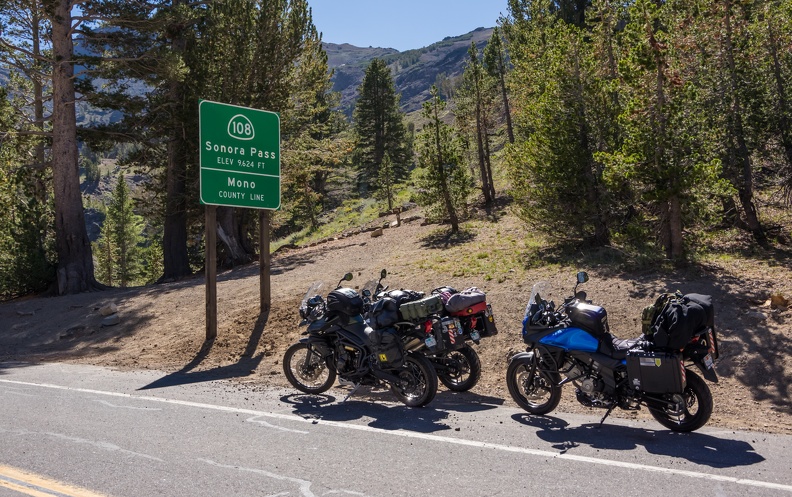
Sonora PassClimbing Sonora Pass
We all stopped at the top of the pass — 9624 feet, right on the Tuolumne-Mono County border. We took the obligatory pictures and walked around a bit to stretch our legs. I walked a little way up a nearby hill to get a view of the east side of the pass and the basin beyond it.
Top of the World
The Sierra Nevada is an interesting mountain range. And maybe writing about that will explain what happens after you crest Sonora Pass. The Sierra Nevada is for all intents and purposes made of a single block of rock known as the Sierra Batholith. Think of it as a door laying on its side with its hinge on the west. If you were to open that door and look at it, you’d see on the hinge side, the door gently rises, but there’s a steep drop at the end. This is pretty much how the Sierra Nevada formed. Many millions of years ago, the block of rock that makes up the Sierra Nevada started to lift on the east side. This continued on for millions of years, leaving a mountain range that gradually slopes up on the west side, but quickly drops on the east side.
Back at the bikes, it felt like being at the top of a roller coaster. There’s nowhere else to go, but down. And Sonora Pass did feel like a roller coaster. Looking east, the road makes a left-hand turn out of sight and you can see it’s already starting to go down. Greg told me this: All that elevation we gained going up the pass from Sonora we lose in 10 miles. While this is not entirely accurate, it gives you an idea of the topography of the Sierra Nevada. Sonora (which we’ll call the western end of the pass) has an elevation of 1785 feet, and the road from Sonora to the top of Sonora Pass climbs 7839 feet over about 65 miles. On the east side the road drops 2824 feet in 10 miles from the summit of Sonora Pass to the USMC Mountain Warfare Training Center. If one was to draw a straight line from the top of the pass to each end, the line from Sonora to the summit would have a slope of about 2.28 percent, while the line from the summit to the MWTC would be more than twice as steep at about 5.35 percent.
I’ll tell you, the road down from the pass did not seem as steep as the one going up. I’m not really sure how to explain this. Maybe it was cut differently.
Once through the pass, we stopped at the intersection of Highway 108 and US Highway 395 to figure out how much farther we’d go. Our tentative plan for the next day was to make it to Panamint Springs in Death Valley to visit “Star Wars Canyon.” We decided Mammoth Lakes, 71 miles south, would be a good stopping point where we could pick up provisions and find a place to camp. While discussing this, an officer from the California Highway Patrol stopped to chat with us. I’m pretty sure cops can sniff out their own quite easily. Via a strange coincidence, the officer was very familiar with where we were from because he used to work in Crescent City! It truly is a small world.
We slabbed it on Highway 395, passing through Bridgeport, Willow Springs, and Lee Vining. The winds picked up as we got closer to Mono Lake. The thing about the Sierras is all that air that goes up one side, has to come back down the other. Since the east side is so much steeper, the air falls much more quickly, leading to very strong winds on the east side. I’ll get more into the wind later. Crosswinds are not one of my favorite things to deal with when I ride, but I managed just fine.
We turned onto Highway 203 and headed west toward the town of Mammoth Lakes. I had been to Mammoth Lakes a few times as a child. My dad took my brother and I there to see Devil’s Postpile. Back then it was a small down with a few hotels and resorts and some shops here and there, as far as I can remember. I always remembered that it seemed weird that none of the restaurants (even the McDonald’s) were open for lunch and then closed until 5 pm.
I was surprised when I rolled into Mammoth Lakes to see that it has grown substantially. There seemed to be a lot more commercial properties, and high-end resorts everywhere you look. There was also a lot of traffic!
We stopped at Vons to pick up food for the night. For such a small town (The population is about 8000), this had to be one of the busiest grocery stores I had ever seen. Every checkstand was open with five to ten people waiting in each line. I would imagine that with the town population and the high number of people who come to visit the area for all its outdoor activities, this is a common thing at this store. Dave and I went in first, while Greg waited by the motorcycles to figure out where we’d camp. Somehow, despite Dave and I going in at the same time, I checked out and Greg went in and made his purchase all before Dave was able to get out. He must have found the slowest line.
Camp for the night was the Twin Lakes Campground. Adjacent to the campground were two lakes, so I can’t figure out how it got its name. In addition to the lakes, the campground sits at the southern base of Mammoth Mountain. All the campsites by the lake were taken, so we circled around looking for a suitable site, finding a large site in the northeastern corner with a great view of the mountain.
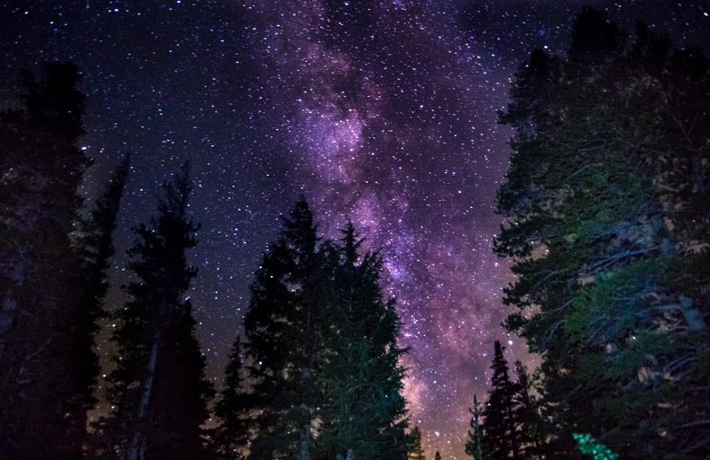
It was windy at the campground and the temperature quickly dropped when the sun went down. Dave and I gathered some fallen tree branches and got a fire going, which was nice, but then the winds kicked up and put it out. Dave was able to get the fire going again, but some of the wood was just not dry enough to stay lit. Greg and I walked out on a nearby trail to get a clear view of the sky. There was not a cloud in it! Due to the altitude, there was little air to hide any stars, and we were greeted with a thousands of pinpoints of white light and a wonderful view of the Milky Way. We even caught a glimpse of a few satellites passing overhead, and I saw a meteor streak through the sky. Soon, the cold got to be too much, and we decided to head back to camp.
Milky Way Over Twin Lakes
We turned in early that night to get out of the cold. My tent did a good job of keeping the wind out, and my sleeping bag worked well to keep me warm.
The thing about camping is you go to bed early, not long after darkness falls, and you wake up early with the sunrise illuminating your tent. I think it was shortly after 6 am when I got up. I stayed in my tent for a while, trying to get some more sleep and waiting for Dave or Greg to wake up. A little after 6:30, the call of nature was too great and I had to get up to relieve the ever increasing pressure on my bladder. By the time I had walked back to camp, I passed Dave, who must have been feeling the same pressure. I made a cup of coffee and restarted the fire to warm up a bit.
We sat around the picnic table perusing Greg’s Butler map in order to lay out our day. We decided we would head to Chico for a late breakfast after riding through the park. Once in Chico, we would plan the rest of our day. We broke camp and headed out, making a stop at the visitor center.
I had last visited LVNP at least 10 years prior during a college geology course field trip. We rode by several of the places I had seen on that trip. I was amazed at the amount of regrowth in the areas I had seen before – places that were wiped out during Lassen Peak’s last eruption in 1917. Life finds a way.
Lassen Volcanic National Park
Before we knew it, we had climbed to more than 8500 feet in elevation as we rode by Lassen Peak. The morning air was very chilly at this height, but my gear kept me warm enough. We passed by frosty meadows, bubbling mud holes, and fumaroles that smelled of rotten eggs. There’s a wide variety of things to see around volcanoes.
The main road through the park has many tight turns that keep you on your toes. One wrong move, or target fixation, and you will find yourself tumbling down a steep drop. Don’t worry, sharp rocks or trees will break your fall at the bottom. At elevation, there was still a lot of snow visible on the mountain sides despite winter ending more than 6 months prior.
We stopped near Emerald Lake and Greg had an idea to take some video of Dave and I riding down the curvy road. We immediately messed it up by not riding in the formation Greg had envisioned, then I stopped as soon as the road straightened out. It’s so hard to find good talent that can see a director’s vision.
We exited the park and made our way to Highway 32 to ride toward Chico. Highway 32 follows a single stream that has multiple names on the map, but I think the main name is Deer Creek. 32 had lots of fun curves that keep you engaged in your ride. The road starts climbing at some point and there were many great vistas to be seen. Dave and Greg had gone ahead of me at some point and I lost sight of them (a common occurrence). I took the opportunity to “ride my ride” as Greg would often tell me to do, and stopped at several places to take pictures of vast valleys being lit by the morning sun. The thing is, I never have to worry about losing Dave and Greg on trips because at some point they will stop and wait for me to catch up. Greg says they’re never waiting long, so I must be doing something right.
Highway 32 follows a ridge line as it descends into Chico. The ridge is the long transition between the Cascade foothills and the vast Central Valley. I could see the foothills were carved into many canyons, one of which was clearly visible from the ridgeline. It wasn’t on the scale of the Grand Canyon (though I’ve never been and have only seen pictures), but the canyon was quite a sight to see.
We fueled up our bikes and ourselves in Chico. Chico is a college town, and riding through it reminded me a bit of Arcata, near where I live, which is also a college town. Perhaps all college towns are similar in some way – strings of bars close to campus, and students commuting to and fro on bicycles and on foot.
Our original plan from Chico was to ride east on Highway 70 toward Quincy, but upon further review, we found that it was almost backtracking as Highway 70 bears northeast. We instead chose to ride down toward Oroville and take Highway 162 to make our way to Highway 49 and try to get as far south as we could before it got dark. Our plan for Tuesday was to cross Sonora Pass, and we wanted to get as close as we could.
We slabbed it on Highway 99 from Chico to Oroville. Straight lines are just no fun. We turned onto Highway 162 and rode through Oroville. Oroville, fortunately had been spared from destruction during heavy rains last year that caused damage to nearby Oroville Dam.
We climbed out of Oroville and turned onto a side road called Forbestown Rd. This road was a windy two-lane road through the forest. It reminded me a lot of some of the local roads closer to home. The twisties were fun through here, but again, nothing too difficult. The nice thing was how little traffic there was, which allowed you to keep your speed up. We wound our way down a bunch of local roads until we reached Highway 20 south of Browns Valley.
We slabbed it again on Highway 20 east until we reached Grass Valley. We then hopped on Highway 49 to continue our journey south. It was in Grass Valley where we ran into our first heavy traffic of the trip. Likely it was because we hit the city right around commute time. We took 49 south to Auburn at a slow pace despite it being an expressway.
In Auburn we stopped at a grocery store to pick up food for the night and to decide where we would camp, as it was getting close to sunset and we were all pretty tired from the day’s ride. My butt was hurting, along with my knees, and the top of my right boot was rubbing my shin raw because my socks weren’t long enough. Note to self: Acquire longer socks when possible.
Greg checked around with local campgrounds to seek out the cheapest option, but found nothing in Auburn proper. He found a deal at a KOA in Placerville, which was less than an hour away. We all agreed we were getting tired, but could handle the remaining 30 miles to the KOA. We continued south on Highway 49.
49, also known as the “Golden Chain Highway,” strings together a series of old gold mining towns throughout the foothills of the Sierra Nevada. As the highway leaves Auburn it climbs up and then immediately descends toward the American River east of town. The downhill grade is steep and the curves are sharp. The highway crosses the river and then immediately starts climbing back up the other side, where the road is steeper and the curves are sharper. It was not uncommon to find myself going 10-15 mph through the curves. Some of the curves seemed like a test to see how slow you could go before the bike would no longer stay up. I managed to find my groove, and some of the things I had been learning through my two years of riding were finally starting to click. Once the road climbed out of the canyon, it straightened out and had many sweepers that let you keep your speed up.
We got a little bit of confusion as we got closer to Placerville. For some reason, Greg’s GPS (and mine) told us to turn down a gated private road, necessitating a quick stop by Greg so he didn’t crash the gate.
Though it was a KOA, not a “real” campground, it was nice to be in civilization for the night. We had decent cell service (I got to Skype home), and even took a hot shower. The downside was the campground was spitting distance from Highway 50. The traffic was loud.
Today was the day Dave, Greg, and I started our adventure to Horizons Unlimited in Mariposa. Greg had been to HU meetings before, and had wanted us to experience the fun and the inspiration that comes along with it.
The Three Amigos
Like all great adventures, this quest started at Starbucks. Greg was already there when I arrived, but Dave was nowhere to be found. Usually, I’m the last one. Dave showed up about 5 minutes after we were supposed to leave – which was 9 o’clock. Oh well, something something, best laid plans of mice and men …
A cup of Joe and breakfast sandwich later, we lined up outside for the obligatory photo with our bikes. Surely, this photo would be given to the media should we disappear. I know how this works. We did the same thing in the Army – prior to deployment, we all took a photo in front of a flag; a photo to be used if you weren’t coming back. Never mind; this picture will be used for good only!
We headed east on California Highway 299 with a plan to stop in Redding for lunch. We didn’t have a plan in mind for where we would stop for the day, but Lassen Volcanic National Park had been thrown around. Greg said we’d see how the day was going when we got to Redding and plan from there.
The weather was very cooperative at the start. Not too hot out here on the coast when we started. It started to warm up as we went inland, which was to be expected. In fact, good weather was the outlook for the whole trip when we started.
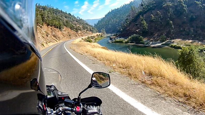
Trinity River
Highway 299 passed fairly quickly. After all, it’s our home turf. We all knew the road well. Soon enough we were rolling through the Trinity River Canyon between Willow Creek and Weaverville. The river was neither high, nor low, and I saw many rafting expeditions sailing downstream.
We rolled eastward toward the area of Helena. No longer really a town, but more a collection of homes and ranches just west of Junction City. A few weeks earlier, the Helena area had been ravaged by the Helena Fire. I didn’t see much smoke, and the fire was fairly well contained at the time. Some areas didn’t even show the telltale black ash, but you could tell it had been burned.
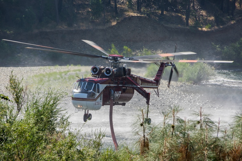
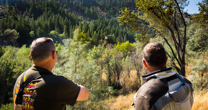
Shortly before arriving at the turn off for Historical Helena, I observed a Skycrane helicopter flying through the canyon. The helicopter was fire engine red and was navigating low through the canyon before climbing and heading south over a ridgeline. Apparently the fire wasn’t quite out. What a sight to see a chopper flying so low. I arrived at the turn off for Helena and the Bagdad River Access area. The river access is the historic location of the town of Bagdad, founded in 1850. Along with nearby Helena, Bagdad was a supply town for local gold mines. Now, it’s a wide spot in the river where people swim and put in their rafts.
I pulled up to Bagdad and saw Greg practically skipping down toward the river. Greg is a pilot and loves all flying machines. This spot was where the Skycranes were dipping their hoses into the Trinity River to fill up their water tanks. We stood by the road and watched the helicopters come, take their drinks, and go. It was impressive to see the control the pilots had in order to keep their birds a few feet above the river and the rocks. We were amazed at the sound of the twin turbines of the Skycranes as they lifted off with their tanks full to drop another load on the fire.
Taking A Drink
After about 30 minutes of watching the helicopters take their drinks, we continued on our way. We passed by the Helena area just west of Junction City, where the fire had originated. It was a somewhat sad sight to see that the entire “town” had essentially been erased. Greg later talked about it and said usually when a fire goes through a town, you see remnants of the buildings that were once there – a lone chimney, remnants of building framing. Not so here in Helena. There was nothing to show that buildings were once there other than concrete foundations and melted car bodies. It was both an awesome example of the destructive nature of wildfires, and sad at the same time for the people who lost everything.
We passed right through Weaverville without stopping and continued east. We crossed Buckhorn Grade to find that most of the sharp curves were gone, and the road was now a set of gradual sweepers. I got stuck behind a Ford Taurus being driven by someone who thought it would be a good idea to take the road at 25 miles per hour. The driver passed several turnouts, but never took the opportunity to pull off and let the long line of cars pass by. I’m sure I wasn’t the only one yelling at the driver.
We made a pit stop in Redding at Five Guys. We filled our bellies with cheeseburgers, fries, and peanuts. It had gotten hot by the time we arrived in Redding, and we were all happy to take a break in air conditioned comfort. After lunch, I requested a detour to the Redding Cycle Gear to try and acquire a tinted visor for my helmet. The sun was becoming a bit annoying to look at while riding. Cycle Gear didn’t have the right visor, but the salesperson was happy to try and sell me a new helmet. Just what exactly would I do with my old one on this trip? Strap it to the bike and let it flop around? No, it’s fine. I’ll deal with it.
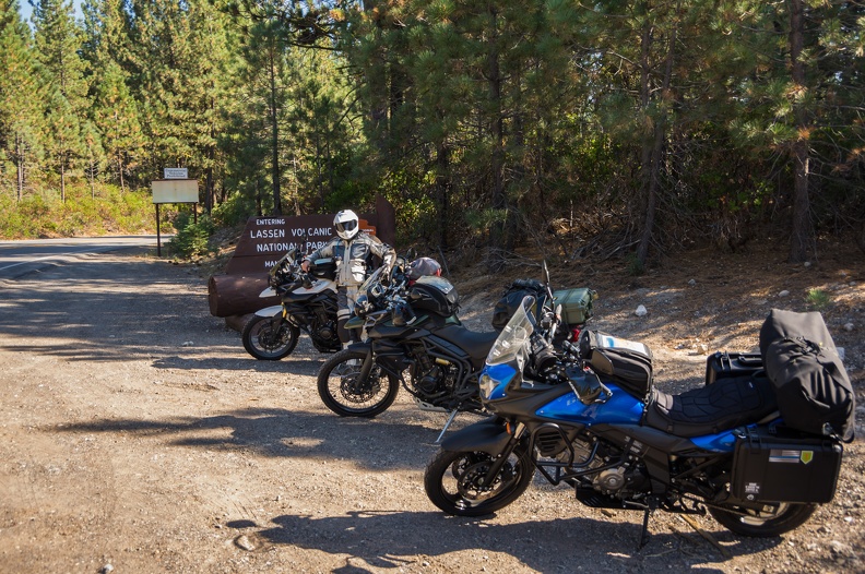
We pointed east on Highway 44 and headed for Lassen. We had made the decision to camp in the National Park for the night. Highway 44 was nice. Nothing too technical, but still fun. We passed through Shingletown and Viola and were soon climbing in elevation. I arrived at the entrance to Lassen National Park to find Dave and Greg waiting there. We parked our bikes in front of the entrance sign and snapped a few pictures.
We took care of the entrance fee with our National Park passes and joked a bit with the gatekeeper. It was getting late in the day and we ran out of time to hit the visitor center. We rode to the Manzanita Lake Campground and sought a campsite. We found most of them had been reserved, but soon found one that was empty with a pending reservation for the next day. We’d be gone long before that.
We parked the bikes and set up our tents. Greg put up a clothesline and we hung up our riding gear to air out.
We walked to the campground store to seek out food for dinner. We arrived at the store just as they were closing. Greg talked them into staying open for a few more minutes if we promised to be quick about it. I balked at paying $5 for a can of soup and opted for a couple cans of Pepsi, a bag of pretzels, and an LVNP sticker instead. I had brought camping meals and would eat one of those.
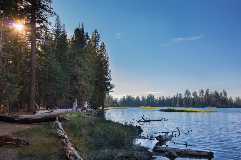
We discovered that we had no cell service, so we were unable to let our loved ones know we had made it to camp. We walked to the lake to see if we could find service there. On the shores of the lake, I had a couple bars of signal, but it kept dropping and none of my messages would go through. Even standing on a picnic table with my arm stretched skyward didn’t help. Oh well, it’s OK to be disconnected for a day.
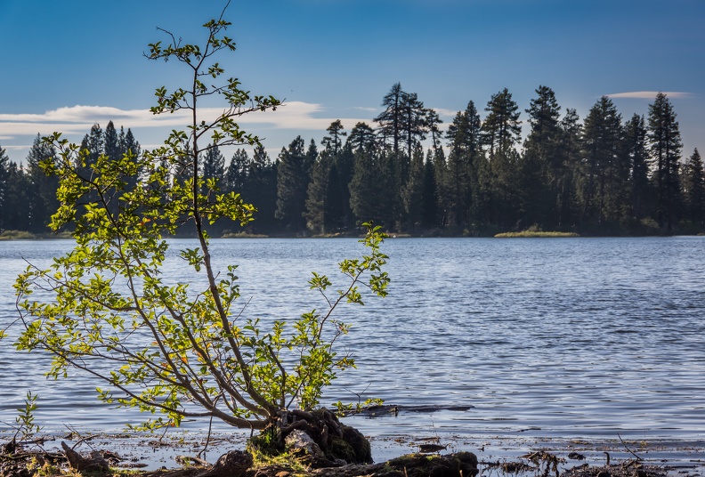
Manzanita Lake
I found some good skipping stones and promptly threw them directly into the water with a plop instead of them skipping. Nailed it! Determined, I found more stones and soon got them to skip across the surface of the lake, leaving sets of concentric rings spreading out across the still water. The lake was quiet and very peaceful. There were a few kayakers visible far out into the lake. They would have to hurry to make it back to shore by sundown.
Back at camp, I started my dinner. I boiled some water in my camp stove and poured it into the Mountain House meal pouch. I’m not sure if I did something wrong, but the meal didn’t rehydrate completely despite following the instructions. Additionally, the chili mac didn’t have much flavor – perhaps I should have taken Greg up on his offer of salt and pepper. My meal was a bit of a disappointment, akin to eating cereal without milk. I told myself, it’s only one night; I’ll survive.
I built a fire with some scrap wood I found around the campsite, and soon we tracked down more wood on a nearby hillside. It wasn’t too cold, but you can’t camp without a fire. We sat around BS-ing for a little bit before turning in for the night. The sky was very clear and dark. More stars than one could count were visible through the treetops. I didn’t take any pictures, but just took it all in. It was a good first day.