Tour of California, Part 4

March 21, 2019: Pinnacles National Park to Santa Rosa (205 miles)
Roads Traveled: California Highway 25, California Highway 156, US Highway 101, Monterey County Road G11, California Highway 1, Soquel-San Jose Road, Summit Road, California Highway 35, Interstate 280

I packed up my camp and headed out of Pinnacles without a plan for where to go. I headed toward Hollister for food and fuel. Along the way, I thought of some of my options. I thought about heading east to the Yosemite Valley, or maybe I would do the Mount Hamilton Loop and Mount Diablo. I stopped at adventure headquarters (Starbucks) to check out my options.

When I arrived, I saw a pack of the official motorcycle of Starbucks, BMW GSs, in the parking lot. I stopped and said hello. It turned out they were heading to Carrizo Plain. I answered some of their questions about the roads in Carrizo Plain and got back some arrogance (These are GSs, they can do anything.)

The weather for the evening and on Friday was not looking too good anywhere. It was supposed to be in the mid-30s and raining in Yosemite. The Bay Area was looking at wind and rain overnight. I decided to head north and figure things out as I went.

I made my way over to Highway 101 and went south a couple miles to take Monterey County Road G11 (aka San Juan Rd.) west to Watsonville. G11 wound its way through miles of flat farmland. The smells of growing vegetables filled the air; however, when I passed the town of Aromas I smelled the unmistakable odor of cinnamon gummy bears – perhaps Aromas was aptly named.

After a few miles of northbound travel on Highway 1, I hoped on one of the area back roads recommended by Lance, Soquel-San Jose Rd. The road used to be the main link between San Jose and the coast before construction of Highway 17. The road was really fun. There was no traffic and there were many great curves. At the top of Soquel-San Jose Rd., it intersects with Summit Rd., which turns into Highway 35 a few miles north. Summit Road passes through the town of Loma Prieta, the epicenter of the 1989 earthquake (there’s the San Andreas again!)

Summit Road crosses Highway 17 and turns into Highway 35, also known as Skyline Boulevard. Heading north from the intersection with Highway 17, Highway 35 is barely one-lane wide and has many tight blind curves. The road was quite a challenge. Once it passed Black Road the highway opened up and I could increase my speeds. I could see why Skyline Blvd. is popular with motorcyclists. I didn’t see many on the road today, though. I saw more sports cars than anything. Perhaps it’s still a little too early in the season.

As the road climbed higher along the ridge and toward Mount McPherson it started to get colder. I had to stop and put my jacket liner in. Off to the west, I could see the Pacific Ocean and an incoming storm. Off to the east, I could see San Francisco Bay.

I stopped at the legendary Alice’s Restaurant at the intersection of Highway 35 and Highway 84. Alice’s is the destination for people riding and driving the area around Skyline Blvd. I had to stop for a snack. When I stopped, I was given some compliments on my motorcycle by some of the customers. One of them, a Canadian, instantly was drawn to my two Canada stickers, which he loved. He told me he was thinking about a V-Strom and was glad to see one in the wild being used as it was intended.

I highly recommend the raspberry cheesecake.

I continued north on Highway 35, eventually meeting up with (gasp!) the Interstate to make my way through San Francisco. I hit the city right at the start of rush hour, so it was slow going, but splitting lanes made things a little quicker.

I made a quick stop at the Golden Gate Bridge for that missing photo op and to get some more National Park stamps.

I decided to cheat again (the horror!) and got a room in Santa Rosa. With bad weather in the forecast I would re-evaluate the plans for my remaining days as the weather changed.

I made a stop for gas in Rohnert Park and was approached by another customer. He told me he had a similar V-Strom and complimented my on mine. He told me he didn’t think the bike would be a good choice for long trips. He was shocked when I told him I had taken mine to Canada and had been riding around California for the last week. Maybe he’ll get out there and see for himself and change his mind.

March 23, 2019: Santa Rosa to McKinleyville (231 miles)
Roads Traveled: US Highway 101, California Highway 175

The weather didn’t improve in Santa Rosa, and I ended up spending the previous day there. It gave me a little time to do a complete proper load of laundry and to do a little cleaning of gear.

I headed north on Highway 101 for the final stretch home. There’s so much more of California to see, but that will wait for another time.

I rode through acres and acres of Sonoma and Mendocino County vineyards. Their grapevines were neatly lined up in ranks and files like soldiers on formation and stretched from the edge of the highway up into the hills.

I made my way back through Leggett, where my journey essentially began by riding through a tree. I hit a patch of rain going through the Leggett area. It only lasted a few minutes, but plenty of it was able to make it under my helmet.

I tried to take Highway 271, which is the old alignment of Highway 101, at Piercy to change things up, but alas the road was closed. I soon crossed back into Humboldt County and wound my way through the towering redwoods of Richardson Grove.

I hit more rain, this time heavier, in Weott. This patch of rain was shockingly cold, and my heated grips on full were not doing much to make my hands more comfortable.

I made it home between 1 and 2, and was greeted by a happy family. Another adventure in the books.

1,535 total miles.

I started out the trip with just a plan of visiting some seemingly unrelated places. Along the way, I discovered the thread that connects these places, and a much of California, together – the earth’s forces, always in motion, making California the beautiful place that it is.

At times I felt lonely. But I also reveled in the silence and solitude, finding beauty in both and experiencing those things you just can’t put into words and have to experience yourself.

Spotwalla Map of the Trip

Tour of California, Part 3

March 19, 2019: Carrizo Plain to Monterey (237 miles)
Roads Traveled: Soda Lake Rd., California Highway 58, Bitterwater Rd., California Highway 41, California Highway 33, California Highway 198, US Highway 101, California 68, California Highway 1

I got up early enough to see some nice golden color as the sun was rising. Pillowy clouds had moved in and subdued the morning light.

As I was packing up, I got a couple visitors to my camp site. The first was an older man who had been camping with his wife on the opposite side of the road from my site. He walked around looking at the bike and told me how impressed he and is wife were that I was able to fit “so much stuff” on the bike. The second was a woman who had arrived shortly after sundown. She had seen the bike parked in the campground as she drove through. She told me she had a motorcycle of her own and had never thought about going camping with it. She picked my brain for a few minutes about the kinds of things to get for camping from a motorcycle. After saying goodbye to my neighbors, I took off down the hill to see some of the plant life on the valley floor.

On my way down the bumpy dirt road I saw a black object laying on the ground. As I got closer, the item looked familiar. It turned out to be the sunshade from my GPS! Apparently it had fallen off from the bumps on the way up the hill the previous day. I was surprised to see it in one piece after spending several hours on the road.

I stopped multiple times on the way out of the monument to take pictures of the wildflowers in bloom. I saw goldfields, baby blue eyes, phacelia, and fiddlenecks in the early stages of their bloom. Another week or so and these flowers will likely be big and bright.

I made a right turn from Highway 58 onto Bitterwater Rd. Bitterwater was devoid of other traffic, allowing me to use the whole road for my travels. I passed through open range and several cows in the roadway and soon entered Bitterwater Canyon – another creation of the San Andreas.

I had to stop in the canyon to reposition my right-side handguard because it had worked its way in, jamming up my brake lever. After a quick adjustment with an Allen wrench, I was good to go.

Bitterwater Rd. let me out on Highway 41 near the Jack Ranch Cafe in Cholame. I took 41 east over Cottonwood Pass and into the Central Valley. As I descended into the valley, I could feel the winds picking up as they too came over the mountains. The air was fragrant from the farmlands and smelled a lot like an herbal tea.

I stopped in Coalinga for gas and a snack so I could plan my next move. All around me, rain was forecast for the late afternoon and evening. I thought about going back to Pinnacles, but my tent wasn’t very waterproof at the time. I had a friend from the Motorcycle Relief Project in Monterey, who was interested in getting together. So I planned to head to Monterey for the night and to meet up with my friend. Not looking forward to the prospect of a leaky tent, I cheated and booked a hotel for the night. I could recharge and get some cleaning of clothes and myself out of the way.

I headed out of Coalinga on Highway 198. The road was like a roller coaster with its ups and downs and twists. There was no traffic and I was able to have a lot of fun. Soon, I was in San Lucas and heading north on Highway 101.

I arrived in Monterey before the rain. I enjoyed a burger and beer at the hotel bar then did some laundry.

I got in touch with Lance from the MRP and we arranged to have breakfast the following morning and do some riding.

Sleeping in a bed felt good.

March 20, 2019: Monterey to Pinnacles National Park (145 miles)
Roads Traveled: California Highway 1, Nacimiento-Ferguson Road, Jolon Road, King City Road, California Highway 25, California Highway 146

As is expected, I slept well in the hotel bed. No shame in this game.

I met Lance for breakfast at the Black Bear Diner. I love Black Bear even though it’s a chain. The portions are big and the prices right.

Lance is a blacksmith, and runs a school with his brother where they teach people how to ride adventure bikes. Though not a veteran himself, he attended the MRP in September as the off-road riding instructor. I learned a lot from Lance in Colorado, and it was good to see him again.

After breakfast we headed south on Highway 1 toward Carmel. As we pulled onto the highway the skies opened up and it started to rain. Onward we went!

We stopped at Mission San Carlos Borromeo for a few pictures. Ryan, my oldest son, had done a report on the mission for school, so I thought it would be nice to stop there for him. Lance, being a blacksmith, looked closely at all the metalwork and told me how difficult some of the stuff was to do by hand. While we were checking out the mission the skies cleared. We continued on.

We rode to the Bixby Creek Bridge near Big Sur. Bixby Creek is one of the most photographed bridges in California – probably slightly less than the Golden Gate. Built in 1932, the concrete arch bridge is 714 feet long and is 280 feet above Bixby Creek as it enters the ocean. We stopped in the turnout for a few pictures and watched all the other people who stop to photograph the bridge.

Lance and I said our goodbyes and I continued south toward Big Sur.

Highway 1 follows hugs the coastline of California for much of its route from north of San Diego until it turns inland west of Leggett. It is famous for the views of the rugged coast and its roadway precariously perched upon the precipitous palisades of the Pacific Coast. The highway follows nearly every curve of the land. Numerous pullouts and vista points were along the highway, giving travelers amazing views of the coast and the ocean. I stopped at one and saw the unmistakable puff of a spouting whale. Unfortunately, the wiley creature disappeared and hid under the water, preventing me from getting a picture of it.

As I continued and approached Julia Pfeiffer Burns State Park, I saw a pullout full of cars with people lined up along the cliff. I stopped and saw one of the coolest sights one could see – a waterfall flowing into the ocean. The scene, with its blue green water and colorful vegetation looked like it belonged in a tropical paradise. California truly gives you a taste of everything.

South of Lucia, I turned inland on Nacimiento-Ferguson Road. The road, a steep, twisty, narrow stretch of pavement connects the coast with Fort Hunter Liggett and King City. In about 4 miles of road distance you climb nearly 3,000 feet into the Santa Lucia Range. The road itself was one you take slow. Its steepness and sharp switchbacks kept me in first and second gear for most of the climb. The road then drops down, following the Nacimiento River into Fort Hunter Liggett, an active Army base. There was no guard posted at the gate on this day and I continued through the base. The road inside the base was very smooth and free of any traffic.

After leaving the base, I turned onto Jolon Road and headed for King City. I picked up a little rain just outside of town, but it was short-lived and I could see clear skies ahead.

I stopped for a cup of coffee and to check on the upcoming night’s weather before heading on to Pinnacles. I headed east on County Road G13 and passed pastures and vineyards before entering the narrow Becker Valley. Soon I found myself back on Highway 25, heading north to Pinnacles.

As I turned onto Highway 146 for the final stretch to the national park, I passed a milestone on the V-Strom. My odometer clicked over to 8,000 miles. It’s not much, but the miles were all mine. I arrived at the park with minutes to spare before the store closed. I picked up food and drink for the night and found myself a campsite.

I did a quick set up of my tent and placed my stuff inside, then headed into the park to explore. It was nearing sunset and the fading light seemed to enhance the reds and greens in the mountains around the Condor Gulch Trail. Looking up at the rocks that make up the Pinnacles, I saw several birds circling overhead. From where I was, I could not tell exactly what they were, but Pinnacles is home to many turkey vultures and has been a place where California condors have been released back into the wild. A few of the birds looked much larger than the others, so it’s quite possible that some of the ones I saw were condors.

Where does Pinnacles fit into my “theme” for the trip? The pinnacles, which are the park’s namesake, are the remnants of an extinct Neenach volcano. The pinnacles are made of solidified andesite and rhyolite produced inside the volcano. The pinnacles happen to be the western half of this extinct volcano. Creep along the San Andreas Fault moved the pinnacles to where they are today from their original location near present-day Lancaster – 200 miles away!

After a short hike along the trail, I returned to camp for my dinner and to wait for nightfall. The moon was full and I had plans to go back into the park for a little night viewing of the pinnacles.

After dinner, I headed back into the park. I arrived at the parking lot at the Condor Gulch Trail and was the only one there. It felt a bit eerie, but at the same time I couldn’t help but wonder why people wouldn’t want to use the brightly lit night to view the pinnacles glowing in the soft moonlight.

I hung out on the trail for about an hour, watching as the light changed as the moon rose. Soon, the pinnacles seemed to glow in contrast to the dark trees and other vegetation around them.

While it’s great to share adventures, sometimes solitude is what makes it special.

Tour of California, Part 2

March 18, 2019: Pinnacles National Park to Carrizo Plain National Monument (235 miles)
Roads Traveled: California Highway 25, Indian Valley Rd., Vineyard Canyon Rd., California Highway 46, US Highway 101, California Highway 58, Soda Lake Rd.

I got up around 7:30 after sleeping much better than the previous night. I bundled myself up so I would stay warm as the overnight temperatures had dipped into the low 40s. I tried to burn my remaining firewood to warm up a bit while drinking my morning coffee and breaking down camp, but it just wasn’t happening.

I took the short ride into the National Park proper to view the Pinnacles. The views of the rock formations were good, but I didn’t have much time to hike around. I thought I might come back on the return leg so I can do some exploring.

I headed south on Highway 25. The highway didn’t have a color rating on my Butler map, but I found it to be quite fun. There was very little traffic and the road was in fairly decent condition.

The hills in the area were bright green! Much of the scenery of rolling hills and grasslands reminded me of the “Bliss” wallpaper that was the default on Windows XP. Soon Highway 25 met up with Highway 198. I continued straight onto Peach Tree Rd. The road, which was very narrow, wound its way through farmland and the valley called Slack Canyon, then climbed up into the hills toward San Miguel. At best, the road was 1 1/2 lanes, maybe less. It didn’t matter though because I didn’t see a single car, truck, or anything until I was a few miles outside San Miguel.

I dropped into San Miguel for a top-off and a stretch. I stopped for a few minutes at Mission San Miguel. Stopping at the mission brought back some memories. When I was growing up, my dad would often take my brother and me to San Francisco for our summer vacation. Along the way, we stopped a few times at Mission San Miguel to tour the grounds. I quickly noticed a lot had changed around the mission since those days of my childhood. The road now had curbs, and the town had been built up quite a bit. No longer was there a dirt parking lot and empty fields around the mission.

I backtracked out of San Miguel to Vineyard Canyon Road to go to Parkfield. As I made the initial climb up the hill out of San Miguel I got a glimpse of Camp Roberts in the distance, my old annual training stomping grounds from my time in the California National Guard. “Camp Bob” still looked like a collection of old World War II-era barracks (because it mostly is), but it looked like it had been built up considerably since my time in the Guard.

Vineyard Canyon Road wound its way through green pastures and soon climbed up into a landscape of brown brush. The road dropped into a valley near the town of Parkfield.

For geology and earthquake fans, Parkfield is the epicenter (har har) of activity. Parkfield lies on the San Andreas Fault and is in an area keenly studied by geologists. Parkfield is the perfect place because since 1857 there has been a magnitude-6 quake on an average of every 22 years. The relatively short time between events and regularity of occurrence makes Parkfield the most closely studied earthquake zone in the world.

I stopped at the bridge into town, where a sign proclaims you are crossing the San Andreas Fault. Heading east the sign tells you that you’re entering the North American Plate; heading west, the Pacific Plate. The bridge itself lies on a portion of the fault that experiences aseismic creep, that is fault movement that does not result in an earthquake. Since the bridge was built in 1936, creep along the San Andreas has resulted in the piers of the bridge shifting 5 feet relative to each other. Looking down the south guard rail, one can see a bend created as a result of the creep.

I stopped at the Parkfield Cafe where a water tower proclaims Parkfield as the “Earthquake Capital of the World” and invites customers to “Be here when it happens.” Across from the cafe is a hotel inviting you to “Sleep here when it happens.” I thought the cafe would be a good place to stop for lunch, but alas, they are closed on Mondays. Fortunately, the cafe’s owner was out and about in town and saw me wandering around the cafe. She was kind enough to go inside and get me a bag of chips.

I left Parkfield and headed south on Cholame Road which runs along the San Andreas until it reaches the Cholame Valley. One thing I noticed on Cholame Road, which runs through Monterey and San Luis Obispo counties, was Monterey County takes care of their road. In Monterey County the road was very smooth and the pavement relatively new. Once I entered SLO County, the road turned into a rough, pothole-covered mess. Those potholes that were filled, were not even filled level with the rest of the road surface.

Cholame Road soon meets up with Highway 46, just west of its junction with Highway 41. The intersection of Highways 41 and 46 is called the James Dean Memorial Intersection. The junction is the site where actor James Dean was killed in a car crash in 1955.

There is not much left in Cholame, other than a restaurant, which I stopped at for lunch. Because of its proximity to the James Dean intersection, the walls are lined with photos of Dean, and there’s a memorial to him in the parking lot. I chose the bacon cheeseburger, which was very good.

Continuing on, I stopped in Santa Maragarita on Highway 58 to top off my gas tank and to pick up some supplies for the night. Carrizo Plain was still another 60 miles away, and there’s no other place to stop before getting there.

Highway 58 was a very nice road. Caltrans had recently laid fresh blacktop over its rises, falls, twists, and turns. The scenery was wonderful as well. Green hills abounded with stands of oak trees and streaks of yellow and blue wild flowers.

58 emerged in the vast Carrizo Plain, tucked between the Temblor Range on the east and the Caliente Range on the west. I soon reached the National Monument boundary and the shores of Soda Lake, a shallow seasonal lake that is a dry bed most of the year. However, because of the wet winter, the lake was full.

The national monument covers nearly 247,000 acres and contains the largest single native grassland remaining in California. The east side of the plain is where the San Andreas fault runs along the base of the Temblor Range. Carrizo is one of the places where it’s easiest to see the surface feature of the fault. If you have seen a picture of the San Andreas Fault from the air, you’ve likely seen the Carrizo Plain section.

I headed up the 5-mile dirt road to the Selby campground nestled in the foothills above the valley, where it’s free to camp. Surprisingly the campground was nearly full and I got the second to last site. It was still somewhat early and I took my time taking in the vistas from the campground before setting up my camp for the night.

As the sun went down, I heard a pack of coyotes in the distance calling each other. After that, there was no sound at all except for the occasional airplane flying overhead. There’s a reason why the Bureau of Land Management’s information about the plain says “you can hear the silence.”

The downside of being so far away from everything is that any items you might need you need to carry in with you. Due to my limited space, I did not have any firewood. I love a campfire, though. I found two partially burned logs inside the fire ring, but was unable to get them lit.

Instead, I enjoyed the clear skies under the light of the nearly full moon. The valley was illuminated in blues and yellows by the moonlight, and thousands of stars were visible overhead.

Tour of California, Part 1

When I discovered I was going to have three weeks “free” at work without a trainee to work with, I got the idea to take a week to do a motorcycle trip. I wasn’t sure where I would go though. I figured given that it was early spring I would stick to California because the weather would be better. A few places crossed my mind: Death Valley, Yosemite, Kings Canyon, to name a few.

As the time got closer and closer, I soon realized that some of the places would not be feasible given a week-long span. Going to Death Valley would require either crossing the Sierra Nevada mountain range and one of its passes – but they’re typically covered in snow until May or June – or going south to Bakersfield, crossing Tehachapi Pass and going north on the east side of the Sierras – a route that would require more time than I had. Another problem with Death Valley was that winter rains had washed out many of the roads I wanted to ride once I got there. There just would not be time.

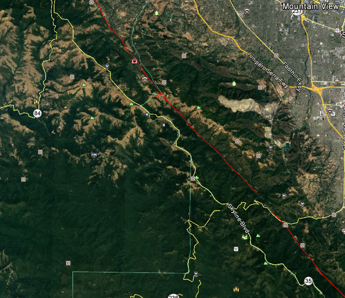
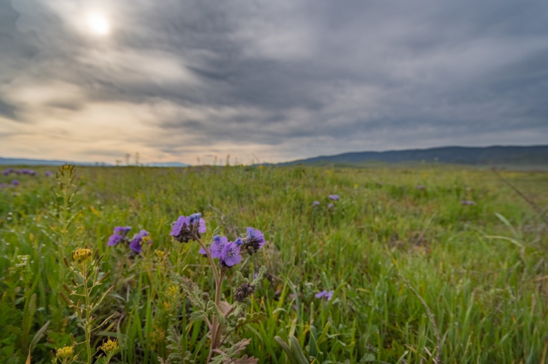
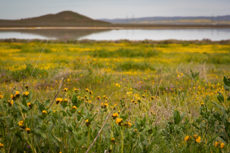
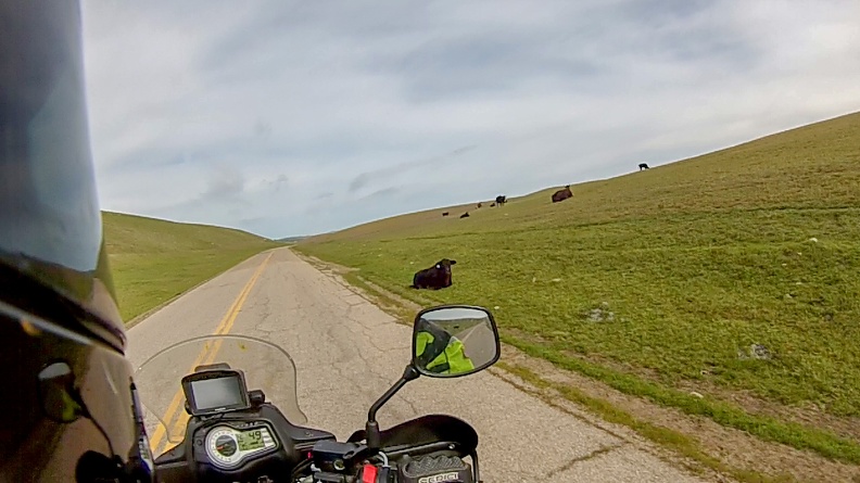
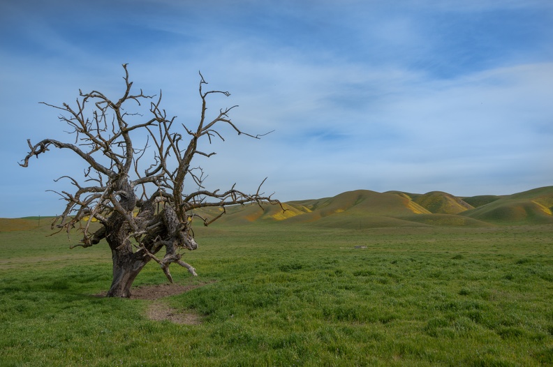
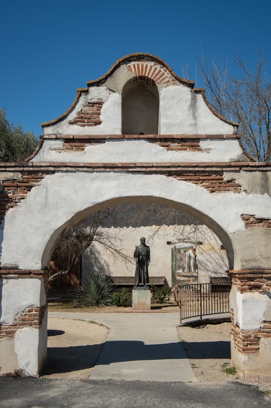
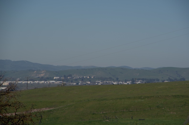
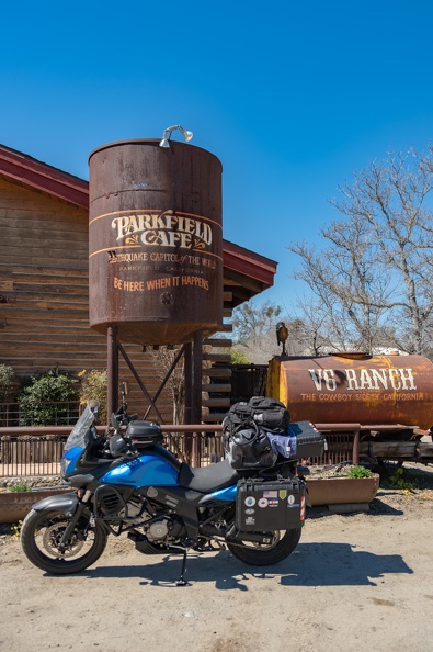
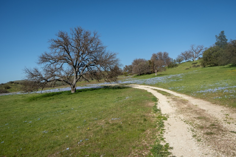
I decided to make a trip to Carrizo Plain National Monument because I heard there was going to be a “superbloom” of wildflowers. Carrizo Plain is a large valley situated about halfway between Santa Margarita and McKittrick. On the west, it’s bounded by the La Panza Range and on the east, the Temblor Range. Carrizo Plain is probably one of California’s secrets, since most people I talked to had no idea where it was.

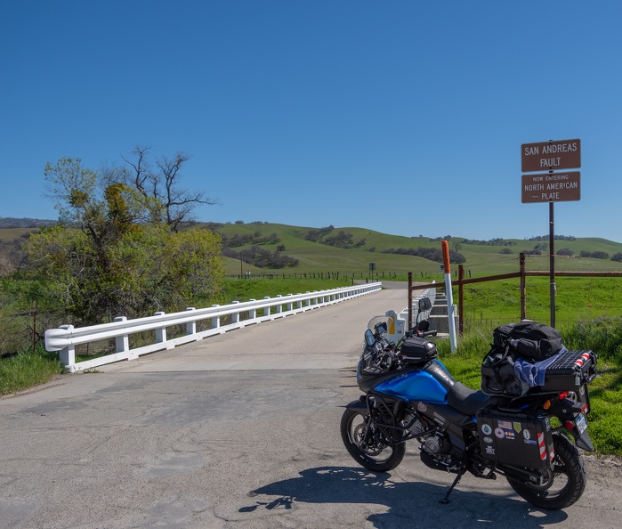
I made my plan to head south, with Carrizo as the “turnaround” point. Once I looked at my rough plan, I realized this was not just a trip about visiting a spot to see wildflowers. It turned out this trip was essentially focused on the San Andreas Fault.

The San Andreas Fault is probably the most famous earthquake fault in the world. It stretches 750 miles across California from the Salton Sea to just off Cape Mendocino. The fault forms the boundary between the Pacific Plate on the west and the North American Plate on the east. The San Andreas has produced large earthquakes from Los Angeles to San Francisco. When the “Big One” hits, it’s likely going to be on the San Andreas.

As I looked at my maps and routes, I learned my path would cross the San Andreas several times, and many of my stops were in some way related to the fault.

Follow along as I wind my way through California to see not only new the power of the earth’s tectonic forces, but also the renewal of life that comes every spring.

March 16, 2019: McKinleyville to Gualala (214 miles)
Roads Traveled: US Highway 101, California Highway 1

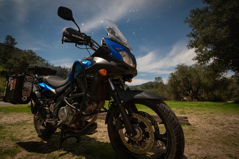
I spent the day of the 15th packing for the trip. I don’t pack much in the way of clothes, just a few days’ worth. This keeps the load light and compact enough to fit in one pannier on the bike.

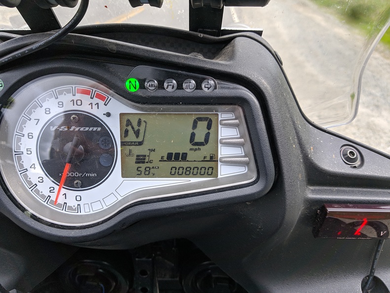
I got suited up and headed for Starbucks, as is tradition. I sat with Greg, my usual traveling buddy, and had breakfast. Greg would have loved to come, but not only was he working, but he was planning a trip of his own. As it was, this would be my first trip that I would plan and take solo. The feeling was strange. I had gone to Oregon with Greg the day I bought my current motorcycle. We had gone to Mariposa for Horizon’s Unlimited, and traveled together to Nakusp, British Columbia, last September for HU CanWest. It seemed the tail end of Greg’s bike was always in front of me. In a way, it was comforting to travel with someone. Greg was an experience motorcycle traveler and I guess I was the Luke Skywalker to his Obi Wan Kenobi. I learned a lot from Greg about motorcycle travel. I had followed his travels from Alaska, to Baja, to the Southwest. Now it was my turn to share a solo adventure. Greg was looking forward to it. I rode off a little before 10.
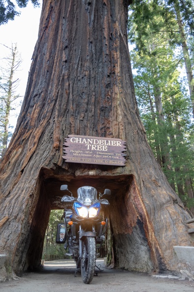
My first stop was at the Chandelier Tree in Leggett. The Chandelier Tree is a tourist trap where you pay for the privilege to drive through a tree with a hole in the bottom. It is practically in my back yard, but I could not resist the urge to stop. I had driven our Ford Explorer through the tree (with mere inches to spare on each side), but never my motorcycle (like throwing a hot dog down a hallway). I forked over the $5 to ride through.

While taking a short break, I talked to two other motorcyclists who had ridden up Highway 1 from Vacaville. One of the guys was on an orange V-Strom, the carrot-hued cousin to my blue one. We talked about the mods I had made to my own bike and his plans for his. They were planning on riding up to Highway 36, a very popular road for motorcyclists, but the clerk in the gift shop talked them out of it. The winter had not been kind to the highway and it was probably not the best route at the time. The clerk instead told them to ride back south and take Highway 20 through Clear Lake. The pair still wanted to ride the Avenue of the Giants, though. I knew it had been flooded in the week prior, but found out for them that the road was clear. They thanked me for my help and we parted ways.

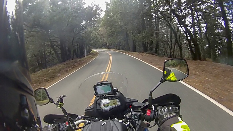
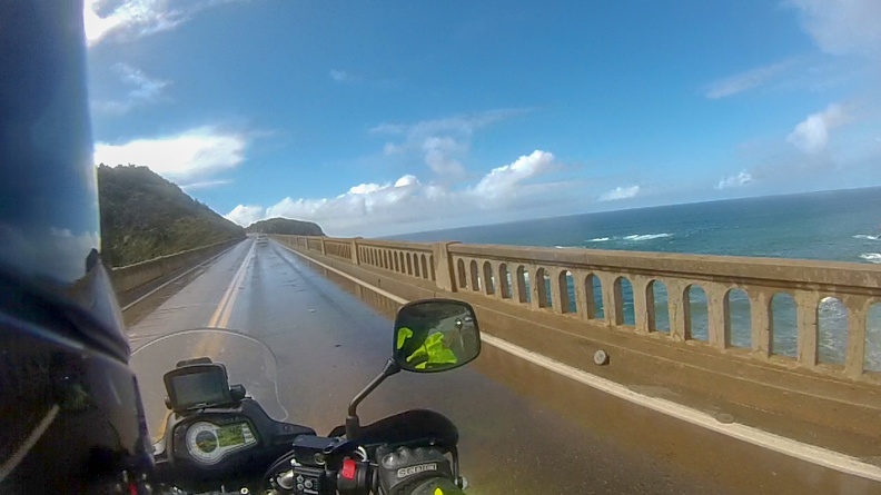
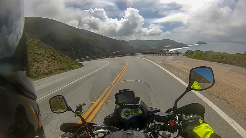
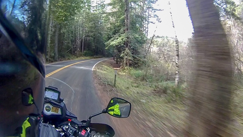
I hopped onto Highway 1 for my first time riding it. The road was nice and twisty, with hill climbs thrown in as well, necessitating low gear for most of the route between Leggett and the coast. Nearly every turn had patches of gravel that had fallen from the hillsides, requiring an open eye and a light touch on the throttle. The highway traveled through thick forests, which occasionally broke enough to get a glimpse of the Pacific Ocean. After a little more than 20 miles riding through the forest, you emerge on the edge of a cliff with a panoramic view of the Mendocino coast and the Pacific Ocean. From here the highway turns south and hugs the coast.

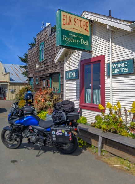
The highway winds its way through the towns of Fort Bragg, Mendocino, and Little River on its way south. I stopped for lunch in Elk at the Elk Store. There wasn’t much to it, a few shelves and coolers, and a deli counter with a vast selection of sandwiches – or you could customize your own. I chose the Cubano, their take on the Cuban sandwich, made with pork belly, ham, lettuce, pickles, and cheese. The sandwich was grilled for several minutes on a panini press. The sandwich was an excellent rendition of the simple Cuban sandwiches I enjoyed in Cuba, and worth the $13.

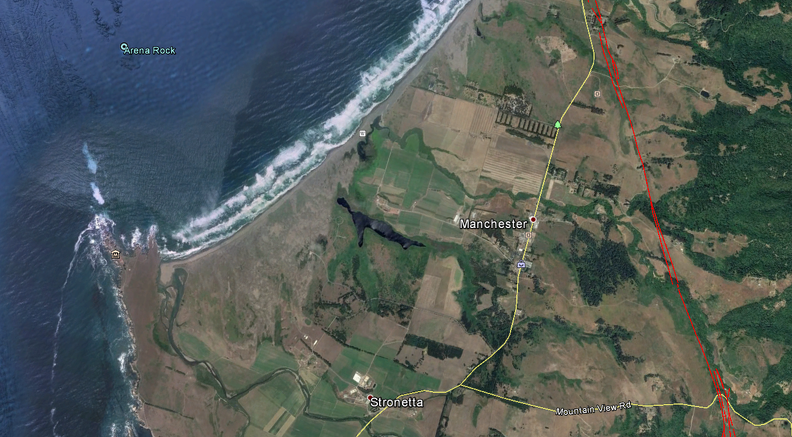
I continued south along the cliffs and through pastures. I passed the town of Manchester, site of the cable landing for a transoceanic cable linking the United States to Japan and Hawaii. Soon I was the gleaming white tower of the Point Arena Lighthouse rising above a rocky peninsula. I stopped to check it out.

The original Point Arena Lighthouse was built in 1870 and damaged beyond repair in the 1906 San Francisco Earthquake. The current lighthouse was built in 1908. Its slender tower rises 115 feet above Point Arena. The new tower was built to withstand earthquakes. It was built by a company that specialized in building smokestacks and utilized steel reinforcement as opposed the unreinforced brickwork of the original tower.

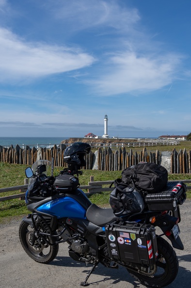
Just off shore from the lighthouse, I saw many rocks with parallel lines running through them oriented in the northwest direction. The parallel lines, or stratifications, are evidence of the movement of the nearby San Andreas, which lies less than 2 miles to the east.

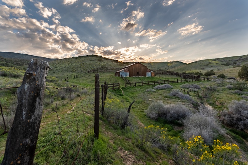
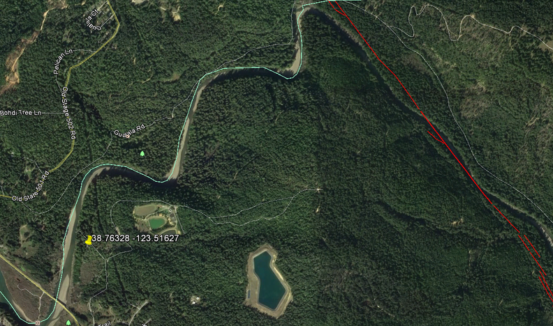
I stopped for the night at Gualala Point Regional Park. The park is owned by Sonoma County and lies on the banks of the Gualala River. This was the only campsite I reserved for the trip due to most campgrounds in the area being fully booked up for the weekend.

A first glance, the campground was not very impressive. The dirt portion of my campsite was a muddy mess, and there was lots of muddy berms and debris around the campground. According to the camp host, a few weeks prior the campground was under about five feet of water. OK, now the mud and debris makes sense. To keep my tent from getting soaked and muddy, I actually put it up on the asphalt parking pad at my site. One of the pluses of traveling on a motorcycle. I wouldn’t have room for a tent on the pad if I had been in a car.

As it turns out, the campground at Gualala Point is a stone’s throw from the San Andreas Fault which makes up a portion of the Gualala River’s bed before it turns toward the sea.

I spent the night sitting by my campfire, listening to the sounds of the forest.

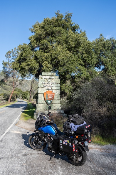
March 17, 2019: Gualala to Pinnacles National Park (270 miles)
Roads Traveled: California Highway 1, US Highway 101, California Highway 152, California Highway 25, California Highway 146

I did not sleep well overnight, not falling asleep until after midnight. It was nothing with my sleeping pad not being comfortable enough, or being on the asphalt pad. I just couldn’t get a good position in my sleeping bag, so I was unable to stay very warm.

I’m not sure when exactly I fell asleep, but I remember waking up sometime around 6:30 and covering my head to keep out the morning light. Next thing I knew it was 8:30. I didn’t get on the road until after 9 am.

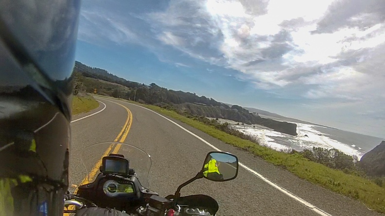
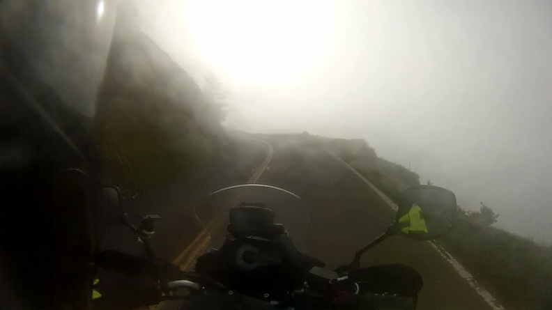
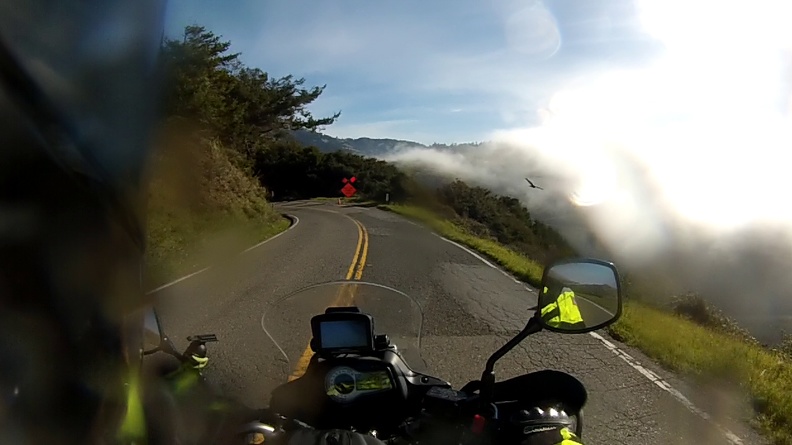
Highway 1 south of Gualala was pretty slow going. Because the road follows the contours of the land, and is in places built directly into cliffs above the ocean, it’s very twisty with many slow-speed switchbacks. That just made it more of a challenge – one I wanted to partake in. Just south of Fort Ross, I ran into very heavy fog. At times I could barely see the road, at other times it seemed like I was riding on a road in the clouds as the road passed barely above the top of the fog mass.

Somewhere near Jenner I managed to get a small bug in my mouth – ack! It wasn’t a big one, likely a gnat or something, and I didn’t immediately know what to do. At first I tried to just tough it out and swallow it, but it had gotten stuck at the back of my mouth and wouldn’t go down. I found a spot to pull over and spit it out.

I desperately needed coffee and a bite to eat – one bug wasn’t enough to fill me. I wasn’t finding much in the way of coffee places along the road. I didn’t get stopped until I reached Tomales. Like a beacon, I saw a place surrounded by numerous motorcycles with their riders milling about chatting with each other. It seemed I had found “The Spot.” That spot was the Tomales Bakery. I carefully parked my motorcycle by backing it to the curb and making double sure I put the sidestand down before stepping off; I didn’t want to be the guy who makes a fool of himself in front of a bunch of strangers.

There were the usual BMW GSs, a couple KTM Super Adventures, even a couple V-Stroms. Now I’m not one who goes out of their way to talk to people, I’m a bit of an introvert, so I just sat there drinking my coffee and eating my almond croissant, while looking at the varied selection of motorcycles.

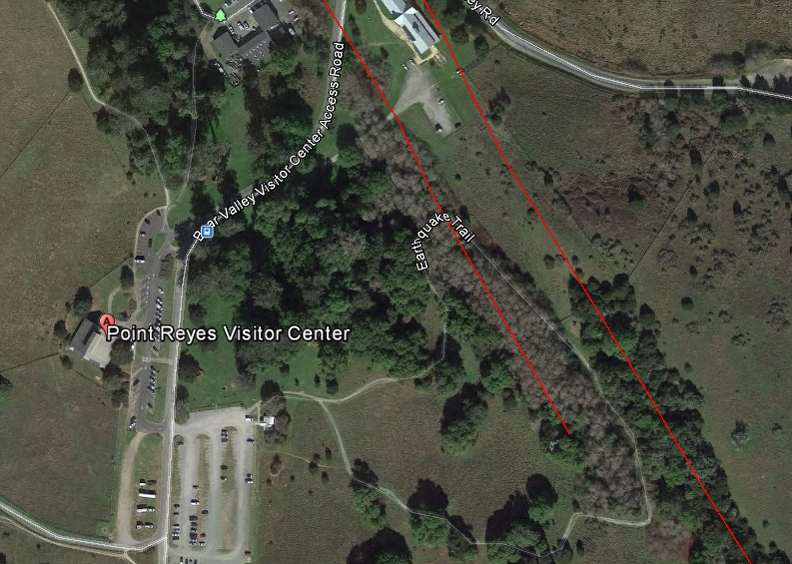
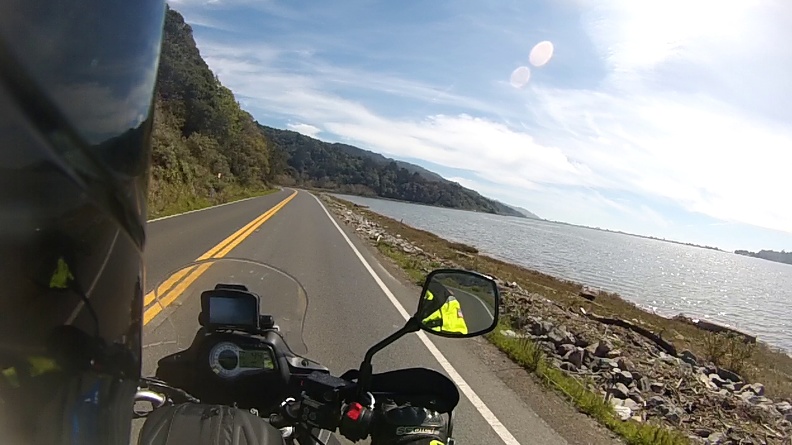
After my breakfast, I continued south as Highway 1 paralleled Tomales Bay. The bay is long and narrow, with a submerged portion of the San Andreas Fault running along the west side of the bay at the Point Reyes Peninsula.

I stopped at the visitor center for the Point Reyes National Seashore. Point Reyes is a triangular peninsula separating Tomales Bay from the Pacific Ocean. The land that makes up the peninsula is interesting in that the rock that makes it up does not match the rock on the east side of the bay. The east side of the bay is made of rock called the Franciscan Complex. It’s comprised of shale, chert, graywacke, and pillow lava. However, the rock under the peninsula is made of granite from the Salinian Block. Geologists have determined the Salinian rock that makes up the Point Reyes Peninsula started its like in the Tehachapi Mountains, more than 300 miles to the south! The Point Reyes Peninsula reached its current location as a result of movement on the San Andreas Fault.

The visitor center has an exhibit on this movement, so people can see an example for themselves. A short trail across the street from the visitor center takes people on a journey through time to learn about tectonic movement. The main attraction of the trail is a pair of picket fences about 15 feet apart. There isn’t anything fancy about the fence, it’s unpainted and is a dull grayish-brown in color. What’s interesting about the two fences is they used to be one! The gap in the fence was caused by fault motion during the 1906 San Francisco Earthquake. A line of blue stakes at the top of a small set of stairs lays out the path of the San Andreas Fault.

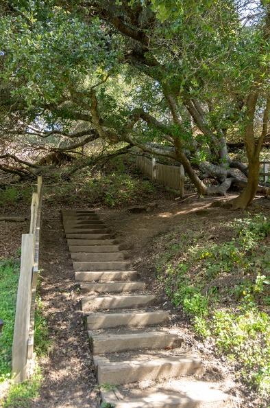
I stood straddling the San Andreas and snapped a couple pictures. I grabbed a passport stamp from the visitor center and continued on my way. I still had a long way to go and it was already noon!

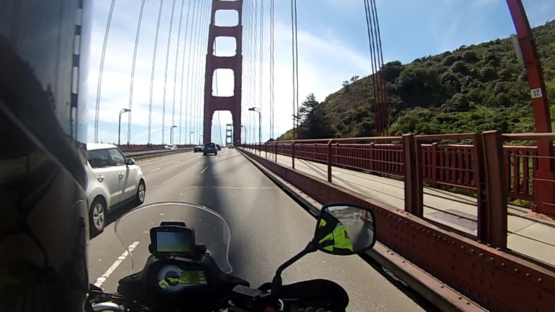
Highway 1 wound its way back inland and met up with Highway 101 just north of San Francisco. I crossed the Golden Gate Bridge for the first time on my motorcycle. I knew the towers were huge, but passing under them on a motorcycle makes you feel very small. After crossing the bridge I made my way through the city along the Great Highway and back to Highway 1.

South of San Francisco the traffic on the highway slowed several times – Pacifica, Half Moon Bay, Pescadero. Tourist traffic was the culprit. It was a very nice day and people wanted to go to the beach!

After passing Pescadero, I looked at the time and saw it was nearly 3 pm! I still had a couple hours to go until I reached Pinnacles and stop-and-go traffic at every town was not helping anything. I was also starting to get tired since I didn’t sleep well the night before. I stopped at the lighthouse at Pigeon Point to figure things out. All I had to do was get passed Santa Cruz and the traffic would let up and I could make up time to get to Pinnacles before it got too late. After all, sunset would not be until after 7 pm.

Traffic slowed again when Highway 1 turned into freeway south of Santa Cruz. It appeared there was an accident on the side of the road. What’s a guy on a motorcycle to do? Keep chugging along and repeatedly put your feet down when traffic stops? Nope! Lane splitting is the answer. As soon as I inched toward the dividing line between lanes, I saw cars in both lanes move to the side like I was Moses parting the Red Sea. I happily rode the gap and soon found myself past the slowdown and onto a nearly empty road.

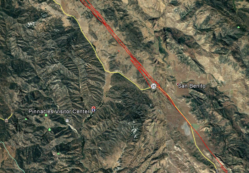
I turned east at Watsonville and hopped on Highway 129. 129 wound itself through a narrow canyon carved by the Pajaro River and came out on Highway 101 near San Juan Bautista. I got onto Highway 156 to get to Hollister to make the final run to Pinnacles.

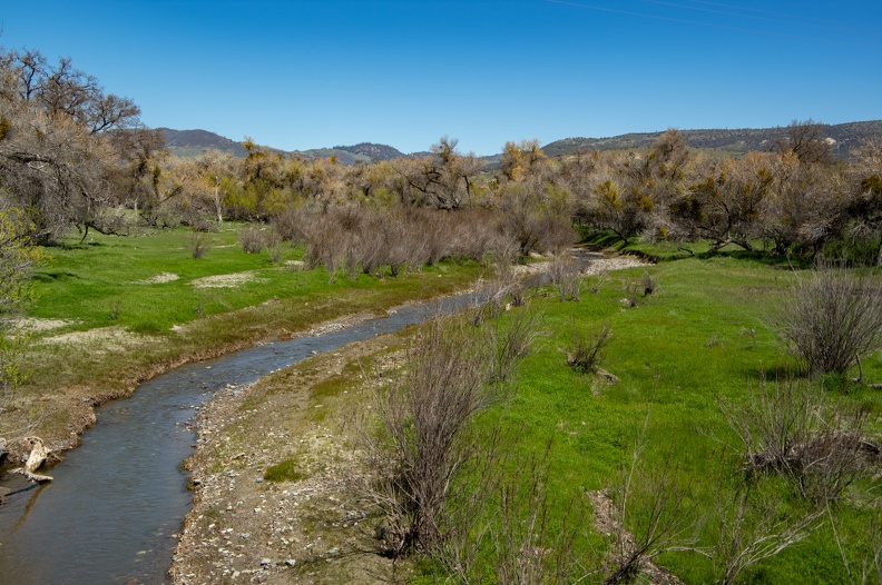
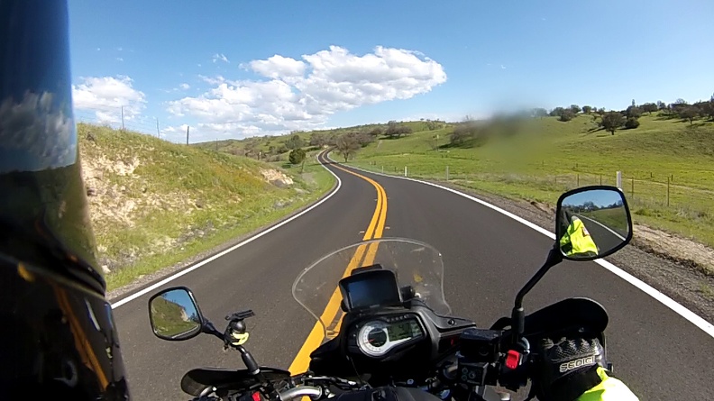
At Hollister I turned onto Highway 25, also known as the Airline Highway because it was once used by pilots to route themselves from town to town. Highway 25 passes through rolling hills and ranches as it runs through a valley created by the San Benito River and our friend the San Andreas Fault. As I navigated from curve to curve and over each rolling hill, I noticed the green hills seemed to glow in the late afternoon light.

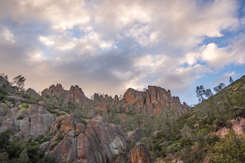
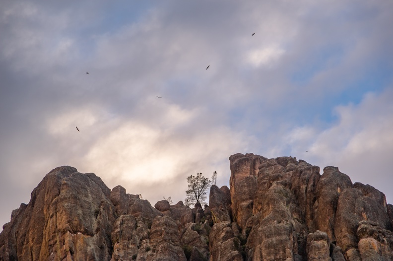
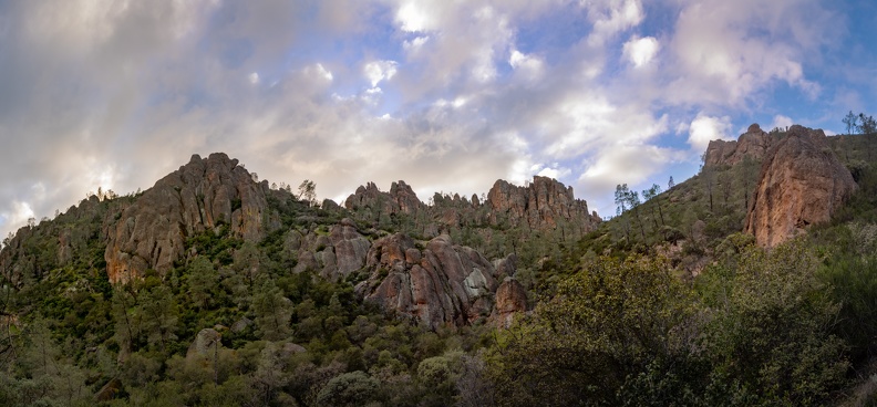
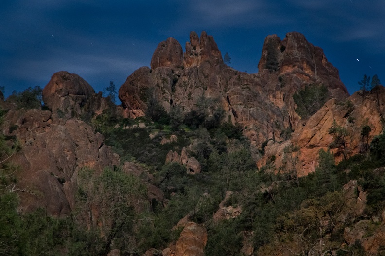
I arrived at Pinnacles National Park just as the store and visitor center closed. Oh well, I can visit in the morning. I set up my camp and made use of the campground’s shower. I sat next to my fire under the stars and relaxed.

As I sat there in silence, I thought about how weird it felt being alone. I had done the trip home from Nakusp by myself, as I had from Mariposa, so it was nothing new. While I enjoyed the solitude, sometimes you want to share adventures with others.

Because I got there so late, I didn’t ride into the park to view the Pinnacles. I decided I would check them out in the morning before heading to Carrizo Plain.