
Calimesa to Sunset Campground, Kings Canyon National Park
It was a long weekend at work, so it was time for another road trip.
I hit the road around 9:30 a.m. and started north. A holiday weekend was coming up, so I expected a little traffic. Surprisingly, I didn’t run into any – even when climbing the Cajon Pass. Maybe the people of Southern California weren’t headed for Vegas yet. For the end of June, it wasn’t even hot.
Highway 138 was not very exciting, the same as before. Just a straight line between Interstate 15 and Palmdale.
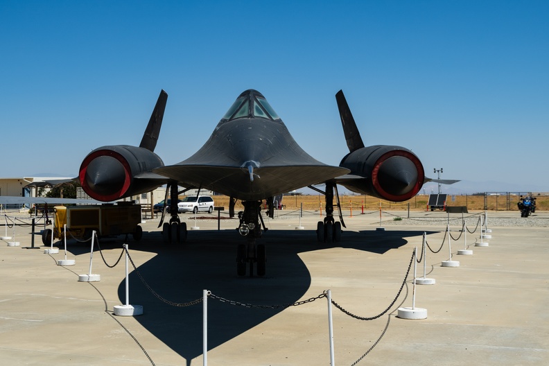
I made a detour in Palmdale to stop at Blackbird Airpark. The park is part of the Air Force’s Flight Test Museum, and is near the Air Force’s Plant 42, where many of the force’s secret planes were built. On display were the Lockheed A-12, SR-71, and U-2 spy planes. A nearby display, which was closed when I was there, had other planes that had a connection to Palmdale and nearby Edwards Air Force Base, like the 747 Shuttle Carrier Aircraft and some of the Century Series fighters.

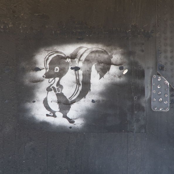
On my way out of Palmdale, I passed Lockheed’s famous Skunk Works. The Skunk Works is famous for secret projects, and the fence makes note of this, warning passersby that bad things will happen if you jump the fence, and that photography of the area is prohibited. As I rode past, I wondered what kind of cool secret stuff they were working on.
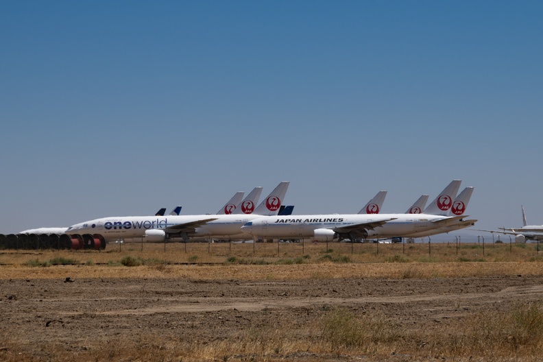
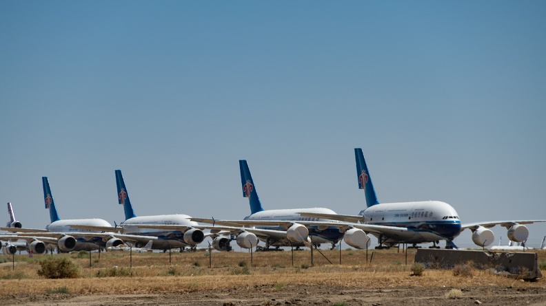
I headed north on Highway 14 – more straight lines – and made a quick detour to Mojave Air and Space Port. From the road, I could see several of the planes being stored at the airport’s boneyard. The dry desert air is good for the planes, in case they need to be brought back into service.
Highway 14 was very windy being at the base of the Tehachapi Pass. Air from the coast gets funneled through the pass and picks up speed, then once it leaves the pass it spreads out across the desert. I’ve probably mentioned before, but I hate the wind when I’m riding. Normally, I scooch a butt cheek off the bike on the side from where the wind is coming. Today I tried something else that I saw in a video about riding in loose sand, and I’m not sure why I never tried it before because I do it all the time in turns. I looked straight ahead where I wanted the bike to go. Sometimes we forget the simple things, like the connection between the eyes and riding, and when things get difficult, look where you want the bike to go. Suddenly, it was like the wind disappeared.
I turned onto Highway 58 and climbed Tehachapi Pass in the shadow of the many wind turbines. I pulled off in Tehachapi to look for lunch. Just as I had gotten a green light getting off the freeway, a semi blew through its stop light. As I passed, I reminded him he was #1.
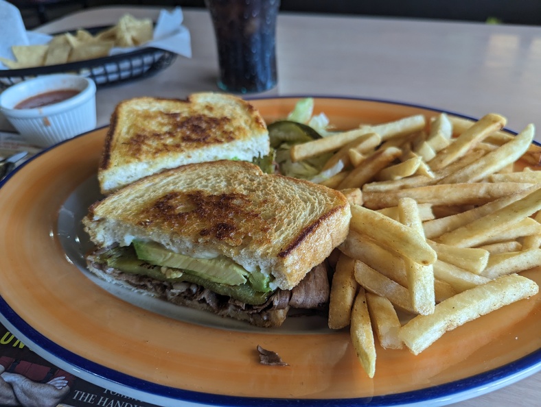
I stopped at a little place called Gracian Grill – a little hole in the wall across from the Tehachapi Airport. The décor was straight out of the 70s. There were wooden posts on the dividing partitions, and lots of orange glass and wood paneling. I ordered the California roast beef sandwich. Of course, when you add “California” to anything, that means avocado and/or chiles. The sandwich of sliced roast beef, avocado, cheese, and Ortega chiles on sourdough was ready good. The fries even had seasoning on them. Despite the place being nearly empty, the service was still slow. However, I would still eat there again.
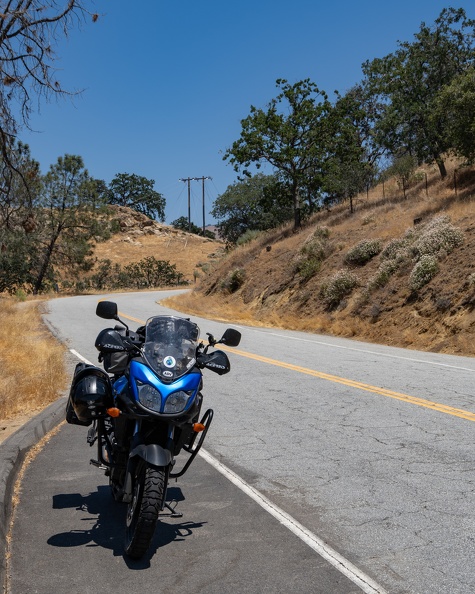
I decided it was time to get off the main highway and look for fun roads. I headed out of town on Woodford-Tehachapi Road. The road twisted through the Tehachapi Creek Canyon. The road was delightful. The road followed the railroad through the canyon, and I stopped at an engineering landmark, the Tehachapi Loop. The loop is a big spiral on the railroad that keeps the grade low enough for trains to climb or descent the hill. The spiral is notable that trains that are long enough will cross over themselves as they go through the loop. Despite the plaque saying 36 trains a day come through the loop, I saw none while I was there.
I made my way back to Highway 58 at Keene and continued out of the pass toward Bakersfield.
I hopped on Highway 99 for a few miles and stopped for gas in Bakersfield before going north on Highway 65. I won’t bore you with the time on Highway 65 because it was BORING. It was straight as an arrow, and full of slow trucks.
At Lindsay, I got off Highway 65 and headed east on Highway 190, which was much more fun. As I passed through the town of Lemon Cove, I passed several old, abandoned gas stations with classic names such as Richfield (now part of ARCO), and Standard (now known as Chevron in California). I turned west on Highway 246 and took it to Dry Creek Drive (County Road J21).
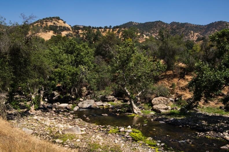
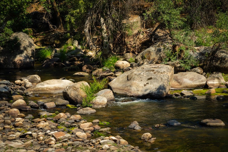
Dry Creek Drive was amazing. It followed Dry Creek (which was notably not dry), into the Sierra Foothills. There was no traffic going my way, and only a few cars passed me going the other way.


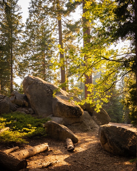
Near Badger, I turned onto Hogback Drive. This was an amazing road. It climbed up a narrow ridge – not as narrow as another “hogback” I’ve done, Skyline Drive in Colorado – but narrow enough to see down into the valleys on both sides. The twisties were tight, and the road narrow with views of the Sierras off in the distance. This was not a road that was built for speed; I stayed in first and second gear most of the way.
I soon turned onto Highway 245 for the final stretch to the park. Highway 245 was tight and twisty, but faster than Hogback Drive. I made it to the park around 4:30 p.m. Since it was getting “late” for the park, I stopped at the nearby market to see if they were close to closing for the day so I could make sure I could pick up ice, firewood, and dinner. They were going to be open for a few more hours, so I went to set up camp to make more room on my bike.
My neighbor at the campground seemed a bit strange. For some reason, he kept staring at me as he cooked his dinner while I unpacked. After he finished, he just went and sat in his truck. Weird.
I grabbed some dinner and supplies at the store. The wood they sold was very hard to split, so I had to search around for some kindling and tinder. Fortunately, there were a lot of fallen logs with really dry bark that worked well.
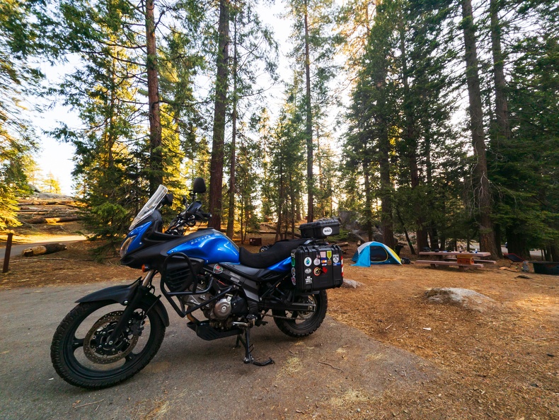

I wasn’t able to stake down my tent. The campsite had about a half inch of dirt covering solid granite underneath. No stake would be able to go through that. Fortunately, it was not windy, and the weight of my gear inside would hold the tent down. The solid rock under the tent also made me glad to have a cot to sleep on.
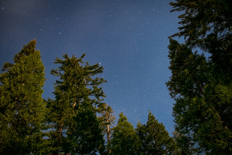
I finished the day sitting by the fire, enjoying a cigar and a brew.


Total Miles: 296