Scott Goes International, Epilogue

Epilogue

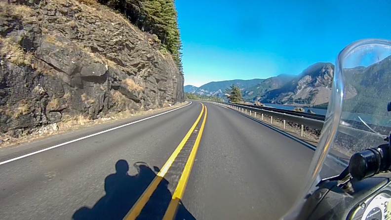
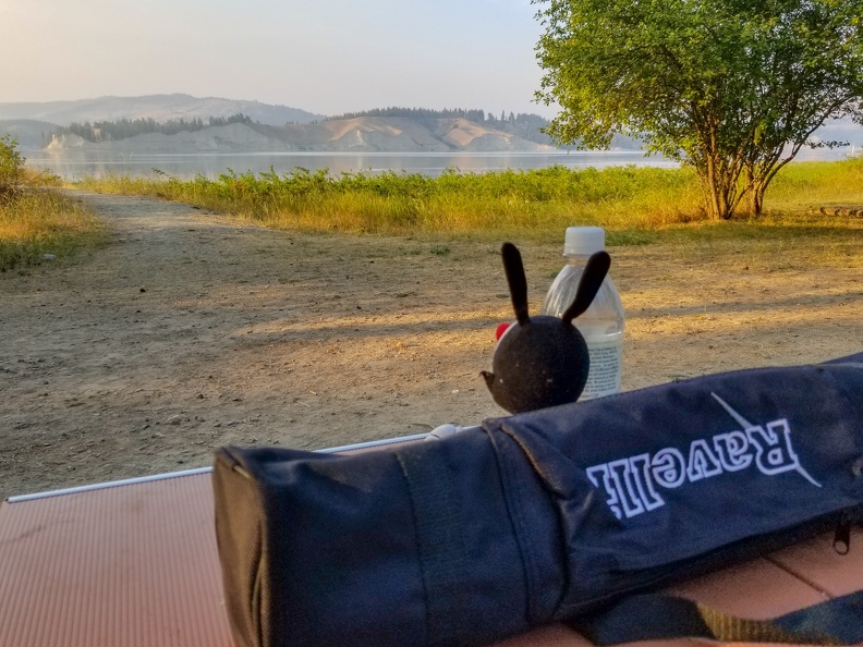
I wrote most of this while sitting by my tent at Joseph Stewart State Park.

My Canada adventure has come to an end. I’ve been riding solo for the last four days, something that was very intimidating to look forward to at the start of the trip. Yet here I am, 1158 miles from Nakusp, with 207 to go. Ted Simon said it best: It is remarkably easy to do things, and much more frightening to contemplate them.

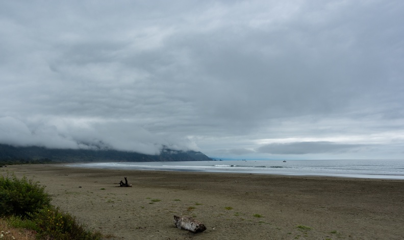
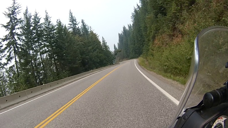
I have ridden some of the most amazing roads, and seen some of the most beautiful scenery British Columbia, Washington, and Oregon have to offer. The only real disappointment is that I had to choose to see some things and not others.

There’s something about riding alone. You can go at your own pace. You can stop whenever you want. When you stop for the night, it’s just you and your thoughts. Sometimes the solitude is exactly what you need to reflect on your journey. If you’ve never done a long trip by yourself, I highly recommend you try it sometime. It just may change your life.

Though you’re alone, you never truly are alone. There’s an amazing community of people sharing an interest in motorcycles out there. People who will slow down or stop when they see a stranger on a bike on the sire of the road just make sure they are OK. Often times, they’ll even lend a helping hand or stay with you until help arrives. We are also connected to our loved ones via little magic boxes that fit in our pocket. Support is only a fingertip away.

All throughout the news, we hear about how much bad there is in the world. This could not be further from the truth. Though, through my job, I often see the worst in people, I really believe that people are inherently good. Once you get on the road, you see this. I met several people who have offered up places to stay if I ever need one while traveling. I even took a chance and spent the night at a complete stranger’s home on my trip. A motorcycle seems to be a magnet that draws people to come out of their shell and make a connection with a stranger. You don’t hear about people on car trips being approached in restaurants to be asked about their travels. Change it to a motorcycle, and there is quite a mystique about a lone traveler.

When I first started riding, I knew I wanted to take trips, but I always thought it would be short weekend trips to places within a few hours’ ride from home. I never thought I’d find myself crossing an international border! Following ADV Rider and attending Horizons Unlimited events have only raised my desire to see more of what’s out there.

Having an understanding family is great. Their support allowed me to take on this trip, when before, it was something I didn’t think I would ever do. It was my own wife who bought my admission to Horizons Unlimited and set this journey in motion. Everyone should have such a supportive spouse. I thank her from the bottom of my heart. I’m forever grateful to Greg as well for taking the lead and accompanying me from home to Nakusp, and for all of his motorcycle travel mentoring. It was quite strange leaving Nakusp without seeing his Tiger in front of me, but I easily found my solo groove.

I’m looking forward to my next great adventure, and I look forward to sharing it with you all. I’ll see you down the road.

Scott Goes International, Part 11

Day 11: August 30, 2018

Route: Prospect, Oregon, to McKinleyville, California – The Home Stretch!

The campground at Joseph Stewart State Park was very quiet overnight, the only sound was the slap of a sprinkler in the distance. I woke to the sound of the wind blowing through the trees above my camp site.

Today was the home stretch, a short ride to the California coast and I would be home. I was excited to be finishing the solo portion of my trip, but at the same time a little sad that it would be coming to an end. I set out westbound on Oregon Highway 62 toward Shady Cove.

Just north of Eagle Point, I turned onto Oregon Highway 234 towards Grants Pass. Highway 234 took a straight line through farm lands before passing on the north side of Upper and Lower Table Rocks – two volcanic plateaus standing alone in the Rogue River Valley. At Gold Hill, Highway 234 takes a turn, joins Oregon Highway 99, and begins following the path of the Rogue River in the shadow of Interstate 5, the highway that replaced 99.

I stopped in Grants Pass for a coffee and muffin then continued west on Highway 199 toward California. With little traffic, Highway 199 was fast until I reached the Illinois River Valley. The air began to get smoky near Selma from ongoing fires in the area. Many signs warned of fire fighting vehicles entering the roadway. However, once I reached Cave Junction, the air began to clear.


South of O’Brien, I reached the California border. I didn’t get stopped and hassled at the agricultural inspection station, and it appeared other vehicles were just getting the hand wave treatment as well.

Shortly after entering California, I passed through the Randolph Collier Tunnel. The 1,900-foot-long tunnel, about one mile into California from the border, was the final link in the road that connected the Illinois Valley to the coast. Prior to the tunnel’s construction, traffic had to pass over Oregon Mountain on a narrow windy road described as a “Jeep path” by the tunnel’s namesake. The tunnel and newly constructed Highway 199 cut a mere 3 miles off the path from Oregon to Crescent City, but eliminated 128 turns and 5 switchbacks needed to cross over Oregon Mountain, and allowed the speed of the road to be raised from 25 mph to 60 mph.

After passing through the tunnel I immediately felt a blast of cold coastal air, an odd feeling so far inland. Typically, I don’t encounter the coastal air until Gasquet, 20 miles to the west.

After passing a slow-moving Honda that refused to use the available turnouts, I picked it up to fully enjoy the twists and turns of Highway 199 as it paralleled the Smith River and entered the coastal redwood forests.

As I rode through Hiouchi, I saw a pair of motorcycles with European plates exiting the gas station. Had I seen them sooner, I would have tried to stop and talk to them and find out their story. I continued west into Jedediah Smith State Park and it’s narrow two-lane road winding through groves of ancient coast redwoods – the tallest trees on Earth. As I rode in the shadow of the ancient giants, I saw the two European bikes a few vehicles back. Perhaps I could get them to stop for a bit in Crescent City.

I pulled into the parking lot at the Chevron gas station in Crescent City and waved at the two Euro riders to get them to stop. They simply waved back and continued south on Highway 101. OK … maybe they didn’t understand what I was trying to do. I pulled back onto the highway and followed after them. I pulled up behind them at a stop light and saw the license plates were from Germany, oddly these Germans were riding Triumphs. Seeing that, I HAD to get them to stop – not only because Greg rides a Tiger and would be interested in hearing about them, but because they were Germans on British bikes.

I pulled ahead of them and waved as I pulled into the parking area at Crescent Beach just south of Crescent City. Again they waved back and continued on. Apparently, I need to put up a giant sign that says, “Germans on Tigers. Stop now!” They disappeared up the “Last Chance Grade” section of Highway 101. I got back on the highway and tried to catch up. My new plan was to follow them and wait for them to stop, then stop to talk to them.

The two German Tigers pulled into the vista point overlooking False Klamath Cove. I pulled in behind them. Well, maybe this wasn’t such a good plan. They seemed to have no interest in talking at all. All I could get out of the Germans was that they were from Germany, riding around the USA, and were staying at Fortuna, California, tonight. Well, that was a bust.

I got back on the road and beat feet for home. Redwood National Park was devoid of the usual roadside wildlife – where were the elk?!

I got home a little after 1 p.m. The journey was done, and when all was said and done, I had ridden more solo miles than I did with a partner. It felt like such and accomplishment to me.

I felt ready for the next adventure, whenever it might be.

Distance: 205 miles, 2534 total – 1,396 miles solo.

Scott Goes International, Part 10

Day 10: August 29, 2018

Route: Mitchell, Oregon, to Prospect, Oregon

The sounds of the creek next to my camp were very relaxing, and I slept well. I broke down camp around 8 a.m. and got on the road westbound on Highway 26. A few miles west of Mitchell, I turned off toward the Painted Hills. The turn-off, Bridge Creek Rd., was nicely paved and twisty, following the sinuous path of Bridge Creek through its valley carved through the foothills of the Sutton Mountains. I passed a few small farms along the way. I turned onto Bear Creek Rd. to make the one-mile climb over the loose gravel into the Painted Hills.

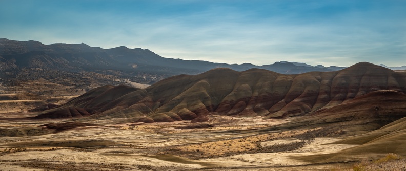
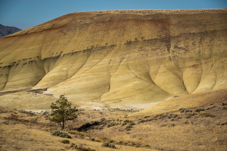
At the overlook, I was graced with a wonderful view of the Painted Hills. The hills were rich with multiple shades of red, gray, orange, and brown – the layers representing various geological eras and deposits laid down when the area was a river floodplain. With the sun still low in the morning sky, the colors were very rich, but I could only imagine what the colors would look like as the sun was on its way down in the west. I should have made the trip yesterday afternoon before calling it a night.

I headed back to Highway 26 and continued west into the Ochoco National Forest. Highway 26 climbed Ochoco Pass then descended into agricultural areas of the Prineville Valley. As I continued towards Bend, the volcanic origin of the area know as the High Lava Plains was very evident. Farms had small outcroppings of volcanic rock randomly dispersed throughout, and small buttes and ancient cinder cones were visible all around.

Just west of Prineville, I turned onto Oregon Highway 126, which climbed from the Prineville Valley into the High Lava Plains, the brown soil and yellow scrub, a stark contrast from the green farms of the valley.

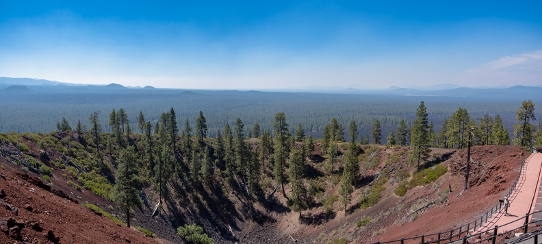
I gassed up in Bend and got onto US Highway 97 to head south to Crater Lake. A few miles south of Bend, I stopped at the Newberry National Volcanic Monument. The Newberry Monument protects the areas around the Newberry Volcano and includes more than 50,000 acres of lava flows. The visitor center is located at the base of Lava Butte, a 500-foot-tall cinder cone that was created in an eruption about 7,000 years ago. Lava Butte is surrounded by lava flows associated with its eruption, stretching 5 miles from the cone to the Deschutes River. I rode the bus to the top of the cone and took in panoramic views of the surrounding lava flows and the Newberry Caldera to the southeast.

After leaving Lava Butte, I continued south on Highway 97, where winds picked up across the vast lava plains. Most of the time, the winds came from the west, blowing down from the Cascades, but on occasion I felt the wind become indecisive and change directions.

I turned off toward Crater Lake at Chemult, where Oregon Highway 138 – The Volcanic Legacy Scenic Byway – meets up with Highway 97. I entered Crater Lake National Park via the east entrance. The road crosses the Pumice Desert on its climb up the flanks of the former Mt. Mazama, the volcano that contains Crater Lake in its caldera. In my past visits to Crater Lake, the entire area has been covered in snow – in winters the national park is often covered in 10 to 15 feet of snow – so seeing the area covered in grasses and trees was different from my “usual.”


About 8 miles past the entrance station, I reached Rim Drive. I pulled into a surprisingly empty viewpoint and my jaw dropped. The view of the lake was breathtaking. Seeing the lake from the back of a motorcycle was one of those experiences that gets you right in the feels. I might have started tearing up at the beautiful deep blues of the lake surrounded by the rich reddish-brown crater walls. Just a week prior, the view of the lake was obscured by heavy smoke. Today, the skies were all but devoid of any smoke. Seeing the lake in this way was like seeing it again for the first time.


I continued to the Rim Village Visitor Center and got another stamp for my National Parks Passport book, my ninth stamp of this trip. Walking around the parking area at Rim Village seemed strange, given that I had only been here in winter before and had only seen the parking lot surrounded by tall walls of snow.

I exited the park and stopped at the Joseph Stewart State Park on the shores of Lost Creek Lake for the penultimate night of the trip. The park was essentially empty, except for a few RVs and trailers, so there were plenty of sites to choose from. All sites have electrical and water hookups (if you’re honest and pay the $24 fee). Each of the loops at the campground surrounds a central building with sinks for washing dishes, bathrooms, and showers within a few yards of each site. The park looked like a great place for families as well, with several children’s playgrounds around the campground.

I sat by my tent looking up at the stars, contemplating my journey and how the entire trip felt. I’ll cover those thoughts later.

One more day to go.

Distance: 240 miles, 2,329 total.

Scott Goes International, Part 9

Day 9: Tuesday, August 28

Route: Hood River, Oregon, to Mitchell, Oregon

I slept like a baby in the king-size bed in my hotel room. I got up and opted for the complimentary breakfast. I’ve only seen these at Holiday Inns, but they had an automatic pancake machine. This marvel of technology lets you push a button on one end and receive fresh pancakes from the other end in about two minutes.

I got a bit of a late stop on the road, finally rolling out around 10:30. I went south on Oregon Highway 35 into the Mount Hood National Forest. Clear skies made for great views of Mt. Hood. I turned off onto Forest Service Highway 44, which connects Highway 35 to US Highway 197 at Dufur. Soon the pine forests turned into rolling hills covered with grass.

Highway 197 followed the ups and downs of the land, climbing up Tygh Ridge before descending into Butler Canyon. Butler Canyon opened into the Tygh Valley, then the road climbed Juniper Flat – a plateau bounded by the White River on its north side and the Deschutes River on the east. On the south side of Juniper Flat, Highway 197 descended into the Deschutes River Canyon and the city of Maupin.

After leaving Maupin, Highway 197 climbed another plateau, topping out at Criterion Summit before meeting up with Highway 97 and dropping into Cow Canyon. At the bottom of Cow Canyon, I turned off onto Oregon Highway 293, which wound its way through the Antelope Creek Canyon toward the city of Antelope.


I should have done some research beforehand, because Antelope is a nearly abandoned city. The city, formed in 1901, rose to some notoriety in the 1980s when members of the Rajneesh movement, a controversial religious movement based on the teachings of Indian guru Bhagwan Shree Rajneesh. In the early 1980s, the Rajneesh movement moved into Antelope, and effectively took over the city government by outnumbering the original residents through new voter registrations. Antelope was renamed to Rajneesh in 1984. In 1985, several of the Rajneesh movement leaders were implicated in criminal behavior, including a mass food poisoning attack and a plot to assassinate a US Attorney. Shortly after, the Rajneesh commune in Antelope collapsed and the city was renamed to its original name. A large number of abandoned buildings stand decaying in the city. Had I known all this, a stop would have likely been in order.

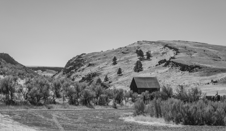
Highway 293 twisted its way through the Antelope Creek canyon. The canyon opened up to a valley of rolling hills dotted buttes and edged with steep-sided cliffs. At Antelope, Highway 293 met up with Oregon Highway 218, which runs to Fossil.

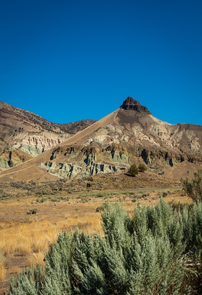
Highway 218 ran past the Clarno Palisades, one of the three parts of the John Day Fossil Beds National Monument. The monument was established in 1975, and is well-known for well-preserved layers of fossil plants and animals that lived in Eastern Oregon between 5 and 45 million years ago. The area around the Palisades was like riding through a John Ford movie. The highway wound its way around the base of exposed rock formations more reminiscent of the American Southwest than what one things of the Pacific Northwest. I stopped at the picnic area for the Clarno Palisades for a stretch.


The Clarno Palisades are about 18 miles west of Fossil. They are made of ancient volcanic lahars, pyroclastic mudslides, that formed between 40 and 54 million years ago when the area was a semi-tropical rainforest. Researchers have found fossils of ancient four-toed horses, rhino-like brontotheres, crocodiles, and other jungle animals in in the rocks around the palisades.

I walked around for a bit, stretching my legs and drinking water to stave off dehydration. While walking around, a couple of BMWs rolled into the parking lot. The riders were visiting the area from Alberta, and had actually been at Horizons Unlimited! Small world!

I was still about 70 miles from the main Fossil Beds Visitor Center, a drive which a sign at the palisades said was two hours long. I looked at the time and saw I would be cutting it close to the center’s closing time. I bid farewell to the Canadians and made tracks for the visitor center.

Making great time is hard when the scenery is so amazing! Dropping down into Fossil the road twisted through small canyons, occasionally giving views of the Butte Creek Valley below. From Fossil, I turned onto Oregon Highway 19, the “Journey Through Time” Scenic Byway, which followed Butte Creek, one of the many tributaries feeding the John Day River.

Just south of Spray, Oregon, I ran into construction on Highway 19. The road was ground up for repaving, but I didn’t see anyone working on actually paving the road. The loose gravel on the road from grinding and preparation for chip sealing was thick at times, keeping speeds down. I kept my bike in the wheel tracks that had been worn into the gravel, but occasionally those tracks disappeared. Ten miles passed with no sign of workers, then 20 miles passed with no sign of road workers. Who grinds up 20+ miles of road at a time before paving? Finally, as I neared the Fossil Beds Visitor Center, the workers appeared – nearly 30 miles from the start of the construction zone.


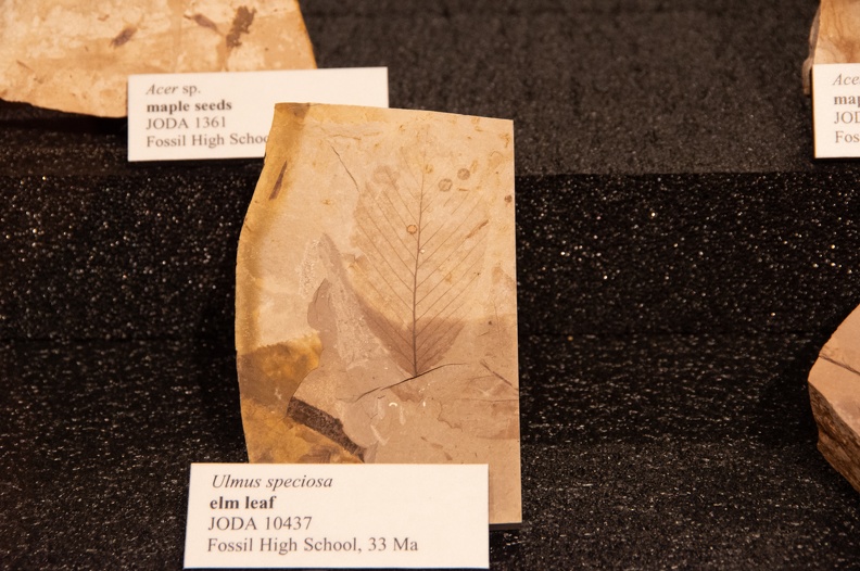
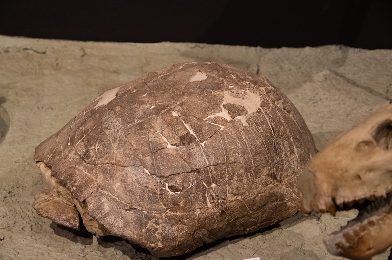
I stopped at the Thomas Condon Paleontology Center, in the shadows of Sheep Rock. The Condon Center is the main visitor center for the Fossil Beds National Monument. The center has many fossils on display of plant and animal life that used to make Eastern Oregon home. The area around Sheep Rock was where Army soldiers first found a multitude of fossils while searching for gold in 1865. The paleontology center is named for Thomas Condon, who accompanied the soldiers to the area after learning of the fossil finds.


After seeing the visitor center, I went south on Highway 19 for a few miles and turned onto US Highway 26 toward Mitchell. Highway 26 runs through Picture Gorge, a narrow canyon cut through deep layers of Columbia basalt lava flows by the John Day River and Rock Creek. The canyon was named for the Native American pictographs found on the canyon walls.

I stopped for the night in Mitchell, Oregon (population 130). Mitchell was founded in 1873 and sits at the bottom of a small canyon. The city calls itself “The Gateway to the Painted Hills” because it’s the only city in relatively close proximity to the Painted Hills Unit of the John Day Fossil Beds National Monument.

I stopped into the Mitchell Stage Stop for dinner and to use the WiFi. The building looked almost as old as the city itself. I ordered myself a bacon jalapeno cheeseburger and fries. The burger was enormous and delicious. My can of soda was cold and was given to me accompanied by a glass mug pulled directly from the freezer.


Across the street from the Stage Stop was the Mitchell City Park. The city allows RV and tent camping at the park, and it’s a popular stop for bicyclists riding through the area. I set up my tent along side a gurgling creek and had the whole park to myself for the night.

Distance: 250 miles, 2,089 total.

Scott Goes International, Part 8

Day 8: Monday, August 27, 2018

Route: Osoyoos, BC, to Hood River, OR

Woke up around 5:30 a.m. because my Couchsurfing hosts were leaving at 6. The sun was just coming over the mountains east of town. I made sure both kidneys were still there, loaded up the bike, and got ready to go. I said goodbye and thanked my hosts for their hospitality and headed to Timmy’s for breakfast before heading for the border.

I started my ride south before 7 a.m. There was no traffic on the road and nobody in line at the border station in Oroville, Washington. I cleared through customs and headed south on US Highway 97.

A few miles into the States, I turned onto a side road that paralleled Highway 97 on the west side of the Okanogan River. This road flowed through farm land taking many twists, turns, ups, and downs. I rejoined Highway 97 when the road ended at Tonasket.

Highway 97 wound its way south through the Okanogan Valley, with the view interspersed with the brown foothills of the Cascades and adjacent Kettle Mountains and the green farms lining the Okanogan River.

The Okanogan met the Columbia near Brewster and the road entered into a canyon, following the Columbia as it flowed into Lake Pateros, impounded by Wells Dam. Wells Dam provides hydroelectric power to several communities around Washington and Northern Oregon. I stopped for a break at the dam information center.


Northeast of Chelan, I turned onto US Highway 97 Alternate. “Alt 97” is a nearly 40-mile-long route that splits off the main highway near Wenatchee and winds along the south shore of Lake Chelan and into Knapp Coulee before following the west bank of the Columbia and meeting up with US Highway 2 at Sunnyslope, Washington.

I turned onto Highway 2, which shared an alignment with Highway 97 and headed west. As I approached the city of Cashmere, Washington, I saw a sign for the 9/11 Spirit of America Memorial. I was surprised to see a memorial to the events of 9/11 this far west. Having served in the Army after 9/11, I decided to make a stop.

The memorial had a bit of a troubled history, being rejected by other Washington cities, including the capital Olympia, before being given a home in Cashmere. The memorial is centered around a sculpture made from steel from the World Trade Center and a concrete block from the Pentagon. A circle of bronze statues – a firefighter, flight attendant, office worker, and member of the military – stand facing outward in a circle in front of an American flag. Today the flag was flying at half staff for the death of Senator John McCain. Though the memorial is next to a park with a children’s playground, the memorial itself was quiet, allowing visitors to reflect on the tragic events and the lives lost on 9/11 and in the ensuing military actions in Iraq and Afghanistan.


As I continued west, I decided to take a short detour to Leavenworth. Leavenworth is a Bavarian-themed town nestled in a canyon along the Wenatchee River. The town is a popular spot in winter time when it is decorated and lit up for Christmas, and as a base for skiers going to Stevens Pass.

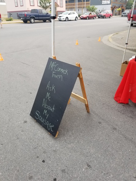
I grabbed myself a kielbasa at Rudloofs Pizza Und Brats. I got there about a half hour before they opened, so I waited patiently outside. I was customer number one for the day. $8 gets you a quarter-pound sausage covered in sauerkraut and a bag of chips. The kielbasa had just the right amount of spice and was a good lunch.


I left Leavenworth and headed east to get back on Highway 97. Highway 97 wound its way through Blewett Pass. After several miles of twists and turns, the green forests gave way to the brown, grassy Columbia Plateau, dotted with giant wind turbines.

The Kittitas Valley Wind Farm, as it is named, covers more than 6,000 acres and has 48 turbines installed. Overlooking the city of Ellensburg, Washington, the farm produces more than 100 megawatts of energy, which is enough to power 26,000 homes each year. The turbine’s towers are 262 feet tall from the base to the hub, and the blades are each more than 100 feet long and weigh about 7,000 pounds. While writing this, I learned there was a visitor center offering tours. Maybe next time.

After reaching the floor of the Kittitas Valley near Ellensburg, I turned onto Washington Highway 821. I had seen Highway 821 on my map and was immediately drawn to its many curves contrasting with the gentle sweeps of Interstate 82 to the east.

Highway 821, named as the Yakima River Canyon Scenic Byway, runs for 25 miles between Ellensburg and Selah. The highway is an old alignment of Highway 97, which was bypassed in the 1970s. Along the are many recreational spots where you can fish, swim, or camp. I chose to keep going.

Looking at the walls of the canyon, you get a sense of the long geologic history of the area. Layers upon layers of volcanic rock laid down over the ages. According to one of the historical markers in the canyon, the area was once a vast plain of rolling hills. Twenty-five million years ago, the first lava flows covered the land. Streams and lakes reformed and the cycle continued again for the next 15 to 20 million years. The visible layers in the canyon are part of one of the largest lava fields in the world, covering large swaths of Washington, Oregon, and Idaho.

At Selah, Washington, where Highway 821 emerged from the canyon, I turned onto US Highway 12 and headed west. This portion of Highway 12 was known as the White Pass Scenic Byway. I think scenic was an understatement. The road was downright gorgeous.

The White Pass Byway starts at the confluence of the Tieton and Naches Rivers below beautiful brown bluffs that look like they’d be just at home in the deserts of Utah or Arizona. I really had no idea the vast range of geographies I would see in Washington. The byway follows the Tieton River, at time inches from the edge, through a narrow canyon as it climbs toward White Pass. The entire way, giving a contrast between the dark greens of the foliage along the river and the brown hills above. Several campgrounds and day-use areas dot the banks of the river. Just west of the summit, the Tieton River is impounded by Tieton Dam – a 319-foot-tall concrete and earth dam – forming Rimrock Lake.

Near the summit of White Pass, I was graced with an amazing view of the Clear Creek Valley. The deep valley, though covered in trees instead of exposed rock, was vaguely reminiscent of views in Yosemite National Park. On the initial descent from the summit, I stopped at the viewpoint for Mt. Rainier. I could see where Rainier was, but unfortunately, most of the mountain was shrouded in clouds.


When I reached Randle, I turned south onto US Forest Service Highway 25. FS Highway 25 meanders along the east side of Mt. St. Helens. The road was mostly good, but there were a lot of portions where the underlying earth was slipping away, requiring riders and drivers to keep an eye out for rim-bending dips. Along the way, I passed many bicyclists coming down into the Randle area. I wanted to take FS Highway 99 to the Windy Ridge Viewpoint to look at Mt. St. Helens, but given it was getting late in the day, and my posterior was sore from the long ride, I felt a 32-mile round-trip addition to my day was not in my best interest, given I was still 80 miles from Hood River, Oregon. Instead, I was presented with many turnoffs with stunning views of St. Helens.

I turned onto NF Highway 90 near Swift Lake and then onto Curly Creek Rd. which climbed a ridge before heading down toward the Columbia River. I stopped at the McClellan Overlook which had a panoramic view of Mt. St. Helens and the surrounding lands. Parked at the overlook was a Ducati ST4. The owner must have worn himself out with riding around the area, because he was taking a nap on a picnic table. Curly Creek Rd. dropped onto Wind River Rd., and wonderful serpentine route with many tight twists and turns that dropped me onto Washington Highway 14 at Carson.


I took Highway 14 east a few miles to the Hood River Bridge crossing at White Salmon. After being on the road for 11 hours, my knees and butt were in some serious need of relief. I decided I’d cross over to Hood River and look for a hotel room for the night. I felt I deserved it.

I knew what to expect this time with the Hood River Bridge’s steel grate deck. Adding to the fun was a crosswind blowing upriver that was doing its best to push me into oncoming traffic.

I booked an “Express Deal” through Priceline and got myself a room at the Holiday Inn Express. The desk clerk was kind enough to let me leave my bike parked in the covered area in front of the main entrance. I got myself a cold can of Angry Orchard from the gas station next door to the hotel and took a relaxing dip in the hot tub to ease my tired muscles and joints. After almost 440 miles, by far my longest day ever on a motorcycle, I wasn’t sure if I ever wanted to ride that long again. A hot shower and comfortable bed capped off the day.

Distance: 437 miles, 1,839 total

Scott Goes International, Part 7

Day 7: August 26, 2018

Route: Nakusp, BC, to Osoyoos, BC

The morning sun woke me up early, around 6 a.m. Maybe it was also the excitement and trepidation of leaving Nakusp. The entire trip to Nakusp, I had been riding with Greg. Something felt calming about seeing him in front of me on the road. Well, Greg is retired. Greg didn’t have to be back to work in a week; I did. I knew this was coming, and Greg had told me I’d likely be returning home alone. Greg planned to see more of British Columbia and Alberta. My return to California would be my first long trip alone. I laid there in the tent for a while planning out my day.

Starting early the previous night, it had rained in Nakusp. The rain was welcome, as it helped reduce some of the smokiness, but at the same time I wasn’t looking forward to riding in it. My rain gear had melted back in California, and I had not bought replacements.

I packed up my camp in the cold morning air. Amazingly, the items that had been hanging on the clothesline had dried despite the rain. I guess the stand of trees around camp had provided enough of a cover that the rain couldn’t get through.

I said goodbye to Greg. He offered some encouraging words, and reminded me to ride my own ride. Greg had every bit of confidence that I could handle the trek home by myself. Greg assured me that though I would be alone, motorcyclists are never truly alone – they look out for each other. A handshake and a hug later, and I was on my way.


It was shortly after 9 when I finally hit the road, taking BC Highway 6 out of Nakusp toward Fauquier. The ride out of town was chilly, and I had to stop to put on my thermal jacket liner. Since Horizons Unlimited was over, several other motorcycles passed as I put on the liner, each one raising a thumb at me to make sure I was all right.

I arrived at the Fauquier ferry and waited in a long line of cars and motorcycles. The Fauquier ferry was different from the ferry I had taken in Washington. They did not allow motorcycles to skip the queue and go directly to the front. I ended up at the back of the ferry with another rider on a BMW. We chatted for a bit about where we were from. He was familiar with the Northern California area, and had ridden many of my “home roads.”

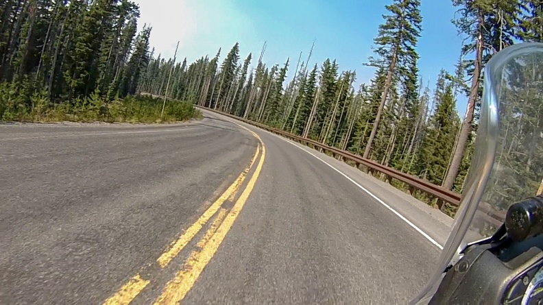
I rolled off the ferry behind a couple minivans and RVs, and made the climb up the Monashee Pass. As I was climbing the pass, it started raining. The rain wasn’t heavy, but it was steady. The road didn’t start getting wet until I reached the top of the pass. My riding jacket and pants did a good job on their own of keeping me dry.

The rain had an added benefit – it was no longer smoky. I had been able to see Arrow Lake while crossing on the ferry, and I was able to see the forest as I rode through the pass. The green and brown trees were a beautiful contrast to the gray skies. The reflections of the clouds on the damp pavement, added to the beauty. As I descended the pass, the highway followed Inonoaklin Creek as it wound down the hills as it flowed eventually into the Kettle River. I stopped for pictures where the road passed McIntyre Lake. I was enjoying the solitude and the natural beauty of the Monashees.


That’s one of the good things about riding alone. I could stop whenever I wanted if I saw something interesting. Greg always told me if I wanted to stop if I wanted, he had no problem waiting for me, but I felt bad doing so because I felt like I was holding him up.

I turned onto BC Highway 97 in Vernon. The rain had stopped, but the air was still cold. While waiting at a stop light in Vernon, I saw a CF-18 circle around overhead. It flew off before I could get my camera out to take a picture of it.

I continued south on Highway 97 past Kalamalka Lake and Wood Lake. I stopped in Lake Country and visited my first Tim Horton’s. It’s mass-market coffee, but everyone tells me it’s a place to stop when you’re in Canada. The coffee was good, and the sausage and egg sandwich filled me up enough to satisfy my hunger for the time being. Other customers were so nice, asking how the ride was going, and even inquiring as to where my license plates were from. Two customers seemed shocked that someone would ride all the way to Canada from California on a motorcycle.

In Kelowna, I gassed up and made a quick stop at Walmart. I had been looking for Canadian flag stickers since I arrived, but had no luck finding any. I thought for sure Walmart would have them, as they always seem to have a small souvenir section. Apparently the Kelowna Walmart was different. They didn’t have a souvenir section, and they didn’t even have Maple Leaf Flag stickers in the customization section of the automotive department. Perhaps they’d be easier to find near the border where all the tourists go.

From Kelowna, I turned onto BC Highway 33, which wound through the West Kettle River Valley. The rain picked up again through the valley, but it still wasn’t so bad that I had to stop. The scenery, once I entered the valley was amazing – green trees, reddish brown grasses, gray clouds. I stopped several times to take pictures. Highway 33 seemed to be the road less traveled, as I didn’t see as much traffic as I had on Highway 97.

It was beginning to get close to the time where I would have to think about finding a place to stop for the night. I knew there was a provincial park in Osoyoos, but when I had checked the previous day, it was almost full. Also, I didn’t want to sleep on the ground again after spending the last week in a tent. I decided to give the Couchsurfing app a try.

Couchsurfing is a website and app where hosts offer up space for people to spend the night, be it simply a couch, a spare bedroom, or a mother-in-law unit. The stays are free, as opposed to other sharing sites like AirBNB. Though staying with a stranger is not something I would typically do, I thought I’d give it a try. I made a couple requests for places in Osoyoos and would check back for my results as I got closer. I was hopeful someone would be amenable to my last-minute request.

At the town of Rock Creek, I turned onto BC Highway 3, the Crowsnest Highway, to make my final approach toward Osoyoos. Highway 3 crosses Anarchist Pass and skirts within a quarter mile of the Canada-US border in some places. Heading west toward the descending sun, I saw amazing displays of light rays piercing the clouds. Descending into Osoyoos, I navigated the tight switchbacks of the highway, unfortunately being stuck behind a slow-moving RV at the front of a long line of cars. I enjoyed the view of Osoyoos Lake on the descent.


When I arrived in Osoyoos, I checked Couchsurfing to see if I had any responses. I got one from a user named Janet. Janet had a private room with a cot available for the night. A warm, dry room and not sleeping on the ground sounded great. I confirmed my stay and told Janet I would be arriving shortly.

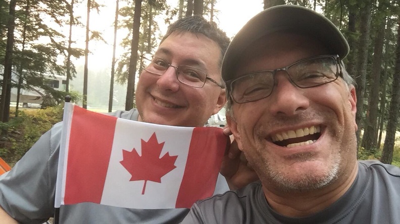
I made a stop at a local store, and finally found myself some Canada stickers. Border towns to the rescue!

The room was not a stay at the Ritz, just a bedroom with a camping cot, but I didn’t care. I’d be off the ground and warm for the night. Janet and her boyfriend Colin, a retired-RCMP officer, were nice people. Janet was quick to offer up a hot cup of tea, and made dinner. I chatted with them about my time on the road, and the differences in police work in Canada and the United States. After dinner, they took me to the local ice rink, where their friend Paulo works. Unfortunately, the rink didn’t have any skates available in my size, so I didn’t get to hit the ice. Instead, I got to help Paulo with some of the end-of-day ice maintenance. I didn’t get to drive the Zamboni, but I got to help Paulo measure the thickness of the ice.

I slept well on the cot, and even managed to hold onto my kidneys! Tomorrow I would say goodbye to Canada and re-enter the United States. Thanks for your hospitality, Canada. Your people and land have been beautiful.

Distance: 264.5 miles, 1402 total.

Scott Goes International, Part 6

Part 6: Horizons Unlimited Canwest

Did not do a lot of riding once we arrived in Nakusp. Nakusp is a small town, only about 3 square miles, so there isn’t much need to ride around. The campground is right on the edge of the central business district of the village.

I’m told the views of Arrow Lake are spectacular. Unfortunately, the entire time I was in Nakusp, the sky was filled with smoke from fires raging all over British Columbia. Regardless, the town was still a nice place.

The night we arrived in Nakusp, we had dinner at the Leland Hotel. The Leland purports to be the “oldest continually operating hotel in British Columbia,” having opened in 1892. The hotel has a garden and patio overlooking Arrow Lake, along with a dining room and bar/card room. The nachos are good, as was the beef dip sandwich.

Prior to Horizons Unlimited starting up, I took the opportunity to walk around the village. There are a bunch of small shops selling things from books to antiques, along with a supermarket and hardware store where you can get almost anything you might need.


Thursday morning, I had a breakfast burrito at Broadway Deli. The tortilla, some called it a “wrap,” was green, but the burrito itself was good – chock full of eggs, peppers, potatoes, and sausage.

I walked around town and picked up some souvenirs to take home, and I mailed a postcard home.

The smoke lingered the entire time I was there, but the waterfront walk was still nice. There’s a Japanese garden with colorful flowers, and many benches to sit and look at the lake.


For those who haven’t been, Horizons Unlimited is a gathering focused on traveling by motorcycle, though they welcome people in any type of vehicle. Presenters give talks on their own travels, tips on taking your own journey, and maintenance tasks you might have to do on the road. If you are looking for inspiration or information on taking your own motorcycle journey, HU is a good thing to attend.

I took the opportunity to take a class on off-road riding skills on the first day. Al, the instructor, is a Canadian police officer and police motorcycle instructor. Much of the class covered low-speed techniques that would benefit a rider both on and off road. I found the class so informative, I took it twice. Al had also set up a course on the old baseball field with some off-road-type obstacles to practice your newly acquired skills. Though, at Al’s recommendation, I steered clear of some of the larger obstacles to prevent any possible damage to my bike.

Something I like to do when I travel is to visit the local police station. I enjoy meeting other officers and learning about how their experiences are both the same and different. When meeting the officer, I always bring a patch from my department to trade for theirs. In the case of Nakusp, police services are provided by the Royal Canadian Mounted Police. I walked over to the station, which was only two blocks from the campground, and met Corporal Moffat. Corporal Moffat was more than happy to find me a patch, which took a bit of searching around the office. She even gave me some stickers and temporary tattoos for the kids!


During some down time, Greg and I took the opportunity to visit the Nakusp Airport to see the fire helicopters coming and going. After visiting the airport, we went to Nakusp Hot Springs.

The hot springs are in the Kuskanax Valley northeast of Nakusp. The road was a fun, windy two-lane road that climbed into the foothills of the Selkirk Mountains following Kuskanax Creek. The trip to the springs was worth it, if only for the ride up. The hot springs had two pools kept at different temperatures. The hot pool was said to be at 104 degrees, but felt hotter. The larger, cooler pool was kept at 97 degrees. While in Nakusp, I still had tightness in my leg, but a soak in the hot springs loosened it up quite nicely. On the way back to town, we stopped to look at Gardner Falls, just off the side of the road.


Just walking around town, I could tell that the stereotype of the polite Canadian is true. I did not meet a single person who did not greet you as you walked by on the street, and all of the people in stores seemed genuinely interested in making sure your experience was a good one. I would think Nakusp would be a great place to visit just as a relaxing getaway.

Scott Goes International, Part 5

Day 5: August 22, 2018

Route: Hunters, Washington, to Nakusp, British Columbia

I woke up around 7 a.m. and looked out the front of my tent to see a very nice sunrise over the lake. Smoke in the air had the side-benefit of warming the reds and oranges of the sunrise. Made my coffee while Greg was still sleeping and just sat and watched the stillness of the lake. The silence was beautiful. Soon Greg got up and we broke camp to head for Canada.

We checked Greg’s Butler Map to decide if we wanted to continue up Highway 25, or cross the Columbia River on the Inchelium-Gifford Ferry. The map labeled the Inchelium Highway as a “gold” road, meaning it was, as Greg called it “Motorcycle Heaven.” I made the choice that we would take the ferry and take the gold road.

We got on the ferry a little south of Gifford. The ferry crew allowed us to the front of the line so we would be first off. The ride on the Columbian Princess took about 10 minutes.

We headed north on Inchelium Highway toward Kettle Falls. While the road followed the river and had many wonderful views, it was not at twisty and “Motorcycle Heaven-ish” as the map made it out to be. It did not seem all that much different from the stretch of Highway 25 we had ridden yesterday between Fort Spokane and Hunters.

We passed through many areas that had been burned by recent fires. We also saw fire crews in the area doing their work to make sure the fires were out. We stopped for gas in Coleville at the junction of Washington Highway 20 and US Highway 395. While the pumps were open, the store was closed, presumably because of the fires. Burned trees and brush went right up to the back edge of the parking lot at the station.

We turned north on Highway 395 and headed for the border crossing at Laurier. Along the way, we passed through small timber communities that showed that logging was still alive and well in Northern Washington.

Laurier was definitely one of those towns that if you blinked you would miss it. It seemed that no sooner did I see the sign for Laurier, then I saw a giant maple leaf flag flapping in the breeze. There she was – Canada! Reaching the international border felt like a huge milestone for me. It hit me, I rode a motorcycle from California to Canada!

Crossing the border was quick and easy. The Canadian Border Services Agency agent was polite and didn’t delay us too much. I got my passport stamped (something you have to actually request) and I was sent on my way. We pulled over over a few hundred meters (we’re now using metric) past the border station to stop and take pictures and exchange handshakes at the sign welcoming us to British Columbia.

We headed north on BC Highway 395 for a few mile – er, kilometers – and turned onto BC Highway 3 toward Castlegar. We rode the shores of Christina Lake then climbed up Bonanza Pass in the Monashee Mountains.

We stopped in Castlegar for lunch. We tried to go to Tim Horton’s for my first visit. However, they were closed. There was a sign saying they were open during construction, but also a sign of unknown age saying they were closed for an employee party. We may never know the true reason, but if it was because of a party, I’m a little disappointed we weren’t invited. I thought Canadians were supposed to be polite. We ended up at A&W, another place we don’t have back at home. I ordered poutine, and found it to be quite good for fast-food poutine.

Castlegar was really smoky. I ended up putting on my N95 mask for the remainder of the trip. We hopped on BC Highway 3A which followed the path of the Kootenay River. At Brilliant, we passed an old suspension bridge that, looking back, I would have liked to have stopped and gotten a picture of. Some might say it was a brilliant suspension bridge.

At Playmor Junction, we turned onto BC Highway 6 for the final stretch to Nakusp. Highway 6 had everything you could want on a motorcycle – fast sweeping turns, tight twisties, and magnificent views (when you could see them through the smoke).

At a few places along Highway 6 the smoke was really bad. The N95 was helping a bit with sparing my lungs. We passed along one stretch of highway, north of Slocan along Slocan Lake, where the road was built into the cliff above the lake. The smoke was so bad I could not tell how far down the lake was, nor could I tell how high the cliff was above me. It was almost like I was riding a road in the sky, and was slightly vertigo-inducing. Below you can see the difference between a smoky day and clear day.


Now, here I was, at least 100 kilometers into Canada, and I had not switched my speedometer to metric. I had switched my GPS to metric, but it was almost impossible to see in the sun. The road signs gave a maximum speed of 100 km/h, but I didn’t know how fast that was. I was trying to do the conversion in my head, but grew tired of it and just went with the flow of traffic. One thing I did notice was, the distances seem to pass faster in kilometers as opposed to miles.

Soon enough, we were rolling into Nakusp. We headed for the municipal campground, where Greg’s friend, The Wookie, had already acquired us a campsite. We dismounted, stretched our legs, and said our hellos – we were here!

We set about putting up our camp, home for the next four days. While doing so, something happened that would end up being a common occurrence over the next few days. I hear a voice say, “Is that Greg?!” It seems Greg is fairly well known by other Horizons Unlimited attendees.

Now for a few days of relaxation, inspiration, and education.

Distance: 221 miles, 1,137 total.

Scott Goes International, Part 4

Day 4: August 21, 2018

Route: Richland, Washington, to Hunters, Washington

As I mentioned before, we slept without tents so we could spend less time packing up in the morning. While hanging around camp last night, a cat wandered into our camp site. I don’t know who the cat belonged to, but it had a collar on it. Perhaps it was the KOA’s cat. In any event, Greg made friends with the cat and it stayed at our site all night sleeping on top of Greg. Greg said the cat made his night.

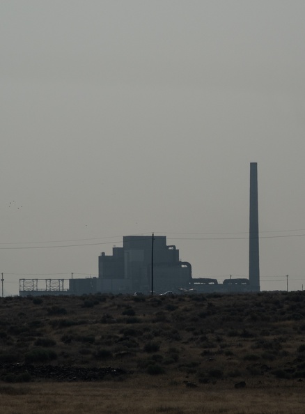
We got up around 6 a.m. to get to the B Reactor tour.

B Reactor was the first large-scale nuclear reactor ever built. It was built as part of the Manhattan Project to develop the atomic bomb. The story behind the reactor was fascinating. The construction of B Reactor went from trying to find a suitable site, to planning, to construction, to production in 21 months! Plutonium created by the reactor was used in the first test of an atomic bomb at Trinity, New Mexico, and in “Fat Man,” the bomb dropped on Nagasaki, Japan. B Reactor, and the Hanford Site as a whole, were instrumental in ending World War II.

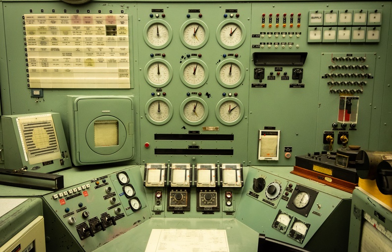
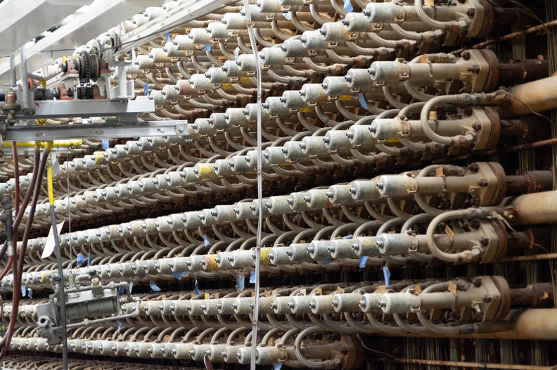
The tour of the reactor itself was great. I was fully expecting to have to go through a bunch of other exhibits and side rooms before we got to see the reactor, but that was not the case. We went through the entrance, into a hallway, then through a set of doors right onto the reactor floor, in full view of the giant face of the reactor. I found the whole building to be fascinating.

The tour gave me a realization: something like B Reactor could not be built so quickly today. There are too many bureaucratic hoops to jump through and environmental red tape to cut through. The permitting process itself, at a minimum, would take longer than the entirety of the Hanford Project took from conception to completion. The reactor, though its ultimate purpose was destructive in nature, is a symbol of a different age, and a testament to the ingenuity and dedication of the American people.

After our tour, we got back on the road and headed north with the goal of getting as far north as we could get before we decided to stop for the night. We hopped on Interstate 192, then US Highway 395. One thing about this area of Washington is that it seems to be an endless stretch of grasslands. As far as the eye could see were brown fields of grass. But once again, I noticed that the roads simply appeared to be placed on the ground and followed the contours of the land instead of cutting through it.

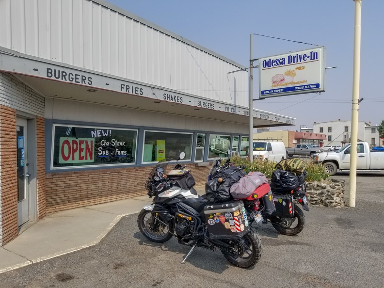
We stopped for lunch at the Odessa Drive-In in Odessa, Washington. Odessa is a farming community with a population of less than 1,000 people. The town was actually named for Odessa, Ukraine.

I had a bacon cheeseburger, which was great. Greg had the special, a cheesesteak sandwich, which he said was also delicious. Mom-and-pop places are the best.

After leaving Odesssa, we rode through additional farmland, the road following the undulating topography of the eastern Washington shrub-steppe. Oddly enough, the road was freshly paved, yet I saw maybe one other vehicle aside from our motorcycles. Who exactly was this road paved for?

At Wilbur, Washington, we turned onto east US Highway 2 for a few miles. Wilbur was another farming community, nearly the epitome of “Small-town America.” We then turned onto Miles-Creston Road, a twisty road connecting US 2 to the Lake Roosevelt National Recreation Area.

Most people, when they think of Washington, think of a place with mountains and evergreen forests. However, much of Washington is largely grassland, especially eastern Washington, which lies in the rain shadow of the Cascade Range. I did not see my first Washington evergreens until we got onto Miles-Creston Rd.

Miles-Creston Rd. dropped us onto Washington Highway 25. We made a quick stop at Fort Spokane, a former U.S. Army outpost located at the confluence of the Columbia and Spokane Rivers. Fort Spokane was the last frontier outpost built by the Army, and was used to keep a buffer between the native Coleville and Spokane tribes from the newly established city of Spokane, 50 miles to the east. After the Army moved out, the fort was used as a boarding school for native children and a tuberculosis sanatorium.

After leaving Fort Spokane, we headed north, finally stopping at the Hunters Campground outside Hunters, Washington. We got a site right on the shores of Lake Roosevelt, with a great view of the lake. Walking along the shores of the lake, I saw a few deer, and multiple flocks of geese. The hills on the opposite side of the lake were evidence of the glacial origins of the land in the area. The hills were made up of loose sandy material left behind after the glaciers melted.

After sundown, I went and sat on the dock near the campsite and watched the stars come out. The smoky skies had cleared just enough to allow the stars to shine. If you keep looking up, you’re bound to see something special. I watched a meteor streak across the entire length of the sky from east to west.

Tomorrow, we cross into Canada.

Distance: 197 miles, 916 total.

Scott Goes International, Part 3

Day 3: August 20, 2018

Route: Maryhill, Washington, to Pasco, Washington

I awoke at the Maryhill State Park Campground to the sound of water being shot out of sprinklers at our bikes. They needed a wash anyway. I had a feeling sprinklers might come on the night before, and had wisely removed my riding gear off the clothesline and into the tent. Greg, on the other hand, had wet gear. I quickly re-aimed the sprinkler head away from the bikes and we went to work drying them off.

It was a smoky morning, blue skies had given way to dirty brown with an orange sun. Some might say it looked post-apocalyptic.

Made my coffee in my cheap Chinese Jetboil knockoff and then boiled some more water for oatmeal. I’ve never seen instant oatmeal go bad, but I think I had a bad packet. The “apples” had turned black. So much for breakfast.

We got on the road and headed east on Highway 14 toward Richland, Washington. Once at Richland, we had a choice to make. We both wanted to visit B Reactor in Hanford, part of the Manhattan Project National Historic Park. The problem was, there was only one tour a day on most days, and it was at 8 in the morning. We surely weren’t going to make it today.

A few miles east of Maryhill, we saw a sign reading “Stonehenge.” Odd, I thought Stonehenge was in England. It turns out the Maryhill Stonehenge was built in 1918 as a memorial to those who had died in World War I, most specifically those service members who were from Klickitat County, Washington. At the time the Maryhill Stonehenge was built, it was still believed that the original Stonehenge had been used as a site for human sacrifice. The designer of the Maryhill Stonehenge, Sam Hill, thought the replica was a fitting reminder that man was still being sacrificed to the god of war.

Maryhill Stonehenge had a great view of the Columbia River Gorge. I stopped and paid my respects to the fallen.

While walking around Stonehenge, I remembered I had brought a Geocoin with me. Geocoins are trackable items associated with Geocaching. I had picked the coin up near home, and I planned to drop it off at a geocache along my travels. As it turns out, there was a geocache at the site of the Maryhill Stonehenge. Greg helped me locate the geocache – his first – and I placed the coin inside for the next person to come along and move it.

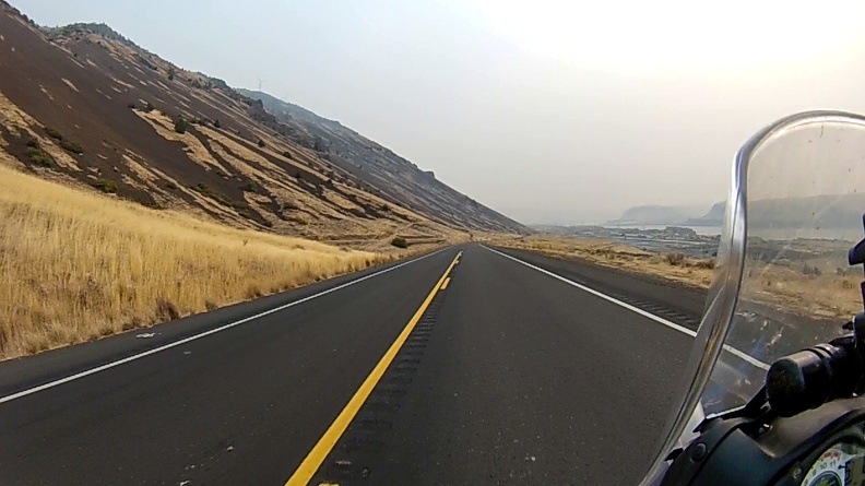
After a while at Stonehenge, we continued east. Highway 14, as opposed Interstate 84 on the opposite side of the Columbia River, followed the contours of the land instead of cutting right through it. The ups and downs of the land, and the twists and turns of the river, made for an enjoyable ride.

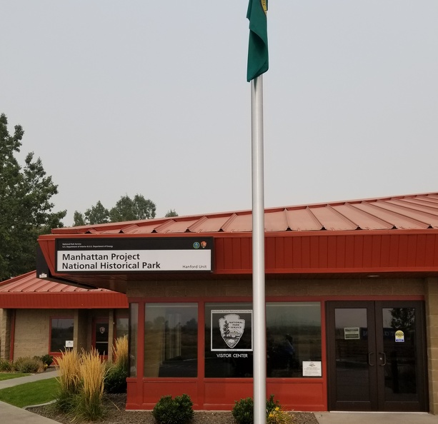
When we reached Richland, which was very smoky, we headed for the Manhattan Project NHP visitor center. The docent at the desk was happy to put us on the list for a tour the following day, so we had to make a decision. The tour would take a big chunk of time out of our day, and we wanted to get to Nakusp by the afternoon of the 22nd. In the end, we thought viewing an important part of history was worth the time.

So today ended up being a short day. We went ended up getting a site at the Pasco KOA campground. Because of the early day the following day, we didn’t even set up our tents, we simply put our sleep mats and sleeping bags on the ground. Tonight, we sleep under the stars – presumably, since we can’t see them through the smoke.


We took a little ride to a local fast food joint for lunch. Despite other mom-and-pop options being around, we also like to eat at places we don’t have at home. So Arby’s it was. Sitting in the air-conditioned restaurant was better than being out in the hot, smoky air. One thing though … what the heck is going on in Washington. Greg found a bag containing what appeared to be a white crystalline controlled substance on the floor in front of the register. Stay classy, Pasco! Last time I was in Washington, I found a similar bag outside a 7-Eleven. Do bags of drugs rain from the sky in Washington?

Distance: 133 miles, 719 total.

Controlled substances flushed: Approximately 1 gram. Drugs are bad, mmmkay.