Scott Goes International, Part 2

Day 2: August 19, 2018

Route: Newport, Oregon, to Maryhill, Washington

I spent the night on Steve’s couch with my leg wrapped, elevated, and heated. Woke up around 8 a.m. and found my leg to be feeling much better. It was still a little tight, but I could walk mostly without a limp.

After a cup of coffee Greg and I packed up our bikes, locked up Steve’s house, and hit the road. We headed east on US Highway 20 toward Corvallis. There was a lot of new pavement on a new alignment of the highway east of Newport.

Along the route east, we passed through many small towns – “Small-Town America,” if you will. Towns with only mom-and-pop businesses and no street lights.

Passing through the town of Lebanon, we saw a police officer standing on the side of the road talking to a guy who was sitting on the curb. Greg and I, being Deputy Sheriffs, both slowed town, turned our heads, and watched as we passed, just to make sure the officer was all right. Old habits take over.

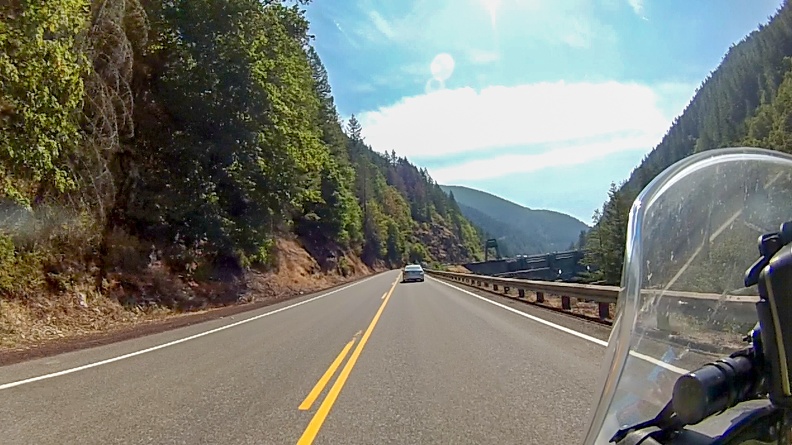
We got onto Oregon Highway 226 and turned toward Stayton. The highway passed through a lot of farm land and followed the up and down contours of the land. When we turned onto Oregon Highway 22 toward Detroit we started seeing signs of a lumber industry that was still a major player in the area. We passed numerous mills and shops selling lumber, along with patches of forest that showed signs of recent logging.

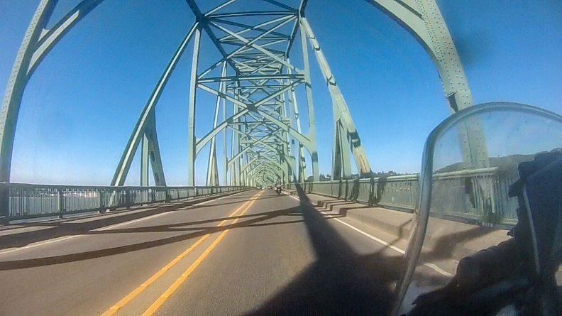
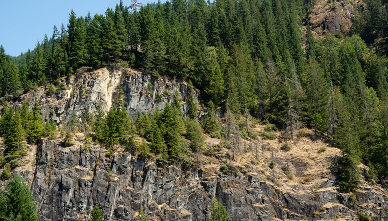
We entered the Santiam River Canyon and soon a dam came into view. It almost looked like the highway headed right for the Dam. The Big Cliff Dam, as it was called by large Art Deco letters emblazoned on the side, was a sign of a past time. The dam was built in the 1950s by the Army Corps of Engineers as part of the Willamette Valley Project. As it turns out, it would not be the only dam we would pass.

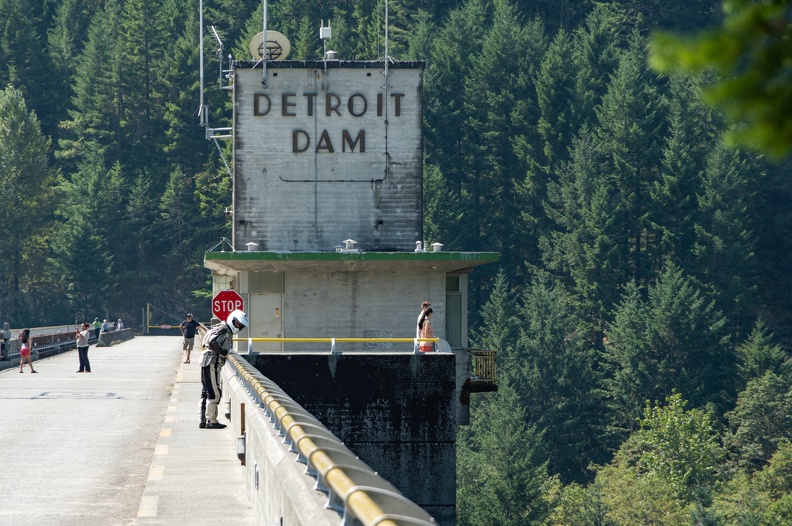
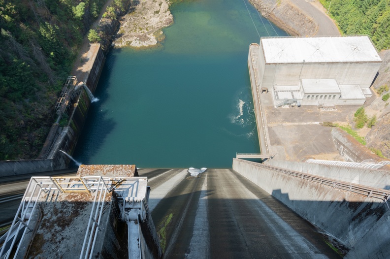
We soon arrived at Detroit Dam a few miles upriver from Big Cliff. We stopped to walk across the top of the dam. Detroit Dam was constructed around the same time as Big Cliff. It is 463 feet tall and impounds Detroit Lake. Several fishermen were lined up on the lake side of the dam.

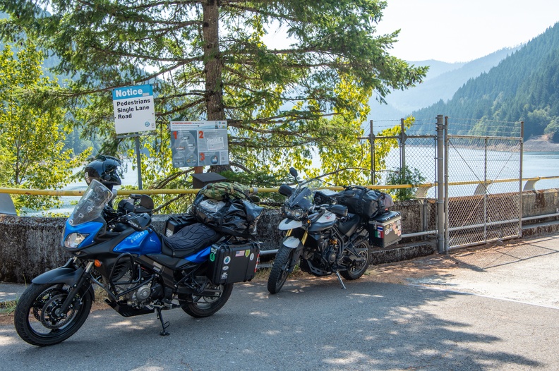
We continued east and turned onto National Forest Highway 46 just east of Detroit Lake. NF 46 was recommended by Bruce, a neighbor of Steve, who had come to the house as we were unpacking the previous night. Bruce said the road was as good as any normal highway, but without the cars. It would be the best route for us to get to Hood River.


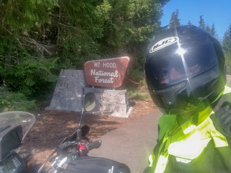
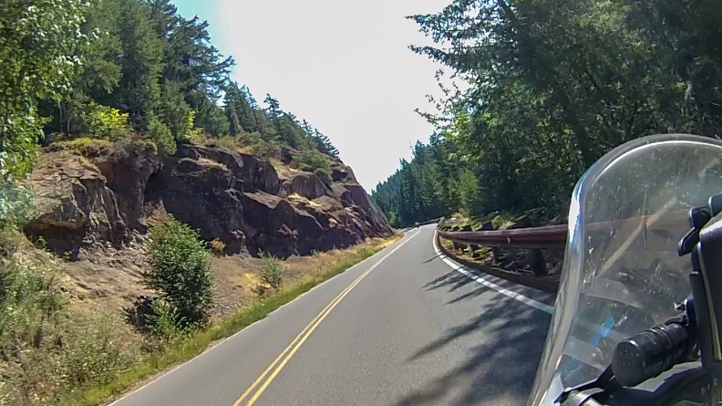
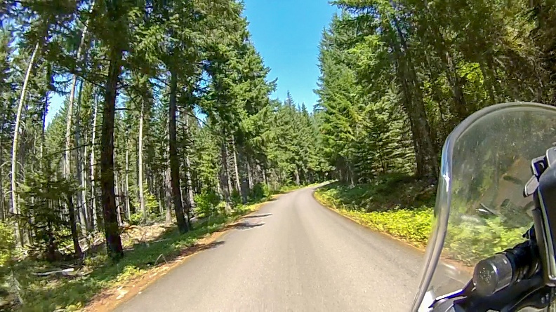
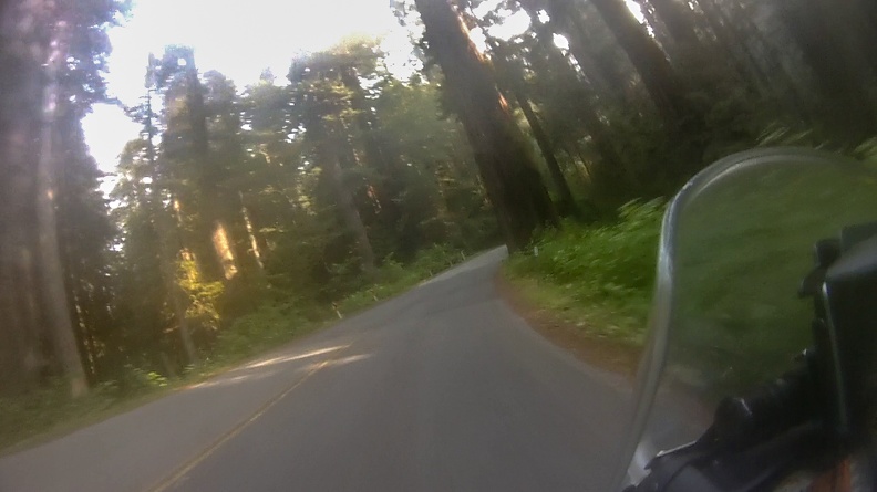
The road rose through the Mt. Hood National Forest. After about 30 miles, we turned onto National Forest Highway 42. NF 42 started out as a one-lane road, climbing up through the forest, eventually coming out at US Highway 26.

We crossed a wooden bridge that, although sturdy, looked like it had seen better days. As the road climbed into the mountains, we were greeted with many twists and turns, and very little traffic. Eventually we came around a bend and were blessed with a view of Mt. Hood through the trees.

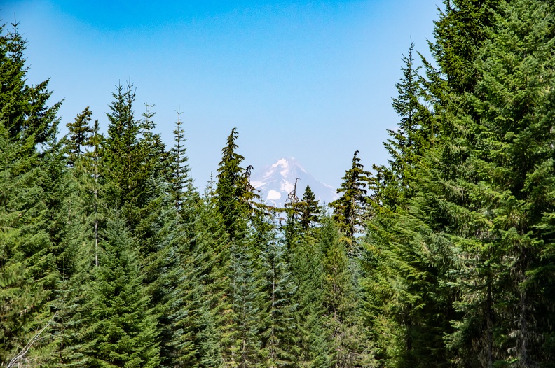
Who could ask for a better view?

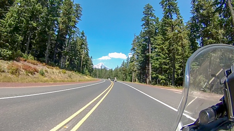
We turned onto US 26 and were given more views of the south flank of Mt. Hood. Despite all the fires across the northwest, we were lucky to see very little smoke throughout Oregon. After a few miles on US 26, we turned onto Oregon 35, which followed the east flank of Mt. Hood and dropped into Hood River.

After a stop to pick up food for the night in Hood River, we decided to cross the Columbia River and stop for the night on the Washington side.

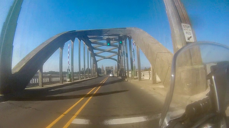
We crossed on the Hood River Bridge, a 4,400-foot steel truss vertical lift bridge with a steel-grate deck. The bridge was opened in 1924 and is the only crossing in the approximately 50 miles between Bridge of the Gods in Cascade Locks, Oregon, and the Dalles Bridge in The Dalles, Oregon.

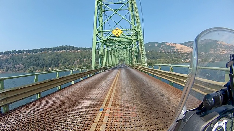
This was my first time on a steel-grate bridge. I had heard about crossing them, and the tendency of a motorcycle’s wheels to wander with the pattern of the grate. Having to cross this bridge was a complete surprise for me. It felt strange, going over the bridge to feel the wheels wander without any input, but I made it without any issues.

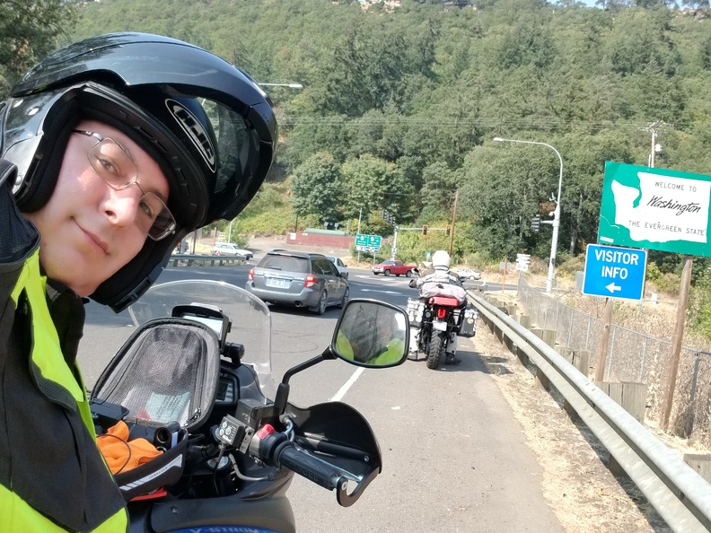
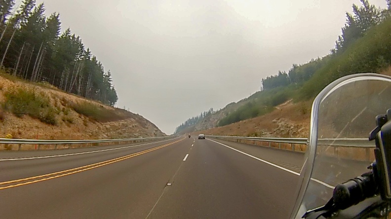
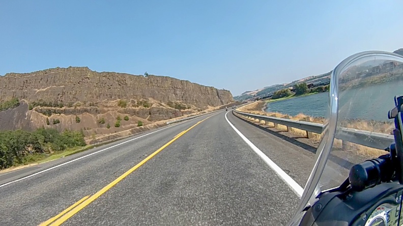
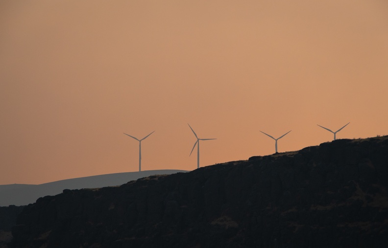
We turned onto Washington Highway 14 and headed east along the banks of the Columbia. Once in Washington, we started to pick up more and more smoke. It was quite a change from being on the Oregon side. Highway 14, though it was hazy and smoky, provided wonderful views of the river and the Columbia Gorge.

We made camp for the night at the Maryhill State Park Campground. The campground was right along the edge of the river. We set up camp, then went for a swim in the river. After a long, hot day of riding, the cold waters of the Columbia felt great. The cold was also a welcome relief for my tight leg.

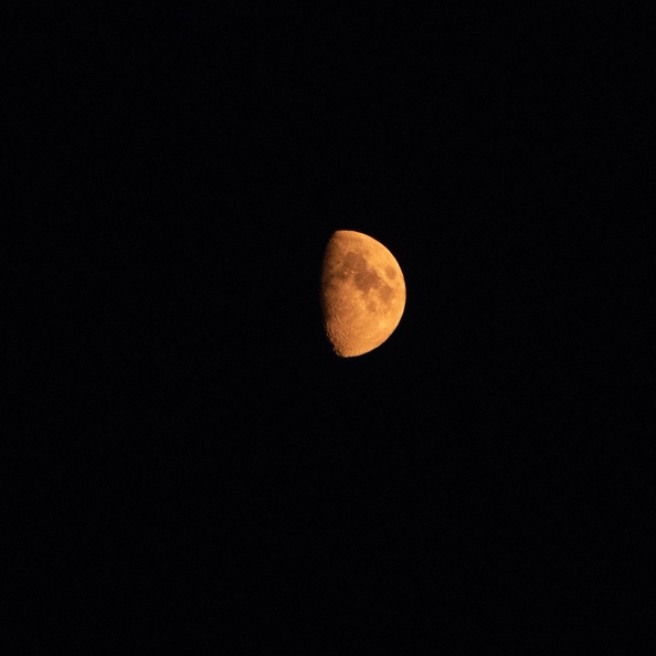
Went to bed under a moon that was red from the smoke. Today was a better day.

Max air temperature: 100 F

Distance: 280 miles, 586 miles total.

Scott Goes International, Part 1

This was my first international motorcycle trip. Our destination was Nakusp, British Columbia, for the Horizons Unlimited CanWest gathering. A result of a very generous and understanding wife.

I’ve already completed the trip, but I’ll be adding my daily reports as I complete them.

The Players:

Greg: A veteran traveler with trips to Alaska, Baja California, Thailand, and the American Southwest under his belt totaling more than 50,000 miles on his 2013 Triumph Tiger.

Me: Somewhat of a newbie. I started riding in 2015, and have mostly done just day rides, save for a weekend trips to Oregon and a trip to Horizons Unlimited California in Mariposa last year. I’m on a 2015 V-Strom 650.

Day 1: August 18, 2018

Route: McKinleyville, California, to Newport, Oregon

Today was going to be an easy start – a 300-mile ride up US Highway 101 along the Northern California and Oregon coasts.


Like all good adventures, we met up at Starbucks, as is tradition. We fueled ourselves up with coffee and food for the ride ahead. Little did I know that today was going to be a strange sequence of events.

Prior to rolling out from Starbucks, I rearranged the luggage on the back of my bike. I had originally placed my Camelbak between my dry bag and me. This did not give me much room to sit, so I moved the Camelbak to just behind the dry bag, resting on the end of the luggage rack.


We rolled out and headed up Highway 101 north toward Oregon. This was a very familiar road to us, hugging the California coastline through Redwood National Park. We turned off onto the Newton B. Drury Scenic Parkway to ride through Prairie Creek Redwoods State Park. Drury Parkway is a former alignment of Highway 101. It is two lanes wide and winds through the majestic redwood forest. The parkway was bypassed in 1993 after construction of a longer, but faster alignment of Highway 101 with two lanes in each direction.

At Crescent City, we stopped for a bathroom break – you only rent coffee – and a stretch. As I came out of the gas station, I discovered my Camelbak had slipped off the luggage rack and had hung down behind the exhaust pipe. The hot exhaust had melted a hole into the corner of the Camelbak. I opened up the backpack and found that my rain suit had also melted, along with my windbreaker. Surprisingly, the water bladder was unharmed.


While readjusting my luggage to prevent further damage from hot gasses, a familiar-looking motorcycle pulled into the parking lot of the gas station. It turned out to be a co-worker of Greg and me. He was on his way back from a trip around Oregon and Idaho. We chatted for a bit and said goodbye to continue our travels.

We rode north from Crescent City toward Oregon. To fully memorialize the trip, I got the bright idea to stop at the “Welcome to Oregon” sign for a picture. I pulled into the turnout and came to a stop in front of the sign. As I was nearly stopped, I didn’t pay heed to the loose gravel at the edge of the turnout and locked up my front wheel. My bike started to slip and I tried to catch it. I failed. I fell over and landed on the ground like a turtle stuck on its back. As I went down, I felt a sharp pain on the back side of my left leg. I was six feet from the sign and not even out of California, and I had hurt myself doing the simplest of maneuvers! I stood up and found it hard to walk or even put weight on my leg. My immediate thought was my trip was over before it began.

Greg saw my misfortune and had stopped, as did a couple going southbound on a Harley. They helped stand my bike back up. There was no damage, thanks to my crash bars, side cases, and hand guards. Well, that was good.

I walked around for a bit trying to walk the tightness in my leg away. I also took some time to sit and stretch. Eventually, my leg felt well enough, though still in pain, to get back on the motorcycle and keep going. We decided it would be a good time to stop in Brookings, Oregon, for a snack and a rest.

While stopped at the KFC in Brookings, I hobbled over to the Fred Meyer store across the street for some first-aid supplies. I picked up an Ace bandage to wrap my leg along with some heat packs for later. When I returned to KFC, after what seemed like an eternity on my bad leg, I wrapped my leg up getting a little relief from the compression of the bandage.

We gassed up in Gold Beach and continued up the coast. The winds picked up north of Gold Beach, which is typical for the Oregon coast. The winds weren’t too strong, but more of an annoyance to deal with for what would be the remaining nearly 200 miles. For those who haven’t been to Oregon, the coast is very beautiful. Highway 101 hugs the coastline, following beaches, sand dunes, and high cliffs from California to Washington.


Normally, I like to stop and take pictures when I travel. However, due to my accident earlier, it was hard to get on and off the bike, something I didn’t want to do repeatedly, so I didn’t stop. I really just wanted to get to Newport to relax my leg.

Things started to take another strange turn.

Greg had arranged a few weeks prior to our departure to stay with a friend, Steve, who lives in Newport. Steve said it would be no problem for us to crash at his place for the night. At various places we stopped along our way, Greg was getting odd messages from Steve … “Just had lunch in Brookings and getting that last good gas before California.” … “Got room for another rider on your couch?” … “Just passed Redwood National Park.” …

Greg wasn’t able to get any response from Steve as to what he meant by the messages. It sounded like Steve was going south, while we were going north. We made a stop for gas in Florence and we came to the realization that Steve might not be home when we got there.

Facepalm.

Greg decided we would go to Steve’s house to see if he was home and just messing with us, or if we’d need to find a campground. We got to Steve’s house and discovered he was not, in fact, home. Steve had gone south to stay at Greg’s house. It was not a problem though. Steve is a stand-up guy, and always looks out for other motorcyclists. Steve let us know where he kept a spare key and let us stay at his place anyway. I guess that’s a win.

I rested my leg and put a heat pack under it, which helped out a lot with the tightness. It appeared my leg would be OK, and I could keep on going.


I enjoyed the view from Steve’s living room while enjoying a delicious pizza dinner.

After such a strange day, I hope tomorrow is better.

Distance: 307 miles.

Gravity: 1, Scott: 0