September 7, 2024

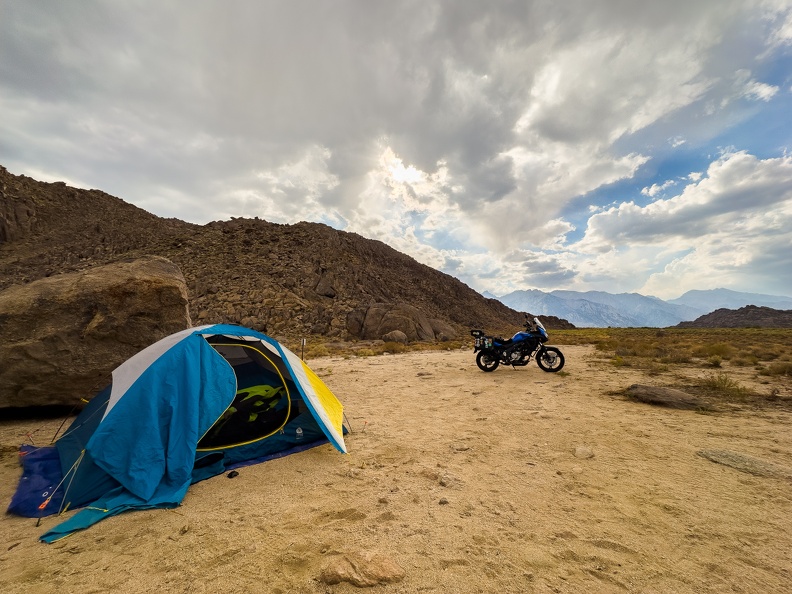
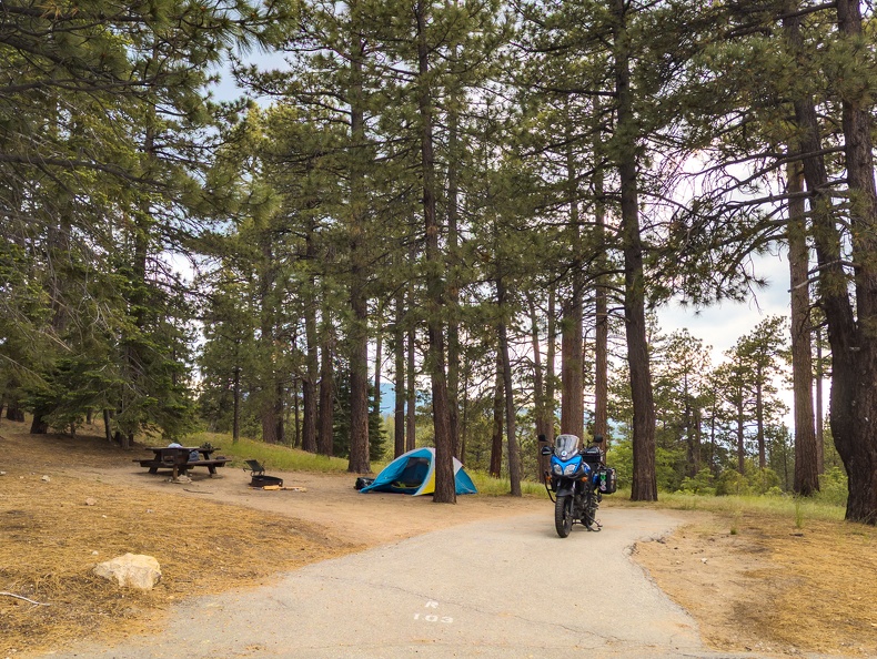
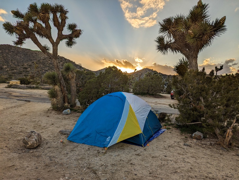
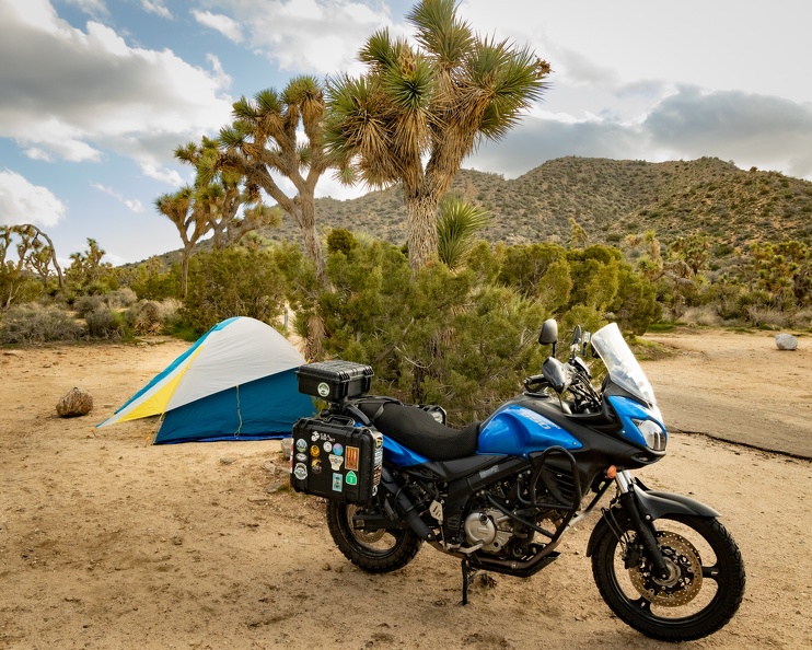
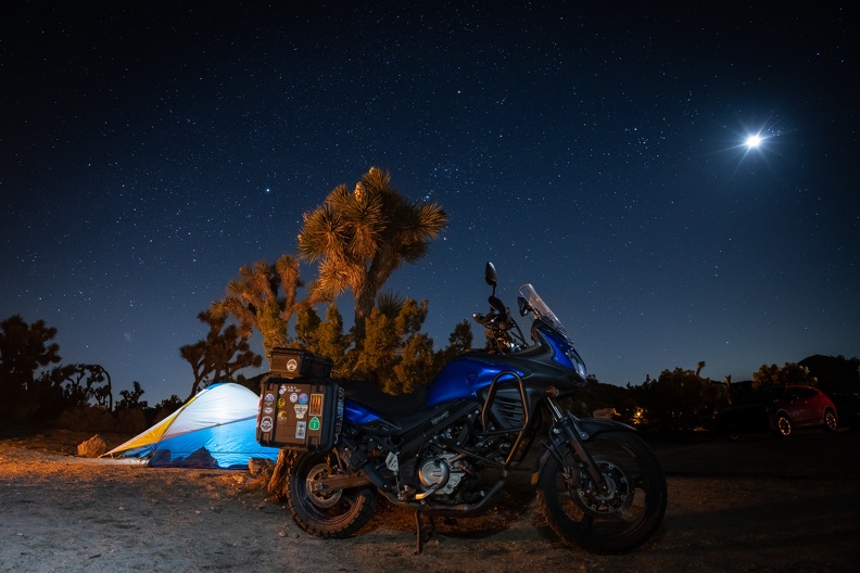
I did not sleep well last night. Not because of wind, or cold, or strange noises going bump in the night, I just could not get comfortable. Throbbing pain in my shoulder and wrists kept me from finding that good position on an otherwise comfortable sleeping pad.

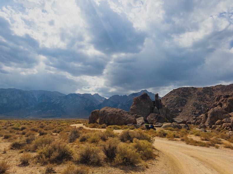
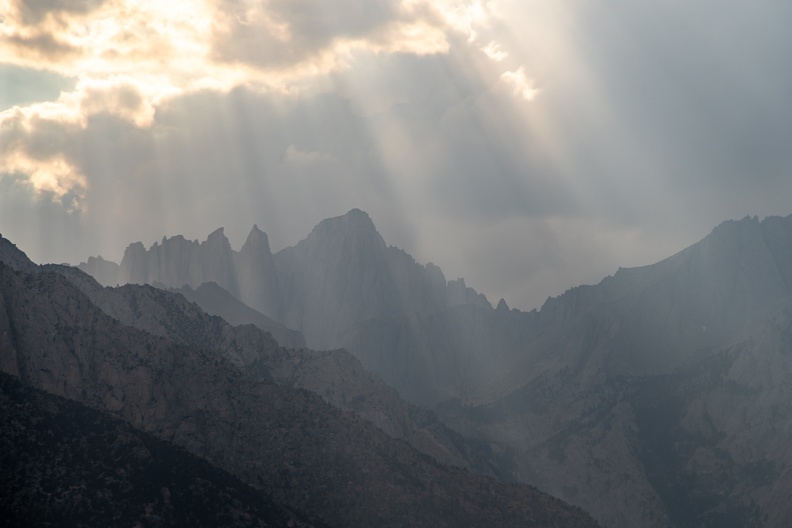
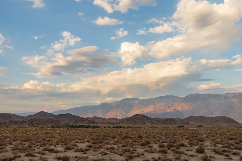
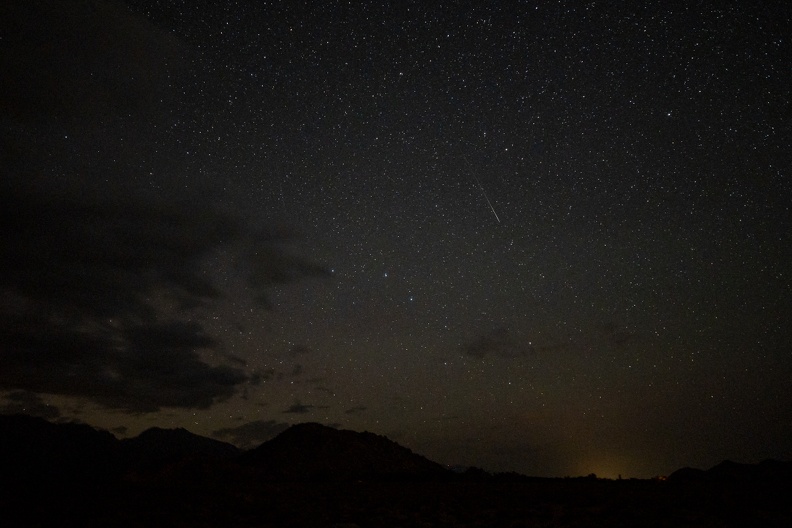
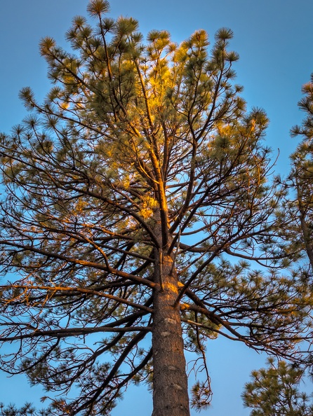
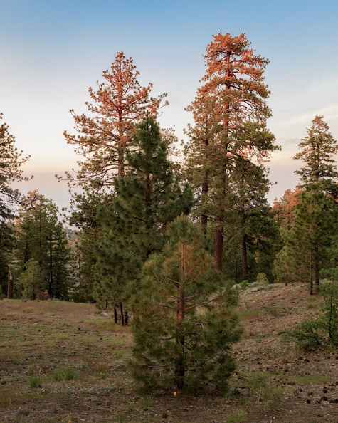
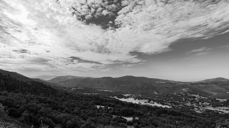
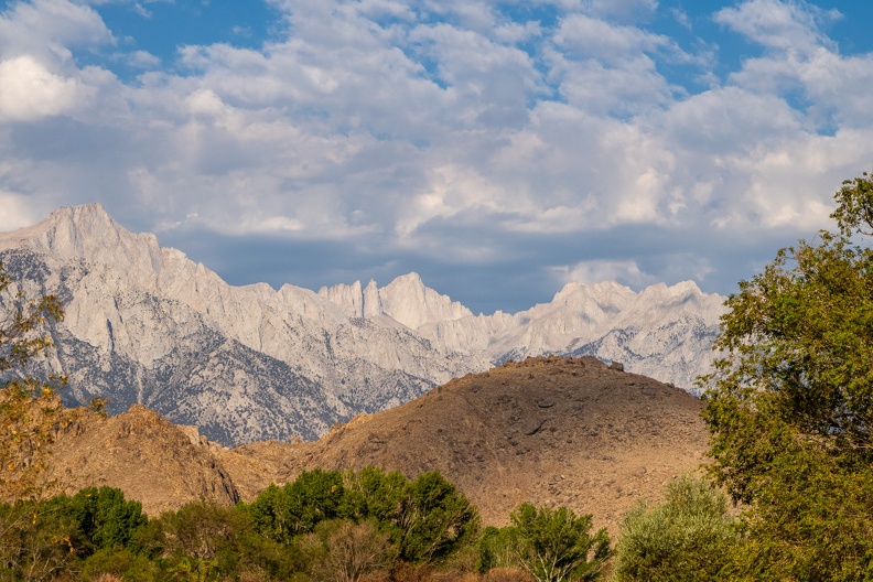
I woke up around 6 o’clock to the rising sun. It was not cold. It was not warm. It was just right. I walked 100 or so yards away from my camp and set my chair and camera up to watch the morning light fall on the Sierras.

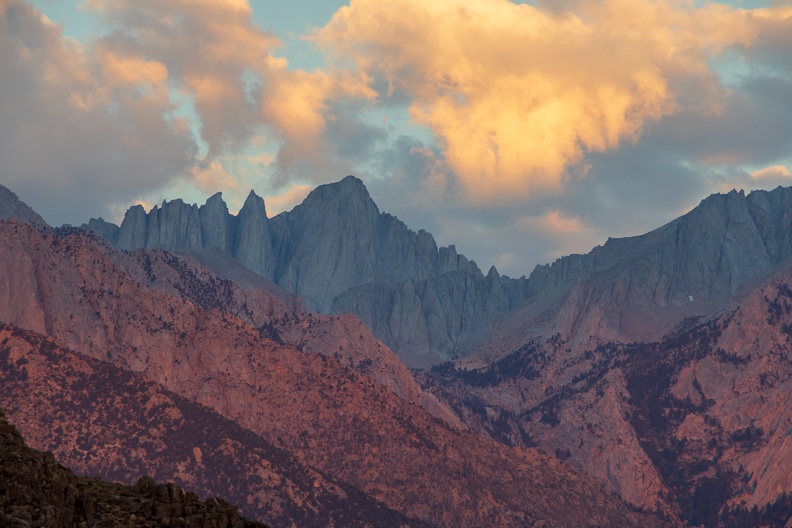
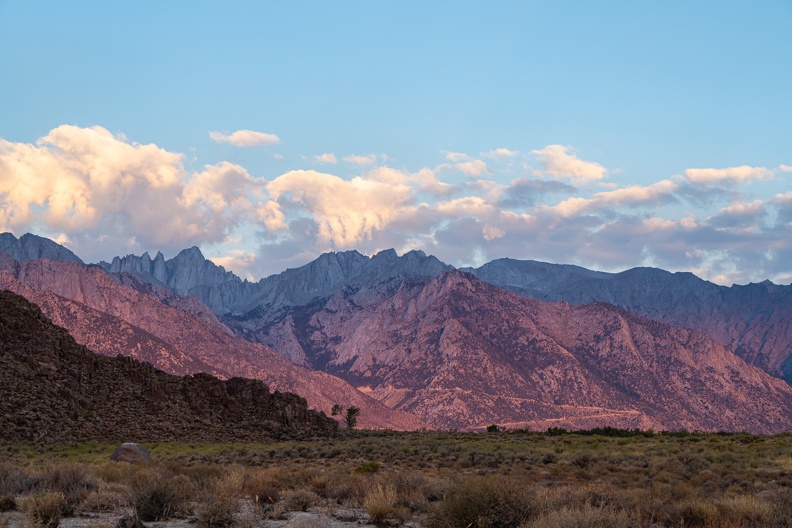
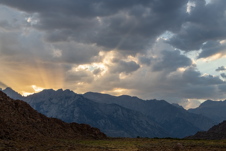
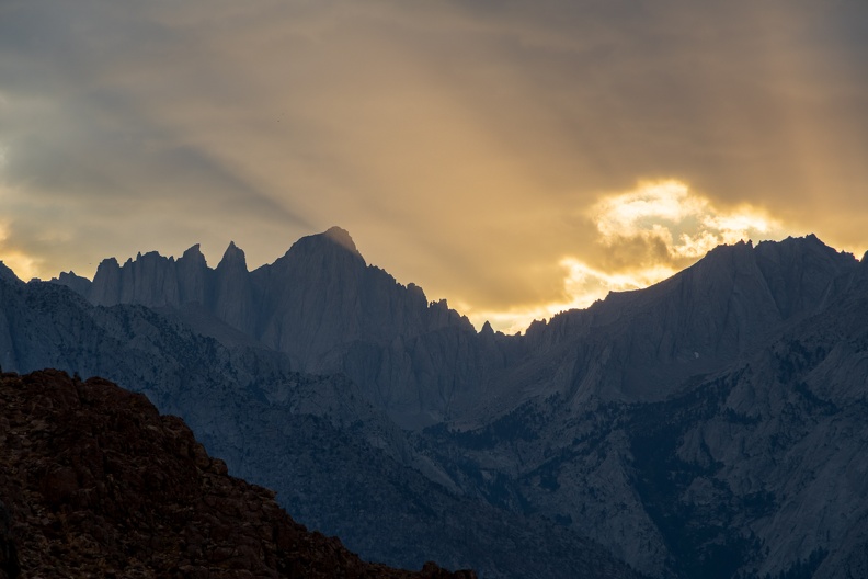
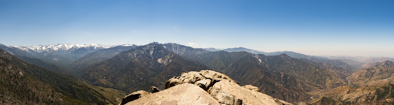
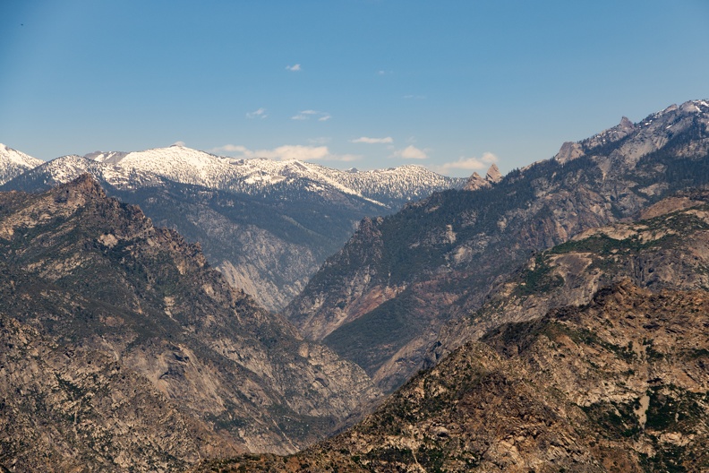
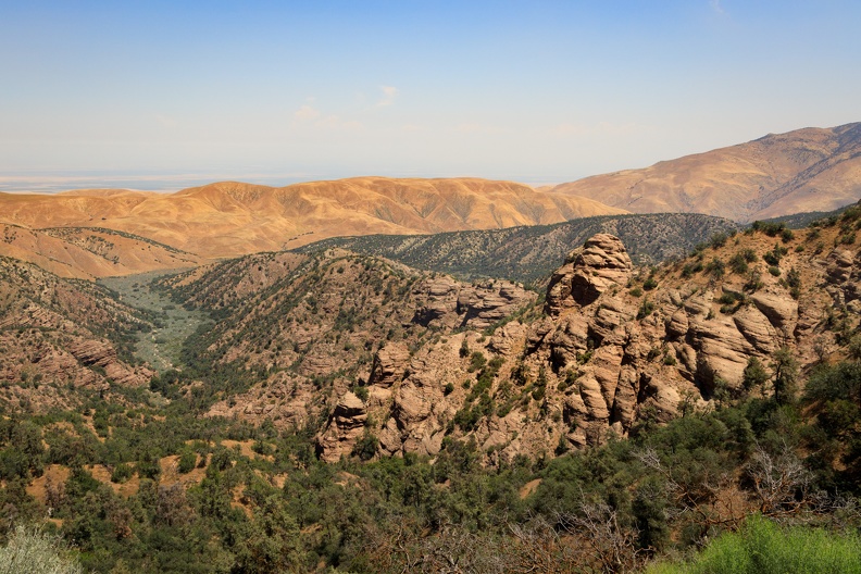
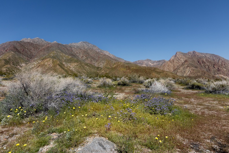
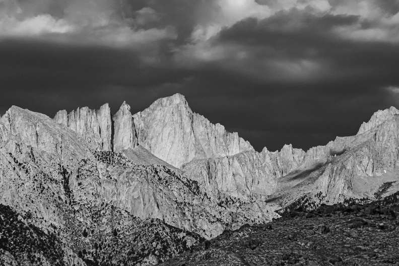
As the sun started to clear the Inyo Mountains to the east, it began to paint the Sierras in a rich pink light. The light slowly moved from my right to left, as if it was painting the rock. The pink hues grew in intensity until the mountains seemed to glow. It was an amazing sight to see, and within minutes, the pink cast disappeared and the Sierras returned to their normal brown and gray color.

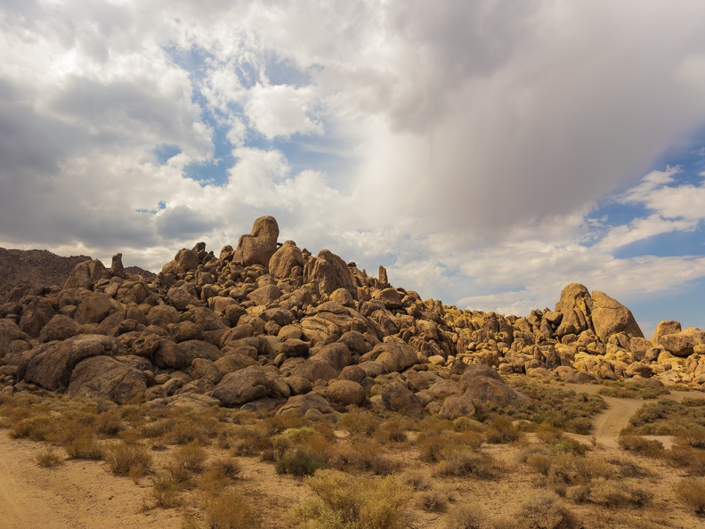
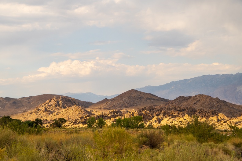
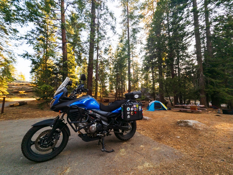
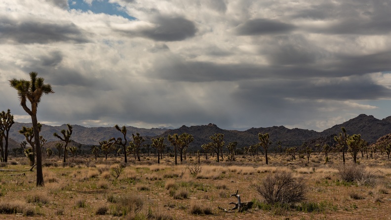
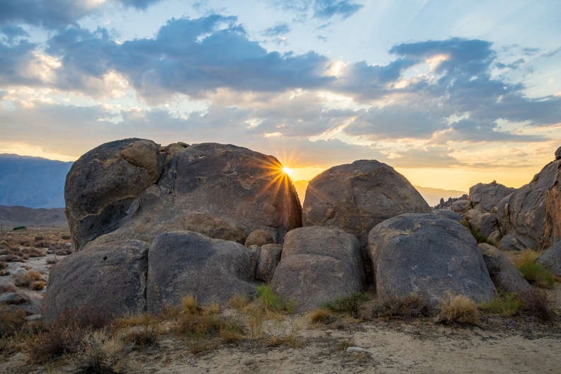
I made my morning coffee and broke down camp. I still did not see anyone around. I wondered if the camping areas south of Whitney Portal Road get less visitors than the more famous areas of the Alabama Hills on the north side along Movie Road.

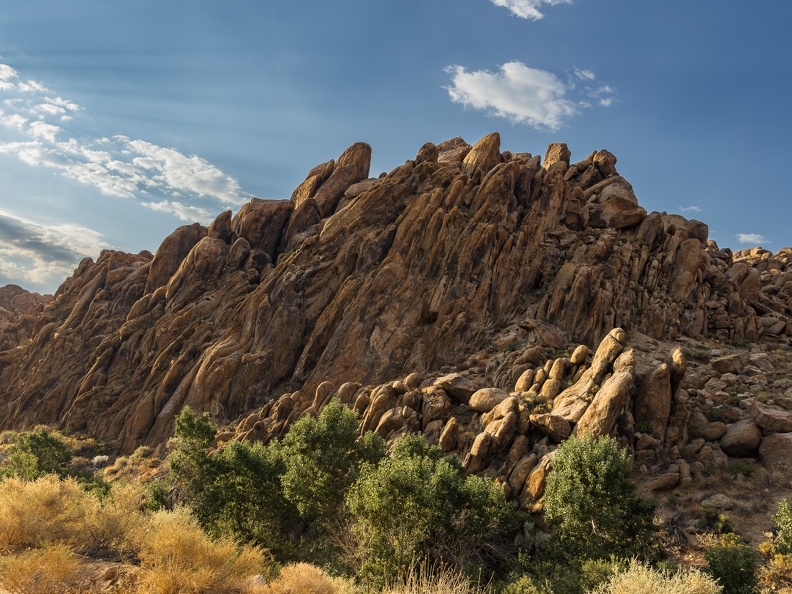
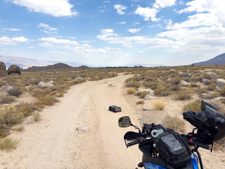
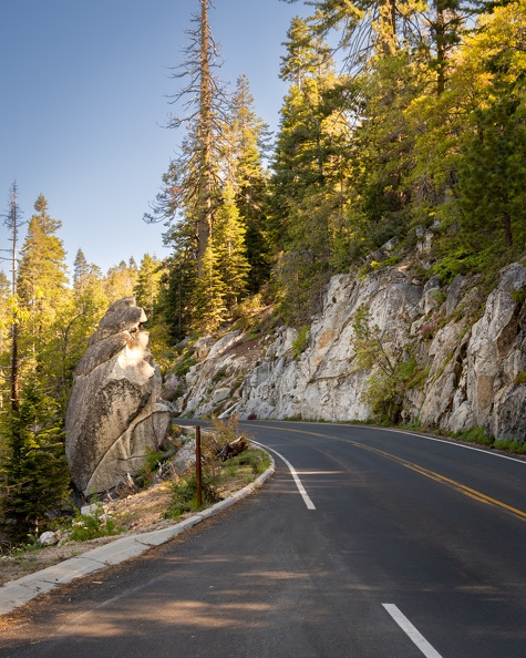
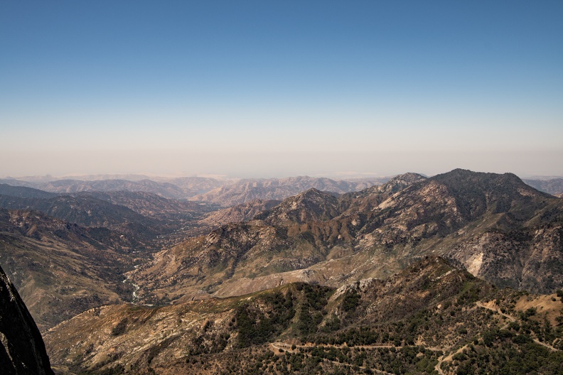
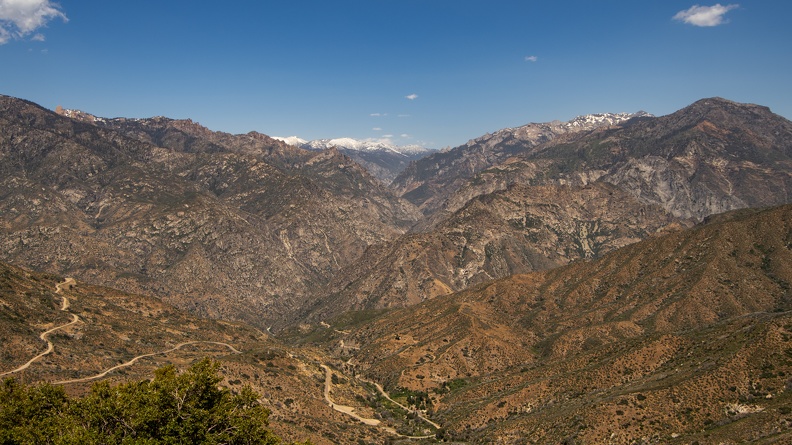
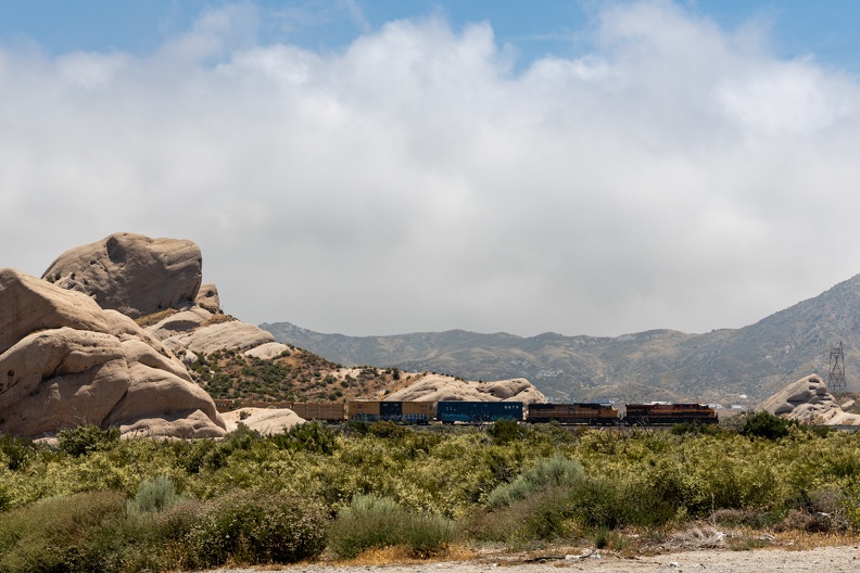
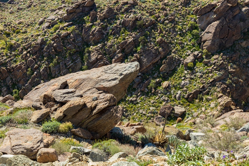
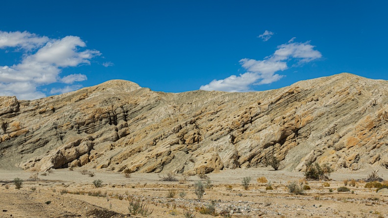
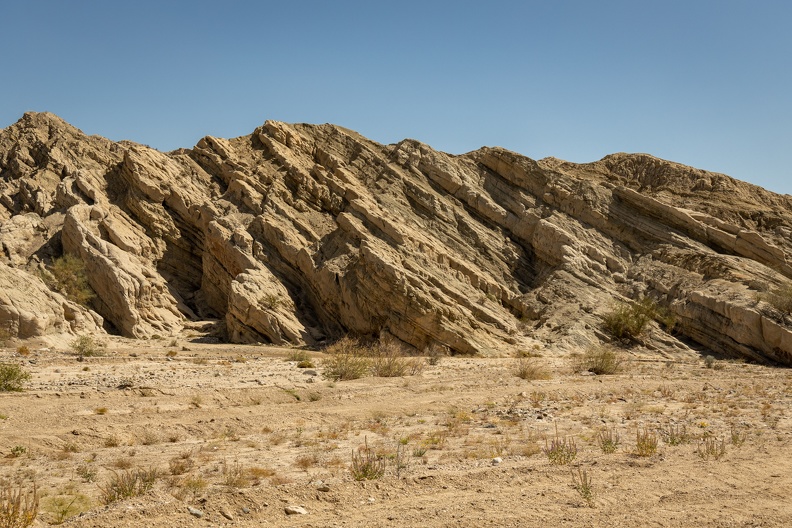
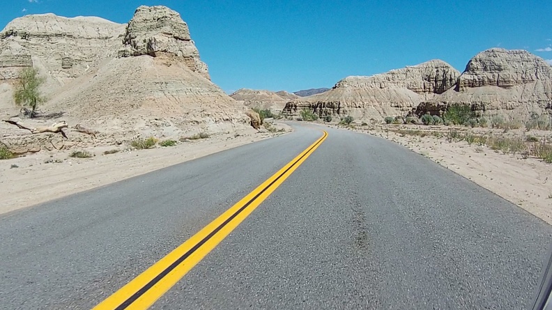
I got on the road around 7:30. I headed toward town on Tuttle Creek Road, which winds its way through a narrow canyon formed by the eponymous creek. Towering rock formations, weathered by wind and sand and tilted by tectonic processes stood right against the pavement’s edge. There were few people out, and the ones who were seemed headed in the opposite direction as me, and seemed to want to drive dead center of the road, oncoming traffic be damned!

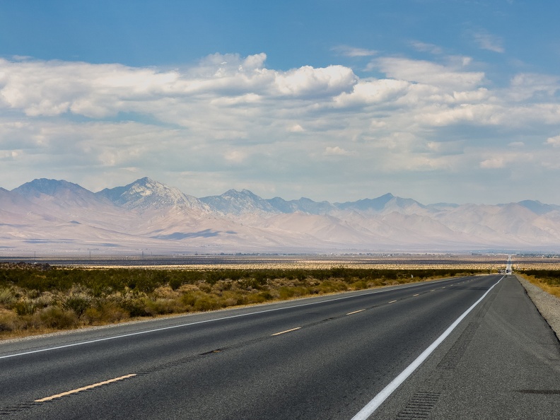
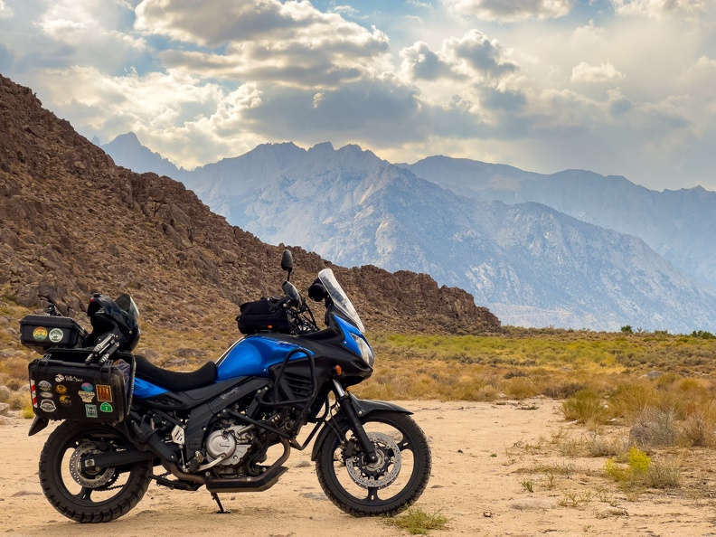
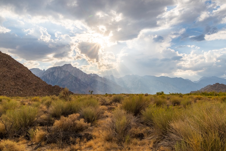
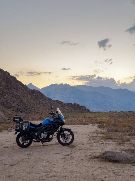
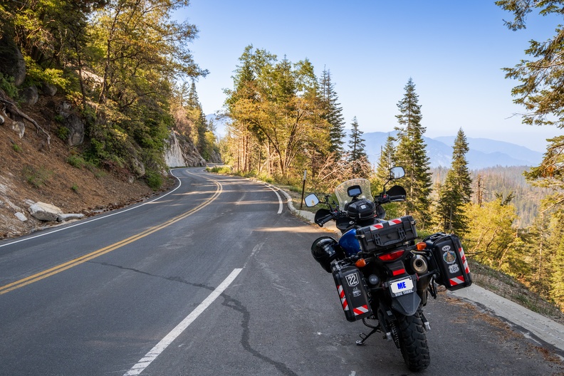
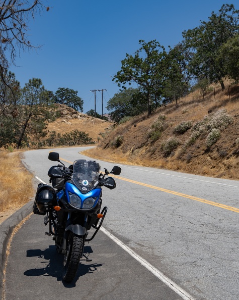
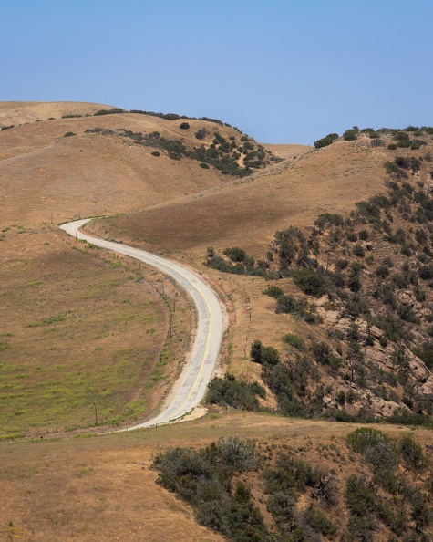
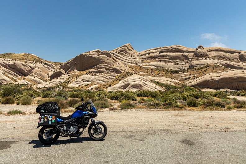
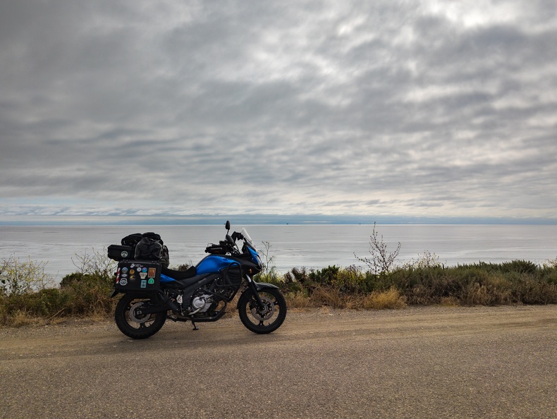
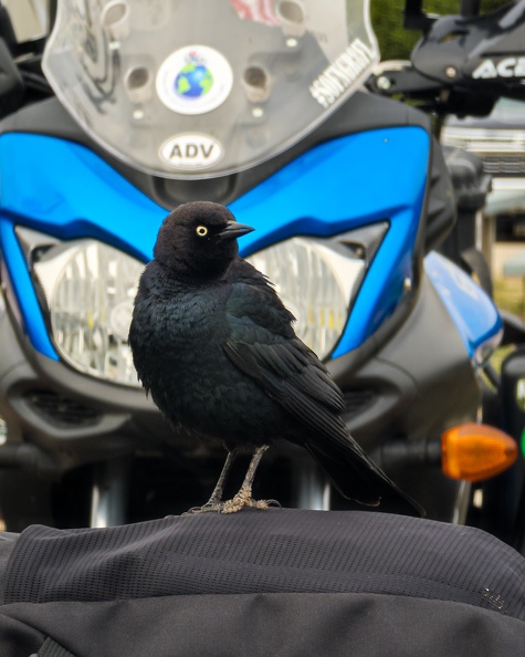
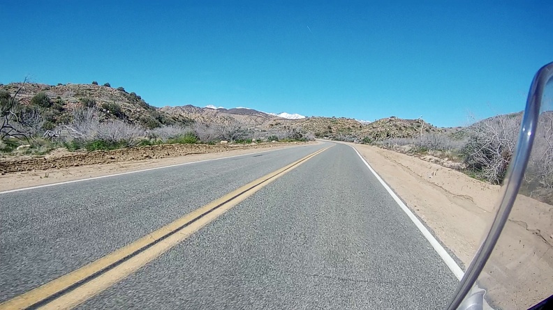
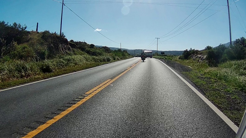
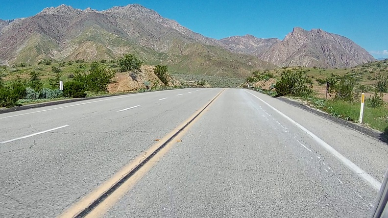
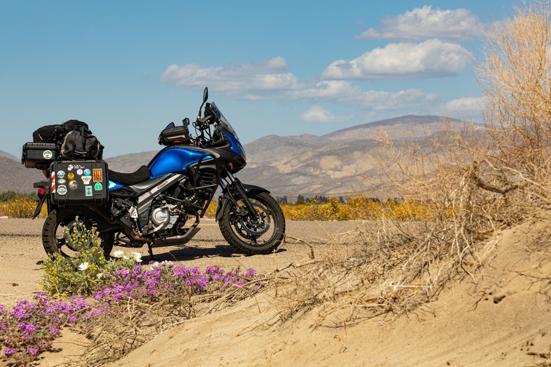
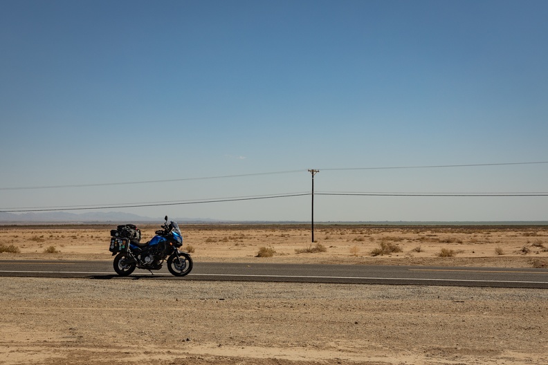
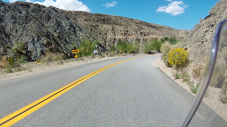
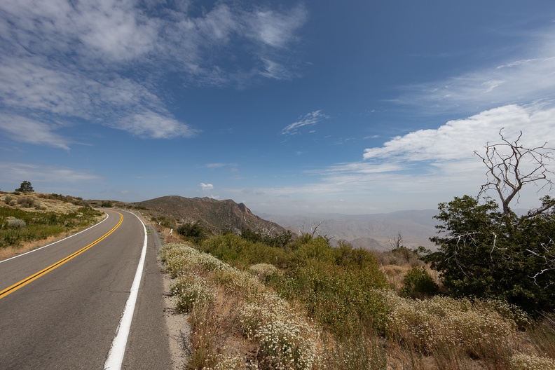
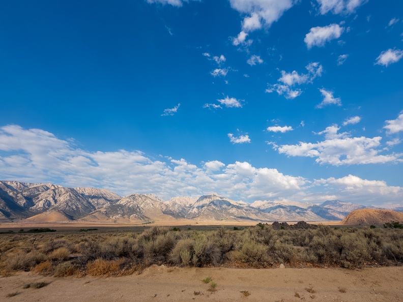
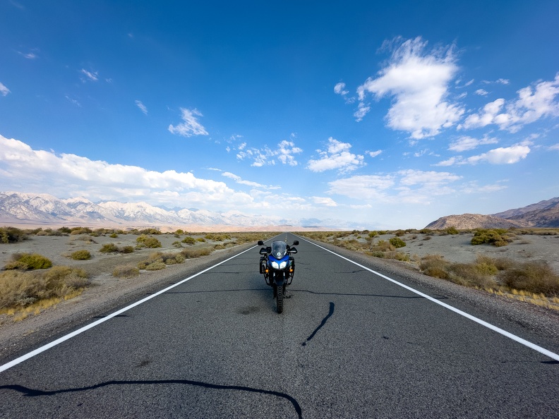
After a quick stop and the local visitor center, I headed out of town and east on Highway 136. I had the road to myself with nobody ahead of me, and nobody behind. The lack of traffic gave a perfect photo opportunity with my bike in the middle of the road and the Sierras as its backdrop.

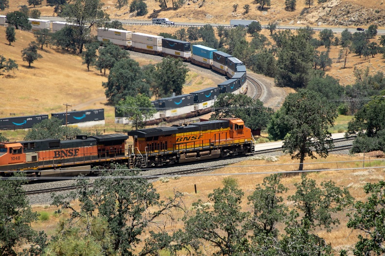
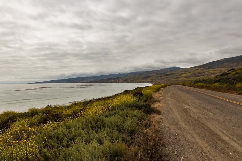
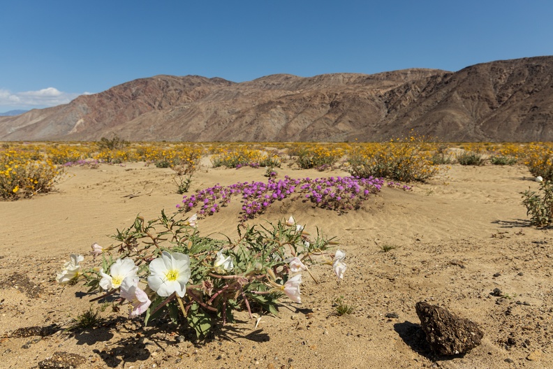
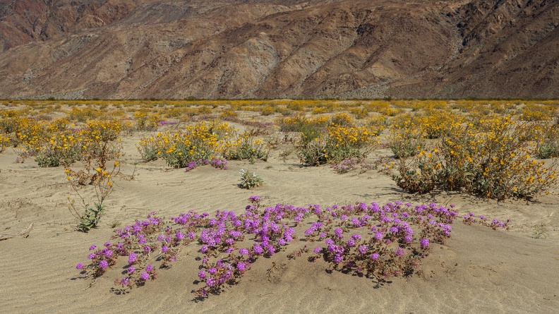
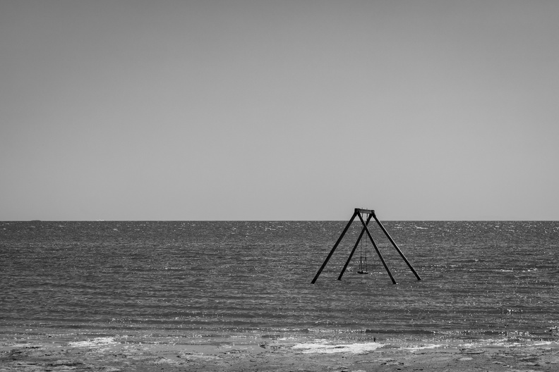
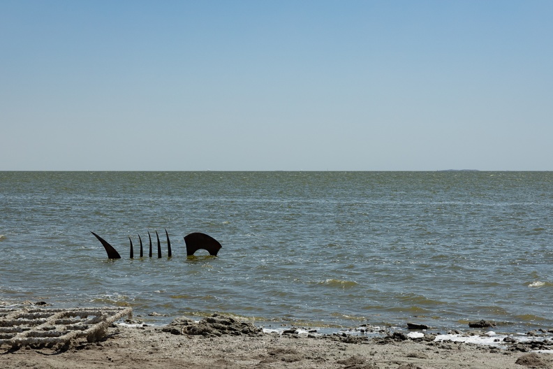
The highway follows the eastern shore of what remained of Owens Lake. The lake once covered more than 100 square miles of land to depths of up to 50 feet. Now, it is all but dry thanks to irrigation projects in the early 1900s that carried water from the river that fed the lake to Los Angeles. Today, lake water is pumped into evaporation ponds so minerals and chemicals can be extracted for use in industry. This industrious use of the lake’s water left a rotten egg smell lingering in the air.

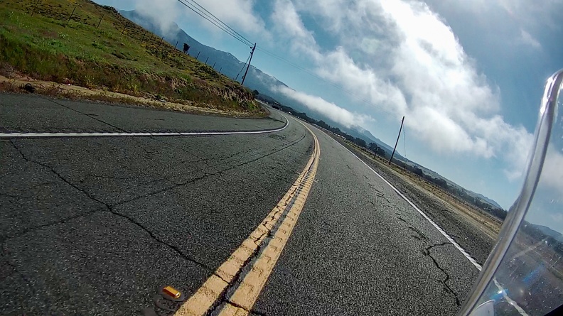
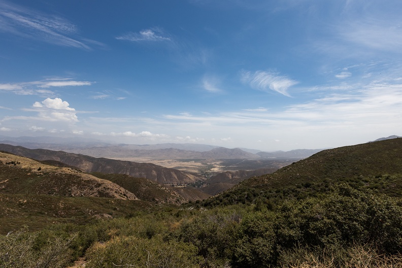
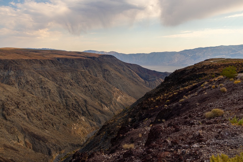
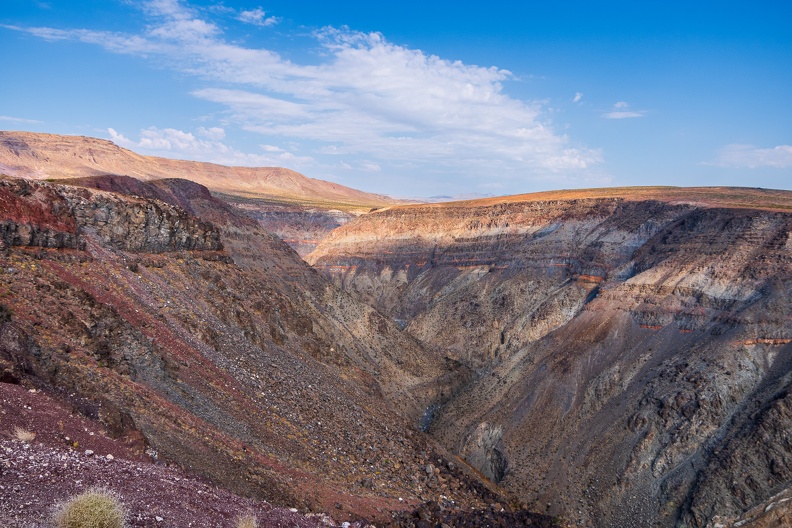
Highway 136 met Highway 190 and climbed into the Inyo Mountains and Death Valley National Park. The air started heating up, and the elevation change did not help. The highway passed the Father Crowley Overlook, which looks down upon Rainbow Canyon. The canyon is famous as a military training site, where all manner of jet aircraft train to fly its tight curves. It is not unusual to see a jet passing at eye level through the canyon. However, today was Saturday, so I kept going, thinking the pilots would have the day off.

As I dropped down into the Panamint Valley, I saw two C-130 cargo planes flying around. Perhaps they were going to make a run through the canyon. I quickly made a U-turn and sped back up toward the overlook. I turned to the overlook and waited for a while, but the planes did not return. Oh well, back to the road.

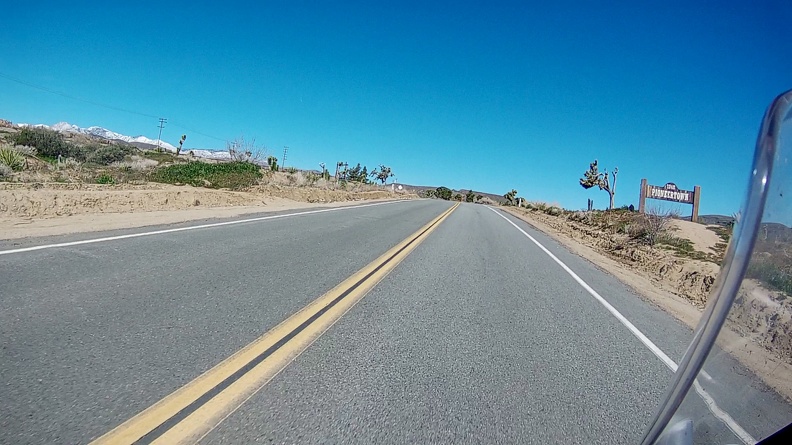
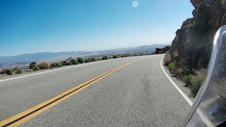
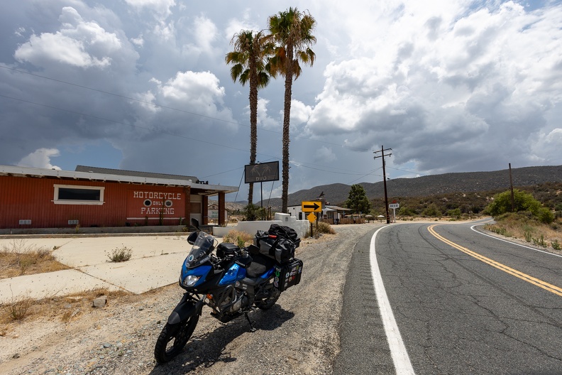
A few miles past the town of Panamint Springs, I made a turn onto Panamint Valley Road. What a terrible road this was! It was almost as bad as Imperial County’s Highway S-22. The pavement was very pebbly, and I could feel the bike sliding and wandering over the tops of the pebbles.

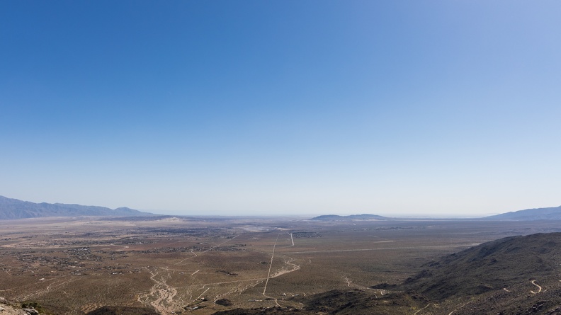
The road crossed over the Argus Range and dropped into the Searles Valley, home of another mostly dry lake, Searles Lake. The remnants of the lake are home to mineral companies that produce various minerals such as sulfate, borate, and halides from the lake bed.

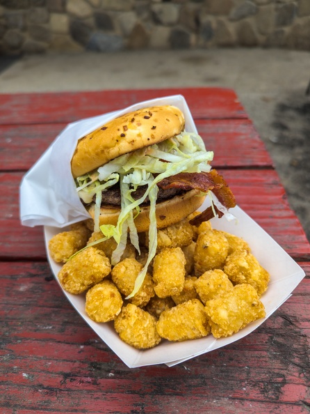
I passed through the town of Trona, home to many crumbling buildings and the only all-dirt high school football field in the country, and stopped for a break. I sat at a picnic table at a rest area wedged between the lake bed and the Searles Valley Minerals plant. It was a weekend, but the plant was whirring and buzzing with activity. A sulfurous scent hung in the air as I drank my water and crunched on an apple.

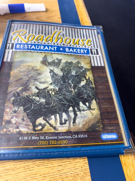
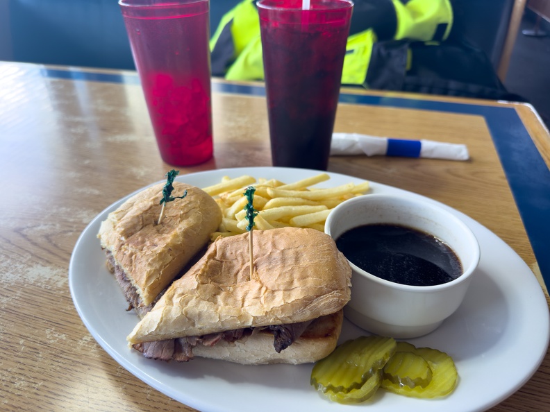
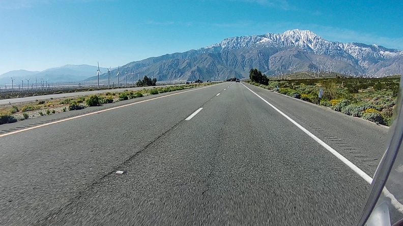
After my break, I left the Searles Valley and returned to Highway 395, stopping at Kramer Junction to top off my tank. I had a decision to make. I could continue on Highway 395 and take it south to Interstate 15 and return home through the Cajon Pass. This would be a quicker route, but would require dealing with heavy truck traffic most of the way. Or, I could go back the way I originally came and go up the backside of the San Bernardino Mountains through Big Bear. This would be a longer route, but would have less traffic. I chose the less-traffic route.

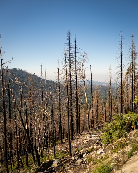
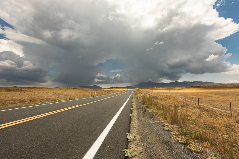
As I rode through the desert south of Barstow, I could see the smoke plume from the Line Fire hanging over the mountaintops. It was blowing west toward the Cajon Pass. I think I made a good decision; I would have had to ride through that!

In addition to the smoke plume, I saw dark rain clouds hanging over the mountains. Fires have a tendency to affect the weather around them. Smoke particles cause cloud formation, and can often create thunderstorms. You see it a lot around large wildfires and volcanoes.

As I neared the north base of the mountains, a single lightning bolt struck in the distance. Hopefully, that is the only one.

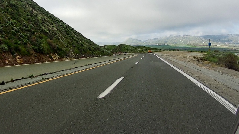
I started climbing Highway 18 and the dark clouds hanging over the mountains. It began to rain. First, a light drizzle, then it got a little heavier. Soon, it was hailing. The rain did not bother me much. I watched the temperature reading on my instrument panel go from 103 degrees to 71 degrees in a few minutes. I got soaked by the rain and hail, but it felt so good to cool off.

The rain only lasted a few minutes, but was a relief. Kind of like air conditioning. As I passed through Big Bear City, I heard a few thunderclaps off in the distance, but the rain stayed away from the rest of my route.

I was dry by the time I got home.

September 6, 2024

I decided on a quick overnight as a sort of end-of-the summer trip. I had wanted to go to Alabama Hills on a previous ride to try out dispersed camping for the first time. Unfortunately, I changed those plans mid-trip due to high winds that made riding miserable.

I got on the road around 9:30 in the morning. This summer brutalized Southern California this year; the air temperature neared 100 degrees as I loaded the bike. Sweat dripped off me like someone had opened a faucet.

Because Interstate 15 and Highway 138 always have traffic, particularly on weekends as people head to Law Vegas and other points north, I decided I would try a different route that would hopefully bypass the traffic.

I headed out of Yucaipa on Highway 38 and climbed into the San Bernardino Mountains. A slight smoky smell hung in the air from the Line Fire east of Highland. The fire, at the time, had burned more than 20,000 acres and steadily climbed toward the mountain communities of Running Springs and Big Bear Lake. The fire sat some miles away from those towns, so I did not think it would affect me much.

Shortly after starting the climb into the mountains, I spotted a black bear sprinting across the road in the town of Angelus Oaks. The bear seemed unfazed by the traffic passing in both directions and it quickly scampered off into the forest almost as quickly as it had appeared.

Climbing higher into the mountains, the temperature dropped about 20 degrees – a nice respite before I dropped into the Mojave Desert. A few miles before reaching Big Bear City, I passed Onyx Summit. The signs had disappeared, but its 8443-foot elevation makes it the highest point on the state highway system in Southern California.

After passing through Big Bear City, where I joined Highway 18 that followed the curves of the shores of the dry Baldwin Lake, I descended into Lucerne Valley. The temperature started climbing again and reached 103 degrees by the time I reached the bottom of the mountain.

As brown and desolate as the desert can look, it has its own beauty. Red rocks and yellow foliage with just a hint of green dotted the landscape. Life out here must adapt to survive the extreme temperatures. As long as I kept moving, I would handle the heat as well. A few clouds floated in the sky – at this time of year, monsoonal moisture coming off the Gulf of California mixes with the hot desert air to create towering cloud formations that often spur sudden rain showers and thunderstorms. I had none of that today, but the slight temperature drops each time I went through a cloud’s shadow felt nice.

After about 30 miles of riding through the desert, I reached Barstow and passed through the city’s old downtown. Main Street through downtown follows the path of old Route 66. It appeared as one would imagine an old Route 66 town, old one- and two-story storefronts of diners and restaurants, both still running and long since closed, small motels built around a parking courtyard with road trippers in mind. However, the faded signs with crumbling paint gave a hint that time started to forget the area once the interstate arrived.

I hopped on Highway 58 and made a stop for food and fuel in Kramer Junction. I had lunch at a place called The Roadhouse, the kind of greasy spoon you would expect in a place that caters to providing service for travelers and truck drivers. The kind of place with the last available food and gas for hours. The water and soda were cold, and the French dip sandwich was delicious.

With a full tank – both on the bike and me – I headed north on Highway 395. The highway is a busy route for trucks going between Nevada and California. Despite the high amount of shipping traffic, the state has not expanded the highway from a two-lane road to four or more. At any opportunity, when the dotted center line presented itself and the coast cleared, I rolled on the throttle and left the rigs behind.

Highway 395 passed through a few old mining towns such as Red Mountain and Johannesburg, crumbling homes, shuttered saloons, and the skeletons of old mining operations sat everywhere. The mines gave up their gold and silver long ago, leaving the towns to mostly rot in place. The few businesses that remained open catered to travelers and off roaders who use the surrounding mountains and desert for recreation.

As I approached Inyokern, the southern peaks of the Sierra Nevada came into view. Brown desert hills gave way to the towering, jagged, gray peaks of the Sierras. The slight haze in the air, desaturating the mountains’ colors and making the summits of Mount Jenkins, Owens Peak and Sawtooth Peak appear like a painting. Another reminder of the large variation of landscapes that make up California.

The highway turned to a more northerly direction, paralleling the Sierras through the Owens Valley. Soon remnants of ancient volcanoes of the Coso Volcanic Field dotted the area around the highway. Sharp lava rocks sat in the highway’s center median and old, dormant cinder cones sat along the highway’s eastern edge.

By this time, temperatures neared 110 degrees. I have found the heat tolerable as long as I keep moving. I had every available vent open on my jacket and pants to keep air flowing through. I also made sure to stop regularly to find shade and drink water.

I reached the Alabama Hills around 2 o’clock. In my research of the area, I knew campers, van-lifers, and off-roaders found the place popular. Given the popularity, the Bureau of Land Management has limited the number of areas allowed for camping. I fully expected difficulty in finding a camping spot on a Friday afternoon. Either I arrived really early, or this weekend was not a popular one. I did not see anyone around as I rolled into the hills. I rode around a few of the dirt roads, looking for just the right spot to set up camp. I found one on the north side of a large hill about one-quarter mile down a rocky dirt road. The campsite sat in the shadow of a large heart-shaped rock balanced on another boulder. The rock vaguely took on the shape of the red monster Gossamer from the Looney Tunes cartoons. Off in the distance I could see the jagged peak of Mount Whitney, the tallest mountain in California. This site will do just nicely.

I started to set up my tent to claim my spot before running into Lone Pine for some supplies. I went to the bike to take my cooking supplies out of my right pannier, but I found the pannier missing! I could not see it in my mirror, so I had no idea when it might have fallen off, but I remembered it there when I stopped for lunch.

I retraced my steps along the dirt roads I had taken to get to camp. I found the missing pannier laying in the middle of a dirt road south of the hill about a miles away. One of the mounting clips had become misaligned, making the pannier susceptible to bouncing around on the bumpy roads. I put it back on and secured it to the bike’s grab handles with my luggage straps to it would stay on till I got back to camp.

Back at camp, I realigned the mounting clip and torqued the bolt holding it to good-n-tight specifications. Like a true dad, I gave it a tug and said, “That’s not going anywhere.” And, so it shall be.

I took a short break in the shade of the boulders at my campsite to rest a bit and cool off. I then rode to Lone Pine to gas up and grab supplies for the night. Before returning to camp, I drank an entire bottle of Gatorade to rehydrate.

I got back to camp around 4 o’clock and took another rest in the shade with some more water and Gatorade after changing out of my riding gear into cooler clothes. Nobody had appeared at the campsite across from mine yet, and it was very quiet except for the occasional whirr of a car passing on the main road.

Afternoon clouds had grown over Mount Whitney and sunbeams shone through the small breaks between clouds. I could see some parts of the Sierras nearby getting some rain. I took a little walk down the road to take in the views of the mountains.

I returned to camp and sat looking at the scenery around me. The rain over the mountains had moved into the valley, dropping a light shower on me. The cool water felt nice and it was not so heavy that I needed to make a run for cover.

Nobody ever showed up at the campsite across from me. I suspect nobody showed up at any of the other campsites in the immediate area. With no water, no bathrooms, and nobody around, it was almost true solitude. As the sun set behind Mount Whitney, it was just me, the night, and the crickets.

As I ate my dinner, I watched the clouds move across the mountains and soon the stars came out. The silence and the scenery relaxed me. I headed into the tent around 10 o’clock to call it a night. It was still 80 degrees out, so I did not need a blanket and a gentle breeze kept things from getting too stuffy inside.

Friday, June 30, 2023

Sunset Campground to Calimesa

I woke up and broke down camp. I got everything packed up, drank my coffee, and hit the road around 9:30. I headed out of the park on the Generals Highway.

Shortly after leaving the park, I encountered the first examples of my GPS being on crack. TomTom, what are you doing? TomTom tried to send me on a Forest Service road off the main highway. Normally, I don’t have an issue with Forest Service roads, but as soon as I turned, it looked like an evil dark tunnel out of a horror movie. The road was covered in fallen tree debris, and the road had deep ruts. While this road may have once been passable by most vehicles, it certainly appeared that the previous winter was not good to this road. Not something I was going to do alone.

I got back on the main highway and continued west. A few miles later, TomTom tried to send me on a road that was blocked by several construction trucks. TomTom, what is you doing?

I got back on Highway 245 and took it to Hogback Drive. If it was good the first time, the second time would be twice as nice. I’ll do this road all day. Indeed, it was just as fun the second time around. I continued onto Dry Creek Drive toward Lemon Cove.

In Lemon Cove, I made a quick stop at the old Richfield gas station.

TomTom tried to redeem himself by directing me onto a side road through the farmlands north of Lindsay. The road went through the Yokohl Valley and over a pass between two hills. I soon found myself on Highway 65, heading south. Highway 65 was still boring, but there were a lot less trucks today, so it went a bit faster.

Soon, TomTom struck again with his crackheadedness. As I got to Bakersfield, TomTom had me exit Highway 65 to take some surface streets heading east out of the city. After turning left off the highway, TomTom had me go to the next intersection, make a U-turn, then get back on the highway I had just exited. TomTom then directed me to go one more exit and ride through a part of Bakersfield that looked more like Tijuana. TomTom then sent me through this part of Bakersfield, as I watched the temperature climb to the high-90s, before making a final turn to put me on Highway 58, which I would have gotten to if I had stayed on Highway 65 for a few more exits. I suppose TomTom was looking for his crack dealer.

I took Highway 58 for a few miles, then got off to take a side road into the Tehachapi Pass. Bena Road followed the path of the dry Caliente Creek, and boy was it caliente out there. I watched the air temperature gauge on my bike stay in the high-90s and hit the low-100s a couple times. I needed to stop for water, but there weren’t any shady spots to stop along the road. I thought I would get lucky by stopping under a highway overpass I saw, but there was a creepy guy in a white van parked there. Not today, Chester! I continued on and drank hot water from my backpack in the sun. Bena Road ended and put me back on Highway 58 for a few more miles until I got to Keene. I hopped on Woodford-Tehachapi Road to continue climbing the pass. It was just as fun going in the opposite direction.

A short distance from the Tehachapi Loop, I spotted a train going toward it. I didn’t want to miss it, so I gave the old wrist a twist and beat the train to the top. Seeing the train coil over itself was a cool sight.

I stopped in Tehachapi to top off the gas tank and to get some lunch in someplace with air conditioning. It was 95 degrees when I parked (in the shade) at the Burger Spot (since 1956!). I dropped my jacket on a seat and ordered a Western bacon cheeseburger and a big soda. I was hurting all over from the trip, and the heat was sapping my energy. I had planned a night near Wrightwood, but the thought of a nice shower, a dip in the hot tub, and night in my own bed overpowered the desire for another night of camping. I decided it was the same amount of time to get home, so I chose to head there.

From Tehachapi, I took Tehachapi-Willow Springs Road south through the Tehachapi Pass Wind Farm. The farm is home to more than 3,000 wind turbines and was one of the first large-scale wind farms in the United States. In total, the giant turbines in the pass generate more than 700 megawatts of electricity for the state.

When I got to Palmdale, it was up to 108 degrees. I stopped for a Gatorade and a cool-off in the shade at a gas station, then continued the push for home. It was about 3 p.m., and the Friday afternoon traffic was already starting to pick up. Traffic came to a standstill near Little Rock, and the mercury had risen to 110. For my own safety, mostly to prevent spontaneous combustion (or maybe to prevent heatstroke), I took to the shoulder and rode to the front of the line as fast as I could.

Pretty much what it felt like between Palmdale and Phelan. (Image: Gunshow Comics)

Each time traffic slowed, I did what I could to keep air moving over me to keep me cooler. Traffic stopped again in Phelan, where the temperature was 114 degrees! After feeling like a pot roast in the oven, I finally reached Interstate 15. There was some traffic on the freeway, as is always the case, but not so much that it was slow going.

I ditched the freeway and the holiday traffic in Highland and took the back roads home. I got home around 4:45 p.m., parked the bike, dropped my jacket, and walked directly to my shower. Now, I felt like a million bucks with another adventure in the books.

Miles: 297
Total Trip Miles: 678

Thursday, June 29, 2023

Tooling Around Sequoia National Park

I got up, had my coffee and breakfast, and got on the road around 8:30 a.m. Rather than move onto another place, I booked two nights at the campground and would just ride around the park to see the sights.

I hopped on the Generals Highway toward Sequoia National Park. The road was in great condition, despite the previous harsh winter, and wound its way along cliffs, through the conifer forests, and grassy meadows. There was no traffic to worry about either!

I spied a waterfall going down what looked like a giant granite waterslide, so I made a quick U-turn to look at it.  Cabin Creek falls were flowing heavily, and the falls’ water flowed under a large stone bridge down the granite waterslide.

I stopped at the parking lot for the General Sherman tree, the largest tree in the world by volume. The parking area is at an elevation 212 feet above the tree’s base. The tree happens to be 275 tall, so you park almost at the tree’s top. The trail then winds its way down to the tree’s base with signs along the way pointing out where you are on the tree’s trunk. Getting to the tree’s base, you realize just how massive it is! The tree is 36 feet in diameter, or more than 113 feet around. The Coast Redwoods (sequoia sempervirens) in Northern California are huge, but they’re not as chunky as this particular Giant Sequoia (sequoiadendron giganteum). The hike back up to the parking area was steep and took some time. The National Park Service was kind enough to place benches along the way for visitors to take a breath.

I continued down the Generals Highway and pulled off just south of the Giant Forest and visited the Tunnel Log. The Tunnel Log is a famous fallen sequoia that had a tunnel carved through it. Surprisingly, unlike the drive-through Redwood trees up north, there was no line of cars waiting to go through the log. I had plenty of time to park the bike and snap some pictures of it “inside” the tree.

Near Tunnel Log was another fallen giant, the Buttress Tree. The Buttress Tree fell in the 1950s and its root complex was exposed next to the road. The 20-foot-tall root complex of the tree dwarfed my bike.

I parked at the parking lot for Moro Rock and changed out of my riding gear for the hike to the top. Moro Rock is an exposed granite dome that protrudes 245 feet above the surrounding land. The trail to the top is 800 feet long and has 350 steps. Once I reached the top, there was a vast panorama of the surrounding area – the snowcapped high Sierras to the east, and the Kaweah River Valley and far-off Central Valley to the west. The path is tight and narrow, with steep drops along both sides, but the views were worth it.

Back on the Generals Highway, I got stuck behind a Toyota pickup towing a camp trailer, and he was stuck behind a slow-moving van from Missouri. The van driver didn’t get the hint for several miles, doing 10 miles per hour under the speed limit. When he finally wised up, the Toyota took off, and so did I. Thumbs down to you, sir!

I turned off the Generals Highway and got on 10 Mile Road (Forest Route 30) to head toward Hume Lake. The joys of another empty road. The twisty road drops down into a valley toward the lake, dropping nearly 1100 feet. The area around the lake was packed with people for the upcoming holiday weekend and summer camp attendees. Since this was the closest place to get gas, I made sure to top off and pick up some supplies for the night.

Climbing out of the Hume Lake area, I was greeted by amazing views of Kings Canyon to the east. I had to stop a few times to take it in. People hate on California, but it definitely is a beautiful place! Unfortunately, I could not ride into the canyon as the road in was badly damaged over the previous winter and was not scheduled to reopen until 2024.

I arrived back at the Kings Canyon visitor center around 2 p.m. I grabbed lunch, a grilled chicken sandwich that took way too long to get and cooled off.

I got back to my camp around 3:30 and just relaxed. I washed off the sweat with a camp bath of cold water and a washcloth. I didn’t quite feel like a million bucks, but maybe a half million.

I had heard my chain slapping while riding, so I did a little maintenance on the bike and reduced its slack a bit. I took it on a quick loop around the campground and found it to be much better.

I spent the night watching dancing flames in my fire pit and gazing up at the stars.

Total Miles: 85

Wednesday, June 28, 2023

Calimesa to Sunset Campground, Kings Canyon National Park

It was a long weekend at work, so it was time for another road trip.

I hit the road around 9:30 a.m. and started north. A holiday weekend was coming up, so I expected a little traffic. Surprisingly, I didn’t run into any – even when climbing the Cajon Pass. Maybe the people of Southern California weren’t headed for Vegas yet. For the end of June, it wasn’t even hot.

Highway 138 was not very exciting, the same as before. Just a straight line between Interstate 15 and Palmdale.

I made a detour in Palmdale to stop at Blackbird Airpark. The park is part of the Air Force’s Flight Test Museum, and is near the Air Force’s Plant 42, where many of the force’s secret planes were built. On display were the Lockheed A-12, SR-71, and U-2 spy planes. A nearby display, which was closed when I was there, had other planes that had a connection to Palmdale and nearby Edwards Air Force Base, like the 747 Shuttle Carrier Aircraft and some of the Century Series fighters.

A-12

On my way out of Palmdale, I passed Lockheed’s famous Skunk Works. The Skunk Works is famous for secret projects, and the fence makes note of this, warning passersby that bad things will happen if you jump the fence, and that photography of the area is prohibited. As I rode past, I wondered what kind of cool secret stuff they were working on.

Skunk Works

I headed north on Highway 14 – more straight lines – and made a quick detour to Mojave Air and Space Port. From the road, I could see several of the planes being stored at the airport’s boneyard. The dry desert air is good for the planes, in case they need to be brought back into service.

JAL 777s

China Southern A380s

Highway 14 was very windy being at the base of the Tehachapi Pass. Air from the coast gets funneled through the pass and picks up speed, then once it leaves the pass it spreads out across the desert. I’ve probably mentioned before, but I hate the wind when I’m riding. Normally, I scooch a butt cheek off the bike on the side from where the wind is coming. Today I tried something else that I saw in a video about riding in loose sand, and I’m not sure why I never tried it before because I do it all the time in turns. I looked straight ahead where I wanted the bike to go. Sometimes we forget the simple things, like the connection between the eyes and riding, and when things get difficult, look where you want the bike to go. Suddenly, it was like the wind disappeared.

I turned onto Highway 58 and climbed Tehachapi Pass in the shadow of the many wind turbines. I pulled off in Tehachapi to look for lunch. Just as I had gotten a green light getting off the freeway, a semi blew through its stop light. As I passed, I reminded him he was #1.

I stopped at a little place called Gracian Grill – a little hole in the wall across from the Tehachapi Airport. The décor was straight out of the 70s. There were wooden posts on the dividing partitions, and lots of orange glass and wood paneling. I ordered the California roast beef sandwich. Of course, when you add “California” to anything, that means avocado and/or chiles. The sandwich of sliced roast beef, avocado, cheese, and Ortega chiles on sourdough was ready good. The fries even had seasoning on them. Despite the place being nearly empty, the service was still slow. However, I would still eat there again.

California Roast Beef

I decided it was time to get off the main highway and look for fun roads. I headed out of town on Woodford-Tehachapi Road. The road twisted through the Tehachapi Creek Canyon. The road was delightful. The road followed the railroad through the canyon, and I stopped at an engineering landmark, the Tehachapi Loop. The loop is a big spiral on the railroad that keeps the grade low enough for trains to climb or descent the hill. The spiral is notable that trains that are long enough will cross over themselves as they go through the loop. Despite the plaque saying 36 trains a day come through the loop, I saw none while I was there.

Woodford-Tehachapi Road

I made my way back to Highway 58 at Keene and continued out of the pass toward Bakersfield.

I hopped on Highway 99 for a few miles and stopped for gas in Bakersfield before going north on Highway 65. I won’t bore you with the time on Highway 65 because it was BORING. It was straight as an arrow, and full of slow trucks.

At Lindsay, I got off Highway 65 and headed east on Highway 190, which was much more fun. As I passed through the town of Lemon Cove, I passed several old, abandoned gas stations with classic names such as Richfield (now part of ARCO), and Standard (now known as Chevron in California). I turned west on Highway 246 and took it to Dry Creek Drive (County Road J21).

Dry Creek Drive was amazing. It followed Dry Creek (which was notably not dry), into the Sierra Foothills. There was no traffic going my way, and only a few cars passed me going the other way.

Dry Creek Drive

Near Badger, I turned onto Hogback Drive. This was an amazing road. It climbed up a narrow ridge – not as narrow as another “hogback” I’ve done, Skyline Drive in Colorado – but narrow enough to see down into the valleys on both sides. The twisties were tight, and the road narrow with views of the Sierras off in the distance. This was not a road that was built for speed; I stayed in first and second gear most of the way.

I soon turned onto Highway 245 for the final stretch to the park. Highway 245 was tight and twisty, but faster than Hogback Drive. I made it to the park around 4:30 p.m. Since it was getting “late” for the park, I stopped at the nearby market to see if they were close to closing for the day so I could make sure I could pick up ice, firewood, and dinner. They were going to be open for a few more hours, so I went to set up camp to make more room on my bike.

My neighbor at the campground seemed a bit strange. For some reason, he kept staring at me as he cooked his dinner while I unpacked. After he finished, he just went and sat in his truck. Weird.

I grabbed some dinner and supplies at the store. The wood they sold was very hard to split, so I had to search around for some kindling and tinder. Fortunately, there were a lot of fallen logs with really dry bark that worked well.

I wasn’t able to stake down my tent. The campsite had about a half inch of dirt covering solid granite underneath. No stake would be able to go through that. Fortunately, it was not windy, and the weight of my gear inside would hold the tent down. The solid rock under the tent also made me glad to have a cot to sleep on.

I finished the day sitting by the fire, enjoying a cigar and a brew.

Total Miles: 296

Friday, June 16, 2023


Jalama Beach to Wrightwood

I slept so well last night. The sound of the waves and my new cot that kept me off the ground were a great combination. However, I was awakened around 6 a.m. by the sound of garbage trucks dumping out all the park’s trash cans. The trucks finished their business, and I went back to sleep, waking up around 7:30, this time to the sound of the neighbor’s toddler screaming.

I made my morning coffee, broke down camp, and planned out my day’s route. I got on the road around 9:00.

I hopped back on Highway 1 and took it a few miles to Santa Rosa Road. The road was windy, bumpy, and had terrible pavement. The road took me past many farms, vineyards, and quarries. I even passed a large farm growing either marijuana or hemp – I didn’t stop to check.

I got onto Highway 101 near Buellton and took it to Highway 166, a former offshoot of the famous Highway 66. Highway 166 was a really nice road that wound its way through scenic canyons and the Twitchell Reservoir, which appeared to be more than full.

I entered the Cuyama Valley, and the temperature rose to the 90s. To the north were rugged red mountains with well-defined visible rock layers. As it turned out, I was a mere 10 miles south of the Carrizo Plain, which I had visited a few years ago on my Tour of California.

Mountain road

I made a quick stop for gas in New Cuyama and kept going east before turning onto Hudson Ranch Road, which is laid essentially right on top of the San Andreas. The road entered the Bitter Creek Wildlife Refuge and climbed into the San Emigdio Mountains. I passed views of vast valleys, and amazing red rock formations. There was no traffic on the road, and I was able to move about quickly.

Valley

Rock formation

I stopped for lunch in Frazier Park along Interstate 5, then headed south toward Gorman. I crossed over I-5 and hopped onto a former portion of the Ridge Route, the original road that crossed the Tejon Pass between Los Angeles and the central valley.

After a short stretch on Highway 138, I turned onto LA County Road N2. This was an amazing road that twisted through the hills. I passed another blue V-Strom going the opposite direction with a wave and carried on.

It started getting hot near Elizabeth Lake just before I dropped into Palmdale. I ran into afternoon traffic on the streets of Palmdale and the temperature rose to 90. For some reason, the GPS took me on the surface streets through the middle of town, so I was stuck in the old stop-and-go.

Soon I reached the Big Pines Highway and climbed into the San Gabriels. What a great road! The view alternated between the Mojave Desert and the tree-covered mountains as it climbed. As I neared the top, I was greeted by the smell of pine trees.

I reached camp around 4 p.m. Off in the distance, I heard thunder while setting up camp. I quickly set everything up to keep my stuff dry while I went to a nearby store to get some supplies for the night.

Motorcycle at camp

After getting back from the store, I got a little drizzle. I stuck my firewood inside my tent to keep it from getting too wet. I kept checking the radar on my phone to see where the rain was going. Fortunately, it stayed to the east and the skies cleared up.

Wild mustard

From my campsite, I could see puffy clouds in the sky and the Mojave Desert off in the distance.

Trees and sky

Sunset tree

Group of pines

Forest

I made a fire but had a hard time keeping it going. I’m not sure if the wood was not completely dry from being stored, or if it was the 7,000-ft altitude. I managed to keep it going by blowing it with my air pad inflator.

After dark, I sat and looked at the thousands of stars in the sky above the trees.

Starry night

Total Miles: 265

Thursday, June 15, 2023

Calimesa to Jalama Beach

It was time for a trip. Alicia had left the previous day for a girls’ trip to Europe, and my mother was willing to watch the boys, so off I was going.

It had been a while since I had heard the ocean, so I reserved a spot at Jalama Beach Campground near Lompoc. Falling asleep to the sound of crashing waves sounded like a great way to spend my days off.

I got a bit of a late start, not hitting the road until around 11 a.m. But the good thing about that was that I would miss the traffic of the morning commute. As I rode away from the ranch, it was still cloudy and cool.

I hopped on I-10, Highway 210, and I-215 to get out of the Inland Empire and on my way. Unfortunately, freeways were a bit of a necessity to go anywhere from here, unless I wanted to add several hours to the trip.

As I got off the Interstate and onto Highway 138 at Cajon Junction, the skies cleared thanks to the San Bernardino and San Gabriel Mountains blocking the marine layer from the high desert.

Shortly after getting onto Highway 138, I made a quick stop at the Mormon Rocks. The rocks are a large outcropping of sandstone called the Cajon Formation. The rocks dip to the north and were pushed up by movement of the adjacent San Andreas Fault. The rocks were a campsite for Mormon settlers heading to the San Bernardino Valley in the 1800s. Today, they are a pretty cool backdrop for trainspotters watching trains climb and descend Cajon Pass.

Highway 138 was pretty boring and straight as I headed west toward the Antelope Valley. Sand, desert scrub, and Joshua trees dotted the landscape all the way to the horizon. As I entered Palmdale, the winds coming off the north side of the San Gabriels got pretty strong, pushing my bike toward the shoulder. I had to take a moment on the side of the road to wait for a lull in the gusts.

Soon, I found myself on Highway 14, the main route between Los Angeles and the Antelope Valley. I had expected to make a turn onto a road that headed toward Elizabeth Lake, but I must have missed it. I pulled off the freeway to figure out where I was and found myself on the Sierra Highway. This was the old highway that the Highway 14 freeway replaced. It was once part of the coast-to-coast US Highway 6, which at one time ran from Long Beach, Calif., to Provincetown, Mass., but has since been truncated to start in Bishop, Calif.

Sierra Highway was a fun detour from the freeway that took me through treelined canyons and past several spots used by Hollywood productions when they need rural scenery. The road soon entered the city of Santa Clarita, where I found myself surrounded by McMansions and shopping centers.

I crossed Interstate 5 just north of Magic Mountain and continued west on Highway 126. The road headed into the valley of the Santa Clara River. Farms lined both sides of the highway. Initially, I was greeted by the scent of cilantro, but soon the scent of the farms changed to a mixture of smells I could only describe as smelling like barbecue seasonings.

At Santa Paula, I turned onto Highway 150 and headed north. This highway was a sweet, twisty route that climbed Santa Paula Ridge into the Upper Ojai Valley. The low clouds of the marine layer were hanging over the ridge, and I got the tiniest bit of drizzle as I entered the Ojai area. It was about time for a lunch stop, so I pulled off at the Summit Drive-in. I ordered the Firehouse #20 burger – covered in jalapenos, pepper jack, and spicy mayo. The fill-up hit the spot.

I continued and Highway 150 dropped into the lower Ojai Valley. Just before dropping, I passed a Ducati rider staring out over the valley below from a vista point. The highway dropped 400 feet in a short distance through a series of tight switchbacks.

After passing Ojai, the highway followed the shore of Lake Casitas and I noticed there was absolutely no other traffic on the road. I had it all to myself. The highway climbed over Casitas Ridge and I got my first glimpse of the Pacific in the distance. The road dropped into Carpinteria and the smell of the ocean air was refreshing.

I made a quick stop for gas and continued pushing north. I ran into some afternoon traffic in Santa Barbara but filtered through with ease.

After passing through the Gaviota Tunnel, I turned onto Highway 1. The final stretch was on Jalama Road, 14 miles of bumpy, narrow, windy, crumbling asphalt that winds over the Santa Ynez Mountains and several large ranches before its final drop to the beach north of Point Concepcion. I rolled into the campground right around 5 p.m.

I quickly set up my tent surrounded by RVs and trailers. I tossed my gear into the tent and hurried to the camp store before it closed for some supplies and dinner before they closed. The Jalama Beach Store was allegedly famous for the Jalama Burger, but I opted for the tri-tip sandwich on garlic bread with some homemade potato salad and seasoned fries.

After eating and setting up my sleeping arrangements inside the tent, I took a stroll on the beach. Surfers were out on the water catching waves and fisherman were lined up on the waterline trying to catch dinner of their own.

I walked around some more and found dozens of velella – a small blue relative of the Portuguese man-o-war – washed up on the beach.

I navigated through the piles of velella and washed-up driftwood and sat along the banks of Jalama Creek, looking up at the railroad trestle above the campground. Amtrak’s Coast Starlight passed by on its way to Lompoc and points north.

I walked back to my campsite and grabbed a cigar and beer. I went back to a bench overlooking the beach and watched the sun set over the surf while listening to the waves.

All proper camping trips need a campfire, and I got mine set up. I finished the night watching the dancing flames.

Total Miles: 259

March 26, 2023 – It’s coming from all over!

Joshua Tree to Calimesa

It got pretty cold overnight, down into the mid-30s. I was mostly warm, but I did not realize that my new “extra-large” sleeping bag would not fit over my shoulders. I dug out my camping quilt for a bit extra insulation. Even once I got warm, I don’t think I slept very well, tossing and turning. It might be time to look for another sleep option.

The sun was already over the hills east of camp when I got up. Though it was only still in the high-40s, the sunlight added just enough warmth to be comfortable as I made my morning coffee. I broke down camp and got on the road a little after 9 a.m.

I took off north into Yucca Valley for the short ride back home. Since just heading home on Highway 62 would be so short, I decided to take a detour to explore just a bit. I turned onto Pioneertown Road and headed into the foothills north of Yucca Valley.

Sawtooths

The road climbed into the Sawtooths, where large granite boulders and desert scrub lined the canyon. The snowcapped 11,503-foot summit of Mount San Gorgonio occasionally made an appearance in the distance. The road emerged in a large desert valley just south of Pioneertown. The town was built in the 1940s as an old-west themed living studio. Hollywood studios could use the town as a movie set and it appeared in hundreds of movies such as The Cisco Kid and Judge Roy Bean. The Singing Cowboy Gene Autry even filmed his weekly TV show in Pioneertown. Today, the town hosts old-west gunfight reenactments, hosts a museum, and sometimes still gets used for productions that need an old-west town. Since it was Sunday, everything was closed, so I did not stop.

Pioneertown

I continued through the valley and turned onto Pipes Road. Along the road were multiple large ranches. Off in the distance, the road disappeared between two flat-top mesas. It was like riding through a John Ford movie.

After a short while, I found myself back on Highway 247 and heading back down toward Yucca Valley, where I rejoined Highway 62.

Highway 62 rejoined Interstate 10 at the east end of San Gorgonio Pass. The many dozens of, actually more than 1,200, large wind turbines that line I-10 stood in the shadow of Mount San Jacinto to the south. The area is perfect for a windfarm. Air moving inland from the Pacific Ocean, gets squeezed as it enters the pass, which separates the San Bernardino and San Jacinto Mountains. As the air enters the narrow pass, it speeds up.

Mt. San Jacinto

The topography of the pass makes things a bit difficult for truckers and motorcyclists. Air along the sides of the pass gets deflected back toward the center when it hits the mountains. At the same time, air that was coming straight down the center of the pass stays its course. The result was I had to ride into a headwind, which wanted to slow me down, and a crosswind, that wanted to push me into the next lane. I kept my head down, gave a bit of throttle and let the bike do what it wanted to do as much as I could.

I pulled over for a quick stop at the Cabazon dinosaurs. The two dinosaurs, a 150-foot-long brontosaurus, and a 65-foot-tall tyrannosaurus, are famous landmarks that have stood next to I-10 for nearly 60 years. Mr. Rex was still decorated for Valentine’s Day with a painted shirt that read “Be Mine.”

Brontosaurus

Romantic Mr. Rex

After avoiding an oblivious BMW driver who did not know how to navigate a roundabout, I got back onto the highway for the short trip back home.

As is typical for Sundays on I-10, traffic started to pick up near Beaumont. There were many more courteous drivers on the freeway, who kindly moved over so I could split the lanes and keep moving.

Weekend traffic

I got home just in time for lunch and to knock out a term paper that was due later that night.

It was a short trip, but a good one. Until next time.

Miles: 77
Tumbleweeds Dodged: 0

Total Trip Miles: 390

Saturday, March 25, 2023 – The Highs and the Lows

Calimesa to Joshua Tree National Park

I had myself a night free and decided to make a full day of riding and a night of camping out of it. I packed minimally the night before. I would not need much in the way of a change of clothes – just a pair of socks, underwear, and sweatpants for lounging around camp. I had room in my boxes for a few extra supplies.

I got on the road around 8:30 in the morning. Overnight it had been a bit cold, and the temperature when I left was in the high-40s. I hoped it would warm up a bit as I got going. The morning sun was a welcome sight after what felt like several straight months of rain here in Southern California.

There was some weekend traffic, it was a Saturday in March after all, so Spring Break was in full swing around the country. Add Spring Break to the first sunny day in a while, and that meant people were getting out.

I headed east on Interstate 10 and turned onto State Highway 79 and headed toward Hemet. As I came out of Lambs Canyon into the San Jacinto Valley, I could see the morning light casting a slight orange glow on the sprawling farmlands, and a bit of wispy haze hung over parts of the valley.

Valley

I made a quick stop for gas – you never can be too careful, right? – and got back on the road, turning onto Sage Road on the south side of Hemet. Sage Road winds its way through several small canyons cutting through the Magee Hills and is a shortcut between the Hemet portion of Highway 79 and its portion that goes through the Aguanga Valley after looping through Temecula. Like a good person, who shares the road, I moved over when necessary to let the giant, speeding trucks pass. Somewhere around the Lancaster Valley on the south side of the hills, I saw a quick-paced Africa Twin approaching from behind. Being one to ride my own ride, I let him pass with a friendly wave.

I caught up to the Africa Twin at the stop sign where Sage Road rejoins Highway 79. Passing traffic on the highway left little in the way of gaps for us to merge in to. After about a minute or two, we got a gap and headed east on 79. As I was riding behind this stranger on the A-Twin, I could not help but to think about the time riding with The Stig. It had been about a year since we had ridden together, and I wished he was along for this ride.

A twin

Highway 79 made a southerly turn toward the town of Warner Springs. Ahead of me was a dump truck that was handling the turns at high speed like a sports car.

The highway crested Sunshine Summit near Holcomb Village and dropped into the San Jose Valley and Warner Springs. Fog was lingering over the valley, yet to be burned away by the rising sun. The fog added a sudden chill to the air, and my grip heaters did little, even on full power, to keep my fingers warm.

Foggy valley

I bid adieu to the Africa Twin as I made a turn onto Montezuma Valley Road and he continued south. Perhaps he was heading for a piece of apple pie and a coffee in Julian, or maybe he was making a run for the border. Who knows?

Montezuma Valley Road climbed from about 2,500-foot elevation at Warner Springs to about 4,200 feet just east of the little town of Ranchita in the San Ysidro Mountains. I had passed the fog, and it was starting to warm up prior to the drop into the Anza-Borrego Desert.

Montezuma Valley Road made the quick drop into the Anza-Borrego Desert via a windy road that drops  more than 3,500 feet in 12 road miles, or 6.5 miles as the crow flies. About halfway down the drop was a vista point that gave a view of the vast desert with the Salton Sea far off on the horizon.

MV Road

Anza-Borrego Desert

Rocks with green foliage

The road leveled off as I rolled into Borrego Springs. The town was bustling with what I imagine is typical weekend traffic of RVs, trucks towing four-wheelers and side-by-sides, and motorcyclists. Metal sculptures dot the desert floor, the work of an artist named Ricardo Breceda. The more than 100 sculptures – velociraptors, giant rats, scorpions, and even a 350-foot-long sea serpent – are made by the self-taught Breceda out of metal. The sculptures are one of the iconic features of the Anza-Borrego desert, and the sea serpent is world famous as a symbol of the area.

Anza-Borrego Desert

I stopped to view a few of the sculptures, including the sea serpent. The serpent stands more than 20 feet tall and its body appears to disappear and re-emerge from the desert sands for its length, which extends across Borrego Springs Road.

Sea serpent sculpture

Sea serpent sculpture

The sides of the mountains and the desert floor were covered in yellow, purple, and orange wildflowers courtesy of the recent rains. Instagrammers wandered through the fields striking various poses, all while avoiding views of the rest of the crowd, to gather likes. I found the colors of the flowers a striking contrast to the red and brown mountain backdrop.

Mountains and wildflowers

Wildflowers

Wildflowers

Flowers and wheels

I turned onto the Borrego-Salton Sea Way and continued east toward into the desert. The desert sands on both sides of the road were filled with dozens of off-roaders enjoying the desert. Nearly every weekend year-round all the area campgrounds are fully booked with fun seekers. One of the special things about the Anza-Borrego Desert, and the eponymous state park that covers the desert, is that camping is allowed almost anywhere and not just limited to campgrounds. Perhaps some time in the future.

As Borrego-Salton Sea Way crossed into Imperial County the quality of the pavement became terrible. There were so many bumps and broken sections that I could not tell if it was still asphalt or had turned to dirt. Imperial County needs to do something about that.

Bike in the desert

I turned onto south Highway 86, which runs along the west shore of the Salton Sea. The vast area of the sea offered little – well, absolutely nothing – to block the winds crossing the highway. I turned at the south side of the sea near the town of Westmoreland. The area was filled with large farms that grow much of the produce available in Southern California. The farms filled the air with the scents of orange blossoms, celery, and even green onions.

I headed north on Highway 111 along the east shore of the Salton Sea. I was waved through a Border Patrol checkpoint north of Niland, well north of the Mexican Border, a quirk in the laws giving the Border Patrol jurisdiction up to 100 miles from the border. Obviously, on my motorcycle, I was not harboring any illegal immigrants, so I was waved through by the agent with a smile.

The Salton Sea is a California oddity. It covers part of the floor of the Salton Sink, a large valley created by geologic stretching between the nearby San Andreas Fault and the East Pacific Rise that runs from the South Pacific off the coast of Chile into the Gulf of California. Three million years ago, the Sink was the northern end of the Gulf of California, and in that time, it has been covered by various lakes that have come and gone. The current Salton Sea covers an area of 343 square miles and was created by Colorado River flooding in 1905.

This accidental lake was once a flourishing resort area, with several communities along its shores. However, the Salton Sea no longer receives as much water as it once did due to the irrigation needs of the Imperial Valley taking much of the water that once flowed into the Sea.

Bombay Beach sign

Bike on the shore

I stopped at Bombay Beach, one of the former resort towns on the Sea’s shores. At 232 feet below sea level, the shore of the Salton Sea is one of the lowest places in California. Only Death Valley is farther below sea level in California. In just a few hours, I dropped nearly 4,500 feet in elevation along the ride.

Bombay Beach is an odd town. Though its glory days are behind it, the town lives on through its history and the odd artworks around the town. I rode onto the beach as far as I could. A creepy old swing set stood just offshore, its solitary swing swaying in the breeze. A metal silhouette of a sea monster poked out of the water not far from the swing. Water so salty that it is mostly inhospitable to life gave the air an odor of dead fish and rotten eggs. The sand along the water’s edge looked to be made up of ground-up fish bones and soggy bird feathers. Were it not for the area’s history, this would likely be the last place someone would want to visit.

Drought resistant landscape

Lonely swing

Sea monster

Nothing

I continued north and stopped for gas in Mecca. My gas light had started to blink, so it was time. Lessons learned, am I right?

From Mecca, I headed east into the Mecca Hills. The hills were created by movement of the nearby San Andreas fault causing the crust under the hills to buckle and fold as both sides of the fault struggled to slip past each other. Box Canyon crosses the hills and the road through the canyon is a shortcut between Mecca and Interstate 10.

As I rode through the canyon, I got a really good glimpse at the amazing geology of the area. Layers of rock, hundreds of millions of years old, rose up from the floor of the canyon at steep angles. In other areas, the layers of rocks had a wavy appearance like ripples on a pond. Wildflowers, ironwoods, and smoke trees dotted the floors of the canyon. There were many spots where campers had set up right next to the canyon walls, which towered over their tents and trailers. It seemed like it would be a peaceful area to spend a night.

Box Canyon rocks

Box Canyon rocks

Box Canyon

Box Canyon

Box Canyon emerges in the Shaver Valley, which separates the Mecca Hills from the Cottonwood Mountains that form the south boundary of Joshua Tree National Park. I rode north into the park a little before 3 p.m. I stopped at the Cottonwood Visitor Center to stretch my legs and have a snack. The parking lot was full, as is typical for the weekends here, so I boldly stopped in a “No Parking” zone for my quick stretch and snack.

As I rode through the park, it started to cool down. It had been around 80 degrees in Mecca, but in the park, it was in the 50s. I stopped in a few spots to take some pictures of the desert landscape. Many of the parking areas of the park’s big attractions were full of crowds. I turned onto Park Boulevard, which leads to the park’s west entrance in Yucca Valley. Off in the distance, over the far-off San Bernardino Mountains, dramatic dark clouds were hanging over the range’s eastern peaks. I continued west through a landscape of giant boulders and thousands of Joshua Trees. The landscape is like nothing else in Southern California. I can see why the park is such a popular place.

Joshua Trees and clouds

Joshua trees and clouds

Joshua Tree

After exiting the park, I made a short stop in Yucca Valley for a late lunch at Steak ‘n’ Shake and picked up some snacks and drinks for camp.

Burger time

I set up camp at Black Rock Canyon Campground, finishing the day’s highs and lows at right about 4,000 feet elevation. The campground is in JTNP but is separated from the main park. The roads in the park were torn up from the winter’s rains, and some of the sites had been washed out. I found my campsite, which I had been fortunate enough to find available for reservation two days earlier and set up my tent. Most of the site was sloped, so it took a while to find a relatively level place to pitch the tent. In the site’s parking spot, the rain had softened the sand, and my bike’s stand sunk in an inch or two.

Sunset camp

JT flower

Camp

Any clouds in the sky had cleared up by the time the sun went down. The air got chilly after dark, and I made myself a campfire. I cheated a bit due to space limitations and brought a couple Duraflame logs for my fire. To the south, the hills of the Little San Bernardino Mountains rose up from camp. To the north, I had a view of the lights of Yucca Valley and the darkness of the desert beyond.

I made myself dinner and enjoyed a beer and cigar by the campfire. As it got darker, packs of coyotes howled in the distance. Other than that, the only sound was that of the occasional airliner passing over on their approaches to Los Angeles. Venus and the waxing crescent moon dominated the western sky. Millions of stars dotted the rest of the heavens, and my fire cast a flickering orange glow over the Joshua Trees surrounding my camp. It was a peaceful end to a great day of riding.

Starry skies

Starry night

Total Mileage: 313 miles
Trees Met Not Named Joshua: 0

A Quick Mountain Overnight, Part II

Monday, July 25, 2022

I slept really well overnight. Maybe it was the noise of the forest, or maybe it was because I had only slept 5 hours the previous day. Despite that I still woke up with some pains in my shoulders from side sleeping, or maybe I’m just getting old.

I got around 7 and made my morning coffee. I fought the super flies again and packed up camp.

I headed down the mountain on South Grade Road, a cornucopia of tight hairpins stair-stepping down the mountain. Alternating views of the San Luis Rey Valley and the San Diego County coast were ahead of me as I continued down the mountain. Once I reached the bottom of the hill, I could feel the humidity. It wasn’t quite hot yet, but the humidity was going to make things feel uncomfortable.

I took Highway 76 east and then went up Mesa Grande Road. The two-lane road climbed up into the hills and reminded me a lot of some of the roads in Northern California. My little detour dropped me back on to Highway 79 in the Santa Ysabel Valley.

I made a pit stop in Santa Ysabel at the Julian Pie Company. I had myself a breakfast of apple pie and coffee – the breakfast of champions.

After filling my belly, I kept going toward Julian. I had to stop a couple times for construction before getting through town.

After passing Julian, I headed south on San Diego Road S-1, also known as Sunrise Highway. The road climbed up into the Laguna Mountains. The road was empty, and once again I felt like I had the place to myself. To my right were forest groves, meadows, and valleys. To my left were glimpses of the desert to the east.

Looped back on Highway 79, back through Julian and north to Warner Springs. Off in the distance, over the San Jacinto and Santa Rosa Mountains, I could see rain clouds dumping on the mountains. The weather forecast called for thunderstorms in the afternoon. My original plan had me taking Highway 371 into the mountains, but I was starting to make contingency plans. As I went through Warner Springs, I could smell the oncoming rain.

I completed my trip, passing through Hemet again, where it was only 103 today.

I’m not speeding away from the stoplight to be a jerk, I’m just trying to cool off.