A Quick Mountain Overnight

Sunday, July 24, 2022

Everyone was on vacation but me – the downside of the “new” job. I took one of my off days for an overnight camping trip.

I had worked the night before, getting off at 7 a.m., so I planned for an afternoon start. I managed to beat my alarm by a few minutes.

I loaded my bike while drinking my “morning” coffee. It was looking to be a hot day here in the pass area.

I headed out I-10 toward Beaumont and hopped on Highway 79 through Lambs Canyon into the Hemet area. The temperature went up when I dropped out of the canyon; the bike’s air temperature gauge read 104 degrees (40 Celsius for you metric folks). I also got a blast of hot wind from the west. It was like riding through a hair dryer.

After negotiating the stop-and-go of Hemet, I took Sage Road out of the valley. While on Sage Road, something felt off about the bike but I couldn’t tell what it was. It felt like the back was wanting to slip or I was getting some movement. Last time I rode on Sage Road, it wasn’t as hot. Can chip seal get slippery when it’s hot? Maybe my load was moving around a bit with the turns. I took it easy and kept on my way.

Sage Road dropped my back on Highway 79 in the Aguanga Valley. The pavement on the state highway felt much better, being asphalt instead of chip. I made a quick stop to double check that my tires were OK and to check my load. The load wasn’t very loose, but the straps accepted a bit more cinching.

Hitting the road after the check and some water (hydration is important), I noticed things felt better. Highway 79 wound its way through the Dodge Valley and the Cañada Aguanga, ranches, farms, and even a winery lined the highway.

As I entered the San Jose Valley near Warner Springs, the winds picked up. I passed by Warner Springs Airport, where several signs advertised “Sailplane rides for one or two!” The airport’s four windsocks fully extended with every wind gust.

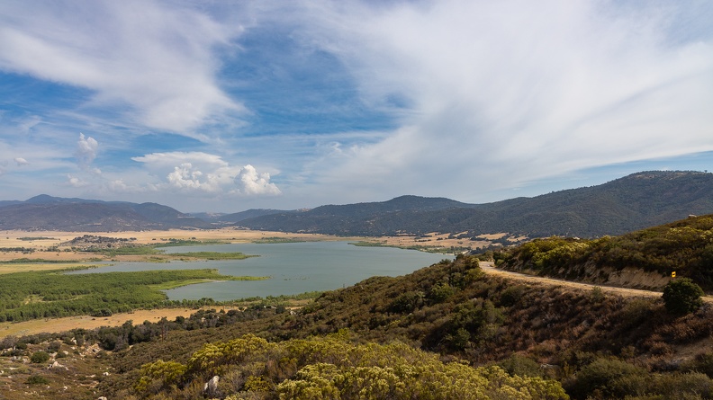
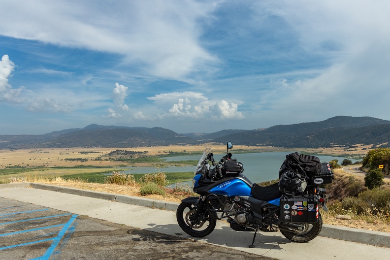
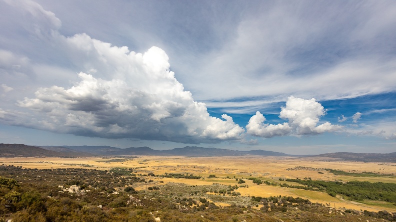
I turned onto Highway 76 and waved at a passing motor cop who was most likely on his way home. Just west of Lake Henshaw, I turned onto East Grade Road to climb Palomar Mountain. Off to my right was the lake and the San Jose Valley stretching to the east. Over the far off mountains on the east side of the valley were tall puffy thunderheads reaching to the sky. I stopped at the overlook for some pictures and I could feel the winds blowing down the mountain toward the valley below.
I felt like I had the road to myself. I only passed one other vehicle, a guy on a little red sportbike. The road went from following a ridgeline to dropping to several small valleys. Other than the red bike, I didn’t see anyone else until I stopped at the Palomar Mountain Store. I made it just a few minutes before they closed. I picked up some adult beverages and dinner supplies then headed to camp.

When I arrived at the campground, it appeared mostly empty. It was surprising considering the online reservations were all full the night before (I made my reservation a few weeks ago). I set up camp while fighting with hoardes of annoying little flies that seemed immune to the effects of DEET or enough citronella candles to look like a prayer altar.
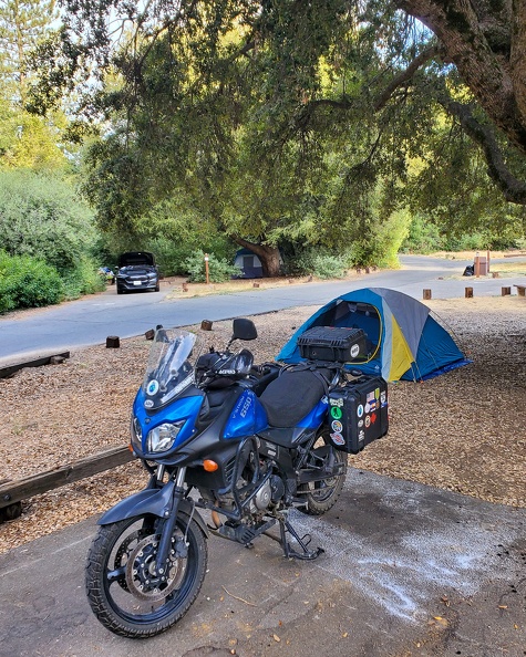
I hadn’t had room at the store to buy a bundle of wood, and the cashier said the campgrounds usually sold wood. I rode over to the host’s trailer to pick up a bundle. The host must not have liked visitors, since he didn’t answer my several knocks. I rode over to the Fry Creek Campground across the street, but there wasn’t a host there. Not one to waste a trip, I rode up toward the Palomar Observatory to see if I could get a glimpse of the domes. Unfortunately, the observatory grounds closed at 3:30, and you can’t see the domes from the road. Back to camp it would be.

When I got back to camp, I walked around looking for firewood at empty campsites. I found a couple large fallen tree branches at one site, so I cut them up and took them back to my site.

I chopped up my wood, made my dinner, and got the fire going. It doesn’t matter if it’s hot or cold, one must have a camp fire. I sat back with my adult beverage and a cigar. I probably solved all the world’s problems with that cigar over the campfire, but I forgot to write them down. I’ll do better next time.

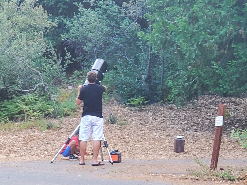
Across from my site, a guy was setting up a telescope. The scope looked to be almost as big as an oil drum – glad to see he brought the small scope. I’m not sure what happened, but almost as soon as he set the scope up, he took it down and packed it up. He and his family left soon after.
Once the sun went down, it was time for nature’s show. The campground has a large clearing in the center, leaving a perfect unobstructed view of the sky for stargazing. Right about this time I realized I didn’t pack my camera tripod. I managed to improvise by using my packed sleeping bag to rest my camera on. Looks like I did remember one of the problems I solved.
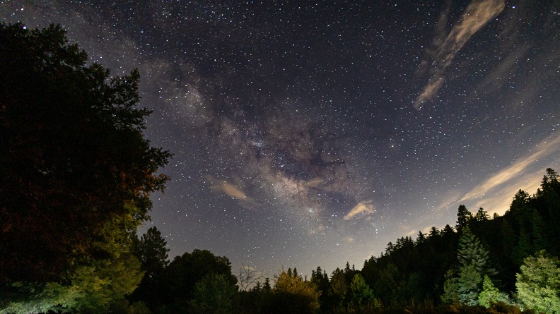
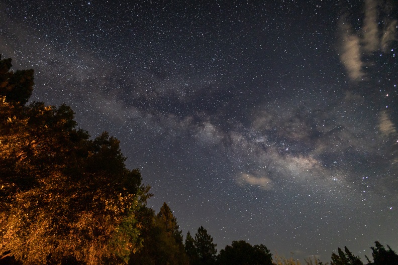
The sky was so clear thanks to the 5000+ foot (1500 meter) elevation. Surprisingly there was very little light pollution despite being just outside the San Diego area. Countless stars and the Milky Way were overhead. No wonder this campground is such a great place for stargazers.

May 25, 2022 – Up We Go

The mountains are calling. It was 90+ degrees in Calimesa and a change in elevation was what I needed to beat the heat.

I headed up highway 38 towards Angelus Oaks. As I rode through the Mill Creek Canyon before making the climb into the San Bernardino Mountains, I noticed no change. The late morning sun brightened the tans and yellows of the mountain slopes.

As I climbed up Highway 38, I passed by pockets of purple and yellow wildflowers that dotted the mountain sides, contrasting with the grays and browns. Their blossoms left a fruity aroma in the air, something you might not notice in a car.

After passing Angelus Oaks proper, I turned onto Glass Road and dropped down into the Santa Ana River Canyon. The Santa Ana River starts not far away in the upper areas of the San Bernardino Mountains and flows 96 miles to its mouth near Huntington Beach. Once the river leaves the mountains, most of it is a dry wash. Up here in the mountains, the river is a small stream twisting through the Seven Oaks area.

I turned onto Seven Oaks Road, a dirt Forest Service road that follows the north bank of the Santa Ana. Several group campgrounds dotted the road and the river banks. The road was packed hard with small patches of river rock; the Strom handled it with ease.

After about 5 miles, I reached Highway 38 and headed back down toward home. I took a side road to Jenks Lake. The lake, which covers about 9 acres, is a popular spot for fishing and hiking. Even a lake as small as Jenks is not immune to the effects of the ongoing drought in California; the lake was surrounded by a 50 feet of “bathtub ring” due to its low water level.

Even next to the lake, the temperature was still up in the 90s – elevation wasn’t helping today. It was time for some of that natural air conditioning by hitting the road again.

As I left Jenks Lake, I could see patches of snow still sitting on the 10,000+ foot north face of Anderson Peak. It’s still cool somewhere … just go higher.

Friday, February 25, 2022 – “Riding through the desert on a horse with no name”

The night was cold. While eating our dinner and watching the stars, the thermometer on Greg’s bike dropped to 22. Surely, it dropped even further through the night. We bundled up in jackets, long underwear, thick socks, and gloves. The cold still found its way in.

I had found a leftover log in our fire ring. I searched adjacent empty campsites for additional logs to make a decent fire, but all I found was kindling. I made do with what I had. I split the leftover log into four pieces and used the kindling to get it going. It wasn’t much, but it got our hands warm.

We retired early to get warm in our sleeping bags. I was actually a little worried about dealing with the cold through the night. I kept my sweatpants, long underwear, and sweatshirt on when I climbed into my sleeping bag. Surprisingly, I was quite toasty through the night.

I had some trouble sleeping; I just couldn’t get comfortable. I woke up with a sore shoulder and back. But the good news was the sun was up and it was relatively warmer than the previous night. Greg and I had our camp coffee and packed up for the day ahead.

We headed north on Black Canyon Road and then Cedar Canyon Road, heading for the town of Cima to top off our gas tanks. The two roads are “graded” for low-clearance vehicles, but graded is a very generous term for the condition of the roads. We rode through about 20 miles of bone-shaking washboards to get to the pavement. Every so often, we’d pass through a patch of thick sand left by recent rains. The sand was loose enough to get your wheels loose, surprising you when the bike turns sideways.

We dropped into the Round Valley, situated between the Providence and New York Mountains. The north slopes of the mountains were covered in snow, and small patches sat along the edge of the road.

We made it to Kelso-Cima Road and managed to have all our bolts and screws still intact. We stopped at the controversial Mojave Cross, a memorial to American war dead. The cross became famous for the long court fight over its presence in a National Preserve and possible First Amendment violations. Eventually, the government transferred the land where the cross was located to a veterans’ group and removed it from the National Preserve.

We stopped at a gas station in Cima, along Interstate 15, to top off our gas. The gas station also had a unique urinal in the restroom. Our original plan for the day was to head toward Anza-Borrego State Park for the night. By the time we got to Cima, it was nearly 1 p.m. and we found the distance to Anza-Borrego was not in our favor. Given that it was a Friday afternoon, and the popularity of Anza-Borrego, we would likely not be able to find a spot to camp due to crowds. We decided to stop for lunch in Baker then start south to see how we do on time.

Interstate 15 is the main route between the Greater Los Angeles area and Las Vegas. It’s known for a high amount of traffic and people driving at high speeds. Today, we got both and a strong wind blowing from the north. We dodged cars going 90+ and trucks that would change lanes while going too slow. You had to prepare for the sudden blast of wind when passing trucks – not only the wind coming off the front of the truck, but also the wind blowing across the valley. A few times, I found myself pushed into the next lane!

After lunch we headed south on Kelbaker Road, passing through more of that magnificent desolation. On the left we had ancient cinder cones and lava fields, on the right, the vast plain of the dry Soda Lake.

We made a stop at the Kelso Depot, a former railway station repurposed as the Mojave National Preserve visitor center. The town of Kelso, a former mining town, had long since died, and the visitor center was closed, but that didn’t stop busses full of tourists from stopping to walk around the grounds.

After a short break, we continued south, passing the enormous Kelso Dunes – the tallest being about 650 feet tall. Though they were miles away from the road, they appeared almost like a mountain range of sand. The dunes are made of sand from sediments deposited by Lake Manix which once covered a large area of the Mojave Desert. About 25,000 years ago, Lake Manix drained, creating nearby Afton Canyon. About 9,000 years ago, winds started causing these sediments to collect into the dunes we see today.

We hopped back on old Route 66 and passed through Amboy, stopping at Amboy Crater. The crater is a 944-foot-tall cinder cone volcano surrounded by a 27 square mile lava field. The crater was formed around 79,000 years ago and is considered dormant, last erupting about 10,000 years ago. The crater was a tourist attraction on Route 66, as it was one of the few volcanoes along the route. A trail to the top of the cone allowed many a traveller to brag they had climbed a real volcano.

It was starting to get later in the day and camping options were slim between Amboy and home. We decided to finish up the trip and head back to my place. It wasn’t exactly what we planned, but it worked out for the best. Greg needed to get a tire swapped out before continuing on his trip, and my family was coming back from a trip of their own. Returning on Saturday would have caused a mad dash to get everything done in a short amount of time.

Ending early didn’t matter to me. Often the times together are more important than the journey. I was happy to have another adventure with my friend.

Daily Mileage: 266
Total Mileage: 502

Back on the Road

A lot has changed since my last trip report. I’ve been on a couple trips that I slacked off on writing the reports. I’ve been busy with exciting changes.

In June, just to test the waters, I applied for a new job at a few different agencies in Southern California. I wasn’t sure what would happen, or if I would want to move, but it didn’t hurt to apply. I heard back from one agency, a university, and got an interview. I took the interview and didn’t think I did that great, but I was given a second interview and then offered the job. It was a huge decision; I had lived in Humboldt County, California, for more than 20 years after graduating from high school. I had put down roots, made friends, and had almost 14 years of seniority at work.

Ultimately, I took the job and we made the crazy decision to pull up our stakes and move across the state. In doing so, I said goodbye to all the friends I had made in my time in Humboldt. Goodbye did not mean forever though. Through the magic of modern communications, I’ve been able to keep in touch with my Humboldt connections.

One of those connections is someone who’s been somewhat of a motorcycle travel mentor to me: my riding partner, Greg. You may remember him from previous trips.

Greg was planning a trip through the southwest with passage through Southern California. Of course, he always has a place to stay with us!

Greg arrived on a Sunday. I was working on stuff in the garage and heard the familiar sound of his Tiger’s triple. It was so exciting to see my friend again! We set about planning our next adventure.

There’s so much to see in Southern California, but we weren’t going to see it all. We’ll save that for future trips. We decided to head for Mojave National Preserve.

Follow along …

Thursday, February 24, 2022 – “We’re getting the band back together.”

Due to my work schedule, Greg spent a few days living out of my guest room. We spent the days catching up and making plans.

We headed out a little before 10 a.m. It wasn’t warm, but it wasn’t too cold. It had rained the previous couple days, and some snow had fallen in the local mountains, so we prepared for the possibility of a cold ride.

Our first leg would see us slabbing it on Interstate 10. The highway would take us through the San Gorgonio Pass, one of three main mountain passes leading to the Los Angeles area. San Gorgonio pass is famous for the large wind farm situated between the San Bernardino Mountains and the San Jacinto Mountains. Snowcapped Mount San Jacinto stood above the south side, with its 10,834-foot peak blanketed in fresh snow.

Interstate 10 is a major trucking route between the west coast and the southern US. When we left, there wasn’t as much truck traffic as there typically seems to be. Normally, drivers would be dodging trucks that take up two of the highway’s three lanes. We had ourselves a clear path as the highway dropped into the Coachella Valley.

Suddenly, my right side mirror decided it was going to become a wind vane and turned itself parallel to my direction of travel. It wouldn’t be one my trips if something didn’t come loose. I guess I only torqued the bolt to [REDACTED] miles per hour. Who needs to see any way?

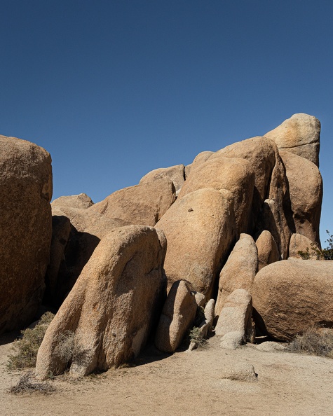
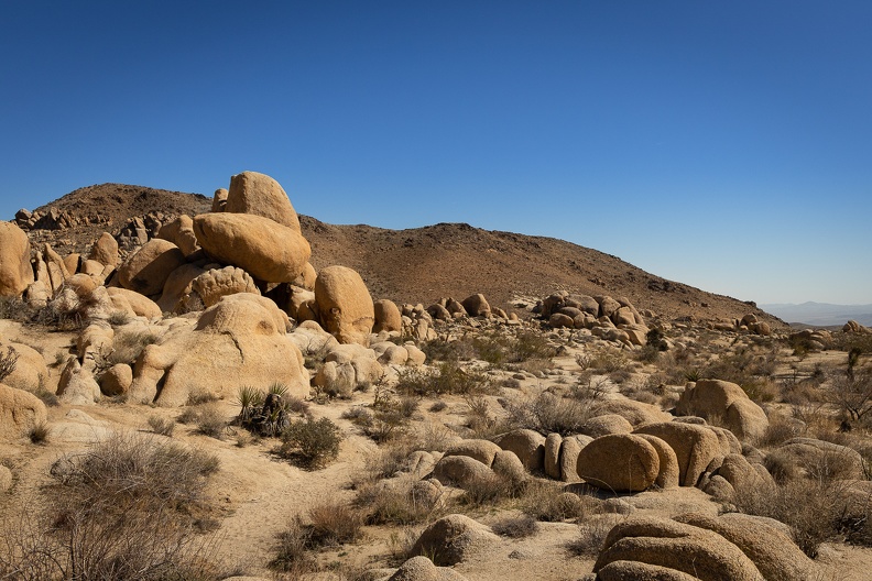
Just west of Chiriaco Summit, we exited I-10 and headed north into Joshua Tree National Park. The park was created as a National Monument in 1936 and made a National Park in 1994. The park straddles the boundary between the lower Colorado Desert and the higher elevation Mojave Desert.

The park showcases the beauty of the California deserts with forests of the eponymous Joshua Trees, desert cholla, and fields of desert scrub. We rode through the narrow Cottonwood Canyon as we entered the park where the road is laid upon a dried stream bed surrounded by red and orange rocks. Much of the rock was created by volcanic forces and later exposed through uplift and erosion.

The ride through the park was spirited, with curves and straightaways mixed equally. The park is a pretty popular destination in Southern California, so there’s always a good amount of traffic; however, much of the other vehicles slowed down or moved over to let us pass.

We exited the north entrance of the park and searched for a place to have lunch in nearby Twentynine Palms. Greg found a place on his GPS, which ended up being closed when we got there. So he found another nearby place, which ended up being so hidden that we couldn’t find it. Hangry Greg pulled into the parking lot at McDonald’s, only to find that they were only serving through the drive-thru. The whole town could probably hear the loud “FUCK” he shouted out when he saw the dining room was closed. I know I heard it through my helmet and earbuds. I managed to find a diner close by, the Cactus Trails Café. And it was open! Hangry Greg was satiated with a bacon cheeseburger.

We headed out of Twentynine Palms on Amboy Road and rode through Sheephole Pass between the Sheephole Mountains and Bullion Mountains to fully cross into the Mojave Desert. As we crested the pass, we were greeted with an expansive view of the Cadiz Valley and Bristol Dry Lake.

Soon we found ourselves on National Trails Highway, formerly known as US Route 66. Yes, that Route 66. We stopped in the town of Amboy at Roy’s Motel and Café, a Route 66 icon famous for its arrowhead shaped sign. Amboy is one of the many towns that Route 66 passed through before it was decommissioned and bypassed by Interstate 40 in the 1960s. Many of these towns, along with the highway were the inspiration for Radiator Springs in Disney’s “Cars.” The motel had long since closed, and the café was now a souvenir shop/convenience store, but the spirit of the Mother Road lived on. We grabbed a couple keepsakes, took some pictures, and picked up a couple supplies before making our last leg for camp.

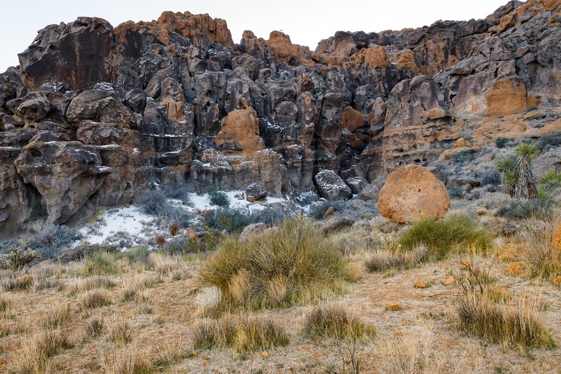
We hopped onto Interstate 40, and headed east further into the desert. We made our way into the Mojave National Preserve to make camp. We stopped at Hole in the Wall Campground, situated in a small valley at the base of the Providence Mountains, red-orange in color with pockets of snow on the north-facing walls. Around the valley was a plethora of desert life, yucca trees, differing types of desert scrub, and barrel cactuses with bright red spines.

Greg and I set up camp and then took a walk around the campground to explore the valley’s beauty. The walls of the valley were made of ancient volcanic rock and were covered in holes small and large that had been carved by the winds that often whip through the Mojave. Walking around, one really gets a feel for how deserts are lands of contrasts … often remembered as hot, dry places in the summer, deserts can get very cold during the winter months; and seemingly harsh to life, deserts are teeming with hardy flora and fauna that have adapted to extreme conditions. This area in particular probably sees temperature swings of up to 100 degrees between summer and winter.

Back at camp, it was like old times. The ride was something familiar. It was good to see my friend ahead of me on the road, while Greg commented on how there was something soothing about seeing my headlights in his rear view mirrors just like on all our prior trips.

We sat around camp watching the light fade from sunset, the appearance of the Belt of Venus, and the rising of the stars. The dark skies showed thousands of stars you wouldn’t normally see in town. I snapped some pictures of familiar constellations. The camera picks up much more than the eye sees. The shapes of the constellations become drowned out by the other stars in the background that are often too dim for the naked eye. To the north, we saw a white glow on the horizon. It turned out the glow was the lights of Las Vegas, 80 miles away! We even caught a glimpse of a few meteors streaking across the sky.

Daily mileage: 236

March 21, 2021: The day the music died

The night was cold. Any opening in the sleeping bag let in a draft of cold air. Temperatures dropped into the low 30s overnight and we woke up to a layer of frost on our bikes. Fortunately, the sun was up and it was quickly warming.

After the damp night at Salt Point and the rain the previous night, our tents had not had a chance to dry out. We laid them out in the sun to dry out while we warmed up.

As we waited for stuff to dry, we took a hike on a nearby trail. The trail climbed up a hill and there were great views of Clear Lake. Spring had sprung and flowers were starting to bloom all around. Many rocks on the trail were green with moss.

After about an hour of walking, we returned to camp to find our stuff dry. We packed up and headed out. We made a quick stop in Lakeport for brunch and got back on the road to power home.

Winds started to pick up on Highway 20 as we passed through the Cold Creek valley around the Blue Lakes. Narrow valleys act like a wind tunnel, speeding up winds as the gap narrows. We turned onto Highway 101 north of Ukiah and the winds turned biting cold.

One thing I like to do when riding is listen to music. My iPod is as much a riding companion as my helmet. Somewhere near Willits the music stopped. We stopped near Willits so Greg could put on a liner and I tried to get the iPod going again to no avail. I guess my headphones were now earplugs for the remainder of the trip.

To add to the losses this trip, near Leggett I felt something hit my right knee. I looked down and saw a piece of plastic wedged between my knee and the tank. I recognized it as a spacer from my handguard clamp. Noticeably missing was half of the handguard clamp. I guess the screws had vibrated loose. Fortunately, the remaining part of the clamp was securely wedged between the brake fittings and the handlebar.

Winds continued to pick up as we continued north. They swirled around in the Eel River valley from Garberville north. At some point, I lost sight of Greg, so it felt like riding solo. Just south of Eureka, Greg appeared out of nowhere behind me.

Winds were strong on the shores of Humboldt Bay as we entered the final stretch. I could see Greg ahead of me leaning noticeably to his left to keep the bike on a straight path.

We arrived home a little before 5 p.m. and put another adventure into the books.

Total Miles: 204.6

Trip Miles: 583.9

March 20, 2021: Spring has sprung

Here’s the thing with camping by the ocean at spring time: everything is damp when you wake up. You would have thought it had rained overnight with how wet the tents and bikes were.

Greg and I took our time getting up and ready; extra time to hopefully have the sun peek through the trees enough to dry our stuff. We made our coffees, wiped down the outside of our tents, and slowly packed up.

We pored over the map to plan out the day’s route. We would head south for a bit and take a windy local road, the Butler map called it a “Paved Mountain Trail,” inland to Guerneville. We would then make our way northeast to Clear Lake. The weather was good and we had all day to explore.

We headed south on Highway 1 and made a left turn at Fort Ross. Fort Ross was the southernmost Russian settlement in North America. The road was narrow, windy, and rough as it wound its way through the forest and climbed into the hills and crossed the San Andreas Fault.

After a few miles, we reached a ridge overlooking the Pacific. We followed the ridge for a few more miles than turned east, dropping down into a narrow valley carved by the south fork of the Gualala River. The road continued to be narrow and twisty with pavement crumbling in many places. It reminded me a lot of the western portion of Nacimiento-Fergusson Road in Monterey County.

Fort Ross Road passed through the town of Cazadero and dropped us onto Highway 116, which follows the Russian River. We stopped for gas in Guerneville and asked for a breakfast recommendation from the clerk. We backtracked and stopped at the Northwood Golf Club outside Guerneville for a hearty breakfast.

We left Guerneville and headed for the hills. We turned onto Sweetwater Springs Road and climbed up another narrow, windy road. We passed the old Sonoma Mine on the way. The mine looked like a cartoon mine, complete with a faded wood “Keep Out” sign. I half expected Yosemite Sam to pop out and start throwing dynamite at us.

The tree-lined road climbed up onto a ridge. Soon the ridge dropped down into wine country. Green hills covered in vineyards stretched out as far as the eye could see. I found a nice hillside covered in bright green grass. A herd of dairy cows had spread out across the hill to graze on the grass. The hill reminded me a lot of the Windows XP wallpaper, “Bliss,” which oddly enough was a photo taken about 30 miles away.

We crossed over Highway 101 and headed east to Calistoga. Traffic in Calistoga was heavy with tourists walking around town and searching for places to park. Being at the north end of wine country, Calistoga has avoided the encroachment of freeways and big business, letting people see “old Wine Country.” The town is also known for its sparkling water and hot spring spas.

Greg and I turned north onto Highway 29, which climbed Calistoga Grade toward Robert Louis Stevenson State Park. The highway’s route was slow-going, with many tight hairpin turns.

Highway 29 dropped us into Middletown, which was severely damaged by fire in 2015. The town was on the rebound, but the scars of the old fire were still evident in the areas around town. From Middletown, we turned onto Highway 175 toward Kelseyville.

We arrived at Clear Lake State Park to find the campground was full. With it being late in the afternoon on the first day of spring, we called several other campgrounds and found they were either booked up or not yet open to tent camping. We had a conundrum on our hands. We asked the gate host, Bailey, if there was anything she could do for us to get us a spot in the campground – give us a no-show site, abandoned site, or even if the camp host would let us set up on his site – it wasn’t looking good. I saw the light bulb illuminate above Bailey’s head. She said the campground has “emergency” sites that are kept empty in case fire fighters or emergency personnel need them. Greg told her she was in luck, and told her what we do for a living. A Sheriff ID was good enough for her. We had ourselves a site! I handed over my pass and she didn’t even charge us for a second vehicle.

Looking at the skies, it appeared rain might have been coming. We repeatedly checked weather apps, which told us rain was imminent. We set up our tents quickly and put gear inside. As if on cue, the skies opened at the time the weather apps predicted. A light rain started to fall and temperatures dropped. A rainbow appeared over the lake. It was a beautiful site. The temperature kept dropping and soon the rain started falling harder. I sat inside my tent with a blanket on to keep warm, waiting for the rain to pass. About an hour later, the skies cleared and the rain stopped.

We tried to start a fire to warm up, but it was stubborn. A lot of the wood and kindling was just damp enough that it didn’t want to stay lit. We split our logs into smaller and smaller pieces to get to the driest wood on the inside of the logs. Eventually, the wood dried out enough to stay lit and we warmed up around the fire.

It was going to be a cold night.

Total Miles: 129 Pots of Gold Found: 0

March 19, 2021: Is this really the first ride of the year?

I’ve been a bad motorcycle owner. My bike has been sitting in the garage since my last trip in October. However, winter is nearly over, and spring is coming and taking colder temps and rain away with it. I sent a message to Greg and suggested a road trip. Greg is always up for some two-wheeled travel.

We looked at our maps, threw out some suggestions, and decided we’d head south and see where the roads would take us. Along the way, we would take some new roads to add to our highlighted maps.

The week before our departure date, things weren’t looking too promising. Nothing but cold temps and rain. Up to the Wednesday before we were to leave, it was still questionable whether the weather would cooperate. I was following several weather web sites and radar images like I was preparing an evening newscast. It looked like it would be a crapshoot whether it would be dry or not.

On the day of departure, we woke up to pleasant mostly sunny skies. Small, puffy clouds were scattered in the air, but there was no rain. Perhaps the weather gods were looking out for us. I dropped the kids off at school, kissed my wife goodbye, and rode over to Greg’s to plot out the day’s route over a cup of coffee. We left ourselves a few options and headed south on Highway 101 around 9:30.

No more than 15 minutes into the trip, I saw Greg raise his arm and wave at the western skies. It appeared there was an ominous wall of clouds hanging off the coast. Could this be an omen of our future? Did the weather gods trick us? I hoped the clouds would stay put and leave us alone.

Just south of Eureka, Greg suddenly put on his right turn signal and exited the highway. I wondered what was going on. Did he suddenly have an idea of a destination that he just had to share? I pulled up alongside him.

“Suit up!” he said as he opened his pannier to get his rain gear.

I dug out my rain suit and put it on over my riding gear. Sporadic drops of rain started to fall, making tapping noises on my helmet. Looks like we’re going to get wet.

I took a peek at the weather radar app on my phone. Bands of rain were descending on the Eureka area, but things looked promising to the south. Maybe this won’t be so bad.

We got back on the road and continued on. We’ve ridden through rain before, so this won’t be a problem.

As we passed the College of the Redwoods area, the rain drops turned into the tapping of hail on my helmet. Well, this will be fun. I cranked the grip heaters to max and squinted through the layer of mist on my visor.

Rainy skies

They say, “If you don’t like the weather in Humboldt County, wait five minutes.” Actually, I think they say that about a lot of places. It rang true in this case. Five minutes later, the rain stopped and the sun started to peek out of the clouds. OK, then. As we rode on, we got the occasional light shower, but nothing crazy. By the time we got out of Humboldt County, the rain had stopped.

Oh look, the sun!

We made a stop in Laytonville for gas and snacks. I warmed myself up with a cup of hot chocolate and looked at the weather radar. The radar and a look at the skies seemed to show the last of the weather passing by and heading away from our path. A line of clouds was passing over the coast range to the west and nothing but blue skies appeared to be on the other side. We decided to head over to the coast and go south on Highway 1.

Greg and I rode west on Branscomb Road, the main route between Laytonville and the coast. For most of the way, Branscomb Road was in much better shape than Highway 1 between Leggett and Westport. Where Highway 1 has many steep, tight turns, Branscomb Road’s curves were much more gradual and the grades were more gradual.

We passed through the town of Branscomb, a relic of a bygone era when logging was king in this area. The abandoned Harwood Lumber Company mill sat empty, having gone bankrupt in 2008. The gates to the property were blocked by several K-rails. Along the road, adjacent to the mill sat the Branscomb Store. The red walls on the outside were fading and cracking from lack of care. The store was long since closed, but still had a single fuel pump out front with a sign that said unleaded gas was 60 cents per gallon.

West of Branscomb, we started to climb into the coast range as the road followed Packard Ridge. We passed through groves of old redwood trees as the road followed the contours of the ridge before dropping down onto Highway 1 north of Westport.

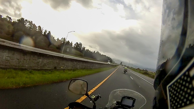
I would have had a video of the ride on Branscomb Road, but there was a little bit of a mishap with my video camera. More on that later.

RIP ProGo :(

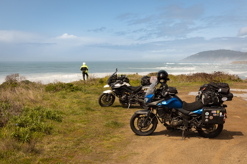
We stopped at a turnout to stretch our legs and look at the waves crashing on the shore. Looking out over the ocean and to the south, it appeared there would be no more rain in our future. The sun was out and we were warming up.

On the coast

We stopped in Fort Bragg to pick up supplies for the night’s camp. Since the weather had passed, we also packed away our now dry rain suits. We looked at the map to see how much farther we would go before finding a place to camp. We decided to head to Salt Point State Park, another 75 miles down the road.

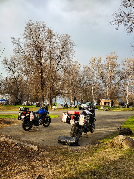
At about 4 p.m. we arrived at Salt Point State Park near Jenner. Greg and I always tend to stay at state parks or federal campgrounds. I have a state park pass that allows me to camp for free, and we both have federal passes that give us heavy discounts at those federal campgrounds that charge. However, here’s a strange thing about the state park pass. Camping is free, but there’s a charge for a second vehicle. So you can show up to the campground in an SUV with seven people inside and camp for free. But if two people show up on two motorcycles, which take up less combined space than an SUV, you pay for an extra vehicle. California State Parks, if you’re reading this, it does not make a lot of sense when one thinks about the reasoning behind the extra vehicle charge.

Apparently we were just in time, as there were only two more walk-up camp sites available. The gate host gave us our choices and we went to check out which site would suit us better. We picked our site and started to set up camp.

As I walked around my bike to get my camping gear out, I noticed something strange. Where my video camera had been was only the metal clamp that held it to the bike’s crash bar. The plastic mount had been sheared off and the camera was nowhere to be found. I remembered it still being there when we stopped after getting off Branscomb Road, but had no idea where it might have fallen off. We had covered about 100 miles of road, and there was no way there was time to go back and look. It wasn’t a huge loss as it was a $40 GoPro knockoff (or “ProGo”), but still sucks to lose it.

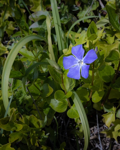
Blue periwinkle
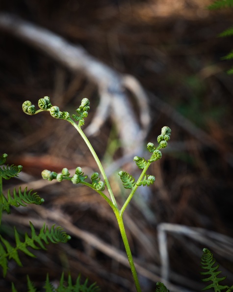
Young fern

After getting home, I went through the video footage from my helmet-mounted Contour camera to see if I could narrow down when the ProGo fell off. Through my sleuthing, I discovered the camera was still there when we stopped in Fort Bragg. Additionally viewing showed the camera was still there just north of the town of Elk. This didn’t help much, as it had been several days, and it only narrowed the area down to a 50-mile stretch of Highway 1. R.I.P. ProGo.

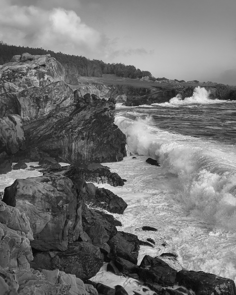
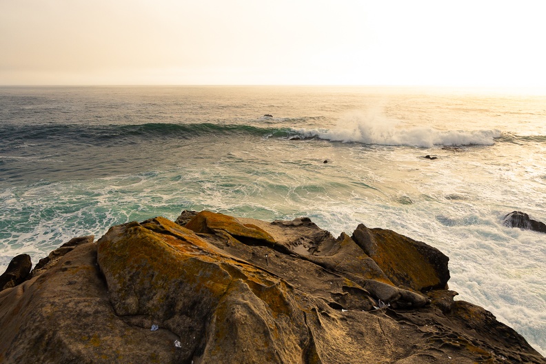
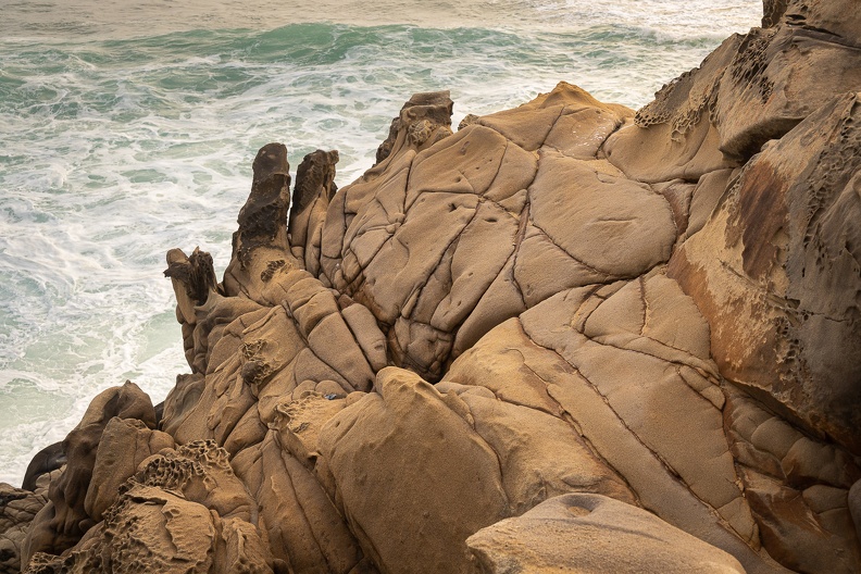
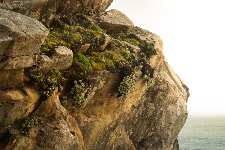
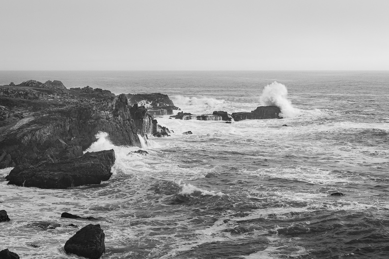
After setting up camp, Greg and I walked down to the cliffs above the ocean to watch the waves. Though the weather had passed, I could tell it was still affecting the surf, producing many large waves. There were many interesting rocks along the coast. The cliffs here are made of sedimentary sandstone, and their sedimentary nature was evident in many places. Several feet of soil was visible above the sandstone rocks where small creeks had found their way to the ocean. Many rocks had small round cavities in them called tafoni. There are many possible explanations for how tafoni are created, but the most likely cause is weathering caused by salt crystals. Water drives salt crystals into crevices in the sandstone. The salt reacts with the sandstone, causing some parts to harden and some to soften. The soft parts then erode away leaving the common honeycomb pattern of the tafoni.

Waves crashing
Incoming wave
Sandstone
Precariously perched succulents
Pine precariously perched on a precipitous palisade

Back at camp, we got a fire going, after Boy Scout Greg worked his magic in getting it started and getting some of the damp wood to dry out. We sat by the fire chatting, solving all the world’s problems, and smoking cigars.

I fell asleep to the sound of the waves crashing against the cliffs in the distance.

Waves crashing

Total Miles: 250
Cameras Lost: 1
Inactive Cell Towers Seen: 1

Sunday, October 11, 2020: The journey home

Old Station, California, to Home

The night was chilly. Thankfully, my sleeping bag was warm. I got up around 8:00 and made myself a cup of coffee. I sat there on the picnic table sipping the hot drink and listening to Hat Creek off in the distance.

We packed up our camps for the home stretch. The air warmed up quickly as we packed.

We rode west on Highway 89, which turned into Highway 44 within a few miles. The highway wound its way thought a fragrant pine forest. The scent of the trees was thick in the air.

As we descended in to the Central Valley east of Redding, fleeting glimpses of Mount Shasta were visible off to the right. It was a breezy day in the Redding area.

We stopped at Five Guys for lunch, then gassed up for the run down Highway 299 and the coast.

Traffic on Highway 299 was light, so the riding was spirited. As we entered the Trinity River Canyon, Greg motioned for me to follow him and gave me an impromptu riding lesson to help improve my riding skills. I did my best to keep up and follow his lines.

We got back to town a little after 2:00. We waved goodbye to each other and headed for our respective homes. I must have gotten back early, because nobody was home. I had time to take a shower and get a shave before the family got home.

Day’s Mileage: 202.3, Total Mileage: 1808.3

… Greg did 1814

Saturday, October 10, 2020: Adventures suck when you’re having them

Virgin Valley Hot Springs, Nevada, to Old Station, California

Woke up to a dramatic sunrise in the east, orange with dark clouds of an approaching weather system. Off in the western distance were skies that looked dark and threatening. I looked up to see what way the clouds were blowing, hoping that any bad weather would be heading away from us. The clouds appeared to be heading northwest, away from our planned route. Hopefully, we would miss any bad weather. We were on the road by 8:30, heading west toward Oregon.

The highway was mostly empty at this time of morning. That gave me a chance to take a “ghost rider” picture with my bike on its center stand parked in the middle of the highway.

We pulled off at the Oregon-Nevada border for a moment. As I lifted up my face shield, I could smell the odor of oncoming rain. Off in the distance were dark clouds with the mist of falling rain below them. We donned our rain gear.

People have asked, “What happens if it starts raining when you ride?” The answer is: You get wet. Our only option is to continue through it. The rain was light at first, but I could feel the temperature dropping as we continued on.

The highway made a right turn and dropped down the side of a steep ridge into the narrow Guano Valley. The highway dropped about 1000 feet from the top of the ridge to the valley floor in a little under three miles. The views from the top of the ridge, and on the way down were amazing. We passed a pickup pulling a trailer, and the view of the oncoming truck looked like it was right out of a commercial.

We crossed into the Fremont National Forest and followed several canyons through the mountains. The temperature continued to drop, settling around 42 degrees. Coupled with the rain, it was fairly miserable. To top it off, my visor kept fogging up. I tried lifting it a bit, but got a face full of frozen water droplets pounding my face. My grip heaters were no match for the wet and cold. Unable to see, and with my hands freezing, I powered on. As Neil Peart said: There’s no such thing as bad weather, only the wrong clothes … Or the wrong attitude.

Greg waited for me at the intersection of Highway 140 and Highway 395. I gave him a thumb’s up and we turned south and continued through the rain.

The rain let up as we crossed into California, and I could see the weather clearing off in the distance.

We stopped for fuel and breakfast in Alturas. Chicken fried steak and hot coffee at the Wagon Wheel were just what I needed to warm up. While eating, I saw a couple of kids, who were probably around 8 years old, running around and looking in awe at the motorcycles. We gave them a wave as we rolled out.

Winds coming off a plateau to the north picked up as we turned onto Highway 299 and rode through the Warm Springs Valley. The winds continued as rode through several canyons that wound through the Modoc National Forest.

We stopped at Burney Falls State Park to get a campsite, only to find out the campground was closed. We checked the map and decided to head for Old Station, outside Lassen National Park, to seek out camp for the night. There were several campgrounds in the area, so finding a spot should be easy.

Oh look, a campground … Closed … Ride on.

Oh look, a campground … Closed … Ride on.

Oh look, a campground … Closed … Ride on.

Guess we might be making a run for home tonight.

Just as we entered Old Station, we found the sign for Cave Campground. It was open! We found a spot a stone’s throw from the rushing Hat Creek. Cloudy skies still appeared to be threatening rain, so we were quick about putting up our tents. Luckily, the skies cleared a while later.

The entire Old Station area is built on ancient lava flows from Lassen Peak and other volcanic vents of the Hat Creek volcanic area. Across Highway 89 from the campground is the Subway Cave, a lava tube. Lava tubes are formed when flowing lava moves under the hard surface of a lava flow. When the tubes empty, they leave caves behind.

Subway Cave formed about 20,000 years ago when lava covered the Hat Creek Valley. Though there are many lava tubes in the Hat Creek area, Subway Cave is the largest and most accessible. Halfway through the cave is an offshoot cave where one can go, turn their light off, and experience complete darkness. On hot days, the cave is a great place to get out of the heat, as the air inside consistently stays around 50 degrees.

Clouds returned early in the evening, so we weren’t able to see the ISS on our final night on the road.

I fell asleep to the sounds of Hat Creek babbling in the distance.

Day’s Mileage: 264, Total Mileage: 1606

Friday, October 9, 2020: Gross Miscalculations

Frenchglen, Oregon, to Virgin Valley Hot Springs, Nevada

The night was cold, but the morning was surprisingly warm. A south wind brought the temperatures up into the 50s by the time we stumbled out of our tents.

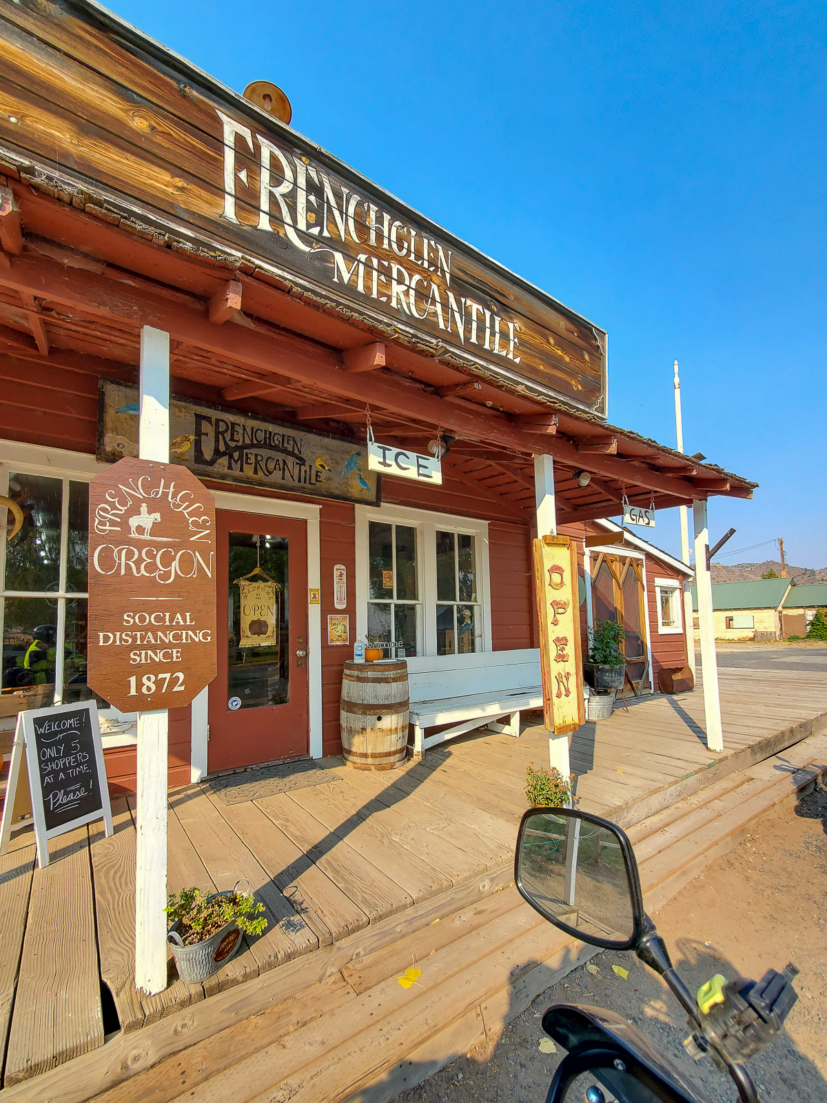
We thanked Rick and his wife for their hospitality and headed out for the day. We stopped in Fenchglen for breakfast at the Frenchglen Hotel on Rick’s recommendation.

The hotel was built in 1916 by the Swift Meatpacking Company who owned a nearby ranch. People doing business at the ranch would stay there. Later, the hotel was used to house the teachers who worked at the Frenchglen School. The hotel was then bought by the Fish and Wildlife Service when it bought the land for the Malheur Wildlife Refuge. In the 1970s, the State of Oregon bought the hotel and owns it to this day.

Breakfast at the hotel was anything we wanted, as long as it was their French toast special. The French toast was thick and sweet, and the bacon was … well … bacon, so it was good.

Across the street from the hotel was a relic of times past … a phone booth. The phone was long since removed, but there was another historical artifact inside, an 8-Track tape. Down the street was an old general store with the only fuel for miles. We plotted our route for the day. We would head to McDermitt, Nevada, 152 miles away, and the next closest gas. Greg topped off his tank to make sure he would make it to McDermitt. I had filled up in Burns and according to my estimation from my fuel gauge, should be able to go about 200 more miles before I needed to fill up.

We headed north on Highway 205 and turned off toward the Diamond Craters. The area was a perfect example of the lands of the Basin and Range – large flat grasslands alternated with steep mountain ranges. The Basin and Range stretches from eastern California to central Utah. In the area around Diamond Craters, we traveled through large stretches of ancient lava flows that covered the plains.

We made a pit stop at Burns Junction at a gas station that had closed back in the days when leaded gas was still available. We were 55 miles from McDermitt and I still had two bars remaining on my fuel gauge – an estimated 100 miles. We headed south from Burns Junction on Highway 95 into one of the basins between parallel mountain ranges. We crossed into the Mountain Time Zone and back into the Pacific Time Zone and I watched the clock on my GPS go forward one hour, then back one hour.

About 20 minutes after leaving Burns Junction, the second bar on my fuel gauge disappeared – 50 miles of fuel left. I thought, “Well, I’m less than 50 miles from McDermitt, so it’s still looking good.” I wasn’t having any regrets of not topping off in Frenchglen. Twenty minutes later, the final bar on my fuel gauge started to flash. I was only 20 minutes from McDermitt. This was going to be close.

Thoughts started going through my mind. I imagined the tank running dry just as I pull into the gas station. I imagined running out miles from town and being stuck on the side of the road. I patted the gas tank and talked to the bike. Come on, baby. You can do it. As the miles went on, I became accepting of the fact that I could run out. If I ran out, I ran out. Not much I could do about it. I reduced my speed to try and save what gas fumes I had left.

Five miles from McDermitt, I started to climb a hill. The engine started to sputter as I went up. Come on, you can do it! The engine died near the crest of the hill. I pulled onto the shoulder and tried to keep the bike going. As I crested the hill, the engine came back to life. I could see McDermitt off in the distance. You can do it. The bike kept running as I went down the other side of the hill. Maybe I would make it after all.

The GPS read 3.2 miles to McDermitt. The road was flat, if not slightly downhill. Things were looking good. I’d like to tell you I made it to McDermitt. I really would. The engine sputtered again and died. I pulled the clutch and hit the start button … nothing. I coasted to a stop with McDermitt clearly visible in the distance.

At least Greg was ahead of me and had a fuel can. I fired off a text, sure that he would see it when he stopped and checked his phone. Out of gas, 3 miles north of town. I’m never going to live this down. I had the chance to top off, but my arrogance over the range of my bike bit me in the ass. Ten minutes went by, cars, RVs, and semi-trucks whizzed by without slowing down. Greg responded. Oh my. Ok. Filling RotoPax.

Almost made it.

I stood there on the side of the road, watching the traffic blow by without so much as slowing down. The narrow shoulder kept the bike and me close to the action.

Soon, off in the distance, I saw a motorcycle approaching. Like a white knight coming to the rescue, it was The Stig with gas to bring my bike back to life. He threw up a finger – you know which one – as he passed and turned around. He shook his head as he got off the bike. I hung my head in shame.

With some gas back in my tank, I was off for McDermitt to top it off. We stopped and grabbed food for the night, then plotted where we would stay.

We headed south on Highway 95 into the desert. To the left of us were the Santa Rosa Montains with their exposed granite peaks. To the right, the vast sagebrush plain of the Quinn River Valley. More magnificent desolation.

Suddenly, a flock of birds flew across my view. One bird was flying just a few feet above the pavement. He looked in my direction, I looked at him. I’m pretty sure the bird’s eyes got huge and he freaked out. The bird turned itself around, trying to stop in midair. He looked like a car trying to skid to a stop. You could almost hear the tire-screeching noise. It wasn’t enough. The poor bird flew into my left shin and exploded into a puff of feathers. A small bird is no match for a man’s leg coming at it at 75 miles per hour. I was left with a crime scene of bird blood and guts on my leg and its associated feathers and splatter on the frame of the motorcycle.

We turned onto Highway 140 and headed west. The road was one of those stereotypical desert roads: Miles of ruler straight pavement stretching from horizon to horizon, disappearing into a far-off mountain range. I could have taken a nap and not hit anything.

We stopped in Denio Junction to top off our tanks (one can’t be too careful), and continued into the valley between the Pueblo Mountains and Pine Forest Range. The road rounded the tip of the Pueblo Mountains and entered the Bog Hot Valley. Evidence of volcanism was present all around. Basaltic hills on each side, ancient lava bombs rested on the sides of the road – rocks bigger than a house that had been flung there by volcanic eruptions. One wouldn’t want to find themselves under one of those.

We turned onto a dirt road with a sign that read “Opal Mines.” After a few miles of dirt road, we came to the Virgin Valley Hot Springs campground. This campground was different from the other camps we had been to. It was all dirt; not a speck of grass in sight. A few old brick buildings whose uses are unknown to me dotted the campground. Some had fences around them, one was right next to a pond. We circled the camp to find the right spot and parked the bikes.
We set up camp and then walked around to explore. A few feet from our campsite was the remains of an old chimney. There was nothing to tell me what it was for. Was it the remains of an old kiln? Did there used to be a house there? It was a mystery.

We got into our swim trunks and headed for the pond. The pond was surprisingly warm; I’d guess at least 90 degrees. It wasn’t like a hot tub, but the warmth felt good. It wasn’t a proper bath, but was nonetheless refreshing.

After the swim, we headed back to our camp to make dinner. While heating our meals, a couple of other campers came up. The mystique of the motorcycle traveler drew them to us. We talked about our trip and the remaining plans. The two campers bid us farewell, thinking we were the coolest guys ever because we were traveling on motorcycles and playing Frank Sinatra music at our campsite. Take the compliments as they come.

The ISS-viewing streak came to an end tonight. The station rose too low in the sky to see.

Day’s Mileage: 296.1 (302.1 for Greg), Total Mileage: 1342