
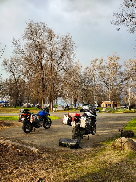
Here’s the thing with camping by the ocean at spring time: everything is damp when you wake up. You would have thought it had rained overnight with how wet the tents and bikes were.
Greg and I took our time getting up and ready; extra time to hopefully have the sun peek through the trees enough to dry our stuff. We made our coffees, wiped down the outside of our tents, and slowly packed up.
We pored over the map to plan out the day’s route. We would head south for a bit and take a windy local road, the Butler map called it a “Paved Mountain Trail,” inland to Guerneville. We would then make our way northeast to Clear Lake. The weather was good and we had all day to explore.
We headed south on Highway 1 and made a left turn at Fort Ross. Fort Ross was the southernmost Russian settlement in North America. The road was narrow, windy, and rough as it wound its way through the forest and climbed into the hills and crossed the San Andreas Fault.


After a few miles, we reached a ridge overlooking the Pacific. We followed the ridge for a few more miles than turned east, dropping down into a narrow valley carved by the south fork of the Gualala River. The road continued to be narrow and twisty with pavement crumbling in many places. It reminded me a lot of the western portion of Nacimiento-Fergusson Road in Monterey County.

Fort Ross Road passed through the town of Cazadero and dropped us onto Highway 116, which follows the Russian River. We stopped for gas in Guerneville and asked for a breakfast recommendation from the clerk. We backtracked and stopped at the Northwood Golf Club outside Guerneville for a hearty breakfast.

We left Guerneville and headed for the hills. We turned onto Sweetwater Springs Road and climbed up another narrow, windy road. We passed the old Sonoma Mine on the way. The mine looked like a cartoon mine, complete with a faded wood “Keep Out” sign. I half expected Yosemite Sam to pop out and start throwing dynamite at us.


The tree-lined road climbed up onto a ridge. Soon the ridge dropped down into wine country. Green hills covered in vineyards stretched out as far as the eye could see. I found a nice hillside covered in bright green grass. A herd of dairy cows had spread out across the hill to graze on the grass. The hill reminded me a lot of the Windows XP wallpaper, “Bliss,” which oddly enough was a photo taken about 30 miles away.


We crossed over Highway 101 and headed east to Calistoga. Traffic in Calistoga was heavy with tourists walking around town and searching for places to park. Being at the north end of wine country, Calistoga has avoided the encroachment of freeways and big business, letting people see “old Wine Country.” The town is also known for its sparkling water and hot spring spas.
Greg and I turned north onto Highway 29, which climbed Calistoga Grade toward Robert Louis Stevenson State Park. The highway’s route was slow-going, with many tight hairpin turns.
Highway 29 dropped us into Middletown, which was severely damaged by fire in 2015. The town was on the rebound, but the scars of the old fire were still evident in the areas around town. From Middletown, we turned onto Highway 175 toward Kelseyville.
We arrived at Clear Lake State Park to find the campground was full. With it being late in the afternoon on the first day of spring, we called several other campgrounds and found they were either booked up or not yet open to tent camping. We had a conundrum on our hands. We asked the gate host, Bailey, if there was anything she could do for us to get us a spot in the campground – give us a no-show site, abandoned site, or even if the camp host would let us set up on his site – it wasn’t looking good. I saw the light bulb illuminate above Bailey’s head. She said the campground has “emergency” sites that are kept empty in case fire fighters or emergency personnel need them. Greg told her she was in luck, and told her what we do for a living. A Sheriff ID was good enough for her. We had ourselves a site! I handed over my pass and she didn’t even charge us for a second vehicle.

Looking at the skies, it appeared rain might have been coming. We repeatedly checked weather apps, which told us rain was imminent. We set up our tents quickly and put gear inside. As if on cue, the skies opened at the time the weather apps predicted. A light rain started to fall and temperatures dropped. A rainbow appeared over the lake. It was a beautiful site. The temperature kept dropping and soon the rain started falling harder. I sat inside my tent with a blanket on to keep warm, waiting for the rain to pass. About an hour later, the skies cleared and the rain stopped.


We tried to start a fire to warm up, but it was stubborn. A lot of the wood and kindling was just damp enough that it didn’t want to stay lit. We split our logs into smaller and smaller pieces to get to the driest wood on the inside of the logs. Eventually, the wood dried out enough to stay lit and we warmed up around the fire.

It was going to be a cold night.
Total Miles: 129 Pots of Gold Found: 0