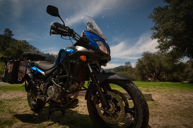
When I discovered I was going to have three weeks “free” at work without a trainee to work with, I got the idea to take a week to do a motorcycle trip. I wasn’t sure where I would go though. I figured given that it was early spring I would stick to California because the weather would be better. A few places crossed my mind: Death Valley, Yosemite, Kings Canyon, to name a few.
As the time got closer and closer, I soon realized that some of the places would not be feasible given a week-long span. Going to Death Valley would require either crossing the Sierra Nevada mountain range and one of its passes – but they’re typically covered in snow until May or June – or going south to Bakersfield, crossing Tehachapi Pass and going north on the east side of the Sierras – a route that would require more time than I had. Another problem with Death Valley was that winter rains had washed out many of the roads I wanted to ride once I got there. There just would not be time.
I decided to make a trip to Carrizo Plain National Monument because I heard there was going to be a “superbloom” of wildflowers. Carrizo Plain is a large valley situated about halfway between Santa Margarita and McKittrick. On the west, it’s bounded by the La Panza Range and on the east, the Temblor Range. Carrizo Plain is probably one of California’s secrets, since most people I talked to had no idea where it was.
I made my plan to head south, with Carrizo as the “turnaround” point. Once I looked at my rough plan, I realized this was not just a trip about visiting a spot to see wildflowers. It turned out this trip was essentially focused on the San Andreas Fault.
The San Andreas Fault is probably the most famous earthquake fault in the world. It stretches 750 miles across California from the Salton Sea to just off Cape Mendocino. The fault forms the boundary between the Pacific Plate on the west and the North American Plate on the east. The San Andreas has produced large earthquakes from Los Angeles to San Francisco. When the “Big One” hits, it’s likely going to be on the San Andreas.
As I looked at my maps and routes, I learned my path would cross the San Andreas several times, and many of my stops were in some way related to the fault.
Follow along as I wind my way through California to see not only new the power of the earth’s tectonic forces, but also the renewal of life that comes every spring.
March 16, 2019: McKinleyville to Gualala (214 miles)
Roads Traveled: US Highway 101, California Highway 1
I spent the day of the 15th packing for the trip. I don’t pack much in the way of clothes, just a few days’ worth. This keeps the load light and compact enough to fit in one pannier on the bike.
I got suited up and headed for Starbucks, as is tradition. I sat with Greg, my usual traveling buddy, and had breakfast. Greg would have loved to come, but not only was he working, but he was planning a trip of his own. As it was, this would be my first trip that I would plan and take solo. The feeling was strange. I had gone to Oregon with Greg the day I bought my current motorcycle. We had gone to Mariposa for Horizon’s Unlimited, and traveled together to Nakusp, British Columbia, last September for HU CanWest. It seemed the tail end of Greg’s bike was always in front of me. In a way, it was comforting to travel with someone. Greg was an experience motorcycle traveler and I guess I was the Luke Skywalker to his Obi Wan Kenobi. I learned a lot from Greg about motorcycle travel. I had followed his travels from Alaska, to Baja, to the Southwest. Now it was my turn to share a solo adventure. Greg was looking forward to it. I rode off a little before 10.
My first stop was at the Chandelier Tree in Leggett. The Chandelier Tree is a tourist trap where you pay for the privilege to drive through a tree with a hole in the bottom. It is practically in my back yard, but I could not resist the urge to stop. I had driven our Ford Explorer through the tree (with mere inches to spare on each side), but never my motorcycle (like throwing a hot dog down a hallway). I forked over the $5 to ride through.
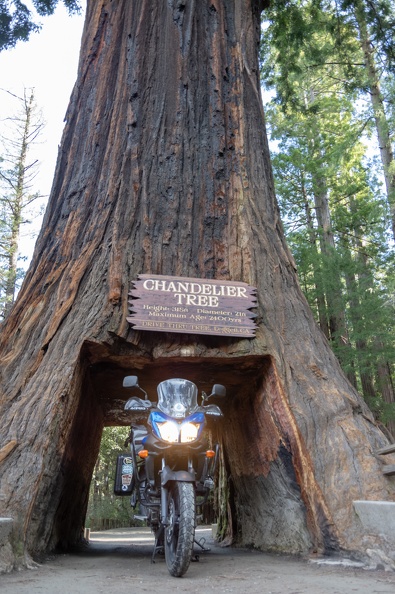

While taking a short break, I talked to two other motorcyclists who had ridden up Highway 1 from Vacaville. One of the guys was on an orange V-Strom, the carrot-hued cousin to my blue one. We talked about the mods I had made to my own bike and his plans for his. They were planning on riding up to Highway 36, a very popular road for motorcyclists, but the clerk in the gift shop talked them out of it. The winter had not been kind to the highway and it was probably not the best route at the time. The clerk instead told them to ride back south and take Highway 20 through Clear Lake. The pair still wanted to ride the Avenue of the Giants, though. I knew it had been flooded in the week prior, but found out for them that the road was clear. They thanked me for my help and we parted ways.
I hopped onto Highway 1 for my first time riding it. The road was nice and twisty, with hill climbs thrown in as well, necessitating low gear for most of the route between Leggett and the coast. Nearly every turn had patches of gravel that had fallen from the hillsides, requiring an open eye and a light touch on the throttle. The highway traveled through thick forests, which occasionally broke enough to get a glimpse of the Pacific Ocean. After a little more than 20 miles riding through the forest, you emerge on the edge of a cliff with a panoramic view of the Mendocino coast and the Pacific Ocean. From here the highway turns south and hugs the coast.
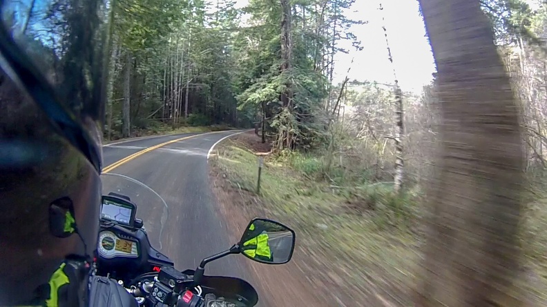

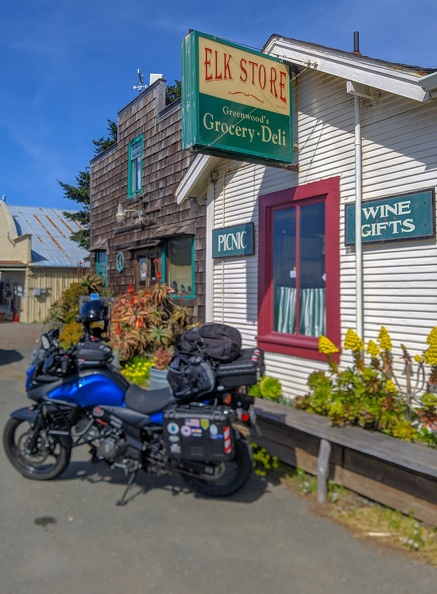
The highway winds its way through the towns of Fort Bragg, Mendocino, and Little River on its way south. I stopped for lunch in Elk at the Elk Store. There wasn’t much to it, a few shelves and coolers, and a deli counter with a vast selection of sandwiches – or you could customize your own. I chose the Cubano, their take on the Cuban sandwich, made with pork belly, ham, lettuce, pickles, and cheese. The sandwich was grilled for several minutes on a panini press. The sandwich was an excellent rendition of the simple Cuban sandwiches I enjoyed in Cuba, and worth the $13.
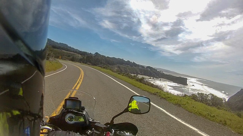

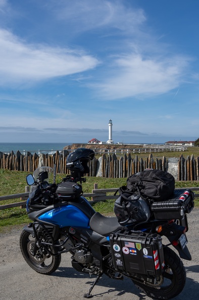
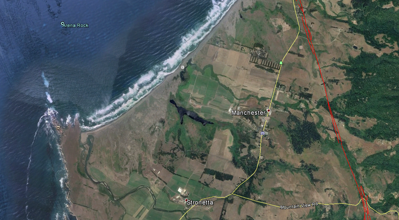
I continued south along the cliffs and through pastures. I passed the town of Manchester, site of the cable landing for a transoceanic cable linking the United States to Japan and Hawaii. Soon I was the gleaming white tower of the Point Arena Lighthouse rising above a rocky peninsula. I stopped to check it out.
The original Point Arena Lighthouse was built in 1870 and damaged beyond repair in the 1906 San Francisco Earthquake. The current lighthouse was built in 1908. Its slender tower rises 115 feet above Point Arena. The new tower was built to withstand earthquakes. It was built by a company that specialized in building smokestacks and utilized steel reinforcement as opposed the unreinforced brickwork of the original tower.

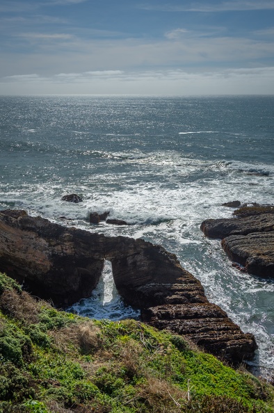
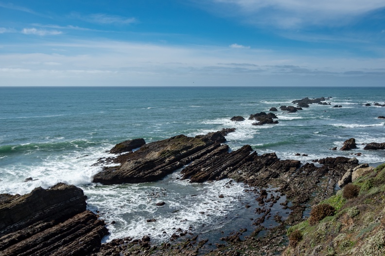
Just off shore from the lighthouse, I saw many rocks with parallel lines running through them oriented in the northwest direction. The parallel lines, or stratifications, are evidence of the movement of the nearby San Andreas, which lies less than 2 miles to the east.
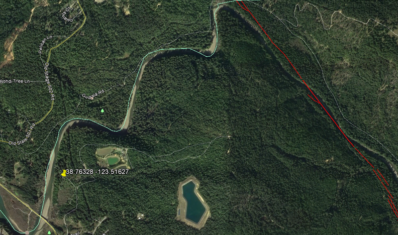
I stopped for the night at Gualala Point Regional Park. The park is owned by Sonoma County and lies on the banks of the Gualala River. This was the only campsite I reserved for the trip due to most campgrounds in the area being fully booked up for the weekend.
A first glance, the campground was not very impressive. The dirt portion of my campsite was a muddy mess, and there was lots of muddy berms and debris around the campground. According to the camp host, a few weeks prior the campground was under about five feet of water. OK, now the mud and debris makes sense. To keep my tent from getting soaked and muddy, I actually put it up on the asphalt parking pad at my site. One of the pluses of traveling on a motorcycle. I wouldn’t have room for a tent on the pad if I had been in a car.
As it turns out, the campground at Gualala Point is a stone’s throw from the San Andreas Fault which makes up a portion of the Gualala River’s bed before it turns toward the sea.
I spent the night sitting by my campfire, listening to the sounds of the forest.

March 17, 2019: Gualala to Pinnacles National Park (270 miles)
Roads Traveled: California Highway 1, US Highway 101, California Highway 152, California Highway 25, California Highway 146
I did not sleep well overnight, not falling asleep until after midnight. It was nothing with my sleeping pad not being comfortable enough, or being on the asphalt pad. I just couldn’t get a good position in my sleeping bag, so I was unable to stay very warm.
I’m not sure when exactly I fell asleep, but I remember waking up sometime around 6:30 and covering my head to keep out the morning light. Next thing I knew it was 8:30. I didn’t get on the road until after 9 am.
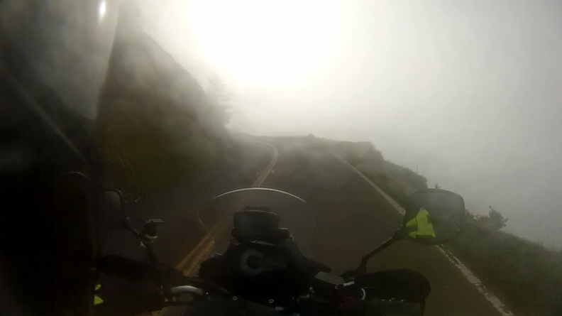
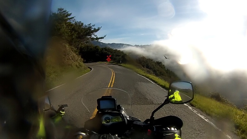
Highway 1 south of Gualala was pretty slow going. Because the road follows the contours of the land, and is in places built directly into cliffs above the ocean, it’s very twisty with many slow-speed switchbacks. That just made it more of a challenge – one I wanted to partake in. Just south of Fort Ross, I ran into very heavy fog. At times I could barely see the road, at other times it seemed like I was riding on a road in the clouds as the road passed barely above the top of the fog mass.
Somewhere near Jenner I managed to get a small bug in my mouth – ack! It wasn’t a big one, likely a gnat or something, and I didn’t immediately know what to do. At first I tried to just tough it out and swallow it, but it had gotten stuck at the back of my mouth and wouldn’t go down. I found a spot to pull over and spit it out.
I desperately needed coffee and a bite to eat – one bug wasn’t enough to fill me. I wasn’t finding much in the way of coffee places along the road. I didn’t get stopped until I reached Tomales. Like a beacon, I saw a place surrounded by numerous motorcycles with their riders milling about chatting with each other. It seemed I had found “The Spot.” That spot was the Tomales Bakery. I carefully parked my motorcycle by backing it to the curb and making double sure I put the sidestand down before stepping off; I didn’t want to be the guy who makes a fool of himself in front of a bunch of strangers.

There were the usual BMW GSs, a couple KTM Super Adventures, even a couple V-Stroms. Now I’m not one who goes out of their way to talk to people, I’m a bit of an introvert, so I just sat there drinking my coffee and eating my almond croissant, while looking at the varied selection of motorcycles.
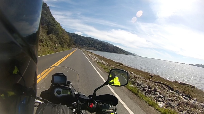
After my breakfast, I continued south as Highway 1 paralleled Tomales Bay. The bay is long and narrow, with a submerged portion of the San Andreas Fault running along the west side of the bay at the Point Reyes Peninsula.
I stopped at the visitor center for the Point Reyes National Seashore. Point Reyes is a triangular peninsula separating Tomales Bay from the Pacific Ocean. The land that makes up the peninsula is interesting in that the rock that makes it up does not match the rock on the east side of the bay. The east side of the bay is made of rock called the Franciscan Complex. It’s comprised of shale, chert, graywacke, and pillow lava. However, the rock under the peninsula is made of granite from the Salinian Block. Geologists have determined the Salinian rock that makes up the Point Reyes Peninsula started its like in the Tehachapi Mountains, more than 300 miles to the south! The Point Reyes Peninsula reached its current location as a result of movement on the San Andreas Fault.
The visitor center has an exhibit on this movement, so people can see an example for themselves. A short trail across the street from the visitor center takes people on a journey through time to learn about tectonic movement. The main attraction of the trail is a pair of picket fences about 15 feet apart. There isn’t anything fancy about the fence, it’s unpainted and is a dull grayish-brown in color. What’s interesting about the two fences is they used to be one! The gap in the fence was caused by fault motion during the 1906 San Francisco Earthquake. A line of blue stakes at the top of a small set of stairs lays out the path of the San Andreas Fault.
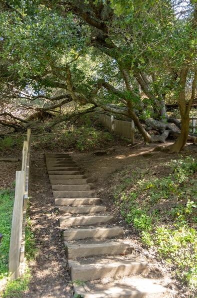

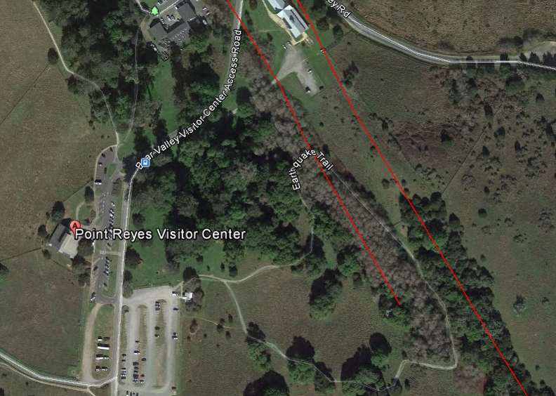
I stood straddling the San Andreas and snapped a couple pictures. I grabbed a passport stamp from the visitor center and continued on my way. I still had a long way to go and it was already noon!
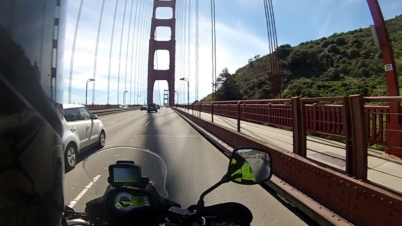
Highway 1 wound its way back inland and met up with Highway 101 just north of San Francisco. I crossed the Golden Gate Bridge for the first time on my motorcycle. I knew the towers were huge, but passing under them on a motorcycle makes you feel very small. After crossing the bridge I made my way through the city along the Great Highway and back to Highway 1.
South of San Francisco the traffic on the highway slowed several times – Pacifica, Half Moon Bay, Pescadero. Tourist traffic was the culprit. It was a very nice day and people wanted to go to the beach!
After passing Pescadero, I looked at the time and saw it was nearly 3 pm! I still had a couple hours to go until I reached Pinnacles and stop-and-go traffic at every town was not helping anything. I was also starting to get tired since I didn’t sleep well the night before. I stopped at the lighthouse at Pigeon Point to figure things out. All I had to do was get passed Santa Cruz and the traffic would let up and I could make up time to get to Pinnacles before it got too late. After all, sunset would not be until after 7 pm.

Traffic slowed again when Highway 1 turned into freeway south of Santa Cruz. It appeared there was an accident on the side of the road. What’s a guy on a motorcycle to do? Keep chugging along and repeatedly put your feet down when traffic stops? Nope! Lane splitting is the answer. As soon as I inched toward the dividing line between lanes, I saw cars in both lanes move to the side like I was Moses parting the Red Sea. I happily rode the gap and soon found myself past the slowdown and onto a nearly empty road.
I turned east at Watsonville and hopped on Highway 129. 129 wound itself through a narrow canyon carved by the Pajaro River and came out on Highway 101 near San Juan Bautista. I got onto Highway 156 to get to Hollister to make the final run to Pinnacles.
At Hollister I turned onto Highway 25, also known as the Airline Highway because it was once used by pilots to route themselves from town to town. Highway 25 passes through rolling hills and ranches as it runs through a valley created by the San Benito River and our friend the San Andreas Fault. As I navigated from curve to curve and over each rolling hill, I noticed the green hills seemed to glow in the late afternoon light.
I arrived at Pinnacles National Park just as the store and visitor center closed. Oh well, I can visit in the morning. I set up my camp and made use of the campground’s shower. I sat next to my fire under the stars and relaxed.
As I sat there in silence, I thought about how weird it felt being alone. I had done the trip home from Nakusp by myself, as I had from Mariposa, so it was nothing new. While I enjoyed the solitude, sometimes you want to share adventures with others.
Because I got there so late, I didn’t ride into the park to view the Pinnacles. I decided I would check them out in the morning before heading to Carrizo Plain.
